| Hyperlink |
Agency |
Basin |
Bearing Direction |
Caption |
CaptionTemplate |
Category |
Datum_Zone |
Description |
ExtraField1 |
ExtraField2 |
Filename |
Filesize |
Funder |
GIS_Project |
Graphic |
Hotlinkfield |
KRIS_Hotlink |
Latitud_DD |
Longit_DD |
Meta_Id |
Miscellaneous_Notes |
Notefile |
Path |
Photo Number |
Photodate |
Photographer |
ProjectLocation |
ProjectName |
Restriction |
Series |
Shapefile |
Site_Name |
Site_Type |
Streamname |
SubBasin |
Time |
UTM_E |
UTM_N |
UpdateDate |
UpdateName |
Watershed |
|
View
|
Marin County Flood Control and Water Conservation District |
East Marin-Sonoma |
-- |
This photo shows Arroyo Avichi at the Nave Center on Novato, in Novato, part of the Novato Creek watershed (flood control zone 1). The following flood control channel maintenance Best Management Practices (BMPs) are performed at this location: Sediment and Debris Removal; Vegetation Management; Bank Stabilization; Temporary Water Diversions. Photo is part of a collection provided by the Marin County Flood Control and Water Conservation District, showing reaches of creeks in Marin County where channel maintenance activities are performed using BMPs that pose minimal threat to water quality and beneficial uses. For more information on BMPs and a Proposed Regional General Permit, see http://www.mcstoppp.org/FloodControlBMPs.htm |
This photo shows [ProjectLocation], in [ExtraField2], part of the [Watershed] watershed ([ExtraField1]). [Description]. Photo is part of a collection provided by the Marin County Flood Control and Water Conservation District, showing reaches of creeks in Marin County where channel maintenance activities are performed using BMPs that pose minimal threat to water quality and beneficial uses. For more information on BMPs and a Proposed Regional General Permit, see http://www.mcstoppp.org/FloodControlBMPs.htm |
Flood Control Maintenance |
-- |
The following flood control channel maintenance Best Management Practices (BMPs) are performed at this location: Sediment and Debris Removal; Vegetation Management; Bank Stabilization; Temporary Water Diversions |
flood control zone 1 |
Novato |
Arroyo Avichi (Nave Center on Novato).2.JPG |
375459 |
-- |
-- |
-- |
-- |
-- |
-- |
-- |
-- |
-- |
-- |
mcfcwcd/chan_maint/zone_1/Arroyo Avichi (Nave Center on Novato).2.JPG |
-- |
-- |
-- |
Arroyo Avichi at the Nave Center on Novato |
-- |
-- |
Flood Control Maintenance: Marin County, Zone 1 - Novato Creek Watershed |
-- |
-- |
-- |
Arroyo Avichi |
Novato and Miller Creeks |
-- |
-- |
-- |
12/16/2006 |
JEA |
Novato Creek |
|
View
|
Marin County Flood Control and Water Conservation District |
East Marin-Sonoma |
-- |
This photo shows Arroyo Avichi at the Nave Center on Novato, in Novato, part of the Novato Creek watershed (flood control zone 1). The following flood control channel maintenance Best Management Practices (BMPs) are performed at this location: Sediment and Debris Removal; Vegetation Management; Bank Stabilization; Temporary Water Diversions. Photo is part of a collection provided by the Marin County Flood Control and Water Conservation District, showing reaches of creeks in Marin County where channel maintenance activities are performed using BMPs that pose minimal threat to water quality and beneficial uses. For more information on BMPs and a Proposed Regional General Permit, see http://www.mcstoppp.org/FloodControlBMPs.htm |
This photo shows [ProjectLocation], in [ExtraField2], part of the [Watershed] watershed ([ExtraField1]). [Description]. Photo is part of a collection provided by the Marin County Flood Control and Water Conservation District, showing reaches of creeks in Marin County where channel maintenance activities are performed using BMPs that pose minimal threat to water quality and beneficial uses. For more information on BMPs and a Proposed Regional General Permit, see http://www.mcstoppp.org/FloodControlBMPs.htm |
Flood Control Maintenance |
-- |
The following flood control channel maintenance Best Management Practices (BMPs) are performed at this location: Sediment and Debris Removal; Vegetation Management; Bank Stabilization; Temporary Water Diversions |
flood control zone 1 |
Novato |
Arroyo Avichi (Nave Center on Novato).JPG |
385024 |
-- |
-- |
-- |
-- |
-- |
-- |
-- |
-- |
-- |
-- |
mcfcwcd/chan_maint/zone_1/Arroyo Avichi (Nave Center on Novato).JPG |
-- |
-- |
-- |
Arroyo Avichi at the Nave Center on Novato |
-- |
-- |
Flood Control Maintenance: Marin County, Zone 1 - Novato Creek Watershed |
-- |
-- |
-- |
Arroyo Avichi |
Novato and Miller Creeks |
-- |
-- |
-- |
12/16/2006 |
JEA |
Novato Creek |
|
View
|
Marin County Flood Control and Water Conservation District |
East Marin-Sonoma |
-- |
This photo shows Arroyo Avichi at the end of Taft Ct, in Novato, part of the Novato Creek watershed (flood control zone 1). The following flood control channel maintenance Best Management Practices (BMPs) are performed at this location: Sediment and Debris Removal; Vegetation Management; Bank Stabilization; Temporary Water Diversions. Photo is part of a collection provided by the Marin County Flood Control and Water Conservation District, showing reaches of creeks in Marin County where channel maintenance activities are performed using BMPs that pose minimal threat to water quality and beneficial uses. For more information on BMPs and a Proposed Regional General Permit, see http://www.mcstoppp.org/FloodControlBMPs.htm |
This photo shows [ProjectLocation], in [ExtraField2], part of the [Watershed] watershed ([ExtraField1]). [Description]. Photo is part of a collection provided by the Marin County Flood Control and Water Conservation District, showing reaches of creeks in Marin County where channel maintenance activities are performed using BMPs that pose minimal threat to water quality and beneficial uses. For more information on BMPs and a Proposed Regional General Permit, see http://www.mcstoppp.org/FloodControlBMPs.htm |
Flood Control Maintenance |
-- |
The following flood control channel maintenance Best Management Practices (BMPs) are performed at this location: Sediment and Debris Removal; Vegetation Management; Bank Stabilization; Temporary Water Diversions |
flood control zone 1 |
Novato |
Arroyo Avichi (end of Taft Ct).3.JPG |
427646 |
-- |
-- |
-- |
-- |
-- |
-- |
-- |
-- |
-- |
-- |
mcfcwcd/chan_maint/zone_1/Arroyo Avichi (end of Taft Ct).3.JPG |
-- |
-- |
-- |
Arroyo Avichi at the end of Taft Ct |
-- |
-- |
Flood Control Maintenance: Marin County, Zone 1 - Novato Creek Watershed |
-- |
-- |
-- |
Arroyo Avichi |
Novato and Miller Creeks |
-- |
-- |
-- |
12/16/2006 |
JEA |
Novato Creek |
|
View
|
Marin County Flood Control and Water Conservation District |
East Marin-Sonoma |
-- |
This photo shows Arroyo Avichi at the end of Taft Ct, in Novato, part of the Novato Creek watershed (flood control zone 1). The following flood control channel maintenance Best Management Practices (BMPs) are performed at this location: Sediment and Debris Removal; Vegetation Management; Bank Stabilization; Temporary Water Diversions. Photo is part of a collection provided by the Marin County Flood Control and Water Conservation District, showing reaches of creeks in Marin County where channel maintenance activities are performed using BMPs that pose minimal threat to water quality and beneficial uses. For more information on BMPs and a Proposed Regional General Permit, see http://www.mcstoppp.org/FloodControlBMPs.htm |
This photo shows [ProjectLocation], in [ExtraField2], part of the [Watershed] watershed ([ExtraField1]). [Description]. Photo is part of a collection provided by the Marin County Flood Control and Water Conservation District, showing reaches of creeks in Marin County where channel maintenance activities are performed using BMPs that pose minimal threat to water quality and beneficial uses. For more information on BMPs and a Proposed Regional General Permit, see http://www.mcstoppp.org/FloodControlBMPs.htm |
Flood Control Maintenance |
-- |
The following flood control channel maintenance Best Management Practices (BMPs) are performed at this location: Sediment and Debris Removal; Vegetation Management; Bank Stabilization; Temporary Water Diversions |
flood control zone 1 |
Novato |
Arroyo Avichi (end of Taft Ct.).2.JPG |
433275 |
-- |
-- |
-- |
-- |
-- |
-- |
-- |
-- |
-- |
-- |
mcfcwcd/chan_maint/zone_1/Arroyo Avichi (end of Taft Ct.).2.JPG |
-- |
-- |
-- |
Arroyo Avichi at the end of Taft Ct |
-- |
-- |
Flood Control Maintenance: Marin County, Zone 1 - Novato Creek Watershed |
-- |
-- |
-- |
Arroyo Avichi |
Novato and Miller Creeks |
-- |
-- |
-- |
12/16/2006 |
JEA |
Novato Creek |
|
View
|
Marin County Flood Control and Water Conservation District |
East Marin-Sonoma |
-- |
This photo shows Arroyo Avichi at the end of Taft Ct, in Novato, part of the Novato Creek watershed (flood control zone 1). The following flood control channel maintenance Best Management Practices (BMPs) are performed at this location: Sediment and Debris Removal; Vegetation Management; Bank Stabilization; Temporary Water Diversions. Photo is part of a collection provided by the Marin County Flood Control and Water Conservation District, showing reaches of creeks in Marin County where channel maintenance activities are performed using BMPs that pose minimal threat to water quality and beneficial uses. For more information on BMPs and a Proposed Regional General Permit, see http://www.mcstoppp.org/FloodControlBMPs.htm |
This photo shows [ProjectLocation], in [ExtraField2], part of the [Watershed] watershed ([ExtraField1]). [Description]. Photo is part of a collection provided by the Marin County Flood Control and Water Conservation District, showing reaches of creeks in Marin County where channel maintenance activities are performed using BMPs that pose minimal threat to water quality and beneficial uses. For more information on BMPs and a Proposed Regional General Permit, see http://www.mcstoppp.org/FloodControlBMPs.htm |
Flood Control Maintenance |
-- |
The following flood control channel maintenance Best Management Practices (BMPs) are performed at this location: Sediment and Debris Removal; Vegetation Management; Bank Stabilization; Temporary Water Diversions |
flood control zone 1 |
Novato |
Arroyo Avichi (end of Taft Ct.).JPG |
442853 |
-- |
-- |
-- |
-- |
-- |
-- |
-- |
-- |
-- |
-- |
mcfcwcd/chan_maint/zone_1/Arroyo Avichi (end of Taft Ct.).JPG |
-- |
-- |
-- |
Arroyo Avichi at the end of Taft Ct |
-- |
-- |
Flood Control Maintenance: Marin County, Zone 1 - Novato Creek Watershed |
-- |
-- |
-- |
Arroyo Avichi |
Novato and Miller Creeks |
-- |
-- |
-- |
12/16/2006 |
JEA |
Novato Creek |
|
View
|
Marin County Flood Control and Water Conservation District |
East Marin-Sonoma |
-- |
This photo shows Arroyo San Jose at the Shell Station off Enfrente, in Novato, part of the Novato Creek watershed (flood control zone 1). The following flood control channel maintenance Best Management Practices (BMPs) are performed at this location: Vegetation Management; Bank Stabilization; Temporary Water Diversions. Photo is part of a collection provided by the Marin County Flood Control and Water Conservation District, showing reaches of creeks in Marin County where channel maintenance activities are performed using BMPs that pose minimal threat to water quality and beneficial uses. For more information on BMPs and a Proposed Regional General Permit, see http://www.mcstoppp.org/FloodControlBMPs.htm |
This photo shows [ProjectLocation], in [ExtraField2], part of the [Watershed] watershed ([ExtraField1]). [Description]. Photo is part of a collection provided by the Marin County Flood Control and Water Conservation District, showing reaches of creeks in Marin County where channel maintenance activities are performed using BMPs that pose minimal threat to water quality and beneficial uses. For more information on BMPs and a Proposed Regional General Permit, see http://www.mcstoppp.org/FloodControlBMPs.htm |
Flood Control Maintenance |
-- |
The following flood control channel maintenance Best Management Practices (BMPs) are performed at this location: Vegetation Management; Bank Stabilization; Temporary Water Diversions |
flood control zone 1 |
Novato |
Arroyo San Jose (Shell Sta off Enfrente).JPG |
480259 |
-- |
-- |
-- |
-- |
-- |
-- |
-- |
-- |
-- |
-- |
mcfcwcd/chan_maint/zone_1/Arroyo San Jose (Shell Sta off Enfrente).JPG |
-- |
-- |
-- |
Arroyo San Jose at the Shell Station off Enfrente |
-- |
-- |
Flood Control Maintenance: Marin County, Zone 1 - Novato Creek Watershed |
-- |
-- |
-- |
Arroyo San Jose |
Novato and Miller Creeks |
-- |
-- |
-- |
12/16/2006 |
JEA |
Novato Creek |
|
View
|
Marin County Flood Control and Water Conservation District |
East Marin-Sonoma |
-- |
This photo shows Arroyo San Jose at the end of chain fence on Ignacio downstream view, in Novato, part of the Novato Creek watershed (flood control zone 1). The following flood control channel maintenance Best Management Practices (BMPs) are performed at this location: Vegetation Management; Bank Stabilization; Temporary Water Diversions. Photo is part of a collection provided by the Marin County Flood Control and Water Conservation District, showing reaches of creeks in Marin County where channel maintenance activities are performed using BMPs that pose minimal threat to water quality and beneficial uses. For more information on BMPs and a Proposed Regional General Permit, see http://www.mcstoppp.org/FloodControlBMPs.htm |
This photo shows [ProjectLocation], in [ExtraField2], part of the [Watershed] watershed ([ExtraField1]). [Description]. Photo is part of a collection provided by the Marin County Flood Control and Water Conservation District, showing reaches of creeks in Marin County where channel maintenance activities are performed using BMPs that pose minimal threat to water quality and beneficial uses. For more information on BMPs and a Proposed Regional General Permit, see http://www.mcstoppp.org/FloodControlBMPs.htm |
Flood Control Maintenance |
-- |
The following flood control channel maintenance Best Management Practices (BMPs) are performed at this location: Vegetation Management; Bank Stabilization; Temporary Water Diversions |
flood control zone 1 |
Novato |
Arroyo San Jose (end of chain fence on Ignacio).2.JPG |
502165 |
-- |
-- |
-- |
-- |
-- |
-- |
-- |
-- |
-- |
-- |
mcfcwcd/chan_maint/zone_1/Arroyo San Jose (end of chain fence on Ignacio).2.JPG |
-- |
-- |
-- |
Arroyo San Jose at the end of chain fence on Ignacio downstream view |
-- |
-- |
Flood Control Maintenance: Marin County, Zone 1 - Novato Creek Watershed |
-- |
-- |
-- |
Arroyo San Jose |
Novato and Miller Creeks |
-- |
-- |
-- |
12/16/2006 |
JEA |
Novato Creek |
|
View
|
Marin County Flood Control and Water Conservation District |
East Marin-Sonoma |
-- |
This photo shows Arroyo San Jose at the end of chain fence on Ignacio, in Novato, part of the Novato Creek watershed (flood control zone 1). The following flood control channel maintenance Best Management Practices (BMPs) are performed at this location: Vegetation Management; Bank Stabilization; Temporary Water Diversions. Photo is part of a collection provided by the Marin County Flood Control and Water Conservation District, showing reaches of creeks in Marin County where channel maintenance activities are performed using BMPs that pose minimal threat to water quality and beneficial uses. For more information on BMPs and a Proposed Regional General Permit, see http://www.mcstoppp.org/FloodControlBMPs.htm |
This photo shows [ProjectLocation], in [ExtraField2], part of the [Watershed] watershed ([ExtraField1]). [Description]. Photo is part of a collection provided by the Marin County Flood Control and Water Conservation District, showing reaches of creeks in Marin County where channel maintenance activities are performed using BMPs that pose minimal threat to water quality and beneficial uses. For more information on BMPs and a Proposed Regional General Permit, see http://www.mcstoppp.org/FloodControlBMPs.htm |
Flood Control Maintenance |
-- |
The following flood control channel maintenance Best Management Practices (BMPs) are performed at this location: Vegetation Management; Bank Stabilization; Temporary Water Diversions |
flood control zone 1 |
Novato |
Arroyo San Jose (end of chain fence on Ignacio).JPG |
467160 |
-- |
-- |
-- |
-- |
-- |
-- |
-- |
-- |
-- |
-- |
mcfcwcd/chan_maint/zone_1/Arroyo San Jose (end of chain fence on Ignacio).JPG |
-- |
-- |
-- |
Arroyo San Jose at the end of chain fence on Ignacio |
-- |
-- |
Flood Control Maintenance: Marin County, Zone 1 - Novato Creek Watershed |
-- |
-- |
-- |
Arroyo San Jose |
Novato and Miller Creeks |
-- |
-- |
-- |
12/16/2006 |
JEA |
Novato Creek |
|
View
|
Marin County Flood Control and Water Conservation District |
East Marin-Sonoma |
-- |
This photo shows Cheda Cr at Cowbarn Ln, in Novato, part of the Novato Creek watershed (flood control zone 1). The following flood control channel maintenance Best Management Practices (BMPs) are performed at this location: Vegetation Management; Maintenance, Repair, Rehabilitation, Replacement of Structures; Bank Stabilization; Temporary Water Diversions. Photo is part of a collection provided by the Marin County Flood Control and Water Conservation District, showing reaches of creeks in Marin County where channel maintenance activities are performed using BMPs that pose minimal threat to water quality and beneficial uses. For more information on BMPs and a Proposed Regional General Permit, see http://www.mcstoppp.org/FloodControlBMPs.htm |
This photo shows [ProjectLocation], in [ExtraField2], part of the [Watershed] watershed ([ExtraField1]). [Description]. Photo is part of a collection provided by the Marin County Flood Control and Water Conservation District, showing reaches of creeks in Marin County where channel maintenance activities are performed using BMPs that pose minimal threat to water quality and beneficial uses. For more information on BMPs and a Proposed Regional General Permit, see http://www.mcstoppp.org/FloodControlBMPs.htm |
Flood Control Maintenance |
-- |
The following flood control channel maintenance Best Management Practices (BMPs) are performed at this location: Vegetation Management; Maintenance, Repair, Rehabilitation, Replacement of Structures; Bank Stabilization; Temporary Water Diversions |
flood control zone 1 |
Novato |
Cheda Cr (Cowbarn Ln).JPG |
347425 |
-- |
-- |
-- |
-- |
-- |
-- |
-- |
-- |
-- |
-- |
mcfcwcd/chan_maint/zone_1/Cheda Cr (Cowbarn Ln).JPG |
-- |
-- |
-- |
Cheda Cr at Cowbarn Ln |
-- |
-- |
Flood Control Maintenance: Marin County, Zone 1 - Novato Creek Watershed |
-- |
-- |
-- |
Cheda Cr |
Novato and Miller Creeks |
-- |
-- |
-- |
12/16/2006 |
JEA |
Novato Creek |
|
View
|
Marin County Flood Control and Water Conservation District |
East Marin-Sonoma |
-- |
This photo shows Ignacio Cr at Ignacio & Indian Way, in Novato, part of the Novato Creek watershed (flood control zone 1). The following flood control channel maintenance Best Management Practices (BMPs) are performed at this location: Sediment and Debris Removal; Vegetation Management; Bank Stabilization; Temporary Water Diversions. Photo is part of a collection provided by the Marin County Flood Control and Water Conservation District, showing reaches of creeks in Marin County where channel maintenance activities are performed using BMPs that pose minimal threat to water quality and beneficial uses. For more information on BMPs and a Proposed Regional General Permit, see http://www.mcstoppp.org/FloodControlBMPs.htm |
This photo shows [ProjectLocation], in [ExtraField2], part of the [Watershed] watershed ([ExtraField1]). [Description]. Photo is part of a collection provided by the Marin County Flood Control and Water Conservation District, showing reaches of creeks in Marin County where channel maintenance activities are performed using BMPs that pose minimal threat to water quality and beneficial uses. For more information on BMPs and a Proposed Regional General Permit, see http://www.mcstoppp.org/FloodControlBMPs.htm |
Flood Control Maintenance |
-- |
The following flood control channel maintenance Best Management Practices (BMPs) are performed at this location: Sediment and Debris Removal; Vegetation Management; Bank Stabilization; Temporary Water Diversions |
flood control zone 1 |
Novato |
Ignacio Cr (Ignacio &Indian Way).JPG |
454423 |
-- |
-- |
-- |
-- |
-- |
-- |
-- |
-- |
-- |
-- |
mcfcwcd/chan_maint/zone_1/Ignacio Cr (Ignacio &Indian Way).JPG |
-- |
-- |
-- |
Ignacio Cr at Ignacio & Indian Way |
-- |
-- |
Flood Control Maintenance: Marin County, Zone 1 - Novato Creek Watershed |
-- |
-- |
-- |
Ignacio Cr |
Novato and Miller Creeks |
-- |
-- |
-- |
12/16/2006 |
JEA |
Novato Creek |
|
View
|
Marin County Flood Control and Water Conservation District |
East Marin-Sonoma |
-- |
This photo shows Ignacio Cr at Ignacio across fr Montura Wy, in Novato, part of the Novato Creek watershed (flood control zone 1). The following flood control channel maintenance Best Management Practices (BMPs) are performed at this location: Vegetation Management; Bank Stabilization; Temporary Water Diversions. Photo is part of a collection provided by the Marin County Flood Control and Water Conservation District, showing reaches of creeks in Marin County where channel maintenance activities are performed using BMPs that pose minimal threat to water quality and beneficial uses. For more information on BMPs and a Proposed Regional General Permit, see http://www.mcstoppp.org/FloodControlBMPs.htm |
This photo shows [ProjectLocation], in [ExtraField2], part of the [Watershed] watershed ([ExtraField1]). [Description]. Photo is part of a collection provided by the Marin County Flood Control and Water Conservation District, showing reaches of creeks in Marin County where channel maintenance activities are performed using BMPs that pose minimal threat to water quality and beneficial uses. For more information on BMPs and a Proposed Regional General Permit, see http://www.mcstoppp.org/FloodControlBMPs.htm |
Flood Control Maintenance |
-- |
The following flood control channel maintenance Best Management Practices (BMPs) are performed at this location: Vegetation Management; Bank Stabilization; Temporary Water Diversions |
flood control zone 1 |
Novato |
Ignacio Cr (Ignacio across fr Montura Wy).JPG |
439525 |
-- |
-- |
-- |
-- |
-- |
-- |
-- |
-- |
-- |
-- |
mcfcwcd/chan_maint/zone_1/Ignacio Cr (Ignacio across fr Montura Wy).JPG |
-- |
-- |
-- |
Ignacio Cr at Ignacio across fr Montura Wy |
-- |
-- |
Flood Control Maintenance: Marin County, Zone 1 - Novato Creek Watershed |
-- |
-- |
-- |
Ignacio Cr |
Novato and Miller Creeks |
-- |
-- |
-- |
12/16/2006 |
JEA |
Novato Creek |
|
View
|
Marin County Flood Control and Water Conservation District |
East Marin-Sonoma |
-- |
This photo shows Lynwood Slough at Donna St, in Novato, part of the Novato Creek watershed (flood control zone 1). The following flood control channel maintenance Best Management Practices (BMPs) are performed at this location: Sediment and Debris Removal; Vegetation Management; Bank Stabilization; Temporary Water Diversions. Photo is part of a collection provided by the Marin County Flood Control and Water Conservation District, showing reaches of creeks in Marin County where channel maintenance activities are performed using BMPs that pose minimal threat to water quality and beneficial uses. For more information on BMPs and a Proposed Regional General Permit, see http://www.mcstoppp.org/FloodControlBMPs.htm |
This photo shows [ProjectLocation], in [ExtraField2], part of the [Watershed] watershed ([ExtraField1]). [Description]. Photo is part of a collection provided by the Marin County Flood Control and Water Conservation District, showing reaches of creeks in Marin County where channel maintenance activities are performed using BMPs that pose minimal threat to water quality and beneficial uses. For more information on BMPs and a Proposed Regional General Permit, see http://www.mcstoppp.org/FloodControlBMPs.htm |
Flood Control Maintenance |
-- |
The following flood control channel maintenance Best Management Practices (BMPs) are performed at this location: Sediment and Debris Removal; Vegetation Management; Bank Stabilization; Temporary Water Diversions |
flood control zone 1 |
Novato |
Lynwood Slough (Donna St).2.JPG |
394578 |
-- |
-- |
-- |
-- |
-- |
-- |
-- |
-- |
-- |
-- |
mcfcwcd/chan_maint/zone_1/Lynwood Slough (Donna St).2.JPG |
-- |
-- |
-- |
Lynwood Slough at Donna St |
-- |
-- |
Flood Control Maintenance: Marin County, Zone 1 - Novato Creek Watershed |
-- |
-- |
-- |
Lynwood Slough |
Novato and Miller Creeks |
-- |
-- |
-- |
12/16/2006 |
JEA |
Novato Creek |
|
View
|
Marin County Flood Control and Water Conservation District |
East Marin-Sonoma |
-- |
This photo shows Lynwood Slough at Donna St, in Novato, part of the Novato Creek watershed (flood control zone 1). The following flood control channel maintenance Best Management Practices (BMPs) are performed at this location: Sediment and Debris Removal; Vegetation Management; Bank Stabilization; Temporary Water Diversions. Photo is part of a collection provided by the Marin County Flood Control and Water Conservation District, showing reaches of creeks in Marin County where channel maintenance activities are performed using BMPs that pose minimal threat to water quality and beneficial uses. For more information on BMPs and a Proposed Regional General Permit, see http://www.mcstoppp.org/FloodControlBMPs.htm |
This photo shows [ProjectLocation], in [ExtraField2], part of the [Watershed] watershed ([ExtraField1]). [Description]. Photo is part of a collection provided by the Marin County Flood Control and Water Conservation District, showing reaches of creeks in Marin County where channel maintenance activities are performed using BMPs that pose minimal threat to water quality and beneficial uses. For more information on BMPs and a Proposed Regional General Permit, see http://www.mcstoppp.org/FloodControlBMPs.htm |
Flood Control Maintenance |
-- |
The following flood control channel maintenance Best Management Practices (BMPs) are performed at this location: Sediment and Debris Removal; Vegetation Management; Bank Stabilization; Temporary Water Diversions |
flood control zone 1 |
Novato |
Lynwood Slough (Donna St.).JPG |
196760 |
-- |
-- |
-- |
-- |
-- |
-- |
-- |
-- |
-- |
-- |
mcfcwcd/chan_maint/zone_1/Lynwood Slough (Donna St.).JPG |
-- |
-- |
-- |
Lynwood Slough at Donna St |
-- |
-- |
Flood Control Maintenance: Marin County, Zone 1 - Novato Creek Watershed |
-- |
-- |
-- |
Lynwood Slough |
Novato and Miller Creeks |
-- |
-- |
-- |
12/16/2006 |
JEA |
Novato Creek |
|
View
|
Marin County Flood Control and Water Conservation District |
East Marin-Sonoma |
-- |
This photo shows Lynwood Slough at Leafwood Dr, in Novato, part of the Novato Creek watershed (flood control zone 1). The following flood control channel maintenance Best Management Practices (BMPs) are performed at this location: Sediment and Debris Removal; Vegetation Management; Bank Stabilization; Temporary Water Diversions. Photo is part of a collection provided by the Marin County Flood Control and Water Conservation District, showing reaches of creeks in Marin County where channel maintenance activities are performed using BMPs that pose minimal threat to water quality and beneficial uses. For more information on BMPs and a Proposed Regional General Permit, see http://www.mcstoppp.org/FloodControlBMPs.htm |
This photo shows [ProjectLocation], in [ExtraField2], part of the [Watershed] watershed ([ExtraField1]). [Description]. Photo is part of a collection provided by the Marin County Flood Control and Water Conservation District, showing reaches of creeks in Marin County where channel maintenance activities are performed using BMPs that pose minimal threat to water quality and beneficial uses. For more information on BMPs and a Proposed Regional General Permit, see http://www.mcstoppp.org/FloodControlBMPs.htm |
Flood Control Maintenance |
-- |
The following flood control channel maintenance Best Management Practices (BMPs) are performed at this location: Sediment and Debris Removal; Vegetation Management; Bank Stabilization; Temporary Water Diversions |
flood control zone 1 |
Novato |
Lynwood Slough (Leafwood Dr).2.JPG |
241256 |
-- |
-- |
-- |
-- |
-- |
-- |
-- |
-- |
-- |
-- |
mcfcwcd/chan_maint/zone_1/Lynwood Slough (Leafwood Dr).2.JPG |
-- |
-- |
-- |
Lynwood Slough at Leafwood Dr |
-- |
-- |
Flood Control Maintenance: Marin County, Zone 1 - Novato Creek Watershed |
-- |
-- |
-- |
Lynwood Slough |
Novato and Miller Creeks |
-- |
-- |
-- |
12/16/2006 |
JEA |
Novato Creek |
|
View
|
Marin County Flood Control and Water Conservation District |
East Marin-Sonoma |
-- |
This photo shows Lynwood Slough at Leafwood Dr, in Novato, part of the Novato Creek watershed (flood control zone 1). The following flood control channel maintenance Best Management Practices (BMPs) are performed at this location: Sediment and Debris Removal; Vegetation Management; Bank Stabilization; Temporary Water Diversions. Photo is part of a collection provided by the Marin County Flood Control and Water Conservation District, showing reaches of creeks in Marin County where channel maintenance activities are performed using BMPs that pose minimal threat to water quality and beneficial uses. For more information on BMPs and a Proposed Regional General Permit, see http://www.mcstoppp.org/FloodControlBMPs.htm |
This photo shows [ProjectLocation], in [ExtraField2], part of the [Watershed] watershed ([ExtraField1]). [Description]. Photo is part of a collection provided by the Marin County Flood Control and Water Conservation District, showing reaches of creeks in Marin County where channel maintenance activities are performed using BMPs that pose minimal threat to water quality and beneficial uses. For more information on BMPs and a Proposed Regional General Permit, see http://www.mcstoppp.org/FloodControlBMPs.htm |
Flood Control Maintenance |
-- |
The following flood control channel maintenance Best Management Practices (BMPs) are performed at this location: Sediment and Debris Removal; Vegetation Management; Bank Stabilization; Temporary Water Diversions |
flood control zone 1 |
Novato |
Lynwood Slough (Leafwood Dr).3.JPG |
283811 |
-- |
-- |
-- |
-- |
-- |
-- |
-- |
-- |
-- |
-- |
mcfcwcd/chan_maint/zone_1/Lynwood Slough (Leafwood Dr).3.JPG |
-- |
-- |
-- |
Lynwood Slough at Leafwood Dr |
-- |
-- |
Flood Control Maintenance: Marin County, Zone 1 - Novato Creek Watershed |
-- |
-- |
-- |
Lynwood Slough |
Novato and Miller Creeks |
-- |
-- |
-- |
12/16/2006 |
JEA |
Novato Creek |
|
View
|
Marin County Flood Control and Water Conservation District |
East Marin-Sonoma |
-- |
This photo shows Lynwood Slough at Leafwood Dr, in Novato, part of the Novato Creek watershed (flood control zone 1). The following flood control channel maintenance Best Management Practices (BMPs) are performed at this location: Sediment and Debris Removal; Vegetation Management; Bank Stabilization; Temporary Water Diversions. Photo is part of a collection provided by the Marin County Flood Control and Water Conservation District, showing reaches of creeks in Marin County where channel maintenance activities are performed using BMPs that pose minimal threat to water quality and beneficial uses. For more information on BMPs and a Proposed Regional General Permit, see http://www.mcstoppp.org/FloodControlBMPs.htm |
This photo shows [ProjectLocation], in [ExtraField2], part of the [Watershed] watershed ([ExtraField1]). [Description]. Photo is part of a collection provided by the Marin County Flood Control and Water Conservation District, showing reaches of creeks in Marin County where channel maintenance activities are performed using BMPs that pose minimal threat to water quality and beneficial uses. For more information on BMPs and a Proposed Regional General Permit, see http://www.mcstoppp.org/FloodControlBMPs.htm |
Flood Control Maintenance |
-- |
The following flood control channel maintenance Best Management Practices (BMPs) are performed at this location: Sediment and Debris Removal; Vegetation Management; Bank Stabilization; Temporary Water Diversions |
flood control zone 1 |
Novato |
Lynwood Slough (Leafwood Dr).JPG |
196719 |
-- |
-- |
-- |
-- |
-- |
-- |
-- |
-- |
-- |
-- |
mcfcwcd/chan_maint/zone_1/Lynwood Slough (Leafwood Dr).JPG |
-- |
-- |
-- |
Lynwood Slough at Leafwood Dr |
-- |
-- |
Flood Control Maintenance: Marin County, Zone 1 - Novato Creek Watershed |
-- |
-- |
-- |
Lynwood Slough |
Novato and Miller Creeks |
-- |
-- |
-- |
12/16/2006 |
JEA |
Novato Creek |
|
View
|
Marin County Flood Control and Water Conservation District |
East Marin-Sonoma |
-- |
This photo shows Novato Cr at 7th & Novato, in Novato, part of the Novato Creek watershed (flood control zone 1). The following flood control channel maintenance Best Management Practices (BMPs) are performed at this location: Sediment and Debris Removal; Vegetation Management; Bank Stabilization; Temporary Water Diversions. Photo is part of a collection provided by the Marin County Flood Control and Water Conservation District, showing reaches of creeks in Marin County where channel maintenance activities are performed using BMPs that pose minimal threat to water quality and beneficial uses. For more information on BMPs and a Proposed Regional General Permit, see http://www.mcstoppp.org/FloodControlBMPs.htm |
This photo shows [ProjectLocation], in [ExtraField2], part of the [Watershed] watershed ([ExtraField1]). [Description]. Photo is part of a collection provided by the Marin County Flood Control and Water Conservation District, showing reaches of creeks in Marin County where channel maintenance activities are performed using BMPs that pose minimal threat to water quality and beneficial uses. For more information on BMPs and a Proposed Regional General Permit, see http://www.mcstoppp.org/FloodControlBMPs.htm |
Flood Control Maintenance |
-- |
The following flood control channel maintenance Best Management Practices (BMPs) are performed at this location: Sediment and Debris Removal; Vegetation Management; Bank Stabilization; Temporary Water Diversions |
flood control zone 1 |
Novato |
Novato Cr (7th & Novato).2.JPG |
484857 |
-- |
-- |
-- |
-- |
-- |
-- |
-- |
-- |
-- |
-- |
mcfcwcd/chan_maint/zone_1/Novato Cr (7th & Novato).2.JPG |
-- |
-- |
-- |
Novato Cr at 7th & Novato |
-- |
-- |
Flood Control Maintenance: Marin County, Zone 1 - Novato Creek Watershed |
-- |
-- |
-- |
Novato Cr |
Novato and Miller Creeks |
-- |
-- |
-- |
12/16/2006 |
JEA |
Novato Creek |
|
View
|
Marin County Flood Control and Water Conservation District |
East Marin-Sonoma |
-- |
This photo shows Novato Cr at 7th & Novato, in Novato, part of the Novato Creek watershed (flood control zone 1). The following flood control channel maintenance Best Management Practices (BMPs) are performed at this location: Sediment and Debris Removal; Vegetation Management; Bank Stabilization; Temporary Water Diversions. Photo is part of a collection provided by the Marin County Flood Control and Water Conservation District, showing reaches of creeks in Marin County where channel maintenance activities are performed using BMPs that pose minimal threat to water quality and beneficial uses. For more information on BMPs and a Proposed Regional General Permit, see http://www.mcstoppp.org/FloodControlBMPs.htm |
This photo shows [ProjectLocation], in [ExtraField2], part of the [Watershed] watershed ([ExtraField1]). [Description]. Photo is part of a collection provided by the Marin County Flood Control and Water Conservation District, showing reaches of creeks in Marin County where channel maintenance activities are performed using BMPs that pose minimal threat to water quality and beneficial uses. For more information on BMPs and a Proposed Regional General Permit, see http://www.mcstoppp.org/FloodControlBMPs.htm |
Flood Control Maintenance |
-- |
The following flood control channel maintenance Best Management Practices (BMPs) are performed at this location: Sediment and Debris Removal; Vegetation Management; Bank Stabilization; Temporary Water Diversions |
flood control zone 1 |
Novato |
Novato Cr (7th & Novato).JPG |
417868 |
-- |
-- |
-- |
-- |
-- |
-- |
-- |
-- |
-- |
-- |
mcfcwcd/chan_maint/zone_1/Novato Cr (7th & Novato).JPG |
-- |
-- |
-- |
Novato Cr at 7th & Novato |
-- |
-- |
Flood Control Maintenance: Marin County, Zone 1 - Novato Creek Watershed |
-- |
-- |
-- |
Novato Cr |
Novato and Miller Creeks |
-- |
-- |
-- |
12/16/2006 |
JEA |
Novato Creek |
|
View
|
Marin County Flood Control and Water Conservation District |
East Marin-Sonoma |
-- |
This photo shows Novato Cr at Redwood Blvd behind fire station, in Novato, part of the Novato Creek watershed (flood control zone 1). The following flood control channel maintenance Best Management Practices (BMPs) are performed at this location: Sediment and Debris Removal; Vegetation Management; Bank Stabilization; Temporary Water Diversions. Photo is part of a collection provided by the Marin County Flood Control and Water Conservation District, showing reaches of creeks in Marin County where channel maintenance activities are performed using BMPs that pose minimal threat to water quality and beneficial uses. For more information on BMPs and a Proposed Regional General Permit, see http://www.mcstoppp.org/FloodControlBMPs.htm |
This photo shows [ProjectLocation], in [ExtraField2], part of the [Watershed] watershed ([ExtraField1]). [Description]. Photo is part of a collection provided by the Marin County Flood Control and Water Conservation District, showing reaches of creeks in Marin County where channel maintenance activities are performed using BMPs that pose minimal threat to water quality and beneficial uses. For more information on BMPs and a Proposed Regional General Permit, see http://www.mcstoppp.org/FloodControlBMPs.htm |
Flood Control Maintenance |
-- |
The following flood control channel maintenance Best Management Practices (BMPs) are performed at this location: Sediment and Debris Removal; Vegetation Management; Bank Stabilization; Temporary Water Diversions |
flood control zone 1 |
Novato |
Novato Cr (Redwood Blvd bhnd fire sta).2.JPG |
294375 |
-- |
-- |
-- |
-- |
-- |
-- |
-- |
-- |
-- |
-- |
mcfcwcd/chan_maint/zone_1/Novato Cr (Redwood Blvd bhnd fire sta).2.JPG |
-- |
-- |
-- |
Novato Cr at Redwood Blvd behind fire station |
-- |
-- |
Flood Control Maintenance: Marin County, Zone 1 - Novato Creek Watershed |
-- |
-- |
-- |
Novato Cr |
Novato and Miller Creeks |
-- |
-- |
-- |
12/16/2006 |
JEA |
Novato Creek |
|
View
|
Marin County Flood Control and Water Conservation District |
East Marin-Sonoma |
-- |
This photo shows Novato Cr at Redwood Blvd behind fire station, in Novato, part of the Novato Creek watershed (flood control zone 1). The following flood control channel maintenance Best Management Practices (BMPs) are performed at this location: Sediment and Debris Removal; Vegetation Management; Bank Stabilization; Temporary Water Diversions. Photo is part of a collection provided by the Marin County Flood Control and Water Conservation District, showing reaches of creeks in Marin County where channel maintenance activities are performed using BMPs that pose minimal threat to water quality and beneficial uses. For more information on BMPs and a Proposed Regional General Permit, see http://www.mcstoppp.org/FloodControlBMPs.htm |
This photo shows [ProjectLocation], in [ExtraField2], part of the [Watershed] watershed ([ExtraField1]). [Description]. Photo is part of a collection provided by the Marin County Flood Control and Water Conservation District, showing reaches of creeks in Marin County where channel maintenance activities are performed using BMPs that pose minimal threat to water quality and beneficial uses. For more information on BMPs and a Proposed Regional General Permit, see http://www.mcstoppp.org/FloodControlBMPs.htm |
Flood Control Maintenance |
-- |
The following flood control channel maintenance Best Management Practices (BMPs) are performed at this location: Sediment and Debris Removal; Vegetation Management; Bank Stabilization; Temporary Water Diversions |
flood control zone 1 |
Novato |
Novato Cr (Redwood Blvd bhnd fire sta).JPG |
252065 |
-- |
-- |
-- |
-- |
-- |
-- |
-- |
-- |
-- |
-- |
mcfcwcd/chan_maint/zone_1/Novato Cr (Redwood Blvd bhnd fire sta).JPG |
-- |
-- |
-- |
Novato Cr at Redwood Blvd behind fire station |
-- |
-- |
Flood Control Maintenance: Marin County, Zone 1 - Novato Creek Watershed |
-- |
-- |
-- |
Novato Cr |
Novato and Miller Creeks |
-- |
-- |
-- |
12/16/2006 |
JEA |
Novato Creek |
|
View
|
Marin County Flood Control and Water Conservation District |
East Marin-Sonoma |
-- |
This photo shows Pacheco Cr at the Marin Independent Journal, in Novato, part of the Novato Creek watershed (flood control zone 1). The following flood control channel maintenance Best Management Practices (BMPs) are performed at this location: Vegetation Management; Bank Stabilization; Temporary Water Diversions. Photo is part of a collection provided by the Marin County Flood Control and Water Conservation District, showing reaches of creeks in Marin County where channel maintenance activities are performed using BMPs that pose minimal threat to water quality and beneficial uses. For more information on BMPs and a Proposed Regional General Permit, see http://www.mcstoppp.org/FloodControlBMPs.htm |
This photo shows [ProjectLocation], in [ExtraField2], part of the [Watershed] watershed ([ExtraField1]). [Description]. Photo is part of a collection provided by the Marin County Flood Control and Water Conservation District, showing reaches of creeks in Marin County where channel maintenance activities are performed using BMPs that pose minimal threat to water quality and beneficial uses. For more information on BMPs and a Proposed Regional General Permit, see http://www.mcstoppp.org/FloodControlBMPs.htm |
Flood Control Maintenance |
-- |
The following flood control channel maintenance Best Management Practices (BMPs) are performed at this location: Vegetation Management; Bank Stabilization; Temporary Water Diversions |
flood control zone 1 |
Novato |
Pacheco Cr (Marin IJ).JPG |
493738 |
-- |
-- |
-- |
-- |
-- |
-- |
-- |
-- |
-- |
-- |
mcfcwcd/chan_maint/zone_1/Pacheco Cr (Marin IJ).JPG |
-- |
-- |
-- |
Pacheco Cr at the Marin Independent Journal |
-- |
-- |
Flood Control Maintenance: Marin County, Zone 1 - Novato Creek Watershed |
-- |
-- |
-- |
Pacheco Cr |
Novato and Miller Creeks |
-- |
-- |
-- |
12/16/2006 |
JEA |
Novato Creek |
|
View
|
Marin County Flood Control and Water Conservation District |
East Marin-Sonoma |
-- |
This photo shows Pacheco Cr at Pamaron Wy, in Novato, part of the Novato Creek watershed (flood control zone 1). The following flood control channel maintenance Best Management Practices (BMPs) are performed at this location: Vegetation Management; Bank Stabilization; Temporary Water Diversions. Photo is part of a collection provided by the Marin County Flood Control and Water Conservation District, showing reaches of creeks in Marin County where channel maintenance activities are performed using BMPs that pose minimal threat to water quality and beneficial uses. For more information on BMPs and a Proposed Regional General Permit, see http://www.mcstoppp.org/FloodControlBMPs.htm |
This photo shows [ProjectLocation], in [ExtraField2], part of the [Watershed] watershed ([ExtraField1]). [Description]. Photo is part of a collection provided by the Marin County Flood Control and Water Conservation District, showing reaches of creeks in Marin County where channel maintenance activities are performed using BMPs that pose minimal threat to water quality and beneficial uses. For more information on BMPs and a Proposed Regional General Permit, see http://www.mcstoppp.org/FloodControlBMPs.htm |
Flood Control Maintenance |
-- |
The following flood control channel maintenance Best Management Practices (BMPs) are performed at this location: Vegetation Management; Bank Stabilization; Temporary Water Diversions |
flood control zone 1 |
Novato |
Pacheco Cr (Pamaron Wy).JPG |
380445 |
-- |
-- |
-- |
-- |
-- |
-- |
-- |
-- |
-- |
-- |
mcfcwcd/chan_maint/zone_1/Pacheco Cr (Pamaron Wy).JPG |
-- |
-- |
-- |
Pacheco Cr at Pamaron Wy |
-- |
-- |
Flood Control Maintenance: Marin County, Zone 1 - Novato Creek Watershed |
-- |
-- |
-- |
Pacheco Cr |
Novato and Miller Creeks |
-- |
-- |
-- |
12/16/2006 |
JEA |
Novato Creek |
|
View
|
Marin County Flood Control and Water Conservation District |
East Marin-Sonoma |
-- |
This photo shows Pacheco Pond, in Novato, part of the Novato Creek watershed (flood control zone 1). The following flood control channel maintenance Best Management Practices (BMPs) are performed at this location: Maintenance, Repair, Rehabilitation, Replacement of Structures. Photo is part of a collection provided by the Marin County Flood Control and Water Conservation District, showing reaches of creeks in Marin County where channel maintenance activities are performed using BMPs that pose minimal threat to water quality and beneficial uses. For more information on BMPs and a Proposed Regional General Permit, see http://www.mcstoppp.org/FloodControlBMPs.htm |
This photo shows [ProjectLocation], in [ExtraField2], part of the [Watershed] watershed ([ExtraField1]). [Description]. Photo is part of a collection provided by the Marin County Flood Control and Water Conservation District, showing reaches of creeks in Marin County where channel maintenance activities are performed using BMPs that pose minimal threat to water quality and beneficial uses. For more information on BMPs and a Proposed Regional General Permit, see http://www.mcstoppp.org/FloodControlBMPs.htm |
Flood Control Maintenance |
-- |
The following flood control channel maintenance Best Management Practices (BMPs) are performed at this location: Maintenance, Repair, Rehabilitation, Replacement of Structures |
flood control zone 1 |
Novato |
Pacheco Pond (the pond).JPG |
118917 |
-- |
-- |
-- |
-- |
-- |
-- |
-- |
-- |
-- |
-- |
mcfcwcd/chan_maint/zone_1/Pacheco Pond (the pond).JPG |
-- |
-- |
-- |
Pacheco Pond |
-- |
-- |
Flood Control Maintenance: Marin County, Zone 1 - Novato Creek Watershed |
-- |
-- |
-- |
Pacheco Pond |
Novato and Miller Creeks |
-- |
-- |
-- |
12/16/2006 |
JEA |
Novato Creek |
|
View
|
Marin County Flood Control and Water Conservation District |
East Marin-Sonoma |
-- |
This photo shows Vineyard Creek at Wilmac Ave, in Novato, part of the Novato Creek watershed (flood control zone 1). The following flood control channel maintenance Best Management Practices (BMPs) are performed at this location: Vegetation Management; Bank Stabilization; Temporary Water Diversions. Photo is part of a collection provided by the Marin County Flood Control and Water Conservation District, showing reaches of creeks in Marin County where channel maintenance activities are performed using BMPs that pose minimal threat to water quality and beneficial uses. For more information on BMPs and a Proposed Regional General Permit, see http://www.mcstoppp.org/FloodControlBMPs.htm |
This photo shows [ProjectLocation], in [ExtraField2], part of the [Watershed] watershed ([ExtraField1]). [Description]. Photo is part of a collection provided by the Marin County Flood Control and Water Conservation District, showing reaches of creeks in Marin County where channel maintenance activities are performed using BMPs that pose minimal threat to water quality and beneficial uses. For more information on BMPs and a Proposed Regional General Permit, see http://www.mcstoppp.org/FloodControlBMPs.htm |
Flood Control Maintenance |
-- |
The following flood control channel maintenance Best Management Practices (BMPs) are performed at this location: Vegetation Management; Bank Stabilization; Temporary Water Diversions |
flood control zone 1 |
Novato |
Vineyard Cr (Wilmac Ave).2.JPG |
471576 |
-- |
-- |
-- |
-- |
-- |
-- |
-- |
-- |
-- |
-- |
mcfcwcd/chan_maint/zone_1/Vineyard Cr (Wilmac Ave).2.JPG |
-- |
-- |
-- |
Vineyard Creek at Wilmac Ave |
-- |
-- |
Flood Control Maintenance: Marin County, Zone 1 - Novato Creek Watershed |
-- |
-- |
-- |
Vineyard Creek |
Novato and Miller Creeks |
-- |
-- |
-- |
12/16/2006 |
JEA |
Novato Creek |
|
View
|
Marin County Flood Control and Water Conservation District |
East Marin-Sonoma |
-- |
This photo shows Vineyard Creek at Wilmac Ave, in Novato, part of the Novato Creek watershed (flood control zone 1). The following flood control channel maintenance Best Management Practices (BMPs) are performed at this location: Vegetation Management; Bank Stabilization; Temporary Water Diversions. Photo is part of a collection provided by the Marin County Flood Control and Water Conservation District, showing reaches of creeks in Marin County where channel maintenance activities are performed using BMPs that pose minimal threat to water quality and beneficial uses. For more information on BMPs and a Proposed Regional General Permit, see http://www.mcstoppp.org/FloodControlBMPs.htm |
This photo shows [ProjectLocation], in [ExtraField2], part of the [Watershed] watershed ([ExtraField1]). [Description]. Photo is part of a collection provided by the Marin County Flood Control and Water Conservation District, showing reaches of creeks in Marin County where channel maintenance activities are performed using BMPs that pose minimal threat to water quality and beneficial uses. For more information on BMPs and a Proposed Regional General Permit, see http://www.mcstoppp.org/FloodControlBMPs.htm |
Flood Control Maintenance |
-- |
The following flood control channel maintenance Best Management Practices (BMPs) are performed at this location: Vegetation Management; Bank Stabilization; Temporary Water Diversions |
flood control zone 1 |
Novato |
Vineyard Cr (Wilmac Ave).JPG |
425293 |
-- |
-- |
-- |
-- |
-- |
-- |
-- |
-- |
-- |
-- |
mcfcwcd/chan_maint/zone_1/Vineyard Cr (Wilmac Ave).JPG |
-- |
-- |
-- |
Vineyard Creek at Wilmac Ave |
-- |
-- |
Flood Control Maintenance: Marin County, Zone 1 - Novato Creek Watershed |
-- |
-- |
-- |
Vineyard Creek |
Novato and Miller Creeks |
-- |
-- |
-- |
12/16/2006 |
JEA |
Novato Creek |
|
View
|
Marin County Flood Control and Water Conservation District |
East Marin-Sonoma |
-- |
This photo shows Warner Cr at S. Novato between Joan & Nave, in Novato, part of the Novato Creek watershed (flood control zone 1). The following flood control channel maintenance Best Management Practices (BMPs) are performed at this location: Sediment and Debris Removal; Vegetation Management; Bank Stabilization; Temporary Water Diversions. Photo is part of a collection provided by the Marin County Flood Control and Water Conservation District, showing reaches of creeks in Marin County where channel maintenance activities are performed using BMPs that pose minimal threat to water quality and beneficial uses. For more information on BMPs and a Proposed Regional General Permit, see http://www.mcstoppp.org/FloodControlBMPs.htm |
This photo shows [ProjectLocation], in [ExtraField2], part of the [Watershed] watershed ([ExtraField1]). [Description]. Photo is part of a collection provided by the Marin County Flood Control and Water Conservation District, showing reaches of creeks in Marin County where channel maintenance activities are performed using BMPs that pose minimal threat to water quality and beneficial uses. For more information on BMPs and a Proposed Regional General Permit, see http://www.mcstoppp.org/FloodControlBMPs.htm |
Flood Control Maintenance |
-- |
The following flood control channel maintenance Best Management Practices (BMPs) are performed at this location: Sediment and Debris Removal; Vegetation Management; Bank Stabilization; Temporary Water Diversions |
flood control zone 1 |
Novato |
Warner Cr (S. Novato btwn Joan & Nave).2.JPG |
295924 |
-- |
-- |
-- |
-- |
-- |
-- |
-- |
-- |
-- |
-- |
mcfcwcd/chan_maint/zone_1/Warner Cr (S. Novato btwn Joan & Nave).2.JPG |
-- |
-- |
-- |
Warner Cr at S. Novato between Joan & Nave |
-- |
-- |
Flood Control Maintenance: Marin County, Zone 1 - Novato Creek Watershed |
-- |
-- |
-- |
Warner Cr |
Novato and Miller Creeks |
-- |
-- |
-- |
12/16/2006 |
JEA |
Novato Creek |
|
View
|
Marin County Flood Control and Water Conservation District |
East Marin-Sonoma |
-- |
This photo shows Warner Cr at the Tamalpias Ave down ramp, in Novato, part of the Novato Creek watershed (flood control zone 1). The following flood control channel maintenance Best Management Practices (BMPs) are performed at this location: Sediment and Debris Removal; Vegetation Management; Bank Stabilization; Temporary Water Diversions. Photo is part of a collection provided by the Marin County Flood Control and Water Conservation District, showing reaches of creeks in Marin County where channel maintenance activities are performed using BMPs that pose minimal threat to water quality and beneficial uses. For more information on BMPs and a Proposed Regional General Permit, see http://www.mcstoppp.org/FloodControlBMPs.htm |
This photo shows [ProjectLocation], in [ExtraField2], part of the [Watershed] watershed ([ExtraField1]). [Description]. Photo is part of a collection provided by the Marin County Flood Control and Water Conservation District, showing reaches of creeks in Marin County where channel maintenance activities are performed using BMPs that pose minimal threat to water quality and beneficial uses. For more information on BMPs and a Proposed Regional General Permit, see http://www.mcstoppp.org/FloodControlBMPs.htm |
Flood Control Maintenance |
-- |
The following flood control channel maintenance Best Management Practices (BMPs) are performed at this location: Sediment and Debris Removal; Vegetation Management; Bank Stabilization; Temporary Water Diversions |
flood control zone 1 |
Novato |
Warner Cr (Tamalpias Ave down ramp).JPG |
404915 |
-- |
-- |
-- |
-- |
-- |
-- |
-- |
-- |
-- |
-- |
mcfcwcd/chan_maint/zone_1/Warner Cr (Tamalpias Ave down ramp).JPG |
-- |
-- |
-- |
Warner Cr at the Tamalpias Ave down ramp |
-- |
-- |
Flood Control Maintenance: Marin County, Zone 1 - Novato Creek Watershed |
-- |
-- |
-- |
Warner Cr |
Novato and Miller Creeks |
-- |
-- |
-- |
12/16/2006 |
JEA |
Novato Creek |
|
View
|
Marin County Flood Control and Water Conservation District |
East Marin-Sonoma |
-- |
This photo shows Wilson Cr at Wilson before Hansen, in Novato, part of the Novato Creek watershed (flood control zone 1). The following flood control channel maintenance Best Management Practices (BMPs) are performed at this location: Vegetation Management; Bank Stabilization; Temporary Water Diversions. Photo is part of a collection provided by the Marin County Flood Control and Water Conservation District, showing reaches of creeks in Marin County where channel maintenance activities are performed using BMPs that pose minimal threat to water quality and beneficial uses. For more information on BMPs and a Proposed Regional General Permit, see http://www.mcstoppp.org/FloodControlBMPs.htm |
This photo shows [ProjectLocation], in [ExtraField2], part of the [Watershed] watershed ([ExtraField1]). [Description]. Photo is part of a collection provided by the Marin County Flood Control and Water Conservation District, showing reaches of creeks in Marin County where channel maintenance activities are performed using BMPs that pose minimal threat to water quality and beneficial uses. For more information on BMPs and a Proposed Regional General Permit, see http://www.mcstoppp.org/FloodControlBMPs.htm |
Flood Control Maintenance |
-- |
The following flood control channel maintenance Best Management Practices (BMPs) are performed at this location: Vegetation Management; Bank Stabilization; Temporary Water Diversions |
flood control zone 1 |
Novato |
Wilson Cr (Wilson before Hansen).JPG |
501955 |
-- |
-- |
-- |
-- |
-- |
-- |
-- |
-- |
-- |
-- |
mcfcwcd/chan_maint/zone_1/Wilson Cr (Wilson before Hansen).JPG |
-- |
-- |
-- |
Wilson Cr at Wilson before Hansen |
-- |
-- |
Flood Control Maintenance: Marin County, Zone 1 - Novato Creek Watershed |
-- |
-- |
-- |
Wilson Cr |
Novato and Miller Creeks |
-- |
-- |
-- |
12/16/2006 |
JEA |
Novato Creek |
|
View
|
Marin County Flood Control and Water Conservation District |
East Marin-Sonoma |
-- |
This photo shows Coyote Cr at the 7-11 on Hwy #1, in Mill Valley, part of the Coyote Creek watershed (flood control zone 3). The following flood control channel maintenance Best Management Practices (BMPs) are performed at this location: Sediment and Debris Removal; Vegetation Management; Maintenance, Repair, Rehabilitation, Replacement of Structures. Photo is part of a collection provided by the Marin County Flood Control and Water Conservation District, showing reaches of creeks in Marin County where channel maintenance activities are performed using BMPs that pose minimal threat to water quality and beneficial uses. For more information on BMPs and a Proposed Regional General Permit, see http://www.mcstoppp.org/FloodControlBMPs.htm |
This photo shows [ProjectLocation], in [ExtraField2], part of the [Watershed] watershed ([ExtraField1]). [Description]. Photo is part of a collection provided by the Marin County Flood Control and Water Conservation District, showing reaches of creeks in Marin County where channel maintenance activities are performed using BMPs that pose minimal threat to water quality and beneficial uses. For more information on BMPs and a Proposed Regional General Permit, see http://www.mcstoppp.org/FloodControlBMPs.htm |
Flood Control Maintenance |
-- |
The following flood control channel maintenance Best Management Practices (BMPs) are performed at this location: Sediment and Debris Removal; Vegetation Management; Maintenance, Repair, Rehabilitation, Replacement of Structures |
flood control zone 3 |
Mill Valley |
Coyote Cr (7-11 on Hwy #1).JPG |
408815 |
-- |
-- |
-- |
-- |
-- |
-- |
-- |
-- |
-- |
-- |
mcfcwcd/chan_maint/zone_3/Coyote Cr (7-11 on Hwy 1).JPG |
-- |
-- |
-- |
Coyote Cr at the 7-11 on Hwy #1 |
-- |
-- |
Flood Control Maintenance: Marin County, Zone 3 - Coyote Creek Watershed |
-- |
-- |
-- |
Coyote Cr |
Arroyo Corte Madera |
-- |
-- |
-- |
12/16/2006 |
JEA |
Coyote Creek |
|
View
|
Marin County Flood Control and Water Conservation District |
East Marin-Sonoma |
-- |
This photo shows Coyote Cr at Flamingo Rd Bridge, in Mill Valley, part of the Coyote Creek watershed (flood control zone 3). The following flood control channel maintenance Best Management Practices (BMPs) are performed at this location: Sediment and Debris Removal; Vegetation Management. Photo is part of a collection provided by the Marin County Flood Control and Water Conservation District, showing reaches of creeks in Marin County where channel maintenance activities are performed using BMPs that pose minimal threat to water quality and beneficial uses. For more information on BMPs and a Proposed Regional General Permit, see http://www.mcstoppp.org/FloodControlBMPs.htm |
This photo shows [ProjectLocation], in [ExtraField2], part of the [Watershed] watershed ([ExtraField1]). [Description]. Photo is part of a collection provided by the Marin County Flood Control and Water Conservation District, showing reaches of creeks in Marin County where channel maintenance activities are performed using BMPs that pose minimal threat to water quality and beneficial uses. For more information on BMPs and a Proposed Regional General Permit, see http://www.mcstoppp.org/FloodControlBMPs.htm |
Flood Control Maintenance |
-- |
The following flood control channel maintenance Best Management Practices (BMPs) are performed at this location: Sediment and Debris Removal; Vegetation Management |
flood control zone 3 |
Mill Valley |
Coyote Cr (Flamingo Rd Bridge).2.JPG |
324503 |
-- |
-- |
-- |
-- |
-- |
-- |
-- |
-- |
-- |
-- |
mcfcwcd/chan_maint/zone_3/Coyote Cr (Flamingo Rd Bridge).2.JPG |
-- |
-- |
-- |
Coyote Cr at Flamingo Rd Bridge |
-- |
-- |
Flood Control Maintenance: Marin County, Zone 3 - Coyote Creek Watershed |
-- |
-- |
-- |
Coyote Cr |
Arroyo Corte Madera |
-- |
-- |
-- |
12/16/2006 |
JEA |
Coyote Creek |
|
View
|
Marin County Flood Control and Water Conservation District |
East Marin-Sonoma |
-- |
This photo shows Coyote Cr at Flamingo Rd Bridge, in Mill Valley, part of the Coyote Creek watershed (flood control zone 3). The following flood control channel maintenance Best Management Practices (BMPs) are performed at this location: Sediment and Debris Removal; Vegetation Management. Photo is part of a collection provided by the Marin County Flood Control and Water Conservation District, showing reaches of creeks in Marin County where channel maintenance activities are performed using BMPs that pose minimal threat to water quality and beneficial uses. For more information on BMPs and a Proposed Regional General Permit, see http://www.mcstoppp.org/FloodControlBMPs.htm |
This photo shows [ProjectLocation], in [ExtraField2], part of the [Watershed] watershed ([ExtraField1]). [Description]. Photo is part of a collection provided by the Marin County Flood Control and Water Conservation District, showing reaches of creeks in Marin County where channel maintenance activities are performed using BMPs that pose minimal threat to water quality and beneficial uses. For more information on BMPs and a Proposed Regional General Permit, see http://www.mcstoppp.org/FloodControlBMPs.htm |
Flood Control Maintenance |
-- |
The following flood control channel maintenance Best Management Practices (BMPs) are performed at this location: Sediment and Debris Removal; Vegetation Management |
flood control zone 3 |
Mill Valley |
Coyote Cr (Flamingo Rd Bridge).JPG |
294477 |
-- |
-- |
-- |
-- |
-- |
-- |
-- |
-- |
-- |
-- |
mcfcwcd/chan_maint/zone_3/Coyote Cr (Flamingo Rd Bridge).JPG |
-- |
-- |
-- |
Coyote Cr at Flamingo Rd Bridge |
-- |
-- |
Flood Control Maintenance: Marin County, Zone 3 - Coyote Creek Watershed |
-- |
-- |
-- |
Coyote Cr |
Arroyo Corte Madera |
-- |
-- |
-- |
12/16/2006 |
JEA |
Coyote Creek |
|
View
|
Marin County Flood Control and Water Conservation District |
East Marin-Sonoma |
-- |
This photo shows Crest Marin Cr at Flamingo & Marin, in Mill Valley, part of the Coyote Creek watershed (flood control zone 3). The following flood control channel maintenance Best Management Practices (BMPs) are performed at this location: Vegetation Management; Maintenance, Repair, Rehabilitation, Replacement of Structures; Bank Stabilization; Temporary Water Diversions. Photo is part of a collection provided by the Marin County Flood Control and Water Conservation District, showing reaches of creeks in Marin County where channel maintenance activities are performed using BMPs that pose minimal threat to water quality and beneficial uses. For more information on BMPs and a Proposed Regional General Permit, see http://www.mcstoppp.org/FloodControlBMPs.htm |
This photo shows [ProjectLocation], in [ExtraField2], part of the [Watershed] watershed ([ExtraField1]). [Description]. Photo is part of a collection provided by the Marin County Flood Control and Water Conservation District, showing reaches of creeks in Marin County where channel maintenance activities are performed using BMPs that pose minimal threat to water quality and beneficial uses. For more information on BMPs and a Proposed Regional General Permit, see http://www.mcstoppp.org/FloodControlBMPs.htm |
Flood Control Maintenance |
-- |
The following flood control channel maintenance Best Management Practices (BMPs) are performed at this location: Vegetation Management; Maintenance, Repair, Rehabilitation, Replacement of Structures; Bank Stabilization; Temporary Water Diversions |
flood control zone 3 |
Mill Valley |
Crest Marin Cr (Flamingo & Marin).JPG |
371117 |
-- |
-- |
-- |
-- |
-- |
-- |
-- |
-- |
-- |
-- |
mcfcwcd/chan_maint/zone_3/Crest Marin Cr (Flamingo & Marin).JPG |
-- |
-- |
-- |
Crest Marin Cr at Flamingo & Marin |
-- |
-- |
Flood Control Maintenance: Marin County, Zone 3 - Coyote Creek Watershed |
-- |
-- |
-- |
Crest Marin Cr |
Arroyo Corte Madera |
-- |
-- |
-- |
12/16/2006 |
JEA |
Coyote Creek |
|
View
|
Marin County Flood Control and Water Conservation District |
East Marin-Sonoma |
-- |
This photo shows Nyhan Cr at Enterprise Concourse, in Mill Valley, part of the Coyote Creek watershed (flood control zone 3). The following flood control channel maintenance Best Management Practices (BMPs) are performed at this location: Sediment and Debris Removal; Vegetation Management; Bank Stabilization; Temporary Water Diversions. Photo is part of a collection provided by the Marin County Flood Control and Water Conservation District, showing reaches of creeks in Marin County where channel maintenance activities are performed using BMPs that pose minimal threat to water quality and beneficial uses. For more information on BMPs and a Proposed Regional General Permit, see http://www.mcstoppp.org/FloodControlBMPs.htm |
This photo shows [ProjectLocation], in [ExtraField2], part of the [Watershed] watershed ([ExtraField1]). [Description]. Photo is part of a collection provided by the Marin County Flood Control and Water Conservation District, showing reaches of creeks in Marin County where channel maintenance activities are performed using BMPs that pose minimal threat to water quality and beneficial uses. For more information on BMPs and a Proposed Regional General Permit, see http://www.mcstoppp.org/FloodControlBMPs.htm |
Flood Control Maintenance |
-- |
The following flood control channel maintenance Best Management Practices (BMPs) are performed at this location: Sediment and Debris Removal; Vegetation Management; Bank Stabilization; Temporary Water Diversions |
flood control zone 3 |
Mill Valley |
Nyhan Cr (Enterprise Con.).JPG |
369259 |
-- |
-- |
-- |
-- |
-- |
-- |
-- |
-- |
-- |
-- |
mcfcwcd/chan_maint/zone_3/Nyhan Cr (Enterprise Con.).JPG |
-- |
-- |
-- |
Nyhan Cr at Enterprise Concourse |
-- |
-- |
Flood Control Maintenance: Marin County, Zone 3 - Coyote Creek Watershed |
-- |
-- |
-- |
Nyhan Cr |
Arroyo Corte Madera |
-- |
-- |
-- |
12/16/2006 |
JEA |
Coyote Creek |
|
View
|
Marin County Flood Control and Water Conservation District |
East Marin-Sonoma |
-- |
This photo shows Reed Cr at Reed & Ethel, in Mill Valley, part of the Coyote Creek watershed (flood control zone 3). The following flood control channel maintenance Best Management Practices (BMPs) are performed at this location: Sediment and Debris Removal; Vegetation Management; Bank Stabilization; Temporary Water Diversions. Photo is part of a collection provided by the Marin County Flood Control and Water Conservation District, showing reaches of creeks in Marin County where channel maintenance activities are performed using BMPs that pose minimal threat to water quality and beneficial uses. For more information on BMPs and a Proposed Regional General Permit, see http://www.mcstoppp.org/FloodControlBMPs.htm |
This photo shows [ProjectLocation], in [ExtraField2], part of the [Watershed] watershed ([ExtraField1]). [Description]. Photo is part of a collection provided by the Marin County Flood Control and Water Conservation District, showing reaches of creeks in Marin County where channel maintenance activities are performed using BMPs that pose minimal threat to water quality and beneficial uses. For more information on BMPs and a Proposed Regional General Permit, see http://www.mcstoppp.org/FloodControlBMPs.htm |
Flood Control Maintenance |
-- |
The following flood control channel maintenance Best Management Practices (BMPs) are performed at this location: Sediment and Debris Removal; Vegetation Management; Bank Stabilization; Temporary Water Diversions |
flood control zone 3 |
Mill Valley |
Reed Cr (Reed & Ethel).2.JPG |
211432 |
-- |
-- |
-- |
-- |
-- |
-- |
-- |
-- |
-- |
-- |
mcfcwcd/chan_maint/zone_3/Reed Cr (Reed & Ethel).2.JPG |
-- |
-- |
-- |
Reed Cr at Reed & Ethel |
-- |
-- |
Flood Control Maintenance: Marin County, Zone 3 - Coyote Creek Watershed |
-- |
-- |
-- |
Reed Cr |
Arroyo Corte Madera |
-- |
-- |
-- |
12/16/2006 |
JEA |
Coyote Creek |
|
View
|
Marin County Flood Control and Water Conservation District |
East Marin-Sonoma |
-- |
This photo shows Reed Cr at Reed & Ethel, in Mill Valley, part of the Coyote Creek watershed (flood control zone 3). The following flood control channel maintenance Best Management Practices (BMPs) are performed at this location: Sediment and Debris Removal; Vegetation Management; Bank Stabilization; Temporary Water Diversions. Photo is part of a collection provided by the Marin County Flood Control and Water Conservation District, showing reaches of creeks in Marin County where channel maintenance activities are performed using BMPs that pose minimal threat to water quality and beneficial uses. For more information on BMPs and a Proposed Regional General Permit, see http://www.mcstoppp.org/FloodControlBMPs.htm |
This photo shows [ProjectLocation], in [ExtraField2], part of the [Watershed] watershed ([ExtraField1]). [Description]. Photo is part of a collection provided by the Marin County Flood Control and Water Conservation District, showing reaches of creeks in Marin County where channel maintenance activities are performed using BMPs that pose minimal threat to water quality and beneficial uses. For more information on BMPs and a Proposed Regional General Permit, see http://www.mcstoppp.org/FloodControlBMPs.htm |
Flood Control Maintenance |
-- |
The following flood control channel maintenance Best Management Practices (BMPs) are performed at this location: Sediment and Debris Removal; Vegetation Management; Bank Stabilization; Temporary Water Diversions |
flood control zone 3 |
Mill Valley |
Reed Cr (Reed & Ethel).JPG |
538265 |
-- |
-- |
-- |
-- |
-- |
-- |
-- |
-- |
-- |
-- |
mcfcwcd/chan_maint/zone_3/Reed Cr (Reed & Ethel).JPG |
-- |
-- |
-- |
Reed Cr at Reed & Ethel |
-- |
-- |
Flood Control Maintenance: Marin County, Zone 3 - Coyote Creek Watershed |
-- |
-- |
-- |
Reed Cr |
Arroyo Corte Madera |
-- |
-- |
-- |
12/16/2006 |
JEA |
Coyote Creek |
|
View
|
Marin County Flood Control and Water Conservation District |
East Marin-Sonoma |
-- |
This photo shows Reed Cr at Stoley Grove Park, in Mill Valley, part of the Coyote Creek watershed (flood control zone 3). The following flood control channel maintenance Best Management Practices (BMPs) are performed at this location: Sediment and Debris Removal; Vegetation Management; Bank Stabilization; Temporary Water Diversions. Photo is part of a collection provided by the Marin County Flood Control and Water Conservation District, showing reaches of creeks in Marin County where channel maintenance activities are performed using BMPs that pose minimal threat to water quality and beneficial uses. For more information on BMPs and a Proposed Regional General Permit, see http://www.mcstoppp.org/FloodControlBMPs.htm |
This photo shows [ProjectLocation], in [ExtraField2], part of the [Watershed] watershed ([ExtraField1]). [Description]. Photo is part of a collection provided by the Marin County Flood Control and Water Conservation District, showing reaches of creeks in Marin County where channel maintenance activities are performed using BMPs that pose minimal threat to water quality and beneficial uses. For more information on BMPs and a Proposed Regional General Permit, see http://www.mcstoppp.org/FloodControlBMPs.htm |
Flood Control Maintenance |
-- |
The following flood control channel maintenance Best Management Practices (BMPs) are performed at this location: Sediment and Debris Removal; Vegetation Management; Bank Stabilization; Temporary Water Diversions |
flood control zone 3 |
Mill Valley |
Reed Cr (Stoley Grove Park).JPG |
354716 |
-- |
-- |
-- |
-- |
-- |
-- |
-- |
-- |
-- |
-- |
mcfcwcd/chan_maint/zone_3/Reed Cr (Stoley Grove Park).JPG |
-- |
-- |
-- |
Reed Cr at Stoley Grove Park |
-- |
-- |
Flood Control Maintenance: Marin County, Zone 3 - Coyote Creek Watershed |
-- |
-- |
-- |
Reed Cr |
Arroyo Corte Madera |
-- |
-- |
-- |
12/16/2006 |
JEA |
Coyote Creek |
|
View
|
Marin County Flood Control and Water Conservation District |
East Marin-Sonoma |
-- |
This photo shows Ryan Cr at Mill Valley Middle School, in Mill Valley, part of the Coyote Creek watershed (flood control zone 3). The following flood control channel maintenance Best Management Practices (BMPs) are performed at this location:. Photo is part of a collection provided by the Marin County Flood Control and Water Conservation District, showing reaches of creeks in Marin County where channel maintenance activities are performed using BMPs that pose minimal threat to water quality and beneficial uses. For more information on BMPs and a Proposed Regional General Permit, see http://www.mcstoppp.org/FloodControlBMPs.htm |
This photo shows [ProjectLocation], in [ExtraField2], part of the [Watershed] watershed ([ExtraField1]). [Description]. Photo is part of a collection provided by the Marin County Flood Control and Water Conservation District, showing reaches of creeks in Marin County where channel maintenance activities are performed using BMPs that pose minimal threat to water quality and beneficial uses. For more information on BMPs and a Proposed Regional General Permit, see http://www.mcstoppp.org/FloodControlBMPs.htm |
Flood Control Maintenance |
-- |
The following flood control channel maintenance Best Management Practices (BMPs) are performed at this location: |
flood control zone 3 |
Mill Valley |
Ryan Cr (New Rec Center).2.JPG |
243525 |
-- |
-- |
-- |
-- |
-- |
-- |
-- |
-- |
-- |
-- |
mcfcwcd/chan_maint/zone_3/Ryan Cr (New Rec Center).2.JPG |
-- |
-- |
-- |
Ryan Cr at Mill Valley Middle School |
-- |
-- |
Flood Control Maintenance: Marin County, Zone 3 - Coyote Creek Watershed |
-- |
-- |
-- |
Ryan Cr |
Arroyo Corte Madera |
-- |
-- |
-- |
12/16/2006 |
JEA |
Coyote Creek |
|
View
|
Marin County Flood Control and Water Conservation District |
East Marin-Sonoma |
-- |
This photo shows Ryan Cr at Mill Valley Middle School, in Mill Valley, part of the Coyote Creek watershed (flood control zone 3). The following flood control channel maintenance Best Management Practices (BMPs) are performed at this location:. Photo is part of a collection provided by the Marin County Flood Control and Water Conservation District, showing reaches of creeks in Marin County where channel maintenance activities are performed using BMPs that pose minimal threat to water quality and beneficial uses. For more information on BMPs and a Proposed Regional General Permit, see http://www.mcstoppp.org/FloodControlBMPs.htm |
This photo shows [ProjectLocation], in [ExtraField2], part of the [Watershed] watershed ([ExtraField1]). [Description]. Photo is part of a collection provided by the Marin County Flood Control and Water Conservation District, showing reaches of creeks in Marin County where channel maintenance activities are performed using BMPs that pose minimal threat to water quality and beneficial uses. For more information on BMPs and a Proposed Regional General Permit, see http://www.mcstoppp.org/FloodControlBMPs.htm |
Flood Control Maintenance |
-- |
The following flood control channel maintenance Best Management Practices (BMPs) are performed at this location: |
flood control zone 3 |
Mill Valley |
Ryan Cr (New Rec Center).3.JPG |
189879 |
-- |
-- |
-- |
-- |
-- |
-- |
-- |
-- |
-- |
-- |
mcfcwcd/chan_maint/zone_3/Ryan Cr (New Rec Center).3.JPG |
-- |
-- |
-- |
Ryan Cr at Mill Valley Middle School |
-- |
-- |
Flood Control Maintenance: Marin County, Zone 3 - Coyote Creek Watershed |
-- |
-- |
-- |
Ryan Cr |
Arroyo Corte Madera |
-- |
-- |
-- |
12/16/2006 |
JEA |
Coyote Creek |
|
View
|
Marin County Flood Control and Water Conservation District |
East Marin-Sonoma |
-- |
This photo shows Ryan Cr at Mill Valley Middle School, in Mill Valley, part of the Coyote Creek watershed (flood control zone 3). The following flood control channel maintenance Best Management Practices (BMPs) are performed at this location:. Photo is part of a collection provided by the Marin County Flood Control and Water Conservation District, showing reaches of creeks in Marin County where channel maintenance activities are performed using BMPs that pose minimal threat to water quality and beneficial uses. For more information on BMPs and a Proposed Regional General Permit, see http://www.mcstoppp.org/FloodControlBMPs.htm |
This photo shows [ProjectLocation], in [ExtraField2], part of the [Watershed] watershed ([ExtraField1]). [Description]. Photo is part of a collection provided by the Marin County Flood Control and Water Conservation District, showing reaches of creeks in Marin County where channel maintenance activities are performed using BMPs that pose minimal threat to water quality and beneficial uses. For more information on BMPs and a Proposed Regional General Permit, see http://www.mcstoppp.org/FloodControlBMPs.htm |
Flood Control Maintenance |
-- |
The following flood control channel maintenance Best Management Practices (BMPs) are performed at this location: |
flood control zone 3 |
Mill Valley |
Ryan Cr (New Rec Center).JPG |
284415 |
-- |
-- |
-- |
-- |
-- |
-- |
-- |
-- |
-- |
-- |
mcfcwcd/chan_maint/zone_3/Ryan Cr (New Rec Center).JPG |
-- |
-- |
-- |
Ryan Cr at Mill Valley Middle School |
-- |
-- |
Flood Control Maintenance: Marin County, Zone 3 - Coyote Creek Watershed |
-- |
-- |
-- |
Ryan Cr |
Arroyo Corte Madera |
-- |
-- |
-- |
12/16/2006 |
JEA |
Coyote Creek |
|
View
|
Marin County Flood Control and Water Conservation District |
East Marin-Sonoma |
-- |
This photo shows Tam Valley Improvement Club at Marin & Tenn. Valley, in Mill Valley, part of the Coyote Creek watershed (flood control zone 3). The following flood control channel maintenance Best Management Practices (BMPs) are performed at this location: Vegetation Management; Bank Stabilization. Photo is part of a collection provided by the Marin County Flood Control and Water Conservation District, showing reaches of creeks in Marin County where channel maintenance activities are performed using BMPs that pose minimal threat to water quality and beneficial uses. For more information on BMPs and a Proposed Regional General Permit, see http://www.mcstoppp.org/FloodControlBMPs.htm |
This photo shows [ProjectLocation], in [ExtraField2], part of the [Watershed] watershed ([ExtraField1]). [Description]. Photo is part of a collection provided by the Marin County Flood Control and Water Conservation District, showing reaches of creeks in Marin County where channel maintenance activities are performed using BMPs that pose minimal threat to water quality and beneficial uses. For more information on BMPs and a Proposed Regional General Permit, see http://www.mcstoppp.org/FloodControlBMPs.htm |
Flood Control Maintenance |
-- |
The following flood control channel maintenance Best Management Practices (BMPs) are performed at this location: Vegetation Management; Bank Stabilization |
flood control zone 3 |
Mill Valley |
Tam Valley Improv Club (Marin & Tenn. Valley).JPG |
377059 |
-- |
-- |
-- |
-- |
-- |
-- |
-- |
-- |
-- |
-- |
mcfcwcd/chan_maint/zone_3/Tam Valley Improv Club (Marin & Tenn. Valley).JPG |
-- |
-- |
-- |
Tam Valley Improvement Club at Marin & Tenn. Valley |
-- |
-- |
Flood Control Maintenance: Marin County, Zone 3 - Coyote Creek Watershed |
-- |
-- |
-- |
Tam Valley Improvement Club |
Arroyo Corte Madera |
-- |
-- |
-- |
12/16/2006 |
JEA |
Coyote Creek |
|
View
|
Marin County Flood Control and Water Conservation District |
East Marin-Sonoma |
-- |
This photo shows East Ditch at Cecilia Way, in Tiburon, part of the Belvedere watershed (flood control zone 4). The following flood control channel maintenance Best Management Practices (BMPs) are performed at this location: Sediment and Debris Removal; Vegetation Management; Bank Stabilization; Temporary Water Diversions. Photo is part of a collection provided by the Marin County Flood Control and Water Conservation District, showing reaches of creeks in Marin County where channel maintenance activities are performed using BMPs that pose minimal threat to water quality and beneficial uses. For more information on BMPs and a Proposed Regional General Permit, see http://www.mcstoppp.org/FloodControlBMPs.htm |
This photo shows [ProjectLocation], in [ExtraField2], part of the [Watershed] watershed ([ExtraField1]). [Description]. Photo is part of a collection provided by the Marin County Flood Control and Water Conservation District, showing reaches of creeks in Marin County where channel maintenance activities are performed using BMPs that pose minimal threat to water quality and beneficial uses. For more information on BMPs and a Proposed Regional General Permit, see http://www.mcstoppp.org/FloodControlBMPs.htm |
Flood Control Maintenance |
-- |
The following flood control channel maintenance Best Management Practices (BMPs) are performed at this location: Sediment and Debris Removal; Vegetation Management; Bank Stabilization; Temporary Water Diversions |
flood control zone 4 |
Tiburon |
East Ditch .JPG |
341933 |
-- |
-- |
-- |
-- |
-- |
-- |
-- |
-- |
-- |
-- |
mcfcwcd/chan_maint/zone_4/East Ditch .JPG |
-- |
-- |
-- |
East Ditch at Cecilia Way |
-- |
-- |
Flood Control Maintenance: Marin County, Zone 4 - Belvedere Watershed |
-- |
-- |
-- |
East Ditch |
Arroyo Corte Madera |
-- |
-- |
-- |
12/16/2006 |
JEA |
Belvedere |
|
View
|
Marin County Flood Control and Water Conservation District |
East Marin-Sonoma |
-- |
This photo shows East Ditch at Cecilia Way, in Tiburon, part of the Belvedere watershed (flood control zone 4). The following flood control channel maintenance Best Management Practices (BMPs) are performed at this location: Sediment and Debris Removal; Vegetation Management; Bank Stabilization; Temporary Water Diversions. Photo is part of a collection provided by the Marin County Flood Control and Water Conservation District, showing reaches of creeks in Marin County where channel maintenance activities are performed using BMPs that pose minimal threat to water quality and beneficial uses. For more information on BMPs and a Proposed Regional General Permit, see http://www.mcstoppp.org/FloodControlBMPs.htm |
This photo shows [ProjectLocation], in [ExtraField2], part of the [Watershed] watershed ([ExtraField1]). [Description]. Photo is part of a collection provided by the Marin County Flood Control and Water Conservation District, showing reaches of creeks in Marin County where channel maintenance activities are performed using BMPs that pose minimal threat to water quality and beneficial uses. For more information on BMPs and a Proposed Regional General Permit, see http://www.mcstoppp.org/FloodControlBMPs.htm |
Flood Control Maintenance |
-- |
The following flood control channel maintenance Best Management Practices (BMPs) are performed at this location: Sediment and Debris Removal; Vegetation Management; Bank Stabilization; Temporary Water Diversions |
flood control zone 4 |
Tiburon |
East Ditch.2.JPG |
305010 |
-- |
-- |
-- |
-- |
-- |
-- |
-- |
-- |
-- |
-- |
mcfcwcd/chan_maint/zone_4/East Ditch.2.JPG |
-- |
-- |
-- |
East Ditch at Cecilia Way |
-- |
-- |
Flood Control Maintenance: Marin County, Zone 4 - Belvedere Watershed |
-- |
-- |
-- |
East Ditch |
Arroyo Corte Madera |
-- |
-- |
-- |
12/16/2006 |
JEA |
Belvedere |
|
View
|
Marin County Flood Control and Water Conservation District |
East Marin-Sonoma |
-- |
This photo shows Salt Works Canal at Hwy 131, in Mill Valley, part of the Belvedere watershed (flood control zone 4). The following flood control channel maintenance Best Management Practices (BMPs) are performed at this location: Sediment and Debris Removal; Vegetation Management; Bank Stabilization; Temporary Water Diversions. Photo is part of a collection provided by the Marin County Flood Control and Water Conservation District, showing reaches of creeks in Marin County where channel maintenance activities are performed using BMPs that pose minimal threat to water quality and beneficial uses. For more information on BMPs and a Proposed Regional General Permit, see http://www.mcstoppp.org/FloodControlBMPs.htm |
This photo shows [ProjectLocation], in [ExtraField2], part of the [Watershed] watershed ([ExtraField1]). [Description]. Photo is part of a collection provided by the Marin County Flood Control and Water Conservation District, showing reaches of creeks in Marin County where channel maintenance activities are performed using BMPs that pose minimal threat to water quality and beneficial uses. For more information on BMPs and a Proposed Regional General Permit, see http://www.mcstoppp.org/FloodControlBMPs.htm |
Flood Control Maintenance |
-- |
The following flood control channel maintenance Best Management Practices (BMPs) are performed at this location: Sediment and Debris Removal; Vegetation Management; Bank Stabilization; Temporary Water Diversions |
flood control zone 4 |
Mill Valley |
Salt Works Canal.JPG |
417961 |
-- |
-- |
-- |
-- |
-- |
-- |
-- |
-- |
-- |
-- |
mcfcwcd/chan_maint/zone_4/Salt Works Canal.JPG |
-- |
-- |
-- |
Salt Works Canal at Hwy 131 |
-- |
-- |
Flood Control Maintenance: Marin County, Zone 4 - Belvedere Watershed |
-- |
-- |
-- |
Salt Works Canal |
Arroyo Corte Madera |
-- |
-- |
-- |
12/16/2006 |
JEA |
Belvedere |
|
View
|
Marin County Flood Control and Water Conservation District |
East Marin-Sonoma |
-- |
This photo shows West Ditch upstream Cecilia Way, in Tiburon, part of the Belvedere watershed (flood control zone 4). The following flood control channel maintenance Best Management Practices (BMPs) are performed at this location: Sediment and Debris Removal; Vegetation Management; Bank Stabilization; Temporary Water Diversions. Photo is part of a collection provided by the Marin County Flood Control and Water Conservation District, showing reaches of creeks in Marin County where channel maintenance activities are performed using BMPs that pose minimal threat to water quality and beneficial uses. For more information on BMPs and a Proposed Regional General Permit, see http://www.mcstoppp.org/FloodControlBMPs.htm |
This photo shows [ProjectLocation], in [ExtraField2], part of the [Watershed] watershed ([ExtraField1]). [Description]. Photo is part of a collection provided by the Marin County Flood Control and Water Conservation District, showing reaches of creeks in Marin County where channel maintenance activities are performed using BMPs that pose minimal threat to water quality and beneficial uses. For more information on BMPs and a Proposed Regional General Permit, see http://www.mcstoppp.org/FloodControlBMPs.htm |
Flood Control Maintenance |
-- |
The following flood control channel maintenance Best Management Practices (BMPs) are performed at this location: Sediment and Debris Removal; Vegetation Management; Bank Stabilization; Temporary Water Diversions |
flood control zone 4 |
Tiburon |
West Ditch.JPG |
477068 |
-- |
-- |
-- |
-- |
-- |
-- |
-- |
-- |
-- |
-- |
mcfcwcd/chan_maint/zone_4/West Ditch.JPG |
-- |
-- |
-- |
West Ditch upstream Cecilia Way |
-- |
-- |
Flood Control Maintenance: Marin County, Zone 4 - Belvedere Watershed |
-- |
-- |
-- |
West Ditch |
Arroyo Corte Madera |
-- |
-- |
-- |
12/16/2006 |
JEA |
Belvedere |
|
View
|
Marin County Flood Control and Water Conservation District |
East Marin-Sonoma |
-- |
This photo shows Castro Ditch at Vendola Cul-de-sac, in San Rafael, part of the Gallinas Creek watershed (flood control zone 7). The following flood control channel maintenance Best Management Practices (BMPs) are performed at this location: Sediment and Debris Removal. Photo is part of a collection provided by the Marin County Flood Control and Water Conservation District, showing reaches of creeks in Marin County where channel maintenance activities are performed using BMPs that pose minimal threat to water quality and beneficial uses. For more information on BMPs and a Proposed Regional General Permit, see http://www.mcstoppp.org/FloodControlBMPs.htm |
This photo shows [ProjectLocation], in [ExtraField2], part of the [Watershed] watershed ([ExtraField1]). [Description]. Photo is part of a collection provided by the Marin County Flood Control and Water Conservation District, showing reaches of creeks in Marin County where channel maintenance activities are performed using BMPs that pose minimal threat to water quality and beneficial uses. For more information on BMPs and a Proposed Regional General Permit, see http://www.mcstoppp.org/FloodControlBMPs.htm |
Flood Control Maintenance |
-- |
The following flood control channel maintenance Best Management Practices (BMPs) are performed at this location: Sediment and Debris Removal |
flood control zone 7 |
San Rafael |
Castro Ditch (Vendola Cul-de-sac).JPG |
392328 |
-- |
-- |
-- |
-- |
-- |
-- |
-- |
-- |
-- |
-- |
mcfcwcd/chan_maint/zone_7/Castro Ditch (Vendola Cul-de-sac).JPG |
-- |
-- |
-- |
Castro Ditch at Vendola Cul-de-sac |
-- |
-- |
Flood Control Maintenance: Marin County, Zone 7 - Gallinas Creek Watershed |
-- |
-- |
-- |
Castro Ditch |
Corte Madera Creek |
-- |
-- |
-- |
12/16/2006 |
JEA |
Gallinas Creek |
|
View
|
Marin County Flood Control and Water Conservation District |
East Marin-Sonoma |
-- |
This photo shows Gallinas Cr and Pump Sta #5 at Vendola, in San Rafael, part of the Gallinas Creek watershed (flood control zone 7). The following flood control channel maintenance Best Management Practices (BMPs) are performed at this location: Maintenance, Repair, Rehabilitation, Replacement of Structures. Photo is part of a collection provided by the Marin County Flood Control and Water Conservation District, showing reaches of creeks in Marin County where channel maintenance activities are performed using BMPs that pose minimal threat to water quality and beneficial uses. For more information on BMPs and a Proposed Regional General Permit, see http://www.mcstoppp.org/FloodControlBMPs.htm |
This photo shows [ProjectLocation], in [ExtraField2], part of the [Watershed] watershed ([ExtraField1]). [Description]. Photo is part of a collection provided by the Marin County Flood Control and Water Conservation District, showing reaches of creeks in Marin County where channel maintenance activities are performed using BMPs that pose minimal threat to water quality and beneficial uses. For more information on BMPs and a Proposed Regional General Permit, see http://www.mcstoppp.org/FloodControlBMPs.htm |
Flood Control Maintenance |
-- |
The following flood control channel maintenance Best Management Practices (BMPs) are performed at this location: Maintenance, Repair, Rehabilitation, Replacement of Structures |
flood control zone 7 |
San Rafael |
Gallinas Cr (Pump Sta #5).JPG |
211345 |
-- |
-- |
-- |
-- |
-- |
-- |
-- |
-- |
-- |
-- |
mcfcwcd/chan_maint/zone_7/Gallinas Cr (Pump Sta 5).JPG |
-- |
-- |
-- |
Gallinas Cr and Pump Sta #5 at Vendola |
-- |
-- |
Flood Control Maintenance: Marin County, Zone 7 - Gallinas Creek Watershed |
-- |
-- |
-- |
Gallinas Cr |
Corte Madera Creek |
-- |
-- |
-- |
12/16/2006 |
JEA |
Gallinas Creek |
|
View
|
Marin County Flood Control and Water Conservation District |
East Marin-Sonoma |
-- |
This photo shows Levee Ditch upstream Pump Sta #5 and Vendola, in San Rafael, part of the Gallinas Creek watershed (flood control zone 7). The following flood control channel maintenance Best Management Practices (BMPs) are performed at this location: Vegetation Management. Photo is part of a collection provided by the Marin County Flood Control and Water Conservation District, showing reaches of creeks in Marin County where channel maintenance activities are performed using BMPs that pose minimal threat to water quality and beneficial uses. For more information on BMPs and a Proposed Regional General Permit, see http://www.mcstoppp.org/FloodControlBMPs.htm |
This photo shows [ProjectLocation], in [ExtraField2], part of the [Watershed] watershed ([ExtraField1]). [Description]. Photo is part of a collection provided by the Marin County Flood Control and Water Conservation District, showing reaches of creeks in Marin County where channel maintenance activities are performed using BMPs that pose minimal threat to water quality and beneficial uses. For more information on BMPs and a Proposed Regional General Permit, see http://www.mcstoppp.org/FloodControlBMPs.htm |
Flood Control Maintenance |
-- |
The following flood control channel maintenance Best Management Practices (BMPs) are performed at this location: Vegetation Management |
flood control zone 7 |
San Rafael |
Levee Ditch (Pump Sta #5).JPG |
226354 |
-- |
-- |
-- |
-- |
-- |
-- |
-- |
-- |
-- |
-- |
mcfcwcd/chan_maint/zone_7/Levee Ditch (Pump Sta 5).JPG |
-- |
-- |
-- |
Levee Ditch upstream Pump Sta #5 and Vendola |
-- |
-- |
Flood Control Maintenance: Marin County, Zone 7 - Gallinas Creek Watershed |
-- |
-- |
-- |
Levee Ditch |
Corte Madera Creek |
-- |
-- |
-- |
12/16/2006 |
JEA |
Gallinas Creek |
|
View
|
Marin County Flood Control and Water Conservation District |
East Marin-Sonoma |
-- |
This photo shows Mabry Ditch at Mabry & Vendola, in San Rafael, part of the Gallinas Creek watershed (flood control zone 7). The following flood control channel maintenance Best Management Practices (BMPs) are performed at this location: Vegetation Management. Photo is part of a collection provided by the Marin County Flood Control and Water Conservation District, showing reaches of creeks in Marin County where channel maintenance activities are performed using BMPs that pose minimal threat to water quality and beneficial uses. For more information on BMPs and a Proposed Regional General Permit, see http://www.mcstoppp.org/FloodControlBMPs.htm |
This photo shows [ProjectLocation], in [ExtraField2], part of the [Watershed] watershed ([ExtraField1]). [Description]. Photo is part of a collection provided by the Marin County Flood Control and Water Conservation District, showing reaches of creeks in Marin County where channel maintenance activities are performed using BMPs that pose minimal threat to water quality and beneficial uses. For more information on BMPs and a Proposed Regional General Permit, see http://www.mcstoppp.org/FloodControlBMPs.htm |
Flood Control Maintenance |
-- |
The following flood control channel maintenance Best Management Practices (BMPs) are performed at this location: Vegetation Management |
flood control zone 7 |
San Rafael |
Mabry Ditch (Mabry & Vendola).JPG |
310215 |
-- |
-- |
-- |
-- |
-- |
-- |
-- |
-- |
-- |
-- |
mcfcwcd/chan_maint/zone_7/Mabry Ditch (Mabry & Vendola).JPG |
-- |
-- |
-- |
Mabry Ditch at Mabry & Vendola |
-- |
-- |
Flood Control Maintenance: Marin County, Zone 7 - Gallinas Creek Watershed |
-- |
-- |
-- |
Mabry Ditch |
Corte Madera Creek |
-- |
-- |
-- |
12/16/2006 |
JEA |
Gallinas Creek |
|
View
|
Marin County Flood Control and Water Conservation District |
East Marin-Sonoma |
-- |
This photo shows Meadow Way between Auto body & 7-11 on Oxford Dr, in San Rafael, part of the Gallinas Creek watershed (flood control zone 7). The following flood control channel maintenance Best Management Practices (BMPs) are performed at this location: Maintenance, Repair, Rehabilitation, Replacement of Structures. Photo is part of a collection provided by the Marin County Flood Control and Water Conservation District, showing reaches of creeks in Marin County where channel maintenance activities are performed using BMPs that pose minimal threat to water quality and beneficial uses. For more information on BMPs and a Proposed Regional General Permit, see http://www.mcstoppp.org/FloodControlBMPs.htm |
This photo shows [ProjectLocation], in [ExtraField2], part of the [Watershed] watershed ([ExtraField1]). [Description]. Photo is part of a collection provided by the Marin County Flood Control and Water Conservation District, showing reaches of creeks in Marin County where channel maintenance activities are performed using BMPs that pose minimal threat to water quality and beneficial uses. For more information on BMPs and a Proposed Regional General Permit, see http://www.mcstoppp.org/FloodControlBMPs.htm |
Flood Control Maintenance |
-- |
The following flood control channel maintenance Best Management Practices (BMPs) are performed at this location: Maintenance, Repair, Rehabilitation, Replacement of Structures |
flood control zone 7 |
San Rafael |
Meadow Way (btwn Auto body & 7-11 on Oxford Dr).JPG |
437825 |
-- |
-- |
-- |
-- |
-- |
-- |
-- |
-- |
-- |
-- |
mcfcwcd/chan_maint/zone_7/Meadow Way (btwn Auto body & 7-11 on Oxford Dr).JPG |
-- |
-- |
-- |
Meadow Way between Auto body & 7-11 on Oxford Dr |
-- |
-- |
Flood Control Maintenance: Marin County, Zone 7 - Gallinas Creek Watershed |
-- |
-- |
-- |
Meadow Way |
Corte Madera Creek |
-- |
-- |
-- |
12/16/2006 |
JEA |
Gallinas Creek |
|
View
|
Marin County Flood Control and Water Conservation District |
East Marin-Sonoma |
-- |
This photo shows Meadow Way between Auto body & 7-11 on Oxford Dr, in San Rafael, part of the Gallinas Creek watershed (flood control zone 7). The following flood control channel maintenance Best Management Practices (BMPs) are performed at this location: Sediment and Debris Removal. Photo is part of a collection provided by the Marin County Flood Control and Water Conservation District, showing reaches of creeks in Marin County where channel maintenance activities are performed using BMPs that pose minimal threat to water quality and beneficial uses. For more information on BMPs and a Proposed Regional General Permit, see http://www.mcstoppp.org/FloodControlBMPs.htm |
This photo shows [ProjectLocation], in [ExtraField2], part of the [Watershed] watershed ([ExtraField1]). [Description]. Photo is part of a collection provided by the Marin County Flood Control and Water Conservation District, showing reaches of creeks in Marin County where channel maintenance activities are performed using BMPs that pose minimal threat to water quality and beneficial uses. For more information on BMPs and a Proposed Regional General Permit, see http://www.mcstoppp.org/FloodControlBMPs.htm |
Flood Control Maintenance |
-- |
The following flood control channel maintenance Best Management Practices (BMPs) are performed at this location: Sediment and Debris Removal |
flood control zone 7 |
San Rafael |
Meadow Way (btwn Auto body &7-11 on Oxford dr).2.JPG |
379933 |
-- |
-- |
-- |
-- |
-- |
-- |
-- |
-- |
-- |
-- |
mcfcwcd/chan_maint/zone_7/Meadow Way (btwn Auto body &7-11 on Oxford dr).2.JPG |
-- |
-- |
-- |
Meadow Way between Auto body & 7-11 on Oxford Dr |
-- |
-- |
Flood Control Maintenance: Marin County, Zone 7 - Gallinas Creek Watershed |
-- |
-- |
-- |
Meadow Way |
Corte Madera Creek |
-- |
-- |
-- |
12/16/2006 |
JEA |
Gallinas Creek |
|
View
|
Marin County Flood Control and Water Conservation District |
East Marin-Sonoma |
-- |
This photo shows Corte Madera Cr at Lagunitas Rd Bridge, in Corte Madera, part of the Ross Valley watershed (flood control zone 9). The following flood control channel maintenance Best Management Practices (BMPs) are performed at this location: Sediment and Debris Removal. Photo is part of a collection provided by the Marin County Flood Control and Water Conservation District, showing reaches of creeks in Marin County where channel maintenance activities are performed using BMPs that pose minimal threat to water quality and beneficial uses. For more information on BMPs and a Proposed Regional General Permit, see http://www.mcstoppp.org/FloodControlBMPs.htm |
This photo shows [ProjectLocation], in [ExtraField2], part of the [Watershed] watershed ([ExtraField1]). [Description]. Photo is part of a collection provided by the Marin County Flood Control and Water Conservation District, showing reaches of creeks in Marin County where channel maintenance activities are performed using BMPs that pose minimal threat to water quality and beneficial uses. For more information on BMPs and a Proposed Regional General Permit, see http://www.mcstoppp.org/FloodControlBMPs.htm |
Flood Control Maintenance |
-- |
The following flood control channel maintenance Best Management Practices (BMPs) are performed at this location: Sediment and Debris Removal |
flood control zone 9 |
Corte Madera |
Corte Madera Cr (Lagunitas Rd Bridge).2.JPG |
386704 |
-- |
-- |
-- |
-- |
-- |
-- |
-- |
-- |
-- |
-- |
mcfcwcd/chan_maint/zone_9/Corte Madera Cr (Lagunitas Rd Bridge).2.JPG |
-- |
-- |
-- |
Corte Madera Cr at Lagunitas Rd Bridge |
-- |
-- |
Flood Control Maintenance: Marin County, Zone 9 - Ross Valley Watershed |
-- |
-- |
-- |
Corte Madera Cr |
Corte Madera Creek |
-- |
-- |
-- |
12/16/2006 |
JEA |
Ross Valley |
|
View
|
Marin County Flood Control and Water Conservation District |
East Marin-Sonoma |
-- |
This photo shows Corte Madera Cr at Lagunitas Rd Bridge, in Corte Madera, part of the Ross Valley watershed (flood control zone 9). The following flood control channel maintenance Best Management Practices (BMPs) are performed at this location: Sediment and Debris Removal. Photo is part of a collection provided by the Marin County Flood Control and Water Conservation District, showing reaches of creeks in Marin County where channel maintenance activities are performed using BMPs that pose minimal threat to water quality and beneficial uses. For more information on BMPs and a Proposed Regional General Permit, see http://www.mcstoppp.org/FloodControlBMPs.htm |
This photo shows [ProjectLocation], in [ExtraField2], part of the [Watershed] watershed ([ExtraField1]). [Description]. Photo is part of a collection provided by the Marin County Flood Control and Water Conservation District, showing reaches of creeks in Marin County where channel maintenance activities are performed using BMPs that pose minimal threat to water quality and beneficial uses. For more information on BMPs and a Proposed Regional General Permit, see http://www.mcstoppp.org/FloodControlBMPs.htm |
Flood Control Maintenance |
-- |
The following flood control channel maintenance Best Management Practices (BMPs) are performed at this location: Sediment and Debris Removal |
flood control zone 9 |
Corte Madera |
Corte Madera Cr (Lagunitas Rd Bridge).JPG |
462750 |
-- |
-- |
-- |
-- |
-- |
-- |
-- |
-- |
-- |
-- |
mcfcwcd/chan_maint/zone_9/Corte Madera Cr (Lagunitas Rd Bridge).JPG |
-- |
-- |
-- |
Corte Madera Cr at Lagunitas Rd Bridge |
-- |
-- |
Flood Control Maintenance: Marin County, Zone 9 - Ross Valley Watershed |
-- |
-- |
-- |
Corte Madera Cr |
Corte Madera Creek |
-- |
-- |
-- |
12/16/2006 |
JEA |
Ross Valley |
|
View
|
Marin County Flood Control and Water Conservation District |
East Marin-Sonoma |
-- |
This photo shows Corte Madera Cr at the end of concrete channel, in Corte Madera, part of the Ross Valley watershed (flood control zone 9). The following flood control channel maintenance Best Management Practices (BMPs) are performed at this location: Sediment and Debris Removal. Photo is part of a collection provided by the Marin County Flood Control and Water Conservation District, showing reaches of creeks in Marin County where channel maintenance activities are performed using BMPs that pose minimal threat to water quality and beneficial uses. For more information on BMPs and a Proposed Regional General Permit, see http://www.mcstoppp.org/FloodControlBMPs.htm |
This photo shows [ProjectLocation], in [ExtraField2], part of the [Watershed] watershed ([ExtraField1]). [Description]. Photo is part of a collection provided by the Marin County Flood Control and Water Conservation District, showing reaches of creeks in Marin County where channel maintenance activities are performed using BMPs that pose minimal threat to water quality and beneficial uses. For more information on BMPs and a Proposed Regional General Permit, see http://www.mcstoppp.org/FloodControlBMPs.htm |
Flood Control Maintenance |
-- |
The following flood control channel maintenance Best Management Practices (BMPs) are performed at this location: Sediment and Debris Removal |
flood control zone 9 |
Corte Madera |
Corte Madera Cr (end of concrete channel).JPG |
198604 |
-- |
-- |
-- |
-- |
-- |
-- |
-- |
-- |
-- |
-- |
mcfcwcd/chan_maint/zone_9/Corte Madera Cr (end of concrete channel).JPG |
-- |
-- |
-- |
Corte Madera Cr at the end of concrete channel |
-- |
-- |
Flood Control Maintenance: Marin County, Zone 9 - Ross Valley Watershed |
-- |
-- |
-- |
Corte Madera Cr |
Corte Madera Creek |
-- |
-- |
-- |
12/16/2006 |
JEA |
Ross Valley |
|
View
|
Marin County Flood Control and Water Conservation District |
East Marin-Sonoma |
-- |
This photo shows Corte Madera Cr at the concrete channel, in Corte Madera, part of the Ross Valley watershed (flood control zone 9). The following flood control channel maintenance Best Management Practices (BMPs) are performed at this location: Sediment and Debris Removal. Photo is part of a collection provided by the Marin County Flood Control and Water Conservation District, showing reaches of creeks in Marin County where channel maintenance activities are performed using BMPs that pose minimal threat to water quality and beneficial uses. For more information on BMPs and a Proposed Regional General Permit, see http://www.mcstoppp.org/FloodControlBMPs.htm |
This photo shows [ProjectLocation], in [ExtraField2], part of the [Watershed] watershed ([ExtraField1]). [Description]. Photo is part of a collection provided by the Marin County Flood Control and Water Conservation District, showing reaches of creeks in Marin County where channel maintenance activities are performed using BMPs that pose minimal threat to water quality and beneficial uses. For more information on BMPs and a Proposed Regional General Permit, see http://www.mcstoppp.org/FloodControlBMPs.htm |
Flood Control Maintenance |
-- |
The following flood control channel maintenance Best Management Practices (BMPs) are performed at this location: Sediment and Debris Removal |
flood control zone 9 |
Corte Madera |
Corte Mamdera Cr (concrete channel).JPG |
299325 |
-- |
-- |
-- |
-- |
-- |
-- |
-- |
-- |
-- |
-- |
mcfcwcd/chan_maint/zone_9/Corte Mamdera Cr (concrete channel).JPG |
-- |
-- |
-- |
Corte Madera Cr at the concrete channel |
-- |
-- |
Flood Control Maintenance: Marin County, Zone 9 - Ross Valley Watershed |
-- |
-- |
-- |
Corte Madera Cr |
Corte Madera Creek |
-- |
-- |
-- |
12/16/2006 |
JEA |
Ross Valley |
|
View
|
Stetson Engineers, Inc |
East Marin-Sonoma |
-- |
This image reflects hillslope instability by geologic terrain type within the Corte Madera watershed. The figure is from Stetson Engineers, Inc. (2000). |
[Description] |
GIS |
-- |
This image reflects hillslope instability by geologic terrain type within the Corte Madera watershed. The figure is from Stetson Engineers, Inc. (2000). |
-- |
-- |
stetson_geoinsatbility.gif |
179721 |
-- |
-- |
-- |
-- |
-- |
-- |
-- |
FCMCW_sed |
-- |
emarins.htm#stetson |
topics/cm/stetson_geoinsatbility.gif |
3 |
-- |
-- |
-- |
-- |
None |
GIS: Geologic and Sediment Maps for Corte Madera Cr 1999 |
-- |
-- |
-- |
-- |
Corte Madera Creek |
-- |
-- |
-- |
8/26/2006 |
JEA |
-- |
|
View
|
Stetson Engineers, Inc |
East Marin-Sonoma |
-- |
This image shows the dominate geological formations in the Corte Madera watershed. The figure is from Stetson Engineers, Inc. (2000). |
[Description] |
GIS |
-- |
This image shows the dominate geological formations in the Corte Madera watershed. The figure is from Stetson Engineers, Inc. (2000). |
-- |
-- |
stetson_geomap.gif |
143746 |
-- |
-- |
-- |
-- |
-- |
-- |
-- |
FCMCW_sed |
-- |
emarins.htm#stetson |
topics/cm/stetson_geomap.gif |
1 |
-- |
-- |
-- |
-- |
None |
GIS: Geologic and Sediment Maps for Corte Madera Cr 1999 |
-- |
-- |
-- |
-- |
Corte Madera Creek |
-- |
-- |
-- |
8/26/2006 |
JEA |
-- |
|
View
|
Stetson Engineers, Inc |
East Marin-Sonoma |
-- |
This image relates vegetation cover and geological formation type within the Corte Madera watershed. The figure is from Stetson Engineers, Inc. (2000). |
[Description] |
GIS |
-- |
This image relates vegetation cover and geological formation type within the Corte Madera watershed. The figure is from Stetson Engineers, Inc. (2000). |
-- |
-- |
stetson_geotype_veg.gif |
191568 |
-- |
-- |
-- |
-- |
-- |
-- |
-- |
FCMCW_sed |
-- |
emarins.htm#stetson |
topics/cm/stetson_geotype_veg.gif |
2 |
-- |
-- |
-- |
-- |
None |
GIS: Geologic and Sediment Maps for Corte Madera Cr 1999 |
-- |
-- |
-- |
-- |
Corte Madera Creek |
-- |
-- |
-- |
8/26/2006 |
JEA |
-- |
|
View
|
Stetson Engineers, Inc |
East Marin-Sonoma |
-- |
This image shows the locations of gully erosion sources within the Corte Madera Creek watershed. The figure is from Stetson Engineers, Inc. (2000). |
[Description] |
GIS |
-- |
This image shows the locations of gully erosion sources within the Corte Madera Creek watershed. The figure is from Stetson Engineers, Inc. (2000). |
-- |
-- |
stetson_gully_distribution.gif |
152155 |
-- |
-- |
-- |
-- |
-- |
-- |
-- |
FCMCW_sed |
-- |
emarins.htm#stetson |
topics/cm/stetson_gully_distribution.gif |
5 |
-- |
-- |
-- |
-- |
None |
GIS: Geologic and Sediment Maps for Corte Madera Cr 1999 |
-- |
-- |
-- |
-- |
Corte Madera Creek |
-- |
-- |
-- |
8/26/2006 |
JEA |
-- |
|
View
|
Stetson Engineers, Inc |
East Marin-Sonoma |
-- |
This image show sample sites used during the Stetson Engineers, Inc (2000) "Geomorphic Assessment of the Corte Madera Creek Watershed". |
[Description] |
GIS |
-- |
This image show sample sites used during the Stetson Engineers, Inc (2000) "Geomorphic Assessment of the Corte Madera Creek Watershed". |
-- |
-- |
stetson_samplesites.gif |
148071 |
-- |
-- |
-- |
-- |
-- |
-- |
-- |
FCMCW_sed |
-- |
emarins.htm#stetson |
topics/cm/stetson_samplesites.gif |
1 |
-- |
-- |
-- |
-- |
None |
GIS: Geologic and Sediment Maps for Corte Madera Cr 1999 |
-- |
-- |
-- |
-- |
Corte Madera Creek |
-- |
-- |
-- |
8/26/2006 |
JEA |
-- |
|
View
|
Stetson Engineers, Inc |
East Marin-Sonoma |
-- |
This image shows the locations of active sediment sources within the Corte Madera Creek watershed. The figure is from Stetson Engineers, Inc. (2000). |
[Description] |
GIS |
-- |
This image shows the locations of active sediment sources within the Corte Madera Creek watershed. The figure is from Stetson Engineers, Inc. (2000). |
-- |
-- |
stetson_sediment_sources.gif |
148449 |
-- |
-- |
-- |
-- |
-- |
-- |
-- |
FCMCW_sed |
-- |
emarins.htm#stetson |
topics/cm/stetson_sediment_sources.gif |
6 |
-- |
-- |
-- |
-- |
None |
GIS: Geologic and Sediment Maps for Corte Madera Cr 1999 |
-- |
-- |
-- |
-- |
Corte Madera Creek |
-- |
-- |
-- |
8/26/2006 |
JEA |
-- |
|
View
|
Stetson Engineers, Inc |
East Marin-Sonoma |
-- |
This image shows the locations of landslides within the Corte Madera Creek watershed. The figure is from Stetson Engineers, Inc. (2000). |
[Description] |
GIS |
-- |
This image shows the locations of landslides within the Corte Madera Creek watershed. The figure is from Stetson Engineers, Inc. (2000). |
-- |
-- |
ststson_landslide_distribution.gif |
149455 |
-- |
-- |
-- |
-- |
-- |
-- |
-- |
FCMCW_sed |
-- |
emarins.htm#stetson |
topics/cm/ststson_landslide_distribution.gif |
4 |
-- |
-- |
-- |
-- |
None |
GIS: Geologic and Sediment Maps for Corte Madera Cr 1999 |
-- |
-- |
-- |
-- |
Corte Madera Creek |
-- |
-- |
-- |
8/26/2006 |
JEA |
-- |
|
View
|
U.S. Army Corps of Engineers |
East Marin-Sonoma |
-- |
This image shows flooding along College Avenue during 1982. Photo provided by the U.S. Army Corps of Engineers. |
[Description] |
Historical Photos |
-- |
This image shows flooding along College Avenue during 1982. Photo provided by the U.S. Army Corps of Engineers. |
-- |
-- |
usace_collegeave_1982.jpg |
184000 |
-- |
-- |
-- |
-- |
-- |
-- |
-- |
USAC_photos |
-- |
emarins.htm#photos |
topics/cm/usace_collegeave_1982.jpg |
8 |
-- |
-- |
-- |
-- |
None |
Historical Photos: Flooding Corte Madera Cr 1927, 1966, 1982, and 1986 |
-- |
-- |
-- |
-- |
Corte Madera Creek |
-- |
-- |
-- |
8/26/2006 |
JEA |
-- |
|
View
|
U.S. Army Corps of Engineers |
East Marin-Sonoma |
-- |
This image shows flooding in Granton Park during 1966. Photo provided by the U.S. Army Corps of Engineers. |
[Description] |
Historical Photos |
-- |
This image shows flooding in Granton Park during 1966. Photo provided by the U.S. Army Corps of Engineers. |
-- |
-- |
usace_grantonpark_1966.jpg |
75306 |
-- |
-- |
-- |
-- |
-- |
-- |
-- |
USAC_photos |
-- |
emarins.htm#photos |
topics/cm/usace_grantonpark_1966.jpg |
3 |
-- |
-- |
-- |
-- |
None |
Historical Photos: Flooding Corte Madera Cr 1927, 1966, 1982, and 1986 |
-- |
-- |
-- |
-- |
Corte Madera Creek |
-- |
-- |
-- |
8/26/2006 |
JEA |
-- |
|
View
|
U.S. Army Corps of Engineers |
East Marin-Sonoma |
-- |
This image shows flooding in Hillview Gardens during 1966. Photo provided by the U.S. Army Corps of Engineers. |
[Description] |
Historical Photos |
-- |
This image shows flooding in Hillview Gardens during 1966. Photo provided by the U.S. Army Corps of Engineers. |
-- |
-- |
usace_hillviewgardens_1966.jpg |
69225 |
-- |
-- |
-- |
-- |
-- |
-- |
-- |
USAC_photos |
-- |
emarins.htm#photos |
topics/cm/usace_hillviewgardens_1966.jpg |
4 |
-- |
-- |
-- |
-- |
None |
Historical Photos: Flooding Corte Madera Cr 1927, 1966, 1982, and 1986 |
-- |
-- |
-- |
-- |
Corte Madera Creek |
-- |
-- |
-- |
8/26/2006 |
JEA |
-- |
|
View
|
U.S. Army Corps of Engineers |
East Marin-Sonoma |
-- |
This image shows flooding along Kent Avenue in Ross during 1982. Photo provided by the U.S. Army Corps of Engineers. |
[Description] |
Historical Photos |
-- |
This image shows flooding along Kent Avenue in Ross during 1982. Photo provided by the U.S. Army Corps of Engineers. |
-- |
-- |
usace_kentave_1982.jpg |
266038 |
-- |
-- |
-- |
-- |
-- |
-- |
-- |
USAC_photos |
-- |
emarins.htm#photos |
topics/cm/usace_kentave_1982.jpg |
6 |
-- |
-- |
-- |
-- |
None |
Historical Photos: Flooding Corte Madera Cr 1927, 1966, 1982, and 1986 |
-- |
-- |
-- |
-- |
Corte Madera Creek |
-- |
-- |
-- |
8/26/2006 |
JEA |
-- |
|
View
|
U.S. Army Corps of Engineers |
East Marin-Sonoma |
-- |
This image shows flooding in Kentfield during 1927. Photo provided by the U.S. Army Corps of Engineers. |
[Description] |
Historical Photos |
-- |
This image shows flooding in Kentfield during 1927. Photo provided by the U.S. Army Corps of Engineers. |
-- |
-- |
usace_kentfield_1927.jpg |
181232 |
-- |
-- |
-- |
-- |
-- |
-- |
-- |
USAC_photos |
-- |
emarins.htm#photos |
topics/cm/usace_kentfield_1927.jpg |
1 |
-- |
-- |
-- |
-- |
None |
Historical Photos: Flooding Corte Madera Cr 1927, 1966, 1982, and 1986 |
-- |
-- |
-- |
-- |
Corte Madera Creek |
-- |
-- |
-- |
8/26/2006 |
JEA |
-- |
|
View
|
U.S. Army Corps of Engineers |
East Marin-Sonoma |
-- |
This image shows flooding in Kentfield during 1982. Photo provided by the U.S. Army Corps of Engineers. |
[Description] |
Historical Photos |
-- |
This image shows flooding in Kentfield during 1982. Photo provided by the U.S. Army Corps of Engineers. |
-- |
-- |
usace_kentfield_1982.jpg |
259438 |
-- |
-- |
-- |
-- |
-- |
-- |
-- |
USAC_photos |
-- |
emarins.htm#photos |
topics/cm/usace_kentfield_1982.jpg |
2 |
-- |
-- |
-- |
-- |
None |
Historical Photos: Flooding Corte Madera Cr 1927, 1966, 1982, and 1986 |
-- |
-- |
-- |
-- |
Corte Madera Creek |
-- |
-- |
-- |
8/26/2006 |
JEA |
-- |
|
View
|
U.S. Army Corps of Engineers |
East Marin-Sonoma |
-- |
This image shows flooding in Ross during 1982. Photo provided by the U.S. Army Corps of Engineers. |
[Description] |
Historical Photos |
-- |
This image shows flooding in Ross during 1982. Photo provided by the U.S. Army Corps of Engineers. |
-- |
-- |
usace_ross_1982.jpg |
217409 |
-- |
-- |
-- |
-- |
-- |
-- |
-- |
USAC_photos |
-- |
emarins.htm#photos |
topics/cm/usace_ross_1982.jpg |
5 |
-- |
-- |
-- |
-- |
None |
Historical Photos: Flooding Corte Madera Cr 1927, 1966, 1982, and 1986 |
-- |
-- |
-- |
-- |
Corte Madera Creek |
-- |
-- |
-- |
8/26/2006 |
JEA |
-- |
|
View
|
U.S. Army Corps of Engineers |
East Marin-Sonoma |
-- |
This image shows flooding in Ross during 1986. Photo provided by the U.S. Army Corps of Engineers. |
[Description] |
Historical Photos |
-- |
This image shows flooding in Ross during 1986. Photo provided by the U.S. Army Corps of Engineers. |
-- |
-- |
usace_ross_1986.jpg |
165386 |
-- |
-- |
-- |
-- |
-- |
-- |
-- |
USAC_photos |
-- |
emarins.htm#photos |
topics/cm/usace_ross_1986.jpg |
7 |
-- |
-- |
-- |
-- |
None |
Historical Photos: Flooding Corte Madera Cr 1927, 1966, 1982, and 1986 |
-- |
-- |
-- |
-- |
Corte Madera Creek |
-- |
-- |
-- |
8/26/2006 |
JEA |
-- |
|
View
|
Environmental Science Associates |
East Marin-Sonoma |
-- |
This is a picture of Miller Creek, flowing through areas of residential development. Photo taken from Environmental Science Associates, 1973.
|
[Description] |
Historical Photos |
-- |
This is a picture of Miller Creek, flowing through areas of residential development. Photo taken from Environmental Science Associates, 1973.
|
-- |
-- |
mcdpw_miller_develop_1973.jpg |
306500 |
-- |
-- |
-- |
-- |
-- |
-- |
-- |
MCDPW_photos |
-- |
emarins.htm#photos |
topics/nm/mcdpw_miller_develop_1973.jpg |
7 |
-- |
-- |
-- |
-- |
None |
Historical Photos: Miller Creek 1973 |
-- |
-- |
-- |
-- |
Novato and Miller Creeks |
-- |
-- |
-- |
8/26/2006 |
JEA |
-- |
|
View
|
Environmental Science Associates |
East Marin-Sonoma |
-- |
The picture shows the Miller Creek flats, upstream of the (former?) Luiz Ranch. Photo taken from Environmental Science Associates, 1973. |
[Description] |
Historical Photos |
-- |
The picture shows the Miller Creek flats, upstream of the (former?) Luiz Ranch. Photo taken from Environmental Science Associates, 1973. |
-- |
-- |
mcdpw_miller_flats_1973.jpg |
340475 |
-- |
-- |
-- |
-- |
-- |
-- |
-- |
MCDPW_photos |
-- |
emarins.htm#photos |
topics/nm/mcdpw_miller_flats_1973.jpg |
1 |
-- |
-- |
-- |
-- |
None |
Historical Photos: Miller Creek 1973 |
-- |
-- |
-- |
-- |
Novato and Miller Creeks |
-- |
-- |
-- |
8/26/2006 |
JEA |
-- |
|
View
|
Environmental Science Associates |
East Marin-Sonoma |
-- |
This picture shows Miller Creek at the Mt. McKinley Road bridge. Photo taken from Environmental Science Associates, 1973. |
[Description] |
Historical Photos |
-- |
This picture shows Miller Creek at the Mt. McKinley Road bridge. Photo taken from Environmental Science Associates, 1973. |
-- |
-- |
mcdpw_miller_mckinbridge_1973.jpg |
342036 |
-- |
-- |
-- |
-- |
-- |
-- |
-- |
MCDPW_photos |
-- |
emarins.htm#photos |
topics/nm/mcdpw_miller_mckinbridge_1973.jpg |
5 |
-- |
-- |
-- |
-- |
None |
Historical Photos: Miller Creek 1973 |
-- |
-- |
-- |
-- |
Novato and Miller Creeks |
-- |
-- |
-- |
8/26/2006 |
JEA |
-- |
|
View
|
Environmental Science Associates |
East Marin-Sonoma |
-- |
This is the north side of Lucas Valley, with Miller Creek in the foreground. Photo taken from Environmental Science Associates, 1973. |
[Description] |
Historical Photos |
-- |
This is the north side of Lucas Valley, with Miller Creek in the foreground. Photo taken from Environmental Science Associates, 1973. |
-- |
-- |
mcdpw_miller_northvalley_1973.jpg |
167458 |
-- |
-- |
-- |
-- |
-- |
-- |
-- |
MCDPW_photos |
-- |
emarins.htm#photos |
topics/nm/mcdpw_miller_northvalley_1973.jpg |
6 |
-- |
-- |
-- |
-- |
None |
Historical Photos: Miller Creek 1973 |
-- |
-- |
-- |
-- |
Novato and Miller Creeks |
-- |
-- |
-- |
8/26/2006 |
JEA |
-- |
|
View
|
Environmental Science Associates |
East Marin-Sonoma |
-- |
This picture shows Miller Creek at the west end of the Lucas Valley development. Photo taken from Environmental Science Associates, 1973. |
[Description] |
Historical Photos |
-- |
This picture shows Miller Creek at the west end of the Lucas Valley development. Photo taken from Environmental Science Associates, 1973. |
-- |
-- |
mcdpw_miller_valleydev_1973.jpg |
176735 |
-- |
-- |
-- |
-- |
-- |
-- |
-- |
MCDPW_photos |
-- |
emarins.htm#photos |
topics/nm/mcdpw_miller_valleydev_1973.jpg |
2 |
-- |
-- |
-- |
-- |
None |
Historical Photos: Miller Creek 1973 |
-- |
-- |
-- |
-- |
Novato and Miller Creeks |
-- |
-- |
-- |
8/26/2006 |
JEA |
-- |
|
View
|
Environmental Science Associates |
East Marin-Sonoma |
-- |
This is a picture of Miller Creek, west of the (former?) Luiz Ranch. Photo taken from Environmental Science Associates, 1973. |
[Description] |
Historical Photos |
-- |
This is a picture of Miller Creek, west of the (former?) Luiz Ranch. Photo taken from Environmental Science Associates, 1973. |
-- |
-- |
mcdpw_miller_westluiz1_1973.jpg |
351599 |
-- |
-- |
-- |
-- |
-- |
-- |
-- |
MCDPW_photos |
-- |
emarins.htm#photos |
topics/nm/mcdpw_miller_westluiz1_1973.jpg |
3 |
-- |
-- |
-- |
-- |
None |
Historical Photos: Miller Creek 1973 |
-- |
-- |
-- |
-- |
Novato and Miller Creeks |
-- |
-- |
-- |
8/26/2006 |
JEA |
-- |
|
View
|
Environmental Science Associates |
East Marin-Sonoma |
-- |
This is a another picture of Miller Creek, west of the (former?) Luiz Ranch. Photo taken from Environmental Science Associates, 1973. |
[Description] |
Historical Photos |
-- |
This is a another picture of Miller Creek, west of the (former?) Luiz Ranch. Photo taken from Environmental Science Associates, 1973. |
-- |
-- |
mcdpw_miller_westluiz2_1973.jpg |
292870 |
-- |
-- |
-- |
-- |
-- |
-- |
-- |
MCDPW_photos |
-- |
emarins.htm#photos |
topics/nm/mcdpw_miller_westluiz2_1973.jpg |
4 |
-- |
-- |
-- |
-- |
None |
Historical Photos: Miller Creek 1973 |
-- |
-- |
-- |
-- |
Novato and Miller Creeks |
-- |
-- |
-- |
8/26/2006 |
JEA |
-- |
|
View
|
Marin County Stormwater Pollution Prevention Program |
East Marin-Sonoma |
-- |
This is a picture of Miller Creek at the Dixie School taken on January 7, 1973. During 1973 this section of the creek was graded and the landuse was changed from agricultural to subdivisions. Since then significant natural revegetation has occurred at this site. Photo provided courtesy of the Marin County Stormwater Pollution Prevention Program. |
[Description] |
Historical Photos |
-- |
This is a picture of Miller Creek at the Dixie School taken on January 7, 1973. During 1973 this section of the creek was graded and the landuse was changed from agricultural to subdivisions. Since then significant natural revegetation has occurred at this site. Photo provided courtesy of the Marin County Stormwater Pollution Prevention Program. |
-- |
-- |
mcdpw_miller_dixie_1973.jpg |
349570 |
-- |
-- |
-- |
-- |
-- |
-- |
-- |
MCDPW_photos |
-- |
emarins.htm#photos |
topics/nm/mcdpw_miller_dixie_1973.jpg |
5 |
-- |
-- |
-- |
-- |
None |
Historical Photos: Miller Creek I969, 1973, 1988 |
-- |
-- |
-- |
-- |
Novato and Miller Creeks |
-- |
-- |
-- |
8/26/2006 |
JEA |
-- |
|
View
|
Marin County Stormwater Pollution Prevention Program |
East Marin-Sonoma |
-- |
This picture shows Miller Creek downstream from Lucas Valley Road and was taken during December 1969. Photo provided courtesy of the Marin County Stormwater Pollution Prevention Program. |
[Description] |
Historical Photos |
-- |
This picture shows Miller Creek downstream from Lucas Valley Road and was taken during December 1969. Photo provided courtesy of the Marin County Stormwater Pollution Prevention Program. |
-- |
-- |
mcdpw_miller_dslvrd1_1969.jpg |
237886 |
-- |
-- |
-- |
-- |
-- |
-- |
-- |
MCDPW_photos |
-- |
emarins.htm#photos |
topics/nm/mcdpw_miller_dslvrd1_1969.jpg |
1 |
-- |
-- |
-- |
-- |
None |
Historical Photos: Miller Creek I969, 1973, 1988 |
-- |
-- |
-- |
-- |
Novato and Miller Creeks |
-- |
-- |
-- |
8/26/2006 |
JEA |
-- |
|
View
|
Marin County Stormwater Pollution Prevention Program |
East Marin-Sonoma |
-- |
This picture shows Miller Creek downstream from Lucas Valley Road and was taken during December 1969. Photo provided courtesy of the Marin County Stormwater Pollution Prevention Program. |
[Description] |
Historical Photos |
-- |
This picture shows Miller Creek downstream from Lucas Valley Road and was taken during December 1969. Photo provided courtesy of the Marin County Stormwater Pollution Prevention Program. |
-- |
-- |
mcdpw_miller_dslvrd2_1969.jpg |
238817 |
-- |
-- |
-- |
-- |
-- |
-- |
-- |
MCDPW_photos |
-- |
emarins.htm#photos |
topics/nm/mcdpw_miller_dslvrd2_1969.jpg |
2 |
-- |
-- |
-- |
-- |
None |
Historical Photos: Miller Creek I969, 1973, 1988 |
-- |
-- |
-- |
-- |
Novato and Miller Creeks |
-- |
-- |
-- |
8/26/2006 |
JEA |
-- |
|
View
|
Marin County Stormwater Pollution Prevention Program |
East Marin-Sonoma |
-- |
In this photo Miller Creek is shown where it flows through upper Lucas Valley Estates. Philip Williams and Associates conducted a restoration project at this previously incised area in the mid 1980s, which included grading the channel to accommodate a 100 year flood flow. This picture was taken in January 1988 and since the late 1990s this area has become heavily vegetated. Photo provided courtesy of the Marin County Stormwater Pollution Prevention Program.
|
[Description] |
Historical Photos |
-- |
In this photo Miller Creek is shown where it flows through upper Lucas Valley Estates. Philip Williams and Associates conducted a restoration project at this previously incised area in the mid 1980s, which included grading the channel to accommodate a 100 year flood flow. This picture was taken in January 1988 and since the late 1990s this area has become heavily vegetated. Photo provided courtesy of the Marin County Stormwater Pollution Prevention Program.
|
-- |
-- |
mcdpw_miller_lvestates_1988.jpg |
190343 |
-- |
-- |
-- |
-- |
-- |
-- |
-- |
MCDPW_photos |
-- |
emarins.htm#photos |
topics/nm/mcdpw_miller_lvestates_1988.jpg |
6 |
-- |
-- |
-- |
-- |
None |
Historical Photos: Miller Creek I969, 1973, 1988 |
-- |
-- |
-- |
-- |
Novato and Miller Creeks |
-- |
-- |
-- |
8/26/2006 |
JEA |
-- |
|
View
|
Marin County Stormwater Pollution Prevention Program |
East Marin-Sonoma |
-- |
This picture shows erosion on Miller Creek and was taken during January 1969 after heavy rains. Notice the person standing on the opposite bank for spatial reference. Photo provided courtesy of the Marin County Stormwater Pollution Prevention Program. |
[Description] |
Historical Photos |
-- |
This picture shows erosion on Miller Creek and was taken during January 1969 after heavy rains. Notice the person standing on the opposite bank for spatial reference. Photo provided courtesy of the Marin County Stormwater Pollution Prevention Program. |
-- |
-- |
mcdpw_miller_mtshasta_1969.jpg |
225794 |
-- |
-- |
-- |
-- |
-- |
-- |
-- |
MCDPW_photos |
-- |
emarins.htm#photos |
topics/nm/mcdpw_miller_mtshasta_1969.jpg |
4 |
-- |
-- |
-- |
-- |
None |
Historical Photos: Miller Creek I969, 1973, 1988 |
-- |
-- |
-- |
-- |
Novato and Miller Creeks |
-- |
-- |
-- |
8/26/2006 |
JEA |
-- |
|
View
|
Marin County Stormwater Pollution Prevention Program |
East Marin-Sonoma |
-- |
This picture shows Miller Creek, upstream of Lucas Valley Road and was taken during December 1969. Photo provided courtesy of the Marin County Stormwater Pollution Prevention Program. |
[Description] |
Historical Photos |
-- |
This picture shows Miller Creek, upstream of Lucas Valley Road and was taken during December 1969. Photo provided courtesy of the Marin County Stormwater Pollution Prevention Program. |
-- |
-- |
mcdpw_miller_uslvrd_1969.jpg |
254719 |
-- |
-- |
-- |
-- |
-- |
-- |
-- |
MCDPW_photos |
-- |
emarins.htm#photos |
topics/nm/mcdpw_miller_uslvrd_1969.jpg |
3 |
-- |
-- |
-- |
-- |
None |
Historical Photos: Miller Creek I969, 1973, 1988 |
-- |
-- |
-- |
-- |
Novato and Miller Creeks |
-- |
-- |
-- |
8/26/2006 |
JEA |
-- |
|
View
|
Mill Valley StreamKeepers |
East Marin-Sonoma |
-- |
This picture was taken in Arroyo Corte Madera del Presidio at Reach 2A, which is near the footbridge downstream of La Goma Road, on July 3, 1996. Note the trapezoidal channel. The California Conservation Corps occasionally conducts non-native vegetation removal at this site. This is one of the only areas in the watershed with low hanging vegetation. Photo provided by Andy Peri. |
[Description] |
Monitoring |
-- |
This picture was taken in Arroyo Corte Madera del Presidio at Reach 2A, which is near the footbridge downstream of La Goma Road, on July 3, 1996. Note the trapezoidal channel. The California Conservation Corps occasionally conducts non-native vegetation removal at this site. This is one of the only areas in the watershed with low hanging vegetation. Photo provided by Andy Peri. |
-- |
-- |
peri_acmdp_2a.jpg |
318208 |
-- |
-- |
-- |
-- |
-- |
-- |
-- |
Peri_hab |
-- |
emarins.htm#photos |
topics/ac/peri_acmdp_2a.jpg |
1 |
-- |
Andy Peri |
-- |
-- |
-- |
Monitoring: Arroyo Corte Madera del Presidio Lower 1996 |
-- |
-- |
-- |
-- |
Arroyo Corte Madera |
-- |
-- |
-- |
8/28/2006 |
JEA |
-- |
|
View
|
Mill Valley StreamKeepers |
East Marin-Sonoma |
-- |
This picture was taken in Arroyo Corte Madera del Presidio at Reach 2B, which is upstream of the Locust Bridge, on July 11, 1996. Note the retaining walls and new house under construction on the right bank. Photo provided by Andy Peri. |
[Description] |
Monitoring |
-- |
This picture was taken in Arroyo Corte Madera del Presidio at Reach 2B, which is upstream of the Locust Bridge, on July 11, 1996. Note the retaining walls and new house under construction on the right bank. Photo provided by Andy Peri. |
-- |
-- |
peri_acmdp_2b.jpg |
332643 |
-- |
-- |
-- |
-- |
-- |
-- |
-- |
Peri_hab |
-- |
emarins.htm#photos |
topics/ac/peri_acmdp_2b.jpg |
2 |
-- |
Andy Peri |
-- |
-- |
-- |
Monitoring: Arroyo Corte Madera del Presidio Lower 1996 |
-- |
-- |
-- |
-- |
Arroyo Corte Madera |
-- |
-- |
-- |
8/26/2006 |
JEA |
-- |
|
View
|
Mill Valley StreamKeepers |
East Marin-Sonoma |
-- |
This picture was taken in Arroyo Corte Madera del Presidio at Reach 2C on July 24, 1996. Note the retaining walls along the creek. During this survey an adjacent landowner indicated the streambank on the west side of the creek has severely eroded over the years. Photo provided by Andy Peri. |
[Description] |
Monitoring |
-- |
This picture was taken in Arroyo Corte Madera del Presidio at Reach 2C on July 24, 1996. Note the retaining walls along the creek. During this survey an adjacent landowner indicated the streambank on the west side of the creek has severely eroded over the years. Photo provided by Andy Peri. |
-- |
-- |
peri_acmdp_2c.jpg |
383242 |
-- |
-- |
-- |
-- |
-- |
-- |
-- |
Peri_hab |
-- |
emarins.htm#photos |
topics/ac/peri_acmdp_2c.jpg |
3 |
-- |
Andy Peri |
-- |
-- |
-- |
Monitoring: Arroyo Corte Madera del Presidio Lower 1996 |
-- |
-- |
-- |
-- |
Arroyo Corte Madera |
-- |
-- |
-- |
8/26/2006 |
JEA |
-- |
|
View
|
Mill Valley StreamKeepers |
East Marin-Sonoma |
-- |
This picture was taken in Arroyo Corte Madera del Presidio at Reach 3A, which is downstream of the Park Street Bridge, on August 7, 1996. The pool in the foreground is approximately 7 feet deep. Photo provided by Andy Peri. |
[Description] |
Monitoring |
-- |
This picture was taken in Arroyo Corte Madera del Presidio at Reach 3A, which is downstream of the Park Street Bridge, on August 7, 1996. The pool in the foreground is approximately 7 feet deep. Photo provided by Andy Peri. |
-- |
-- |
peri_acmdp_3a.jpg |
263112 |
-- |
-- |
-- |
-- |
-- |
-- |
-- |
Peri_hab |
-- |
emarins.htm#photos |
topics/ac/peri_acmdp_3a.jpg |
4 |
-- |
Andy Peri |
-- |
-- |
-- |
Monitoring: Arroyo Corte Madera del Presidio Lower 1996 |
-- |
-- |
-- |
-- |
Arroyo Corte Madera |
-- |
-- |
-- |
8/26/2006 |
JEA |
-- |
|
View
|
Mill Valley StreamKeepers |
East Marin-Sonoma |
-- |
This picture was taken in Arroyo Corte Madera del Presidio at Reach 3B, which is upstream of the Park Street Bridge, on October 1, 1996. Photo provided by Andy Peri. |
[Description] |
Monitoring |
-- |
This picture was taken in Arroyo Corte Madera del Presidio at Reach 3B, which is upstream of the Park Street Bridge, on October 1, 1996. Photo provided by Andy Peri. |
-- |
-- |
peri_acmdp_3b.jpg |
439924 |
-- |
-- |
-- |
-- |
-- |
-- |
-- |
Peri_hab |
-- |
emarins.htm#photos |
topics/ac/peri_acmdp_3b.jpg |
5 |
-- |
Andy Peri |
-- |
-- |
-- |
Monitoring: Arroyo Corte Madera del Presidio Lower 1996 |
-- |
-- |
-- |
-- |
Arroyo Corte Madera |
-- |
-- |
-- |
8/26/2006 |
JEA |
-- |
|
View
|
Mill Valley StreamKeepers |
East Marin-Sonoma |
-- |
This picture was taken in Arroyo Corte Madera del Presidio at Reach 3C, which is upstream of the Mill Valley Lumber Company, on October 25, 1996. Photo provided by Andy Peri. |
[Description] |
Monitoring |
-- |
This picture was taken in Arroyo Corte Madera del Presidio at Reach 3C, which is upstream of the Mill Valley Lumber Company, on October 25, 1996. Photo provided by Andy Peri. |
-- |
-- |
peri_acmdp_3c.jpg |
484036 |
-- |
-- |
-- |
-- |
-- |
-- |
-- |
Peri_hab |
-- |
emarins.htm#photos |
topics/ac/peri_acmdp_3c.jpg |
6 |
-- |
Andy Peri |
-- |
-- |
-- |
Monitoring: Arroyo Corte Madera del Presidio Lower 1996 |
-- |
-- |
-- |
-- |
Arroyo Corte Madera |
-- |
-- |
-- |
8/26/2006 |
JEA |
-- |
|
View
|
Mill Valley StreamKeepers |
East Marin-Sonoma |
-- |
This picture was taken in Arroyo Corte Madera del Presidio at Reach 4A on August 23, 1996. Photo provided by Andy Peri. |
[Description] |
Monitoring |
-- |
This picture was taken in Arroyo Corte Madera del Presidio at Reach 4A on August 23, 1996. Photo provided by Andy Peri. |
-- |
-- |
peri_acmdp_4a.jpg |
350843 |
-- |
-- |
-- |
-- |
-- |
-- |
-- |
Peri_hab |
-- |
emarins.htm#photos |
topics/ac/peri_acmdp_4a.jpg |
7 |
-- |
Andy Peri |
-- |
-- |
-- |
Monitoring: Arroyo Corte Madera del Presidio Lower 1996 |
-- |
-- |
-- |
-- |
Arroyo Corte Madera |
-- |
-- |
-- |
8/26/2006 |
JEA |
-- |
|
View
|
Mill Valley StreamKeepers |
East Marin-Sonoma |
-- |
This picture was also taken in Arroyo Corte Madera del Presidio at Reach 4A on August 23, 1996. Note the bank armoring and close proximity of the apartment building to the creek. Photo provided by Andy Peri. |
[Description] |
Monitoring |
-- |
This picture was also taken in Arroyo Corte Madera del Presidio at Reach 4A on August 23, 1996. Note the bank armoring and close proximity of the apartment building to the creek. Photo provided by Andy Peri. |
-- |
-- |
peri_acmdp_4a2.jpg |
469235 |
-- |
-- |
-- |
-- |
-- |
-- |
-- |
Peri_hab |
-- |
emarins.htm#photos |
topics/ac/peri_acmdp_4a2.jpg |
8 |
-- |
Andy Peri |
-- |
-- |
-- |
Monitoring: Arroyo Corte Madera del Presidio Lower 1996 |
-- |
-- |
-- |
-- |
Arroyo Corte Madera |
-- |
-- |
-- |
8/26/2006 |
JEA |
-- |
|
View
|
Mill Valley StreamKeepers |
East Marin-Sonoma |
-- |
This picture was taken in Arroyo Corte Madera del Presidio at Reach 4B, near the "Ring of Fire," on September 5, 1996. Photo provided by Andy Peri. |
[Description] |
Monitoring |
-- |
This picture was taken in Arroyo Corte Madera del Presidio at Reach 4B, near the "Ring of Fire," on September 5, 1996. Photo provided by Andy Peri. |
-- |
-- |
peri_acmdp_4b.jpg |
340734 |
-- |
-- |
-- |
-- |
-- |
-- |
-- |
Peri_hab |
-- |
emarins.htm#photos |
topics/ac/peri_acmdp_4b.jpg |
1 |
-- |
Andy Peri |
-- |
-- |
-- |
Monitoring: Arroyo Corte Madera del Presidio Upper 1996 |
-- |
-- |
-- |
-- |
Arroyo Corte Madera |
-- |
-- |
-- |
8/26/2006 |
JEA |
-- |
|
View
|
Mill Valley StreamKeepers |
East Marin-Sonoma |
-- |
This picture was taken in Arroyo Corte Madera del Presidio at Reach 4C, near Throckmorton Road and adjacent to the Mill Valley City Hall, on October 4, 1996. Photo provided by Andy Peri. |
[Description] |
Monitoring |
-- |
This picture was taken in Arroyo Corte Madera del Presidio at Reach 4C, near Throckmorton Road and adjacent to the Mill Valley City Hall, on October 4, 1996. Photo provided by Andy Peri. |
-- |
-- |
peri_acmdp_4c.jpg |
455735 |
-- |
-- |
-- |
-- |
-- |
-- |
-- |
Peri_hab |
-- |
emarins.htm#photos |
topics/ac/peri_acmdp_4c.jpg |
2 |
-- |
Andy Peri |
-- |
-- |
-- |
Monitoring: Arroyo Corte Madera del Presidio Upper 1996 |
-- |
-- |
-- |
-- |
Arroyo Corte Madera |
-- |
-- |
-- |
8/26/2006 |
JEA |
-- |
|
View
|
Mill Valley StreamKeepers |
East Marin-Sonoma |
-- |
This picture was taken in Arroyo Corte Madera del Presidio at Reach 5A, which is upstream of Hillside Road, on October 14, 1996. Photo provided by Andy Peri. |
[Description] |
Monitoring |
-- |
This picture was taken in Arroyo Corte Madera del Presidio at Reach 5A, which is upstream of Hillside Road, on October 14, 1996. Photo provided by Andy Peri. |
-- |
-- |
peri_acmdp_5a.jpg |
455618 |
-- |
-- |
-- |
-- |
-- |
-- |
-- |
Peri_hab |
-- |
emarins.htm#photos |
topics/ac/peri_acmdp_5a.jpg |
3 |
-- |
Andy Peri |
-- |
-- |
-- |
Monitoring: Arroyo Corte Madera del Presidio Upper 1996 |
-- |
-- |
-- |
-- |
Arroyo Corte Madera |
-- |
-- |
-- |
8/26/2006 |
JEA |
-- |
|
View
|
Mill Valley StreamKeepers |
East Marin-Sonoma |
-- |
This picture was taken in Arroyo Corte Madera del Presidio at Reach 5B, which is near Eldridge Street, on October 14, 1996. Photo provided by Andy Peri. |
[Description] |
Monitoring |
-- |
This picture was taken in Arroyo Corte Madera del Presidio at Reach 5B, which is near Eldridge Street, on October 14, 1996. Photo provided by Andy Peri. |
-- |
-- |
peri_acmdp_5b.jpg |
413481 |
-- |
-- |
-- |
-- |
-- |
-- |
-- |
Peri_hab |
-- |
emarins.htm#photos |
topics/ac/peri_acmdp_5b.jpg |
4 |
-- |
Andy Peri |
-- |
-- |
-- |
Monitoring: Arroyo Corte Madera del Presidio Upper 1996 |
-- |
-- |
-- |
-- |
Arroyo Corte Madera |
-- |
-- |
-- |
8/26/2006 |
JEA |
-- |
|
View
|
Mill Valley StreamKeepers |
East Marin-Sonoma |
-- |
This picture was taken in Arroyo Corte Madera del Presidio at Reach 6A, which is downstream of the King Bridge at Corte Madera Avenue, on August 19, 1996. Photo provided by Andy Peri. |
[Description] |
Monitoring |
-- |
This picture was taken in Arroyo Corte Madera del Presidio at Reach 6A, which is downstream of the King Bridge at Corte Madera Avenue, on August 19, 1996. Photo provided by Andy Peri. |
-- |
-- |
peri_acmdp_6a.jpg |
461543 |
-- |
-- |
-- |
-- |
-- |
-- |
-- |
Peri_hab |
-- |
emarins.htm#photos |
topics/ac/peri_acmdp_6a.jpg |
5 |
-- |
Andy Peri |
-- |
-- |
-- |
Monitoring: Arroyo Corte Madera del Presidio Upper 1996 |
-- |
-- |
-- |
-- |
Arroyo Corte Madera |
-- |
-- |
-- |
8/26/2006 |
JEA |
-- |
|
View
|
Mill Valley StreamKeepers |
East Marin-Sonoma |
-- |
This picture was taken in Arroyo Corte Madera del Presidio at Reach 6B, which is near Corte Madera Avenue at West Blithedale Road, on October 19, 1996. Photo provided by Andy Peri. |
[Description] |
Monitoring |
-- |
This picture was taken in Arroyo Corte Madera del Presidio at Reach 6B, which is near Corte Madera Avenue at West Blithedale Road, on October 19, 1996. Photo provided by Andy Peri. |
-- |
-- |
peri_acmdp_6b.jpg |
221976 |
-- |
-- |
-- |
-- |
-- |
-- |
-- |
Peri_hab |
-- |
emarins.htm#photos |
topics/ac/peri_acmdp_6b.jpg |
6 |
-- |
Andy Peri |
-- |
-- |
-- |
Monitoring: Arroyo Corte Madera del Presidio Upper 1996 |
-- |
-- |
-- |
-- |
Arroyo Corte Madera |
-- |
-- |
-- |
8/26/2006 |
JEA |
-- |
|
View
|
Mill Valley StreamKeepers |
East Marin-Sonoma |
-- |
This picture was taken in Arroyo Corte Madera del Presidio at Reach 6C, which is near the Corte Madera Avenue Bridge adjacent to Blithedale Park, on November 10, 1996. Photo provided by Andy Peri. |
[Description] |
Monitoring |
-- |
This picture was taken in Arroyo Corte Madera del Presidio at Reach 6C, which is near the Corte Madera Avenue Bridge adjacent to Blithedale Park, on November 10, 1996. Photo provided by Andy Peri. |
-- |
-- |
peri_acmdp_6c.jpg |
485106 |
-- |
-- |
-- |
-- |
-- |
-- |
-- |
Peri_hab |
-- |
emarins.htm#photos |
topics/ac/peri_acmdp_6c.jpg |
7 |
-- |
Andy Peri |
-- |
-- |
-- |
Monitoring: Arroyo Corte Madera del Presidio Upper 1996 |
-- |
-- |
-- |
-- |
Arroyo Corte Madera |
-- |
-- |
-- |
8/26/2006 |
JEA |
-- |
|
View
|
Southern Sonoma County Resource Conservation District |
East Marin-Sonoma |
-- |
This photo shows a degraded section of Carriger Creek, labeled the Intermittent Reach during stream surveys in 2000. Laurel Collins, pictured here, conducted the survey. Notice the aggraded stream bed, sorted small boulder material, and lack of salmonid habitat features. Photo provided by Laurel Collins. |
[Description] |
Monitoring |
-- |
This photo shows a degraded section of Carriger Creek, labeled the Intermittent Reach during stream surveys in 2000. Laurel Collins, pictured here, conducted the survey. Notice the aggraded stream bed, sorted small boulder material, and lack of salmonid habitat features. Photo provided by Laurel Collins. |
-- |
-- |
no10pg27intermittent.jpg |
410849 |
-- |
-- |
-- |
-- |
-- |
-- |
-- |
Collins_son |
-- |
emarins.htm#collins |
topics/sc/no10pg27intermittent.jpg |
1 |
-- |
Laurel Collins |
-- |
-- |
None |
Monitoring: Carriger Creek Stream Survey 2000 |
-- |
-- |
-- |
-- |
Sonoma Creek |
-- |
-- |
-- |
8/26/2006 |
JEA |
-- |
|
View
|
Southern Sonoma County Resource Conservation District |
East Marin-Sonoma |
-- |
This photo shows a high, unstable bank on an aggraded section of Carriger Creek, labeled the Intermittent Reach during stream surveys in 2000. Notice the algae covered pool and lack of flow. Photo provided by Laurel Collins. |
[Description] |
Monitoring |
-- |
This photo shows a high, unstable bank on an aggraded section of Carriger Creek, labeled the Intermittent Reach during stream surveys in 2000. Notice the algae covered pool and lack of flow. Photo provided by Laurel Collins. |
-- |
-- |
no11intermittent.jpg |
506549 |
-- |
-- |
-- |
-- |
-- |
-- |
-- |
Collins_son |
-- |
emarins.htm#collins |
topics/sc/no11intermittent.jpg |
2 |
-- |
Laurel Collins |
-- |
-- |
None |
Monitoring: Carriger Creek Stream Survey 2000 |
-- |
-- |
-- |
-- |
Sonoma Creek |
-- |
-- |
-- |
8/26/2006 |
JEA |
-- |
|
View
|
Southern Sonoma County Resource Conservation District |
East Marin-Sonoma |
-- |
This photo shows a shaded riparian section of Carriger Creek, labeled the Steelhead Reach during stream surveys in 2000. An intact riparian canopy helps keep stream temperatures cool, and boulder scour pools, pictured here, provide valuable juvenile steelhead habitat. Photo provided by Laurel Collins. |
[Description] |
Monitoring |
-- |
This photo shows a shaded riparian section of Carriger Creek, labeled the Steelhead Reach during stream surveys in 2000. An intact riparian canopy helps keep stream temperatures cool, and boulder scour pools, pictured here, provide valuable juvenile steelhead habitat. Photo provided by Laurel Collins. |
-- |
-- |
no12neg29steelhead.jpg |
441672 |
-- |
-- |
-- |
-- |
-- |
-- |
-- |
Collins_son |
-- |
emarins.htm#collins |
topics/sc/no12neg29steelhead.jpg |
3 |
-- |
Laurel Collins |
-- |
-- |
None |
Monitoring: Carriger Creek Stream Survey 2000 |
-- |
-- |
-- |
-- |
Sonoma Creek |
-- |
-- |
-- |
8/26/2006 |
JEA |
-- |
|
View
|
Southern Sonoma County Resource Conservation District |
East Marin-Sonoma |
-- |
This photo shows a shaded riparian section of Carriger Creek, labeled the Diversion Reach during stream surveys in 2000. The large alder on the left not only provides shade to keep stream temperatures cool, but the roots hold together a complex structure of undercut banks and protective cover for juvenile steelhead. Photo provided by Laurel Collins. |
[Description] |
Monitoring |
-- |
This photo shows a shaded riparian section of Carriger Creek, labeled the Diversion Reach during stream surveys in 2000. The large alder on the left not only provides shade to keep stream temperatures cool, but the roots hold together a complex structure of undercut banks and protective cover for juvenile steelhead. Photo provided by Laurel Collins. |
-- |
-- |
no13neg9diversion.jpg |
457892 |
-- |
-- |
-- |
-- |
-- |
-- |
-- |
Collins_son |
-- |
emarins.htm#collins |
topics/sc/no13neg9diversion.jpg |
4 |
-- |
Laurel Collins |
-- |
-- |
None |
Monitoring: Carriger Creek Stream Survey 2000 |
-- |
-- |
-- |
-- |
Sonoma Creek |
-- |
-- |
-- |
8/26/2006 |
JEA |
-- |
|
View
|
Southern Sonoma County Resource Conservation District |
East Marin-Sonoma |
-- |
This photo shows a baffled box culvert in a section of Carriger Creek, labeled the Grove Reach during a stream surveys in 2000. The baffles help break up stream velocities for migrating salmonids. Photo provided by Laurel Collins. |
[Description] |
Monitoring |
-- |
This photo shows a baffled box culvert in a section of Carriger Creek, labeled the Grove Reach during a stream surveys in 2000. The baffles help break up stream velocities for migrating salmonids. Photo provided by Laurel Collins. |
-- |
-- |
no14grove.jpg |
317275 |
-- |
-- |
-- |
-- |
-- |
-- |
-- |
Collins_son |
-- |
emarins.htm#collins |
topics/sc/no14grove.jpg |
5 |
-- |
Laurel Collins |
-- |
-- |
None |
Monitoring: Carriger Creek Stream Survey 2000 |
-- |
-- |
-- |
-- |
Sonoma Creek |
-- |
-- |
-- |
8/26/2006 |
JEA |
-- |
|
View
|
Southern Sonoma County Resource Conservation District |
East Marin-Sonoma |
-- |
This photo shows a shaded riparian section of Carriger Creek, labeled the Confluence Reach during stream surveys in 2000. Notice the riparian trees growing right down to the banks. Photo provided by Laurel Collins. |
[Description] |
Monitoring |
-- |
This photo shows a shaded riparian section of Carriger Creek, labeled the Confluence Reach during stream surveys in 2000. Notice the riparian trees growing right down to the banks. Photo provided by Laurel Collins. |
-- |
-- |
no1neg1confluence.jpg |
490243 |
-- |
-- |
-- |
-- |
-- |
-- |
-- |
Collins_son |
-- |
emarins.htm#collins |
topics/sc/no1neg1confluence.jpg |
6 |
-- |
Laurel Collins |
-- |
-- |
None |
Monitoring: Carriger Creek Stream Survey 2000 |
-- |
-- |
-- |
-- |
Sonoma Creek |
-- |
-- |
-- |
8/26/2006 |
JEA |
-- |
|
View
|
Southern Sonoma County Resource Conservation District |
East Marin-Sonoma |
-- |
This photo shows a section of Carriger Creek labeled the Distributary Reach during stream surveys in 2000. The cattails are indicative of stagnant, warm water. Photo provided by Laurel Collins. |
[Description] |
Monitoring |
-- |
This photo shows a section of Carriger Creek labeled the Distributary Reach during stream surveys in 2000. The cattails are indicative of stagnant, warm water. Photo provided by Laurel Collins. |
-- |
-- |
no2neg19distributary.jpg |
514042 |
-- |
-- |
-- |
-- |
-- |
-- |
-- |
Collins_son |
-- |
emarins.htm#collins |
topics/sc/no2neg19distributary.jpg |
7 |
-- |
Laurel Collins |
-- |
-- |
None |
Monitoring: Carriger Creek Stream Survey 2000 |
-- |
-- |
-- |
-- |
Sonoma Creek |
-- |
-- |
-- |
8/26/2006 |
JEA |
-- |
|
View
|
Southern Sonoma County Resource Conservation District |
East Marin-Sonoma |
-- |
This photo shows a section of Carriger Creek, labeled the Riparian Reach during stream surveys in 2000. The old alder root wad in the picture provides important habitat structure for juvenile steelhead. Photo provided by Laurel Collins. |
[Description] |
Monitoring |
-- |
This photo shows a section of Carriger Creek, labeled the Riparian Reach during stream surveys in 2000. The old alder root wad in the picture provides important habitat structure for juvenile steelhead. Photo provided by Laurel Collins. |
-- |
-- |
no3neg23riparian.jpg |
421663 |
-- |
-- |
-- |
-- |
-- |
-- |
-- |
Collins_son |
-- |
emarins.htm#collins |
topics/sc/no3neg23riparian.jpg |
8 |
-- |
Laurel Collins |
-- |
-- |
None |
Monitoring: Carriger Creek Stream Survey 2000 |
-- |
-- |
-- |
-- |
Sonoma Creek |
-- |
-- |
-- |
8/26/2006 |
JEA |
-- |
|
View
|
Southern Sonoma County Resource Conservation District |
East Marin-Sonoma |
-- |
This photo shows a degraded section of Carriger Creek, labeled the Arnold Reach during stream surveys in 2000. While the channel is shaded in the foreground, the wide stream bed is highly aggraded with sorted cobble material and lacks salmonid habitat features. Photo provided by Laurel Collins. |
[Description] |
Monitoring |
-- |
This photo shows a degraded section of Carriger Creek, labeled the Arnold Reach during stream surveys in 2000. While the channel is shaded in the foreground, the wide stream bed is highly aggraded with sorted cobble material and lacks salmonid habitat features. Photo provided by Laurel Collins. |
-- |
-- |
no4neg23quercus.jpg |
476661 |
-- |
-- |
-- |
-- |
-- |
-- |
-- |
Collins_son |
-- |
emarins.htm#collins |
topics/sc/no4neg23quercus.jpg |
8 |
-- |
Laurel Collins |
-- |
-- |
None |
Monitoring: Carriger Creek Stream Survey 2000 |
-- |
-- |
-- |
-- |
Sonoma Creek |
-- |
-- |
-- |
8/26/2006 |
JEA |
-- |
|
View
|
Southern Sonoma County Resource Conservation District |
East Marin-Sonoma |
-- |
This photo shows a degraded section of Carriger Creek, labeled the Few Oaks Reach during stream surveys in 2000. Notice the high, eroding bank in the background. The channel appears aggraded with sand material. Photo provided by Laurel Collins. |
[Description] |
Monitoring |
-- |
This photo shows a degraded section of Carriger Creek, labeled the Few Oaks Reach during stream surveys in 2000. Notice the high, eroding bank in the background. The channel appears aggraded with sand material. Photo provided by Laurel Collins. |
-- |
-- |
no5neg24fewoaks.jpg |
409915 |
-- |
-- |
-- |
-- |
-- |
-- |
-- |
Collins_son |
-- |
emarins.htm#collins |
topics/sc/no5neg24fewoaks.jpg |
9 |
-- |
Laurel Collins |
-- |
-- |
None |
Monitoring: Carriger Creek Stream Survey 2000 |
-- |
-- |
-- |
-- |
Sonoma Creek |
-- |
-- |
-- |
8/26/2006 |
JEA |
-- |
|
View
|
Southern Sonoma County Resource Conservation District |
East Marin-Sonoma |
-- |
This photo shows a degraded section of Carriger Creek, labeled the Denuded Reach during stream surveys in 2000. Sorted cobble material is piled high in the foreground while eroded banks line the channel. Photo provided by Laurel Collins. |
[Description] |
Monitoring |
-- |
This photo shows a degraded section of Carriger Creek, labeled the Denuded Reach during stream surveys in 2000. Sorted cobble material is piled high in the foreground while eroded banks line the channel. Photo provided by Laurel Collins. |
-- |
-- |
no6neg17denuded.jpg |
438312 |
-- |
-- |
-- |
-- |
-- |
-- |
-- |
Collins_son |
-- |
emarins.htm#collins |
topics/sc/no6neg17denuded.jpg |
11 |
-- |
Laurel Collins |
-- |
-- |
None |
Monitoring: Carriger Creek Stream Survey 2000 |
-- |
-- |
-- |
-- |
Sonoma Creek |
-- |
-- |
-- |
8/26/2006 |
JEA |
-- |
|
View
|
Southern Sonoma County Resource Conservation District |
East Marin-Sonoma |
-- |
This photo shows a degraded section of Carriger Creek, labeled the Shamrock Reach during stream surveys in 2000. The green willow thicket is a contrast to the aggraded cobble channel and high, eroding banks. Photo provided by Laurel Collins. |
[Description] |
Monitoring |
-- |
This photo shows a degraded section of Carriger Creek, labeled the Shamrock Reach during stream surveys in 2000. The green willow thicket is a contrast to the aggraded cobble channel and high, eroding banks. Photo provided by Laurel Collins. |
-- |
-- |
no7neg24shamrock.jpg |
407496 |
-- |
-- |
-- |
-- |
-- |
-- |
-- |
Collins_son |
-- |
emarins.htm#collins |
topics/sc/no7neg24shamrock.jpg |
12 |
-- |
Laurel Collins |
-- |
-- |
None |
Monitoring: Carriger Creek Stream Survey 2000 |
-- |
-- |
-- |
-- |
Sonoma Creek |
-- |
-- |
-- |
8/26/2006 |
JEA |
-- |
|
View
|
Southern Sonoma County Resource Conservation District |
East Marin-Sonoma |
-- |
This photo shows a degraded section of Carriger Creek, labeled the Arnold Reach during stream surveys in 2000. The stream appears highly aggraded with large cobble material. Notice the cut banks in the background. Photo provided by Laurel Collins. |
[Description] |
Monitoring |
-- |
This photo shows a degraded section of Carriger Creek, labeled the Arnold Reach during stream surveys in 2000. The stream appears highly aggraded with large cobble material. Notice the cut banks in the background. Photo provided by Laurel Collins. |
-- |
-- |
no8pg26arnold.jpg |
454059 |
-- |
-- |
-- |
-- |
-- |
-- |
-- |
Collins_son |
-- |
emarins.htm#collins |
topics/sc/no8pg26arnold.jpg |
13 |
-- |
Laurel Collins |
-- |
-- |
None |
Monitoring: Carriger Creek Stream Survey 2000 |
-- |
-- |
-- |
-- |
Sonoma Creek |
-- |
-- |
-- |
8/26/2006 |
JEA |
-- |
|
View
|
Southern Sonoma County Resource Conservation District |
East Marin-Sonoma |
-- |
This photo shows a degraded section of Carriger Creek, labeled the Few Willows Reach during stream surveys in 2000. Sorted large cobble material dominate the aggraded channel. Willows to the left contrast the cut banks on the right. Photo provided by Laurel Collins. |
[Description] |
Monitoring |
-- |
This photo shows a degraded section of Carriger Creek, labeled the Few Willows Reach during stream surveys in 2000. Sorted large cobble material dominate the aggraded channel. Willows to the left contrast the cut banks on the right. Photo provided by Laurel Collins. |
-- |
-- |
no9neg13fewwillows.jpg |
386678 |
-- |
-- |
-- |
-- |
-- |
-- |
-- |
Collins_son |
-- |
emarins.htm#collins |
topics/sc/no9neg13fewwillows.jpg |
14 |
-- |
Laurel Collins |
-- |
-- |
None |
Monitoring: Carriger Creek Stream Survey 2000 |
-- |
-- |
-- |
-- |
Sonoma Creek |
-- |
-- |
-- |
8/26/2006 |
JEA |
-- |
|
View
|
Southern Sonoma County Resource Conservation District |
East Marin-Sonoma |
-- |
This graph shows mainstem bankfull widths and structures crossing the channel going upstream in a study section of San Antonio Creek, a tributary of the Petaluma River, evaluated during September through November 2000. Data were collected by San Francisco Estuary Institute staff for the Southern Sonoma County Resource Conservation District. This image was taken from Collins, 2000. |
[Description] |
Data Charts |
-- |
This graph shows mainstem bankfull widths and structures crossing the channel going upstream in a study section of San Antonio Creek, a tributary of the Petaluma River, evaluated during September through November 2000. Data were collected by San Francisco Estuary Institute staff for the Southern Sonoma County Resource Conservation District. This image was taken from Collins, 2000. |
-- |
-- |
collins_sanant_bankfulwidths.gif |
71482 |
-- |
-- |
-- |
-- |
-- |
-- |
-- |
Collins_sanant |
-- |
emarins.htm#collins |
topics/pr/collins_sanant_bankfulwidths.gif |
1 |
-- |
-- |
-- |
-- |
None |
Monitoring: Charts from Habitat and Sediment Surveys in San Antonio Creek 2000 |
-- |
-- |
-- |
-- |
Petaluma River |
-- |
-- |
-- |
8/26/2006 |
JEA |
-- |
|
View
|
Southern Sonoma County Resource Conservation District |
East Marin-Sonoma |
-- |
This graph shows bed widths going upstream in a study section of San Antonio Creek, a tributary of the Petaluma River, evaluated during September through November 2000. Data were collected by San Francisco Estuary Institute staff for the Southern Sonoma County Resource Conservation District. This image was taken from Collins, 2000. |
[Description] |
Data Charts |
-- |
This graph shows bed widths going upstream in a study section of San Antonio Creek, a tributary of the Petaluma River, evaluated during September through November 2000. Data were collected by San Francisco Estuary Institute staff for the Southern Sonoma County Resource Conservation District. This image was taken from Collins, 2000. |
-- |
-- |
collins_sanant_bedwidths.gif |
55929 |
-- |
-- |
-- |
-- |
-- |
-- |
-- |
Collins_sanant |
-- |
emarins.htm#collins |
topics/pr/collins_sanant_bedwidths.gif |
2 |
-- |
-- |
-- |
-- |
None |
Monitoring: Charts from Habitat and Sediment Surveys in San Antonio Creek 2000 |
-- |
-- |
-- |
-- |
Petaluma River |
-- |
-- |
-- |
8/26/2006 |
JEA |
-- |
|
View
|
Southern Sonoma County Resource Conservation District |
East Marin-Sonoma |
-- |
This map shows the 6.6 mile portion of San Antonio Creek surveyed by Laurel Collins in 2000. Also note the current versus historical connection of San Antonio Creek to the Petaluma River and the historical laguna. This image was taken from Collins, 2000. |
[Description] |
Monitoring |
-- |
This map shows the 6.6 mile portion of San Antonio Creek surveyed by Laurel Collins in 2000. Also note the current versus historical connection of San Antonio Creek to the Petaluma River and the historical laguna. This image was taken from Collins, 2000. |
-- |
-- |
collins_sanant_map.jpg |
425364 |
-- |
-- |
-- |
-- |
-- |
-- |
-- |
Collins_sanant |
-- |
emarins.htm#collins |
topics/pr/collins_sanant_map.jpg |
1 |
-- |
-- |
-- |
-- |
None |
Monitoring: Charts from Habitat and Sediment Surveys in San Antonio Creek 2000 |
-- |
-- |
-- |
-- |
Petaluma River |
-- |
-- |
-- |
8/26/2006 |
JEA |
-- |
|
View
|
Southern Sonoma County Resource Conservation District |
East Marin-Sonoma |
-- |
This graph shows the number of pools per volume class and their associated causes per reach in a study section of San Antonio Creek, a tributary of the Petaluma River, evaluated during September through November 2000. Data were collected by San Francisco Estuary Institute staff for the Southern Sonoma County Resource Conservation District. This image was taken from Collins, 2000. |
[Description] |
Monitoring |
-- |
This graph shows the number of pools per volume class and their associated causes per reach in a study section of San Antonio Creek, a tributary of the Petaluma River, evaluated during September through November 2000. Data were collected by San Francisco Estuary Institute staff for the Southern Sonoma County Resource Conservation District. This image was taken from Collins, 2000. |
-- |
-- |
collins_sanant_poolcauses.gif |
52906 |
-- |
-- |
-- |
-- |
-- |
-- |
-- |
Collins_sanant |
-- |
emarins.htm#collins |
topics/pr/collins_sanant_poolcauses.gif |
2 |
-- |
-- |
-- |
-- |
None |
Monitoring: Charts from Habitat and Sediment Surveys in San Antonio Creek 2000 |
-- |
-- |
-- |
-- |
Petaluma River |
-- |
-- |
-- |
8/26/2006 |
JEA |
-- |
|
View
|
Southern Sonoma County Resource Conservation District |
East Marin-Sonoma |
-- |
This graph shows the number of pools per volume class per reach in a study section of San Antonio Creek, a tributary of the Petaluma River, evaluated during September through November 2000. The reaches are arranged going upstream from left to right. Data were collected by San Francisco Estuary Institute staff for the Southern Sonoma County Resource Conservation District. This image was taken from Collins, 2000. |
[Description] |
Monitoring |
-- |
This graph shows the number of pools per volume class per reach in a study section of San Antonio Creek, a tributary of the Petaluma River, evaluated during September through November 2000. The reaches are arranged going upstream from left to right. Data were collected by San Francisco Estuary Institute staff for the Southern Sonoma County Resource Conservation District. This image was taken from Collins, 2000. |
-- |
-- |
collins_sanant_poolsperreach.gif |
151607 |
-- |
-- |
-- |
-- |
-- |
-- |
-- |
Collins_sanant |
-- |
emarins.htm#collins |
topics/pr/collins_sanant_poolsperreach.gif |
1 |
-- |
-- |
-- |
-- |
None |
Monitoring: Charts from Habitat and Sediment Surveys in San Antonio Creek 2000 |
-- |
-- |
-- |
-- |
Petaluma River |
-- |
-- |
-- |
8/26/2006 |
JEA |
-- |
|
View
|
Southern Sonoma County Resource Conservation District |
East Marin-Sonoma |
-- |
This graph shows the revetment conditions per reach in a study section of San Antonio Creek, a tributary of the Petaluma River, evaluated during September through November 2000. The reaches are arranged going upstream from left to right. Data were collected by San Francisco Estuary Institute staff for the Southern Sonoma County Resource Conservation District. This image was taken from Collins, 2000. |
[Description] |
Monitoring |
-- |
This graph shows the revetment conditions per reach in a study section of San Antonio Creek, a tributary of the Petaluma River, evaluated during September through November 2000. The reaches are arranged going upstream from left to right. Data were collected by San Francisco Estuary Institute staff for the Southern Sonoma County Resource Conservation District. This image was taken from Collins, 2000. |
-- |
-- |
collins_sanant_revetcond.gif |
83592 |
-- |
-- |
-- |
-- |
-- |
-- |
-- |
Collins_sanant |
-- |
emarins.htm#collins |
topics/pr/collins_sanant_revetcond.gif |
2 |
-- |
-- |
-- |
-- |
None |
Monitoring: Charts from Habitat and Sediment Surveys in San Antonio Creek 2000 |
-- |
-- |
-- |
-- |
Petaluma River |
-- |
-- |
-- |
8/26/2006 |
JEA |
-- |
|
View
|
Southern Sonoma County Resource Conservation District |
East Marin-Sonoma |
-- |
This graph shows the length of different revetment types per reach in a study section of San Antonio Creek, a tributary of the Petaluma River, evaluated during September through November 2000. The reaches are arranged going upstream from left to right. Data were collected by San Francisco Estuary Institute staff for the Southern Sonoma County Resource Conservation District. This image was taken from Collins, 2000. |
[Description] |
Monitoring |
-- |
This graph shows the length of different revetment types per reach in a study section of San Antonio Creek, a tributary of the Petaluma River, evaluated during September through November 2000. The reaches are arranged going upstream from left to right. Data were collected by San Francisco Estuary Institute staff for the Southern Sonoma County Resource Conservation District. This image was taken from Collins, 2000. |
-- |
-- |
collins_sanant_revetlengths.gif |
53743 |
-- |
-- |
-- |
-- |
-- |
-- |
-- |
Collins_sanant |
-- |
emarins.htm#collins |
topics/pr/collins_sanant_revetlengths.gif |
1 |
-- |
-- |
-- |
-- |
None |
Monitoring: Charts from Habitat and Sediment Surveys in San Antonio Creek 2000 |
-- |
-- |
-- |
-- |
Petaluma River |
-- |
-- |
-- |
8/26/2006 |
JEA |
-- |
|
View
|
A.A. Rich and Associates |
East Marin-Sonoma |
-- |
Map of sites electrofished in Adobe Creek during September-October, 1998 by A.A. Rich and Associates. |
[Description] |
Monitoring |
-- |
Map of sites electrofished in Adobe Creek during September-October, 1998 by A.A. Rich and Associates. |
-- |
-- |
rich_adobe_efishmap_1998.jpg |
86863 |
-- |
-- |
-- |
-- |
-- |
-- |
-- |
Rich_Adobe |
-- |
emarins.htm#rich |
topics/pr/rich_adobe_efishmap_1998.jpg |
1 |
-- |
-- |
-- |
-- |
None |
Monitoring: Fish- Adobe Creek Electrofishing Sites Map 1998 |
-- |
-- |
-- |
-- |
Petaluma River |
-- |
-- |
-- |
8/26/2006 |
JEA |
-- |
|
View
|
A. A. Rich and Associates |
East Marin-Sonoma |
-- |
This graph shows the mean density, along with the standard error, for four species of fish captured in Arroyo Corte Madera del Presidio. The results summarize overall fish community structure sampled by electrofishing. The sampling was conducted by A. A. Rich and Associates from October 26 through November 4, 1994. This image was taken from Rich, 1995. |
[Description] |
Monitoring |
-- |
This graph shows the mean density, along with the standard error, for four species of fish captured in Arroyo Corte Madera del Presidio. The results summarize overall fish community structure sampled by electrofishing. The sampling was conducted by A. A. Rich and Associates from October 26 through November 4, 1994. This image was taken from Rich, 1995. |
-- |
-- |
rich_acmdp_allpop.gif |
15974 |
-- |
-- |
-- |
-- |
-- |
-- |
-- |
Rich_MVSK |
-- |
emarins.htm#rich |
topics/ac/rich_acmdp_allpop.gif |
3 |
-- |
-- |
-- |
-- |
None |
Monitoring: Fish- Charts of Electrofishing Results in A. Corte Madera del Presidio 1994 |
-- |
-- |
-- |
-- |
Arroyo Corte Madera |
-- |
-- |
-- |
8/26/2006 |
JEA |
-- |
|
View
|
A. A. Rich and Associates |
East Marin-Sonoma |
-- |
This map shows the electrofishing sites sampled in the Arroyo Corte Madera del Presidio watershed by A. A. Rich and Associates from October 26 through November 4, 1994. This image was taken from Rich, 1995. |
[Description] |
Monitoring |
-- |
This map shows the electrofishing sites sampled in the Arroyo Corte Madera del Presidio watershed by A. A. Rich and Associates from October 26 through November 4, 1994. This image was taken from Rich, 1995. |
-- |
-- |
rich_acmdp_efishingmap.gif |
21599 |
-- |
-- |
-- |
-- |
-- |
-- |
-- |
Rich_MVSK |
-- |
emarins.htm#rich |
topics/ac/rich_acmdp_efishingmap.gif |
1 |
-- |
-- |
-- |
-- |
None |
Monitoring: Fish- Charts of Electrofishing Results in A. Corte Madera del Presidio 1994 |
-- |
-- |
-- |
-- |
Arroyo Corte Madera |
-- |
-- |
-- |
8/26/2006 |
JEA |
-- |
|
View
|
A. A. Rich and Associates |
East Marin-Sonoma |
-- |
This graph shows the relative lengths of rainbow/steelhead trout caught in Arroyo Corte Madera del Presidio during electrofishing by A. A. Rich and Associates during October 26 through November 4, 1994. This image was taken from Rich, 1995. |
[Description] |
Monitoring |
-- |
This graph shows the relative lengths of rainbow/steelhead trout caught in Arroyo Corte Madera del Presidio during electrofishing by A. A. Rich and Associates during October 26 through November 4, 1994. This image was taken from Rich, 1995. |
-- |
-- |
rich_acmdp_rstlength_mainstem.gif |
19063 |
-- |
-- |
-- |
-- |
-- |
-- |
-- |
Rich_MVSK |
-- |
emarins.htm#rich |
topics/ac/rich_acmdp_rstlength_mainstem.gif |
2 |
-- |
-- |
-- |
-- |
None |
Monitoring: Fish- Charts of Electrofishing Results in A. Corte Madera del Presidio 1994 |
-- |
-- |
-- |
-- |
Arroyo Corte Madera |
-- |
-- |
-- |
8/26/2006 |
JEA |
-- |
|
View
|
A. A. Rich and Associates |
East Marin-Sonoma |
-- |
This graph shows the relative lengths of rainbow/steelhead trout caught in Old Mill Creek during electrofishing by A. A. Rich and Associates during October 26 through November 4, 1994. This image was taken from Rich, 1995. |
[Description] |
Monitoring |
-- |
This graph shows the relative lengths of rainbow/steelhead trout caught in Old Mill Creek during electrofishing by A. A. Rich and Associates during October 26 through November 4, 1994. This image was taken from Rich, 1995. |
-- |
-- |
rich_acmdp_rstlength_oldmill.gif |
18726 |
-- |
-- |
-- |
-- |
-- |
-- |
-- |
Rich_MVSK |
-- |
emarins.htm#rich |
topics/ac/rich_acmdp_rstlength_oldmill.gif |
4 |
-- |
-- |
-- |
-- |
None |
Monitoring: Fish- Charts of Electrofishing Results in A. Corte Madera del Presidio 1994 |
-- |
-- |
-- |
-- |
Arroyo Corte Madera |
-- |
-- |
-- |
8/26/2006 |
JEA |
-- |
|
View
|
A. A. Rich and Associates |
East Marin-Sonoma |
-- |
This graph shows the relative lengths of rainbow/steelhead trout caught in Widow Reed Creek during electrofishing by A. A. Rich and Associates during October 26 through November 4, 1994. This image was taken from Rich, 1995. |
[Description] |
Monitoring |
-- |
This graph shows the relative lengths of rainbow/steelhead trout caught in Widow Reed Creek during electrofishing by A. A. Rich and Associates during October 26 through November 4, 1994. This image was taken from Rich, 1995. |
-- |
-- |
rich_acmdp_rstlength_widowreed.gif |
19962 |
-- |
-- |
-- |
-- |
-- |
-- |
-- |
Rich_MVSK |
-- |
emarins.htm#rich |
topics/ac/rich_acmdp_rstlength_widowreed.gif |
3 |
-- |
-- |
-- |
-- |
None |
Monitoring: Fish- Charts of Electrofishing Results in A. Corte Madera del Presidio 1994 |
-- |
-- |
-- |
-- |
Arroyo Corte Madera |
-- |
-- |
-- |
8/26/2006 |
JEA |
-- |
|
View
|
A. A. Rich and Associates |
East Marin-Sonoma |
-- |
This graph shows mean density, along with standard error, of rainbow/steelhead trout in various reaches of the Arroyo Corte Madera del Presidio watershed derived from electrofishing studies conducted by A. A. Rich and Associates from October 26 through November 4, 1994. The highest salmonid populations were found in mainstem Arroyo Corte Madera del Presidio along Miller Avenue, however this was a result of stranding of fish. This image was taken from Rich, 1995. |
[Description] |
Monitoring |
-- |
This graph shows mean density, along with standard error, of rainbow/steelhead trout in various reaches of the Arroyo Corte Madera del Presidio watershed derived from electrofishing studies conducted by A. A. Rich and Associates from October 26 through November 4, 1994. The highest salmonid populations were found in mainstem Arroyo Corte Madera del Presidio along Miller Avenue, however this was a result of stranding of fish. This image was taken from Rich, 1995. |
-- |
-- |
rich_acmdp_rstpop.gif |
18273 |
-- |
-- |
-- |
-- |
-- |
-- |
-- |
Rich_MVSK |
-- |
emarins.htm#rich |
topics/ac/rich_acmdp_rstpop.gif |
2 |
-- |
-- |
-- |
-- |
None |
Monitoring: Fish- Charts of Electrofishing Results in A. Corte Madera del Presidio 1994 |
-- |
-- |
-- |
-- |
Arroyo Corte Madera |
-- |
-- |
-- |
8/26/2006 |
JEA |
-- |
|
View
|
A.A. Rich and Associates |
East Marin-Sonoma |
-- |
This map shows the locations of electrofishing surveys conducted in the Corte Madera Creek watershed during August through October, 1999. Data were collected by A.A. Rich and Associates. Map taken from Rich, 2000. |
[Description] |
Monitoring |
-- |
This map shows the locations of electrofishing surveys conducted in the Corte Madera Creek watershed during August through October, 1999. Data were collected by A.A. Rich and Associates. Map taken from Rich, 2000. |
-- |
-- |
rich_cortemad_efishingmap.gif |
72511 |
-- |
-- |
-- |
-- |
-- |
-- |
-- |
Rich_FCMCW |
-- |
emarins.htm#rich |
topics/cm/rich_cortemad_efishingmap.gif |
1 |
-- |
-- |
-- |
-- |
None |
Monitoring: Fish- Corte Madera Cr Watershed Electrofishing Sites and Data Charts 1999 |
-- |
-- |
-- |
-- |
Corte Madera Creek |
-- |
-- |
-- |
8/26/2006 |
JEA |
-- |
|
View
|
A.A. Rich and Associates |
East Marin-Sonoma |
-- |
This image from the A.A. Rich report on Corte Madera Creek shows the fish community structure from pooled samples in Corte Madera Creek. |
[Description] |
Monitoring |
-- |
This image from the A.A. Rich report on Corte Madera Creek shows the fish community structure from pooled samples in Corte Madera Creek. |
-- |
-- |
rich_cortemad_fishpop_mainstem.gif |
24823 |
-- |
-- |
-- |
-- |
-- |
-- |
-- |
Rich_FCMCW |
-- |
emarins.htm#rich |
topics/cm/rich_cortemad_fishpop_mainstem.gif |
2 |
-- |
-- |
-- |
-- |
None |
Monitoring: Fish- Corte Madera Cr Watershed Electrofishing Sites and Data Charts 1999 |
-- |
-- |
-- |
-- |
Corte Madera Creek |
-- |
-- |
-- |
8/26/2006 |
JEA |
-- |
|
View
|
A.A. Rich and Associates |
East Marin-Sonoma |
-- |
This image from the A.A. Rich report on Corte Madera Creek shows the fish community structure from pooled samples in San Anselmo Creek. |
[Description] |
Monitoring |
-- |
This image from the A.A. Rich report on Corte Madera Creek shows the fish community structure from pooled samples in San Anselmo Creek. |
-- |
-- |
rich_cortemad_fishpop_sananselmo.gif |
25555 |
-- |
-- |
-- |
-- |
-- |
-- |
-- |
Rich_FCMCW |
-- |
emarins.htm#rich |
topics/cm/rich_cortemad_fishpop_sananselmo.gif |
3 |
-- |
-- |
-- |
-- |
None |
Monitoring: Fish- Corte Madera Cr Watershed Electrofishing Sites and Data Charts 1999 |
-- |
-- |
-- |
-- |
Corte Madera Creek |
-- |
-- |
-- |
8/26/2006 |
JEA |
-- |
|
View
|
A.A. Rich and Associates |
East Marin-Sonoma |
-- |
This image from the A.A. Rich report on Corte Madera Creek shows the fish community structure from pooled samples in Sleepy Hollow Creek. |
[Description] |
Monitoring |
-- |
This image from the A.A. Rich report on Corte Madera Creek shows the fish community structure from pooled samples in Sleepy Hollow Creek. |
-- |
-- |
rich_cortemad_fishpop_slpyhollow.gif |
20068 |
-- |
-- |
-- |
-- |
-- |
-- |
-- |
Rich_FCMCW |
-- |
emarins.htm#rich |
topics/cm/rich_cortemad_fishpop_slpyhollow.gif |
4 |
-- |
-- |
-- |
-- |
None |
Monitoring: Fish- Corte Madera Cr Watershed Electrofishing Sites and Data Charts 1999 |
-- |
-- |
-- |
-- |
Corte Madera Creek |
-- |
-- |
-- |
8/26/2006 |
JEA |
-- |
|
View
|
A.A. Rich and Associates |
East Marin-Sonoma |
-- |
This map, taken from a report by A.A. Rich and Associates, shows the location of electrofishing sites in Novato Creek sampled in 1997.
|
[Description] |
Monitoring |
-- |
This map, taken from a report by A.A. Rich and Associates, shows the location of electrofishing sites in Novato Creek sampled in 1997.
|
-- |
-- |
rich_novato_efishmap_1997.jpg |
93205 |
-- |
-- |
-- |
-- |
-- |
-- |
-- |
Rich_Novato |
-- |
emarins.htm#rich |
topics/nm/rich_novato_efishmap_1997.jpg |
1 |
-- |
-- |
-- |
-- |
None |
Monitoring: Fish- Novato Creek Electrofishing Sites 1997 |
-- |
-- |
-- |
-- |
Novato and Miller Creeks |
-- |
-- |
-- |
8/26/2006 |
JEA |
-- |
|
View
|
Marin County Department of Public Works |
East Marin-Sonoma |
-- |
This is the map of the study reaches in the Novato Creek watershed found in Collins, 1998. |
[Description] |
Monitoring |
-- |
This is the map of the study reaches in the Novato Creek watershed found in Collins, 1998. |
-- |
-- |
collins_novato_map.jpg |
752522 |
-- |
-- |
-- |
-- |
-- |
-- |
-- |
Collins_novato |
-- |
emarins.htm#collins |
topics/nm/collins_novato_map.jpg |
1 |
-- |
-- |
-- |
-- |
None |
Monitoring: Lower Novato Creek Study Reaches 1998 |
-- |
-- |
-- |
-- |
Novato and Miller Creeks |
-- |
-- |
-- |
8/26/2006 |
JEA |
-- |
|
View
|
Marin County Stormwater Pollution Prevention Program |
East Marin-Sonoma |
-- |
Photo provided courtesy of the Marin County Stormwater Pollution Prevention Program. |
[Description] |
Monitoring |
-- |
Photo provided courtesy of the Marin County Stormwater Pollution Prevention Program. |
-- |
-- |
mcstoppp_1730novatoblvd-a(sta-33-65).jpg |
299564 |
-- |
-- |
-- |
-- |
-- |
-- |
-- |
MCDPW_photos |
-- |
emarins.htm#photos |
topics/nm/mcstoppp_1730novatoblvd-a(sta-33-65).jpg |
1 |
-- |
-- |
-- |
-- |
None |
Monitoring: MCSTOPPP sites in Novato Creek |
-- |
-- |
-- |
-- |
Novato and Miller Creeks |
-- |
-- |
-- |
8/26/2006 |
JEA |
-- |
|
View
|
Marin County Stormwater Pollution Prevention Program |
East Marin-Sonoma |
-- |
Photo provided courtesy of the Marin County Stormwater Pollution Prevention Program. |
[Description] |
Monitoring |
-- |
Photo provided courtesy of the Marin County Stormwater Pollution Prevention Program. |
-- |
-- |
mcstoppp_1730novatoblvd-b(sta-45-31)arc.jpg |
452602 |
-- |
-- |
-- |
-- |
-- |
-- |
-- |
MCDPW_photos |
-- |
emarins.htm#photos |
topics/nm/mcstoppp_1730novatoblvd-b(sta-45-31)arc.jpg |
2 |
-- |
-- |
-- |
-- |
None |
Monitoring: MCSTOPPP sites in Novato Creek |
-- |
-- |
-- |
-- |
Novato and Miller Creeks |
-- |
-- |
-- |
8/26/2006 |
JEA |
-- |
|
View
|
Marin County Stormwater Pollution Prevention Program |
East Marin-Sonoma |
-- |
Photo provided courtesy of the Marin County Stormwater Pollution Prevention Program. |
[Description] |
Monitoring |
-- |
Photo provided courtesy of the Marin County Stormwater Pollution Prevention Program. |
-- |
-- |
mcstoppp_1730novatoblvd-c(sta-46-50.jpg |
302472 |
-- |
-- |
-- |
-- |
-- |
-- |
-- |
MCDPW_photos |
-- |
emarins.htm#photos |
topics/nm/mcstoppp_1730novatoblvd-c(sta-46-50.jpg |
3 |
-- |
-- |
-- |
-- |
None |
Monitoring: MCSTOPPP sites in Novato Creek |
-- |
-- |
-- |
-- |
Novato and Miller Creeks |
-- |
-- |
-- |
8/26/2006 |
JEA |
-- |
|
View
|
Marin County Stormwater Pollution Prevention Program |
East Marin-Sonoma |
-- |
Photo provided courtesy of the Marin County Stormwater Pollution Prevention Program. |
[Description] |
Monitoring |
-- |
Photo provided courtesy of the Marin County Stormwater Pollution Prevention Program. |
-- |
-- |
mcstoppp_1730novatoblvd-d(sta-47-50).jpg |
397412 |
-- |
-- |
-- |
-- |
-- |
-- |
-- |
MCDPW_photos |
-- |
emarins.htm#photos |
topics/nm/mcstoppp_1730novatoblvd-d(sta-47-50).jpg |
4 |
-- |
-- |
-- |
-- |
None |
Monitoring: MCSTOPPP sites in Novato Creek |
-- |
-- |
-- |
-- |
Novato and Miller Creeks |
-- |
-- |
-- |
8/26/2006 |
JEA |
-- |
|
View
|
Marin County Stormwater Pollution Prevention Program |
East Marin-Sonoma |
-- |
Photo provided courtesy of the Marin County Stormwater Pollution Prevention Program. |
[Description] |
Monitoring |
-- |
Photo provided courtesy of the Marin County Stormwater Pollution Prevention Program. |
-- |
-- |
mcstoppp_1730novatoblvd-e(sta-49-00).jpg |
291106 |
-- |
-- |
-- |
-- |
-- |
-- |
-- |
MCDPW_photos |
-- |
emarins.htm#photos |
topics/nm/mcstoppp_1730novatoblvd-e(sta-49-00).jpg |
5 |
-- |
-- |
-- |
-- |
None |
Monitoring: MCSTOPPP sites in Novato Creek |
-- |
-- |
-- |
-- |
Novato and Miller Creeks |
-- |
-- |
-- |
8/26/2006 |
JEA |
-- |
|
View
|
Marin County Stormwater Pollution Prevention Program |
East Marin-Sonoma |
-- |
Photo provided courtesy of the Marin County Stormwater Pollution Prevention Program. |
[Description] |
Monitoring |
-- |
Photo provided courtesy of the Marin County Stormwater Pollution Prevention Program. |
-- |
-- |
mcstoppp_1730novatoblvd-f(sta-54-00).jpg |
454068 |
-- |
-- |
-- |
-- |
-- |
-- |
-- |
MCDPW_photos |
-- |
emarins.htm#photos |
topics/nm/mcstoppp_1730novatoblvd-f(sta-54-00).jpg |
6 |
-- |
-- |
-- |
-- |
None |
Monitoring: MCSTOPPP sites in Novato Creek |
-- |
-- |
-- |
-- |
Novato and Miller Creeks |
-- |
-- |
-- |
8/26/2006 |
JEA |
-- |
|
View
|
Marin County Stormwater Pollution Prevention Program |
East Marin-Sonoma |
-- |
Photo provided courtesy of the Marin County Stormwater Pollution Prevention Program. |
[Description] |
Monitoring |
-- |
Photo provided courtesy of the Marin County Stormwater Pollution Prevention Program. |
-- |
-- |
mcstoppp_1730novatoblvd-g(sta-60-50).jpg |
361152 |
-- |
-- |
-- |
-- |
-- |
-- |
-- |
MCDPW_photos |
-- |
emarins.htm#photos |
topics/nm/mcstoppp_1730novatoblvd-g(sta-60-50).jpg |
7 |
-- |
-- |
-- |
-- |
None |
Monitoring: MCSTOPPP sites in Novato Creek |
-- |
-- |
-- |
-- |
Novato and Miller Creeks |
-- |
-- |
-- |
8/26/2006 |
JEA |
-- |
|
View
|
Marin County Stormwater Pollution Prevention Program |
East Marin-Sonoma |
-- |
Photo provided courtesy of the Marin County Stormwater Pollution Prevention Program. |
[Description] |
Monitoring |
-- |
Photo provided courtesy of the Marin County Stormwater Pollution Prevention Program. |
-- |
-- |
mcstoppp_1730novatoblvd-h(sta-62-80).jpg |
357510 |
-- |
-- |
-- |
-- |
-- |
-- |
-- |
MCDPW_photos |
-- |
emarins.htm#photos |
topics/nm/mcstoppp_1730novatoblvd-h(sta-62-80).jpg |
8 |
-- |
-- |
-- |
-- |
None |
Monitoring: MCSTOPPP sites in Novato Creek |
-- |
-- |
-- |
-- |
Novato and Miller Creeks |
-- |
-- |
-- |
8/26/2006 |
JEA |
-- |
|
View
|
Marin County Stormwater Pollution Prevention Program |
East Marin-Sonoma |
-- |
Photo provided courtesy of the Marin County Stormwater Pollution Prevention Program. |
[Description] |
Monitoring |
-- |
Photo provided courtesy of the Marin County Stormwater Pollution Prevention Program. |
-- |
-- |
mcstoppp_1730novatoblvd-i(sta-64-50).jpg |
342721 |
-- |
-- |
-- |
-- |
-- |
-- |
-- |
MCDPW_photos |
-- |
emarins.htm#photos |
topics/nm/mcstoppp_1730novatoblvd-i(sta-64-50).jpg |
9 |
-- |
-- |
-- |
-- |
None |
Monitoring: MCSTOPPP sites in Novato Creek |
-- |
-- |
-- |
-- |
Novato and Miller Creeks |
-- |
-- |
-- |
8/26/2006 |
JEA |
-- |
|
View
|
Marin County Stormwater Pollution Prevention Program |
East Marin-Sonoma |
-- |
Photo provided courtesy of the Marin County Stormwater Pollution Prevention Program. |
[Description] |
Monitoring |
-- |
Photo provided courtesy of the Marin County Stormwater Pollution Prevention Program. |
-- |
-- |
mcstoppp_1730novatoblvd-j(sta-66-00).jpg |
416023 |
-- |
-- |
-- |
-- |
-- |
-- |
-- |
MCDPW_photos |
-- |
emarins.htm#photos |
topics/nm/mcstoppp_1730novatoblvd-j(sta-66-00).jpg |
10 |
-- |
-- |
-- |
-- |
None |
Monitoring: MCSTOPPP sites in Novato Creek |
-- |
-- |
-- |
-- |
Novato and Miller Creeks |
-- |
-- |
-- |
8/26/2006 |
JEA |
-- |
|
View
|
Marin County Stormwater Pollution Prevention Program |
East Marin-Sonoma |
-- |
Photo provided courtesy of the Marin County Stormwater Pollution Prevention Program. |
[Description] |
Monitoring |
-- |
Photo provided courtesy of the Marin County Stormwater Pollution Prevention Program. |
-- |
-- |
mcstoppp_1730novatoblvd-k(sta-72-70).jpg |
375879 |
-- |
-- |
-- |
-- |
-- |
-- |
-- |
MCDPW_photos |
-- |
emarins.htm#photos |
topics/nm/mcstoppp_1730novatoblvd-k(sta-72-70).jpg |
11 |
-- |
-- |
-- |
-- |
None |
Monitoring: MCSTOPPP sites in Novato Creek |
-- |
-- |
-- |
-- |
Novato and Miller Creeks |
-- |
-- |
-- |
8/26/2006 |
JEA |
-- |
|
View
|
Marin County Stormwater Pollution Prevention Program |
East Marin-Sonoma |
-- |
Photo provided courtesy of the Marin County Stormwater Pollution Prevention Program. |
[Description] |
Monitoring |
-- |
Photo provided courtesy of the Marin County Stormwater Pollution Prevention Program. |
-- |
-- |
mcstoppp_1730novatoblvd-l(sta-75-30).jpg |
342774 |
-- |
-- |
-- |
-- |
-- |
-- |
-- |
MCDPW_photos |
-- |
emarins.htm#photos |
topics/nm/mcstoppp_1730novatoblvd-l(sta-75-30).jpg |
12 |
-- |
-- |
-- |
-- |
None |
Monitoring: MCSTOPPP sites in Novato Creek |
-- |
-- |
-- |
-- |
Novato and Miller Creeks |
-- |
-- |
-- |
8/26/2006 |
JEA |
-- |
|
View
|
Marin County Stormwater Pollution Prevention Program |
East Marin-Sonoma |
-- |
Photo provided courtesy of the Marin County Stormwater Pollution Prevention Program. |
[Description] |
Monitoring |
-- |
Photo provided courtesy of the Marin County Stormwater Pollution Prevention Program. |
-- |
-- |
mcstoppp_1730novatoblvd-m(sta-88-00).jpg |
384162 |
-- |
-- |
-- |
-- |
-- |
-- |
-- |
MCDPW_photos |
-- |
emarins.htm#photos |
topics/nm/mcstoppp_1730novatoblvd-m(sta-88-00).jpg |
13 |
-- |
-- |
-- |
-- |
None |
Monitoring: MCSTOPPP sites in Novato Creek |
-- |
-- |
-- |
-- |
Novato and Miller Creeks |
-- |
-- |
-- |
8/26/2006 |
JEA |
-- |
|
View
|
Marin County Stormwater Pollution Prevention Program |
East Marin-Sonoma |
-- |
Photo provided courtesy of the Marin County Stormwater Pollution Prevention Program. |
[Description] |
Monitoring |
-- |
Photo provided courtesy of the Marin County Stormwater Pollution Prevention Program. |
-- |
-- |
mcstoppp_1730novatoblvd-n(sta-91-00).jpg |
308793 |
-- |
-- |
-- |
-- |
-- |
-- |
-- |
MCDPW_photos |
-- |
emarins.htm#photos |
topics/nm/mcstoppp_1730novatoblvd-n(sta-91-00).jpg |
14 |
-- |
-- |
-- |
-- |
None |
Monitoring: MCSTOPPP sites in Novato Creek |
-- |
-- |
-- |
-- |
Novato and Miller Creeks |
-- |
-- |
-- |
8/26/2006 |
JEA |
-- |
|
View
|
Marin County Stormwater Pollution Prevention Program |
East Marin-Sonoma |
-- |
Photo provided courtesy of the Marin County Stormwater Pollution Prevention Program. |
[Description] |
Monitoring |
-- |
Photo provided courtesy of the Marin County Stormwater Pollution Prevention Program. |
-- |
-- |
mcstoppp_1730novatoblvd-o(sta-103-19).jpg |
360726 |
-- |
-- |
-- |
-- |
-- |
-- |
-- |
MCDPW_photos |
-- |
emarins.htm#photos |
topics/nm/mcstoppp_1730novatoblvd-o(sta-103-19).jpg |
15 |
-- |
-- |
-- |
-- |
None |
Monitoring: MCSTOPPP sites in Novato Creek |
-- |
-- |
-- |
-- |
Novato and Miller Creeks |
-- |
-- |
-- |
8/26/2006 |
JEA |
-- |
|
View
|
Prunuske Chatham Inc. and Marin County Flood Control and Water Conservation District |
East Marin-Sonoma |
-- |
This map show the results of an erosion inventory conducted in Upper Bowman Canyon, in the Novato Creek watershed, during 2001. Image provided courtesy of Prunuske Chatham Inc. and the Marin County Department of Public Works (PCI 2001). |
[Description] |
Monitoring |
-- |
This map show the results of an erosion inventory conducted in Upper Bowman Canyon, in the Novato Creek watershed, during 2001. Image provided courtesy of Prunuske Chatham Inc. and the Marin County Department of Public Works (PCI 2001). |
-- |
-- |
pci_novato_erosionmap1.jpg |
604635 |
-- |
-- |
-- |
-- |
-- |
-- |
-- |
PCI_photosmaps |
-- |
emarins.htm#photos |
topics/nm/pci_novato_erosionmap1.jpg |
1 |
-- |
-- |
-- |
-- |
None |
Monitoring: Maps of Erosion Inventory Novato Creek 2001 |
-- |
-- |
-- |
-- |
Novato and Miller Creeks |
-- |
-- |
-- |
8/26/2006 |
JEA |
-- |
|
View
|
Prunuske Chatham Inc. and Marin County Flood Control and Water Conservation District |
East Marin-Sonoma |
-- |
This map show the results of an erosion inventory conducted along lower mainstem Novato Creek during 2001. Image provided courtesy of Prunuske Chatham Inc. and the Marin County Department of Public Works (PCI 2001). |
[Description] |
Monitoring |
-- |
This map show the results of an erosion inventory conducted along lower mainstem Novato Creek during 2001. Image provided courtesy of Prunuske Chatham Inc. and the Marin County Department of Public Works (PCI 2001). |
-- |
-- |
pci_novato_erosionmap2.jpg |
605108 |
-- |
-- |
-- |
-- |
-- |
-- |
-- |
PCI_photosmaps |
-- |
emarins.htm#photos |
topics/nm/pci_novato_erosionmap2.jpg |
2 |
-- |
-- |
-- |
-- |
None |
Monitoring: Maps of Erosion Inventory Novato Creek 2001 |
-- |
-- |
-- |
-- |
Novato and Miller Creeks |
-- |
-- |
-- |
8/26/2006 |
JEA |
-- |
|
View
|
Sonoma Ecology Center |
East Marin-Sonoma |
-- |
This picture was taken at the same area as the preceding picture after Arundo donax removal efforts. You can see areas of second grow-back in the foreground. Photo courtesy of Sonoma Ecology Center.
|
[Description] |
Monitoring |
-- |
This picture was taken at the same area as the preceding picture after Arundo donax removal efforts. You can see areas of second grow-back in the foreground. Photo courtesy of Sonoma Ecology Center.
|
-- |
-- |
sec_arundoafter_1995.jpg |
163090 |
-- |
-- |
-- |
-- |
-- |
-- |
-- |
SEC_photos |
-- |
emarins.htm#photos |
topics/sc/sec_arundoafter_1995.jpg |
8 |
-- |
-- |
-- |
-- |
None |
Monitoring: Monitoring Sites and Restoration in Sonoma Creek Watershed |
-- |
-- |
-- |
-- |
Sonoma Creek |
-- |
-- |
-- |
8/26/2006 |
JEA |
-- |
|
View
|
Sonoma Ecology Center |
East Marin-Sonoma |
-- |
Restoration efforts of the Sonoma Ecology Center include removal of non-native vegetation such as Arundo donax. This picture shows a removal project during 1995. Note that the creek is obscured from view. The following picture shows a post-removal scene. Photo courtesy of the Sonoma Ecology Center. |
[Description] |
Monitoring |
-- |
Restoration efforts of the Sonoma Ecology Center include removal of non-native vegetation such as Arundo donax. This picture shows a removal project during 1995. Note that the creek is obscured from view. The following picture shows a post-removal scene. Photo courtesy of the Sonoma Ecology Center. |
-- |
-- |
sec_arundobefore_1995.jpg |
446674 |
-- |
-- |
-- |
-- |
-- |
-- |
-- |
SEC_photos |
-- |
emarins.htm#photos |
topics/sc/sec_arundobefore_1995.jpg |
7 |
-- |
-- |
-- |
-- |
None |
Monitoring: Monitoring Sites and Restoration in Sonoma Creek Watershed |
-- |
-- |
-- |
-- |
Sonoma Creek |
-- |
-- |
-- |
8/26/2006 |
JEA |
-- |
|
View
|
Sonoma Ecology Center |
East Marin-Sonoma |
-- |
The Sonoma Ecology Center also organizes community efforts to remove trash from the creeks, as pictured here during 1995. Photo courtesy of the Sonoma Ecology Center.
|
[Description] |
Monitoring |
-- |
The Sonoma Ecology Center also organizes community efforts to remove trash from the creeks, as pictured here during 1995. Photo courtesy of the Sonoma Ecology Center.
|
-- |
-- |
sec_cleanup_1995.jpg |
97740 |
-- |
-- |
-- |
-- |
-- |
-- |
-- |
SEC_photos |
-- |
emarins.htm#photos |
topics/sc/sec_cleanup_1995.jpg |
6 |
-- |
-- |
-- |
-- |
None |
Monitoring: Monitoring Sites and Restoration in Sonoma Creek Watershed |
-- |
-- |
-- |
-- |
Sonoma Creek |
-- |
-- |
-- |
8/26/2006 |
JEA |
-- |
|
View
|
Sonoma Ecology Center |
East Marin-Sonoma |
-- |
This picture also shows low flow monitoring and was taken at the Kenwood site during 2001. Photo courtesy of the Sonoma Ecology Center. |
[Description] |
Monitoring |
-- |
This picture also shows low flow monitoring and was taken at the Kenwood site during 2001. Photo courtesy of the Sonoma Ecology Center. |
-- |
-- |
sec_loflo_kenwood_2001.jpg |
78453 |
-- |
-- |
-- |
-- |
-- |
-- |
-- |
SEC_photos |
-- |
emarins.htm#photos |
topics/sc/sec_loflo_kenwood_2001.jpg |
3 |
-- |
-- |
-- |
-- |
None |
Monitoring: Monitoring Sites and Restoration in Sonoma Creek Watershed |
-- |
-- |
-- |
-- |
Sonoma Creek |
-- |
-- |
-- |
8/26/2006 |
JEA |
-- |
|
View
|
Sonoma Ecology Center |
East Marin-Sonoma |
-- |
One of the Sonoma Ecology Center's monitoring programs includes measurements of low flow conditions throughout the Sonoma Creek watershed. This picture was taken at the Sonoma Development Center site during 2001. Photo courtesy of the Sonoma Ecology Center.
|
[Description] |
Monitoring |
-- |
One of the Sonoma Ecology Center's monitoring programs includes measurements of low flow conditions throughout the Sonoma Creek watershed. This picture was taken at the Sonoma Development Center site during 2001. Photo courtesy of the Sonoma Ecology Center.
|
-- |
-- |
sec_loflo_sdc_2001.jpg |
84173 |
-- |
-- |
-- |
-- |
-- |
-- |
-- |
SEC_photos |
-- |
emarins.htm#photos |
topics/sc/sec_loflo_sdc_2001.jpg |
2 |
-- |
-- |
-- |
-- |
None |
Monitoring: Monitoring Sites and Restoration in Sonoma Creek Watershed |
-- |
-- |
-- |
-- |
Sonoma Creek |
-- |
-- |
-- |
8/26/2006 |
JEA |
-- |
|
View
|
Sonoma Ecology Center |
East Marin-Sonoma |
-- |
This picture shows low flow monitoring at the Sugarloaf site during 2001. Photo courtesy of the Sonoma Ecology Center. |
[Description] |
Monitoring |
-- |
This picture shows low flow monitoring at the Sugarloaf site during 2001. Photo courtesy of the Sonoma Ecology Center. |
-- |
-- |
sec_loflo_sugarloaf_2001.jpg |
73076 |
-- |
-- |
-- |
-- |
-- |
-- |
-- |
SEC_photos |
-- |
emarins.htm#photos |
topics/sc/sec_loflo_sugarloaf_2001.jpg |
4 |
-- |
-- |
-- |
-- |
None |
Monitoring: Monitoring Sites and Restoration in Sonoma Creek Watershed |
-- |
-- |
-- |
-- |
Sonoma Creek |
-- |
-- |
-- |
8/26/2006 |
JEA |
-- |
|
View
|
Sonoma Ecology Center |
East Marin-Sonoma |
-- |
The Sonoma Ecology Center is also engaged in assessing the status of riparian areas and stream channels throughout Sonoma Creek. Photo courtesy of the Sonoma Ecology Center. |
[Description] |
Monitoring |
-- |
The Sonoma Ecology Center is also engaged in assessing the status of riparian areas and stream channels throughout Sonoma Creek. Photo courtesy of the Sonoma Ecology Center. |
-- |
-- |
sec_riparian.jpg |
337286 |
-- |
-- |
-- |
-- |
-- |
-- |
-- |
SEC_photos |
-- |
emarins.htm#photos |
topics/sc/sec_riparian.jpg |
5 |
-- |
-- |
-- |
-- |
None |
Monitoring: Monitoring Sites and Restoration in Sonoma Creek Watershed |
-- |
-- |
-- |
-- |
Sonoma Creek |
-- |
-- |
-- |
8/26/2006 |
JEA |
-- |
|
View
|
Sonoma Ecology Center |
East Marin-Sonoma |
-- |
The Sonoma Ecology Center conducts continuous monitoring of turbidity, water and air temperature, flow, and rainfall at the Eldridge Station in Sonoma Creek. This effort is on-going and began in 2001. Photo courtesy of the Sonoma Ecology Center. |
[Description] |
Monitoring |
-- |
The Sonoma Ecology Center conducts continuous monitoring of turbidity, water and air temperature, flow, and rainfall at the Eldridge Station in Sonoma Creek. This effort is on-going and began in 2001. Photo courtesy of the Sonoma Ecology Center. |
-- |
-- |
sec_stationa_2001.jpg |
78772 |
-- |
-- |
-- |
-- |
-- |
-- |
-- |
SEC_photos |
-- |
emarins.htm#photos |
topics/sc/sec_stationa_2001.jpg |
1 |
-- |
-- |
-- |
-- |
None |
Monitoring: Monitoring Sites and Restoration in Sonoma Creek Watershed |
-- |
-- |
-- |
-- |
Sonoma Creek |
-- |
-- |
-- |
8/26/2006 |
JEA |
-- |
|
View
|
Sonoma Ecology Center |
East Marin-Sonoma |
-- |
This photo shows Sonoma Ecology Center staff setting up the continuous monitoring station at the Eldridge Station on Sonoma Creek. The station collects turbidity, rainfall, water and air temperatures continuously in 10 minute intervals in Sonoma Creek. Photo provided by Sonoma Ecology Center. |
[Description] |
Monitoring |
-- |
This photo shows Sonoma Ecology Center staff setting up the continuous monitoring station at the Eldridge Station on Sonoma Creek. The station collects turbidity, rainfall, water and air temperatures continuously in 10 minute intervals in Sonoma Creek. Photo provided by Sonoma Ecology Center. |
-- |
-- |
stationa2001f.jpg |
105081 |
-- |
-- |
-- |
-- |
-- |
-- |
-- |
SEC_suspsed |
-- |
emarins.htm#sec_sed |
topics/sc/stationa2001f.jpg |
9 |
-- |
-- |
-- |
-- |
None |
Monitoring: Monitoring Sites and Restoration in Sonoma Creek Watershed |
-- |
-- |
-- |
-- |
Sonoma Creek |
-- |
-- |
-- |
8/26/2006 |
JEA |
-- |
|
View
|
A.A. Rich and Associates |
East Marin-Sonoma |
-- |
Habitat typing site CC-O-10 contained a high gradient riffle. Cascade Creek had good quality steelhead trout habitat, similar to that found in San Anselmo Creek within Cascade Canyon Open Space Preserve (Rich, 2000). This area was photographed and habitat typed on November 3, 1999 by A.A. Rich and Associates. |
[Description] |
Monitoring |
-- |
Habitat typing site CC-O-10 contained a high gradient riffle. Cascade Creek had good quality steelhead trout habitat, similar to that found in San Anselmo Creek within Cascade Canyon Open Space Preserve (Rich, 2000). This area was photographed and habitat typed on November 3, 1999 by A.A. Rich and Associates. |
-- |
-- |
rich_cascade_cc1_1999.jpg |
562423 |
-- |
-- |
-- |
-- |
-- |
-- |
-- |
Rich_FCMCW |
-- |
emarins.htm#photos |
topics/cm/rich_cascade_cc1_1999.jpg |
1 |
-- |
-- |
-- |
-- |
None |
Monitoring: Monitoring Sites in Cascade Creek 1999 |
-- |
-- |
-- |
-- |
Corte Madera Creek |
-- |
-- |
-- |
8/26/2006 |
JEA |
-- |
|
View
|
A.A. Rich and Associates |
East Marin-Sonoma |
-- |
Habitat typing site CC-O-12 was the site of cascade pools, with an average depth of 0.24 meters and associated with bedrock. This is a picture of the gravel at the site. Cascade Creek did not contain much spawning gravel, however there was spawning gravel for approximately a mile downstream of this area (Rich, 2000). This area was photographed and habitat typed on November 3, 1999 by A.A. Rich and Associates. |
[Description] |
Monitoring |
-- |
Habitat typing site CC-O-12 was the site of cascade pools, with an average depth of 0.24 meters and associated with bedrock. This is a picture of the gravel at the site. Cascade Creek did not contain much spawning gravel, however there was spawning gravel for approximately a mile downstream of this area (Rich, 2000). This area was photographed and habitat typed on November 3, 1999 by A.A. Rich and Associates. |
-- |
-- |
rich_cascade_cc2_1999.jpg |
485511 |
-- |
-- |
-- |
-- |
-- |
-- |
-- |
Rich_FCMCW |
-- |
emarins.htm#photos |
topics/cm/rich_cascade_cc2_1999.jpg |
2 |
-- |
-- |
-- |
-- |
None |
Monitoring: Monitoring Sites in Cascade Creek 1999 |
-- |
-- |
-- |
-- |
Corte Madera Creek |
-- |
-- |
-- |
8/26/2006 |
JEA |
-- |
|
View
|
A.A. Rich and Associates |
East Marin-Sonoma |
-- |
Habitat typing site CC-O-13 contained a lateral scour pool with an average depth of 0.21 meters and associated with bedrock. This area was photographed and habitat typed on November 3, 1999 by A.A. Rich and Associates. |
[Description] |
Monitoring |
-- |
Habitat typing site CC-O-13 contained a lateral scour pool with an average depth of 0.21 meters and associated with bedrock. This area was photographed and habitat typed on November 3, 1999 by A.A. Rich and Associates. |
-- |
-- |
rich_cascade_cc3_1999.jpg |
582477 |
-- |
-- |
-- |
-- |
-- |
-- |
-- |
Rich_FCMCW |
-- |
emarins.htm#photos |
topics/cm/rich_cascade_cc3_1999.jpg |
3 |
-- |
-- |
-- |
-- |
None |
Monitoring: Monitoring Sites in Cascade Creek 1999 |
-- |
-- |
-- |
-- |
Corte Madera Creek |
-- |
-- |
-- |
8/26/2006 |
JEA |
-- |
|
View
|
A.A. Rich and Associates |
East Marin-Sonoma |
-- |
Habitat typing site CC-O-16 contained a high gradient riffle. This area was photographed and habitat typed on November 3, 1999 by A.A. Rich and Associates. |
[Description] |
Monitoring |
-- |
Habitat typing site CC-O-16 contained a high gradient riffle. This area was photographed and habitat typed on November 3, 1999 by A.A. Rich and Associates. |
-- |
-- |
rich_cascade_cc4_1999.jpg |
573248 |
-- |
-- |
-- |
-- |
-- |
-- |
-- |
Rich_FCMCW |
-- |
emarins.htm#photos |
topics/cm/rich_cascade_cc4_1999.jpg |
4 |
-- |
-- |
-- |
-- |
None |
Monitoring: Monitoring Sites in Cascade Creek 1999 |
-- |
-- |
-- |
-- |
Corte Madera Creek |
-- |
-- |
-- |
8/26/2006 |
JEA |
-- |
|
View
|
A.A. Rich and Associates |
East Marin-Sonoma |
-- |
Habitat typing site CC-O-19 contained a lateral scour pool with an average depth of 0.3 meters and associated with bank cuts and bedrock. This area was photographed and habitat typed on November 3, 1999 by A.A. Rich and Associates. |
[Description] |
Monitoring |
-- |
Habitat typing site CC-O-19 contained a lateral scour pool with an average depth of 0.3 meters and associated with bank cuts and bedrock. This area was photographed and habitat typed on November 3, 1999 by A.A. Rich and Associates. |
-- |
-- |
rich_cascade_cc5_1999.jpg |
575384 |
-- |
-- |
-- |
-- |
-- |
-- |
-- |
Rich_FCMCW |
-- |
emarins.htm#photos |
topics/cm/rich_cascade_cc5_1999.jpg |
5 |
-- |
-- |
-- |
-- |
None |
Monitoring: Monitoring Sites in Cascade Creek 1999 |
-- |
-- |
-- |
-- |
Corte Madera Creek |
-- |
-- |
-- |
8/26/2006 |
JEA |
-- |
|
View
|
A.A. Rich and Associates |
East Marin-Sonoma |
-- |
Habitat typing site CC-O-23 contained a high gradient riffle. This area was photographed and habitat typed on November 3, 1999 by A.A. Rich and Associates. |
[Description] |
Monitoring |
-- |
Habitat typing site CC-O-23 contained a high gradient riffle. This area was photographed and habitat typed on November 3, 1999 by A.A. Rich and Associates. |
-- |
-- |
rich_cascade_cc6_1999.jpg |
428230 |
-- |
-- |
-- |
-- |
-- |
-- |
-- |
Rich_FCMCW |
-- |
emarins.htm#photos |
topics/cm/rich_cascade_cc6_1999.jpg |
6 |
-- |
-- |
-- |
-- |
None |
Monitoring: Monitoring Sites in Cascade Creek 1999 |
-- |
-- |
-- |
-- |
Corte Madera Creek |
-- |
-- |
-- |
8/26/2006 |
JEA |
-- |
|
View
|
A.A. Rich and Associates |
East Marin-Sonoma |
-- |
Habitat typing site CC-O-27 contained a lateral scour plunge pool with an average depth of 0.32 meters and associated with bedrock. This area was photographed and habitat typed on November 3, 1999 by A.A. Rich and Associates. |
[Description] |
Monitoring |
-- |
Habitat typing site CC-O-27 contained a lateral scour plunge pool with an average depth of 0.32 meters and associated with bedrock. This area was photographed and habitat typed on November 3, 1999 by A.A. Rich and Associates. |
-- |
-- |
rich_cascade_cc7_1999.jpg |
673010 |
-- |
-- |
-- |
-- |
-- |
-- |
-- |
Rich_FCMCW |
-- |
emarins.htm#photos |
topics/cm/rich_cascade_cc7_1999.jpg |
7 |
-- |
-- |
-- |
-- |
None |
Monitoring: Monitoring Sites in Cascade Creek 1999 |
-- |
-- |
-- |
-- |
Corte Madera Creek |
-- |
-- |
-- |
8/26/2006 |
JEA |
-- |
|
View
|
A.A. Rich and Associates |
East Marin-Sonoma |
-- |
Habitat typing site CC-O-32 contained a cascade waterfall, which was noted to be a fish migration barrier. This area was photographed and habitat typed on November 3, 1999 by A.A. Rich and Associates. |
[Description] |
Monitoring |
-- |
Habitat typing site CC-O-32 contained a cascade waterfall, which was noted to be a fish migration barrier. This area was photographed and habitat typed on November 3, 1999 by A.A. Rich and Associates. |
-- |
-- |
rich_cascade_cc8_1999.jpg |
301597 |
-- |
-- |
-- |
-- |
-- |
-- |
-- |
Rich_FCMCW |
-- |
emarins.htm#photos |
topics/cm/rich_cascade_cc8_1999.jpg |
8 |
-- |
-- |
-- |
-- |
None |
Monitoring: Monitoring Sites in Cascade Creek 1999 |
-- |
-- |
-- |
-- |
Corte Madera Creek |
-- |
-- |
-- |
8/26/2006 |
JEA |
-- |
|
View
|
A.A. Rich and Associates |
East Marin-Sonoma |
-- |
Habitat typing site CM-01 was located at the U.S. Army Corps of Engineers concrete flood control channel in Kentfield. This area is under tidal influence and serves as a migration corridor for steelhead trout. However, due to the absence of structure and protective cover, as well as a poorly functioning fish ladder upstream, emigrating steelhead may be prone to predation by birds (Rich, 2000). Photo taken by A.A. Rich and Associates in 1999. |
[Description] |
Monitoring |
-- |
Habitat typing site CM-01 was located at the U.S. Army Corps of Engineers concrete flood control channel in Kentfield. This area is under tidal influence and serves as a migration corridor for steelhead trout. However, due to the absence of structure and protective cover, as well as a poorly functioning fish ladder upstream, emigrating steelhead may be prone to predation by birds (Rich, 2000). Photo taken by A.A. Rich and Associates in 1999. |
-- |
-- |
rich_cortemad_cmc1_1999.jpg |
596435 |
-- |
-- |
-- |
-- |
-- |
-- |
-- |
Rich_FCMCW |
-- |
emarins.htm#photos |
topics/cm/rich_cortemad_cmc1_1999.jpg |
1 |
-- |
-- |
-- |
-- |
None |
Monitoring: Monitoring Sites in Corte Madera Creek 1999 |
-- |
-- |
-- |
-- |
Corte Madera Creek |
-- |
-- |
-- |
8/26/2006 |
JEA |
-- |
|
View
|
A.A. Rich and Associates |
East Marin-Sonoma |
-- |
Temperature monitoring was conducted at the beginning of the concrete channel seen in the previous picture by A. A. Rich and Associates using a thermograph during April through September 1999. The temperature site number was CMC-1b. Photo taken in 1999 by A.A. Rich and Associates. |
[Description] |
Monitoring |
-- |
Temperature monitoring was conducted at the beginning of the concrete channel seen in the previous picture by A. A. Rich and Associates using a thermograph during April through September 1999. The temperature site number was CMC-1b. Photo taken in 1999 by A.A. Rich and Associates. |
-- |
-- |
rich_cortemad_cmc2_1999.jpg |
546982 |
-- |
-- |
-- |
-- |
-- |
-- |
-- |
Rich_FCMCW |
-- |
emarins.htm#photos |
topics/cm/rich_cortemad_cmc2_1999.jpg |
2 |
-- |
-- |
-- |
-- |
None |
Monitoring: Monitoring Sites in Corte Madera Creek 1999 |
-- |
-- |
-- |
-- |
Corte Madera Creek |
-- |
-- |
-- |
8/26/2006 |
JEA |
-- |
|
View
|
A.A. Rich and Associates |
East Marin-Sonoma |
-- |
A large California roach was found during electrofishing at the habitat typing site CM-02 in mainstem Corte Madera Creek. Photo taken in 1999 by A.A. Rich and Associates |
[Description] |
Monitoring |
-- |
A large California roach was found during electrofishing at the habitat typing site CM-02 in mainstem Corte Madera Creek. Photo taken in 1999 by A.A. Rich and Associates |
-- |
-- |
rich_cortemad_cmc3_1999.jpg |
650405 |
-- |
-- |
-- |
-- |
-- |
-- |
-- |
Rich_FCMCW |
-- |
emarins.htm#photos |
topics/cm/rich_cortemad_cmc3_1999.jpg |
5 |
-- |
-- |
-- |
-- |
None |
Monitoring: Monitoring Sites in Corte Madera Creek 1999 |
-- |
-- |
-- |
-- |
Corte Madera Creek |
-- |
-- |
-- |
8/26/2006 |
JEA |
-- |
|
View
|
A.A. Rich and Associates |
East Marin-Sonoma |
-- |
This is another picture showing electrofishing at habitat typing site CM-02 in mainstem Corte Madera Creek. Photo taken in 1999 by A.A. Rich and Associates. |
[Description] |
Monitoring |
-- |
This is another picture showing electrofishing at habitat typing site CM-02 in mainstem Corte Madera Creek. Photo taken in 1999 by A.A. Rich and Associates. |
-- |
-- |
rich_cortemad_cmc4_1999.jpg |
606120 |
-- |
-- |
-- |
-- |
-- |
-- |
-- |
Rich_FCMCW |
-- |
emarins.htm#photos |
topics/cm/rich_cortemad_cmc4_1999.jpg |
4 |
-- |
-- |
-- |
-- |
None |
Monitoring: Monitoring Sites in Corte Madera Creek 1999 |
-- |
-- |
-- |
-- |
Corte Madera Creek |
-- |
-- |
-- |
8/26/2006 |
JEA |
-- |
|
View
|
A.A. Rich and Associates |
East Marin-Sonoma |
-- |
This picture shows habitat typing site CM-02 in mainstem Corte Madera Creek, which contains a lateral scour pool, with an average depth of 0.35 meters, associated with bank cut and rip-rap. The people shown are electrofishing using block nets. Photo taken and habitat typing conducted by A.A. Rich and Associates in 1999. |
[Description] |
Monitoring |
-- |
This picture shows habitat typing site CM-02 in mainstem Corte Madera Creek, which contains a lateral scour pool, with an average depth of 0.35 meters, associated with bank cut and rip-rap. The people shown are electrofishing using block nets. Photo taken and habitat typing conducted by A.A. Rich and Associates in 1999. |
-- |
-- |
rich_cortemad_cmc5_1999.jpg |
656728 |
-- |
-- |
-- |
-- |
-- |
-- |
-- |
Rich_FCMCW |
-- |
emarins.htm#photos |
topics/cm/rich_cortemad_cmc5_1999.jpg |
3 |
-- |
-- |
-- |
-- |
None |
Monitoring: Monitoring Sites in Corte Madera Creek 1999 |
-- |
-- |
-- |
-- |
Corte Madera Creek |
-- |
-- |
-- |
8/26/2006 |
JEA |
-- |
|
View
|
A.A. Rich and Associates |
East Marin-Sonoma |
-- |
The electrofishing crew shown has assembled block nets to sample habitat typing site CM-05 in mainstem Corte Madera Creek, which contains a low gradient riffle. Photo taken and habitat typing conducted in 1999 by A.A. Rich and Associates. |
[Description] |
Monitoring |
-- |
The electrofishing crew shown has assembled block nets to sample habitat typing site CM-05 in mainstem Corte Madera Creek, which contains a low gradient riffle. Photo taken and habitat typing conducted in 1999 by A.A. Rich and Associates. |
-- |
-- |
rich_cortemad_cmc6_1999.jpg |
633163 |
-- |
-- |
-- |
-- |
-- |
-- |
-- |
Rich_FCMCW |
-- |
emarins.htm#photos |
topics/cm/rich_cortemad_cmc6_1999.jpg |
6 |
-- |
-- |
-- |
-- |
None |
Monitoring: Monitoring Sites in Corte Madera Creek 1999 |
-- |
-- |
-- |
-- |
Corte Madera Creek |
-- |
-- |
-- |
8/26/2006 |
JEA |
-- |
|
View
|
A.A. Rich and Associates |
East Marin-Sonoma |
-- |
This is a picture of Fairfax Creek just off Bolinas Road. This creek was not habitat typed. However, from cursory observations, it seemed that habitat in this creek was similar to Sleepy Hollow Creek in the dry months of a wet or normal year (Rich, 1999). Photo taken by A.A. Rich and Associates on November 22, 1999. |
[Description] |
Monitoring |
-- |
This is a picture of Fairfax Creek just off Bolinas Road. This creek was not habitat typed. However, from cursory observations, it seemed that habitat in this creek was similar to Sleepy Hollow Creek in the dry months of a wet or normal year (Rich, 1999). Photo taken by A.A. Rich and Associates on November 22, 1999. |
-- |
-- |
rich_fairfax_fc1_1999.jpg |
460948 |
-- |
-- |
-- |
-- |
-- |
-- |
-- |
Rich_FCMCW |
-- |
emarins.htm#photos |
topics/cm/rich_fairfax_fc1_1999.jpg |
1 |
-- |
-- |
-- |
-- |
None |
Monitoring: Monitoring Sites in Fairfax Creek 1999 |
-- |
-- |
-- |
-- |
Corte Madera Creek |
-- |
-- |
-- |
8/26/2006 |
JEA |
-- |
|
View
|
A.A. Rich and Associates |
East Marin-Sonoma |
-- |
This is a picture of Fairfax Creek behind Fairfax Town Hall. During brief observations, it appeared that this creek had little water by the end of the dry season (Rich, 2000). Photo taken by A.A. Rich and Associates on November 22, 1999. |
[Description] |
Monitoring |
-- |
This is a picture of Fairfax Creek behind Fairfax Town Hall. During brief observations, it appeared that this creek had little water by the end of the dry season (Rich, 2000). Photo taken by A.A. Rich and Associates on November 22, 1999. |
-- |
-- |
rich_fairfax_fc2_1999.jpg |
508140 |
-- |
-- |
-- |
-- |
-- |
-- |
-- |
Rich_FCMCW |
-- |
emarins.htm#photos |
topics/cm/rich_fairfax_fc2_1999.jpg |
2 |
-- |
-- |
-- |
-- |
None |
Monitoring: Monitoring Sites in Fairfax Creek 1999 |
-- |
-- |
-- |
-- |
Corte Madera Creek |
-- |
-- |
-- |
8/26/2006 |
JEA |
-- |
|
View
|
A.A. Rich and Associates |
East Marin-Sonoma |
-- |
This is a picture of Fairfax Creek behind the Youth Center. Photo taken by A.A. Rich and Associates on November 22, 1999. |
[Description] |
Monitoring |
-- |
This is a picture of Fairfax Creek behind the Youth Center. Photo taken by A.A. Rich and Associates on November 22, 1999. |
-- |
-- |
rich_fairfax_fc3_1999.jpg |
538067 |
-- |
-- |
-- |
-- |
-- |
-- |
-- |
Rich_FCMCW |
-- |
emarins.htm#photos |
topics/cm/rich_fairfax_fc3_1999.jpg |
3 |
-- |
-- |
-- |
-- |
None |
Monitoring: Monitoring Sites in Fairfax Creek 1999 |
-- |
-- |
-- |
-- |
Corte Madera Creek |
-- |
-- |
-- |
8/26/2006 |
JEA |
-- |
|
View
|
A.A. Rich and Associates |
East Marin-Sonoma |
-- |
Here is another picture of Fairfax Creek behind the Youth Center. Photo taken by A.A. Rich and Associates on November 22, 1999. |
[Description] |
Monitoring |
-- |
Here is another picture of Fairfax Creek behind the Youth Center. Photo taken by A.A. Rich and Associates on November 22, 1999. |
-- |
-- |
rich_fairfax_fc4_1999.jpg |
482450 |
-- |
-- |
-- |
-- |
-- |
-- |
-- |
Rich_FCMCW |
-- |
emarins.htm#photos |
topics/cm/rich_fairfax_fc4_1999.jpg |
4 |
-- |
-- |
-- |
-- |
None |
Monitoring: Monitoring Sites in Fairfax Creek 1999 |
-- |
-- |
-- |
-- |
Corte Madera Creek |
-- |
-- |
-- |
8/26/2006 |
JEA |
-- |
|
View
|
A.A. Rich and Associates |
East Marin-Sonoma |
-- |
Habitat typing site RC-6, located in Natalie Coffin Greene Park, also contained a high gradient riffle. The was also the location of electrofishing site RCE2. This area was photographed and habitat typed in 1999 by A.A. Rich and Associates. |
[Description] |
Monitoring |
-- |
Habitat typing site RC-6, located in Natalie Coffin Greene Park, also contained a high gradient riffle. The was also the location of electrofishing site RCE2. This area was photographed and habitat typed in 1999 by A.A. Rich and Associates. |
-- |
-- |
rich_ross_rc10_1999.jpg |
564218 |
-- |
-- |
-- |
-- |
-- |
-- |
-- |
Rich_FCMCW |
-- |
emarins.htm#photos |
topics/cm/rich_ross_rc10_1999.jpg |
6 |
-- |
-- |
-- |
-- |
None |
Monitoring: Monitoring Sites in Ross Creek 1999 |
-- |
-- |
-- |
-- |
Corte Madera Creek |
-- |
-- |
-- |
8/26/2006 |
JEA |
-- |
|
View
|
A.A. Rich and Associates |
East Marin-Sonoma |
-- |
This is a picture of rainbow/steelhead trout captured at electrofishing site RCE1 (which is also habitat typing site RC-6), located in Natalie Coffin Greene Park. Photo taken by A.A. Rich and Associates in 1999. |
[Description] |
Monitoring |
-- |
This is a picture of rainbow/steelhead trout captured at electrofishing site RCE1 (which is also habitat typing site RC-6), located in Natalie Coffin Greene Park. Photo taken by A.A. Rich and Associates in 1999. |
-- |
-- |
rich_ross_rc1_1999.jpg |
135693 |
-- |
-- |
-- |
-- |
-- |
-- |
-- |
Rich_FCMCW |
-- |
emarins.htm#photos |
topics/cm/rich_ross_rc1_1999.jpg |
7 |
-- |
-- |
-- |
-- |
None |
Monitoring: Monitoring Sites in Ross Creek 1999 |
-- |
-- |
-- |
-- |
Corte Madera Creek |
-- |
-- |
-- |
8/26/2006 |
JEA |
-- |
|
View
|
A.A. Rich and Associates |
East Marin-Sonoma |
-- |
This is another picture of a rainbow/steelhead trout captured at electrofishing site RCE1 (which was also habitat typing site RC-6), located in Natalie Coffin Greene Park. Photo taken by A.A. Rich and Associates in 1999. |
[Description] |
Monitoring |
-- |
This is another picture of a rainbow/steelhead trout captured at electrofishing site RCE1 (which was also habitat typing site RC-6), located in Natalie Coffin Greene Park. Photo taken by A.A. Rich and Associates in 1999. |
-- |
-- |
rich_ross_rc2_1999.jpg |
514425 |
-- |
-- |
-- |
-- |
-- |
-- |
-- |
Rich_FCMCW |
-- |
emarins.htm#photos |
topics/cm/rich_ross_rc2_1999.jpg |
8 |
-- |
-- |
-- |
-- |
None |
Monitoring: Monitoring Sites in Ross Creek 1999 |
-- |
-- |
-- |
-- |
Corte Madera Creek |
-- |
-- |
-- |
8/26/2006 |
JEA |
-- |
|
View
|
A.A. Rich and Associates |
East Marin-Sonoma |
-- |
Habitat typing site RC-1, located near Katherine Branson School, contained dry habitat with spawning gravels. During the survey this creek was dry from its confluence to Glenwood Avenue (Rich, 2000). This area was photographed and habitat typed on November 12, 1999 by A.A. Rich and Associates. |
[Description] |
Monitoring |
-- |
Habitat typing site RC-1, located near Katherine Branson School, contained dry habitat with spawning gravels. During the survey this creek was dry from its confluence to Glenwood Avenue (Rich, 2000). This area was photographed and habitat typed on November 12, 1999 by A.A. Rich and Associates. |
-- |
-- |
rich_ross_rc5_1999.jpg |
555670 |
-- |
-- |
-- |
-- |
-- |
-- |
-- |
Rich_FCMCW |
-- |
emarins.htm#photos |
topics/cm/rich_ross_rc5_1999.jpg |
1 |
-- |
-- |
-- |
-- |
None |
Monitoring: Monitoring Sites in Ross Creek 1999 |
-- |
-- |
-- |
-- |
Corte Madera Creek |
-- |
-- |
-- |
8/26/2006 |
JEA |
-- |
|
View
|
A.A. Rich and Associates |
East Marin-Sonoma |
-- |
This is another picture of habitat typing site RC-1, located near Katherine Branson School, which contained dry habitat with spawning gravels. This area was photographed and habitat typed on November 12, 1999 by A.A. Rich and Associates. |
[Description] |
Monitoring |
-- |
This is another picture of habitat typing site RC-1, located near Katherine Branson School, which contained dry habitat with spawning gravels. This area was photographed and habitat typed on November 12, 1999 by A.A. Rich and Associates. |
-- |
-- |
rich_ross_rc6_1999.jpg |
437696 |
-- |
-- |
-- |
-- |
-- |
-- |
-- |
Rich_FCMCW |
-- |
emarins.htm#photos |
topics/cm/rich_ross_rc6_1999.jpg |
2 |
-- |
-- |
-- |
-- |
None |
Monitoring: Monitoring Sites in Ross Creek 1999 |
-- |
-- |
-- |
-- |
Corte Madera Creek |
-- |
-- |
-- |
8/26/2006 |
JEA |
-- |
|
View
|
A.A. Rich and Associates |
East Marin-Sonoma |
-- |
Habitat typing site RC-5 contained a low gradient riffle. This area was photographed and habitat typed on November 1999 by A.A. Rich and Associates. |
[Description] |
Monitoring |
-- |
Habitat typing site RC-5 contained a low gradient riffle. This area was photographed and habitat typed on November 1999 by A.A. Rich and Associates. |
-- |
-- |
rich_ross_rc7_1999.jpg |
567929 |
-- |
-- |
-- |
-- |
-- |
-- |
-- |
Rich_FCMCW |
-- |
emarins.htm#photos |
topics/cm/rich_ross_rc7_1999.jpg |
3 |
-- |
-- |
-- |
-- |
None |
Monitoring: Monitoring Sites in Ross Creek 1999 |
-- |
-- |
-- |
-- |
Corte Madera Creek |
-- |
-- |
-- |
8/26/2006 |
JEA |
-- |
|
View
|
A.A. Rich and Associates |
East Marin-Sonoma |
-- |
Habitat typing site RC-6 was located in Natalie Coffin Greene Park. The creek within this park had pools with good structure and provided rearing habitat for trout, although it was relatively limited (Rich, 2000). This area was photographed and habitat typed on November 15, 1999 by A.A. Rich and Associates. |
[Description] |
Monitoring |
-- |
Habitat typing site RC-6 was located in Natalie Coffin Greene Park. The creek within this park had pools with good structure and provided rearing habitat for trout, although it was relatively limited (Rich, 2000). This area was photographed and habitat typed on November 15, 1999 by A.A. Rich and Associates. |
-- |
-- |
rich_ross_rc8_1999.jpg |
582404 |
-- |
-- |
-- |
-- |
-- |
-- |
-- |
Rich_FCMCW |
-- |
emarins.htm#photos |
topics/cm/rich_ross_rc8_1999.jpg |
4 |
-- |
-- |
-- |
-- |
None |
Monitoring: Monitoring Sites in Ross Creek 1999 |
-- |
-- |
-- |
-- |
Corte Madera Creek |
-- |
-- |
-- |
8/26/2006 |
JEA |
-- |
|
View
|
A.A. Rich and Associates |
East Marin-Sonoma |
-- |
Habitat typing site RC-6, located in Natalie Coffin Greene Park, contained a lateral scour pool associated with bedrock. The was also the location of electrofishing site RCE1. This area was photographed and habitat typed in 1999 by A.A. Rich and Associates. |
[Description] |
Monitoring |
-- |
Habitat typing site RC-6, located in Natalie Coffin Greene Park, contained a lateral scour pool associated with bedrock. The was also the location of electrofishing site RCE1. This area was photographed and habitat typed in 1999 by A.A. Rich and Associates. |
-- |
-- |
rich_ross_rc9_1999.jpg |
598790 |
-- |
-- |
-- |
-- |
-- |
-- |
-- |
Rich_FCMCW |
-- |
emarins.htm#photos |
topics/cm/rich_ross_rc9_1999.jpg |
5 |
-- |
-- |
-- |
-- |
None |
Monitoring: Monitoring Sites in Ross Creek 1999 |
-- |
-- |
-- |
-- |
Corte Madera Creek |
-- |
-- |
-- |
8/26/2006 |
JEA |
-- |
|
View
|
A.A. Rich and Associates |
East Marin-Sonoma |
-- |
Habitat typing site SA-054 in San Anselmo Creek, located between Nokomis Avenue and Sleepy Hollow Creek, contained a lateral scour pool with an average depth of 0.36 meters and associated with a concrete wall. This section was mostly channelized and therefore poor habitat for steelhead trout (Rich, 2000). This area was photographed and habitat typed on October 8, 1999 by A.A. Rich and Associates. |
[Description] |
Monitoring |
-- |
Habitat typing site SA-054 in San Anselmo Creek, located between Nokomis Avenue and Sleepy Hollow Creek, contained a lateral scour pool with an average depth of 0.36 meters and associated with a concrete wall. This section was mostly channelized and therefore poor habitat for steelhead trout (Rich, 2000). This area was photographed and habitat typed on October 8, 1999 by A.A. Rich and Associates. |
-- |
-- |
rich_sananselmo_sa12_1999.jpg |
458387 |
-- |
-- |
-- |
-- |
-- |
-- |
-- |
Rich_FCMCW |
-- |
emarins.htm#photos |
topics/cm/rich_sananselmo_sa12_1999.jpg |
3 |
-- |
-- |
-- |
-- |
None |
Monitoring: Monitoring Sites in San Anselmo Creek 1999 |
-- |
-- |
-- |
-- |
Corte Madera Creek |
-- |
-- |
-- |
8/26/2006 |
JEA |
-- |
|
View
|
A.A. Rich and Associates |
East Marin-Sonoma |
-- |
Habitat typing site SA-076, located at Saunders Avenue and the Sir Francis Drake High School, contained a Denil fish ladder. This area was photographed and habitat typed on October 8, 1999 by A.A. Rich and Associates. |
[Description] |
Monitoring |
-- |
Habitat typing site SA-076, located at Saunders Avenue and the Sir Francis Drake High School, contained a Denil fish ladder. This area was photographed and habitat typed on October 8, 1999 by A.A. Rich and Associates. |
-- |
-- |
rich_sananselmo_sa13_1999.jpg |
527385 |
-- |
-- |
-- |
-- |
-- |
-- |
-- |
Rich_FCMCW |
-- |
emarins.htm#photos |
topics/cm/rich_sananselmo_sa13_1999.jpg |
4 |
-- |
-- |
-- |
-- |
None |
Monitoring: Monitoring Sites in San Anselmo Creek 1999 |
-- |
-- |
-- |
-- |
Corte Madera Creek |
-- |
-- |
-- |
8/26/2006 |
JEA |
-- |
|
View
|
A.A. Rich and Associates |
East Marin-Sonoma |
-- |
Habitat typing site SA-084, located between Saunders Avenue and San Anselmo Avenue at Lansdale Station, contained a lateral scour pool with an average depth of 0.28 meters and associated with riprap. As with the section downstream, there were many channelized portion of creek that created poor trout habitat (Rich, 2000). This area was photographed and habitat typed on October 18, 1999 by A.A. Rich and Associates. |
[Description] |
Monitoring |
-- |
Habitat typing site SA-084, located between Saunders Avenue and San Anselmo Avenue at Lansdale Station, contained a lateral scour pool with an average depth of 0.28 meters and associated with riprap. As with the section downstream, there were many channelized portion of creek that created poor trout habitat (Rich, 2000). This area was photographed and habitat typed on October 18, 1999 by A.A. Rich and Associates. |
-- |
-- |
rich_sananselmo_sa15_1999.jpg |
468124 |
-- |
-- |
-- |
-- |
-- |
-- |
-- |
Rich_FCMCW |
-- |
emarins.htm#photos |
topics/cm/rich_sananselmo_sa15_1999.jpg |
5 |
-- |
-- |
-- |
-- |
None |
Monitoring: Monitoring Sites in San Anselmo Creek 1999 |
-- |
-- |
-- |
-- |
Corte Madera Creek |
-- |
-- |
-- |
8/26/2006 |
JEA |
-- |
|
View
|
A.A. Rich and Associates |
East Marin-Sonoma |
-- |
Habitat typing site SA-122, located at Pastori Avenue, contained another Denil fish ladder. This area was photographed and habitat typed on October 18, 1999 by A.A. Rich and Associates. |
[Description] |
Monitoring |
-- |
Habitat typing site SA-122, located at Pastori Avenue, contained another Denil fish ladder. This area was photographed and habitat typed on October 18, 1999 by A.A. Rich and Associates. |
-- |
-- |
rich_sananselmo_sa22_1999.jpg |
615705 |
-- |
-- |
-- |
-- |
-- |
-- |
-- |
Rich_FCMCW |
-- |
emarins.htm#photos |
topics/cm/rich_sananselmo_sa22_1999.jpg |
7 |
-- |
-- |
-- |
-- |
None |
Monitoring: Monitoring Sites in San Anselmo Creek 1999 |
-- |
-- |
-- |
-- |
Corte Madera Creek |
-- |
-- |
-- |
8/26/2006 |
JEA |
-- |
|
View
|
A.A. Rich and Associates |
East Marin-Sonoma |
-- |
Habitat typing site SA-111, located between San Anselmo Avenue at Lansdale Station and #10 Adler Court, contained cascade pools with an average depth of 0.1 to 0.33 meters deep. Fewer retaining walls in this reach compared to downstream provided a more natural look (Rich, 2000). This area was photographed and habitat typed on October 18, 1999 by A.A. Rich and Associates. |
[Description] |
Monitoring |
-- |
Habitat typing site SA-111, located between San Anselmo Avenue at Lansdale Station and #10 Adler Court, contained cascade pools with an average depth of 0.1 to 0.33 meters deep. Fewer retaining walls in this reach compared to downstream provided a more natural look (Rich, 2000). This area was photographed and habitat typed on October 18, 1999 by A.A. Rich and Associates. |
-- |
-- |
rich_sananselmo_sa24_1999.jpg |
534310 |
-- |
-- |
-- |
-- |
-- |
-- |
-- |
Rich_FCMCW |
-- |
emarins.htm#photos |
topics/cm/rich_sananselmo_sa24_1999.jpg |
6 |
-- |
-- |
-- |
-- |
None |
Monitoring: Monitoring Sites in San Anselmo Creek 1999 |
-- |
-- |
-- |
-- |
Corte Madera Creek |
-- |
-- |
-- |
8/26/2006 |
JEA |
-- |
|
View
|
A.A. Rich and Associates |
East Marin-Sonoma |
-- |
Habitat typing site SA-133, located between Fairfax Creek and #40 Inyo Avenue, contained a lateral scour pool with an average depth of .38 meters and associated with bank cuts. Note the bare bank which appears to be eroding into the creek. This area was photographed and habitat typed on October 20, 1999 by A.A. Rich and Associates. |
[Description] |
Monitoring |
-- |
Habitat typing site SA-133, located between Fairfax Creek and #40 Inyo Avenue, contained a lateral scour pool with an average depth of .38 meters and associated with bank cuts. Note the bare bank which appears to be eroding into the creek. This area was photographed and habitat typed on October 20, 1999 by A.A. Rich and Associates. |
-- |
-- |
rich_sananselmo_sa25_1999.jpg |
420702 |
-- |
-- |
-- |
-- |
-- |
-- |
-- |
Rich_FCMCW |
-- |
emarins.htm#photos |
topics/cm/rich_sananselmo_sa25_1999.jpg |
8 |
-- |
-- |
-- |
-- |
None |
Monitoring: Monitoring Sites in San Anselmo Creek 1999 |
-- |
-- |
-- |
-- |
Corte Madera Creek |
-- |
-- |
-- |
8/26/2006 |
JEA |
-- |
|
View
|
A.A. Rich and Associates |
East Marin-Sonoma |
-- |
Habitat typing site SA-144, located at Pacheco Avenue, contained a mid-channel pool with an average depth of 0.35 meters. The dam in the picture measures about three meters high, nine meters wide, and over 0.5 meters deep and has a cut in the middle to allow the creek to flow through (Rich, 2000). This area was photographed and habitat typed on October 20, 1999 by A.A. Rich and Associates. |
[Description] |
Monitoring |
-- |
Habitat typing site SA-144, located at Pacheco Avenue, contained a mid-channel pool with an average depth of 0.35 meters. The dam in the picture measures about three meters high, nine meters wide, and over 0.5 meters deep and has a cut in the middle to allow the creek to flow through (Rich, 2000). This area was photographed and habitat typed on October 20, 1999 by A.A. Rich and Associates. |
-- |
-- |
rich_sananselmo_sa27_1999.jpg |
484891 |
-- |
-- |
-- |
-- |
-- |
-- |
-- |
Rich_FCMCW |
-- |
emarins.htm#photos |
topics/cm/rich_sananselmo_sa27_1999.jpg |
9 |
-- |
-- |
-- |
-- |
None |
Monitoring: Monitoring Sites in San Anselmo Creek 1999 |
-- |
-- |
-- |
-- |
Corte Madera Creek |
-- |
-- |
-- |
8/26/2006 |
JEA |
-- |
|
View
|
A.A. Rich and Associates |
East Marin-Sonoma |
-- |
Habitat typing site SA-158A, located between Pacheco Avenue and Creek Road, contained a lateral scour pool with an average depth of 0.18 meters and was associated with a concrete wall. This area was photographed and habitat typed on October 20, 1999 by A.A. Rich and Associates. |
[Description] |
Monitoring |
-- |
Habitat typing site SA-158A, located between Pacheco Avenue and Creek Road, contained a lateral scour pool with an average depth of 0.18 meters and was associated with a concrete wall. This area was photographed and habitat typed on October 20, 1999 by A.A. Rich and Associates. |
-- |
-- |
rich_sananselmo_sa30_1999.jpg |
420781 |
-- |
-- |
-- |
-- |
-- |
-- |
-- |
Rich_FCMCW |
-- |
emarins.htm#photos |
topics/cm/rich_sananselmo_sa30_1999.jpg |
10 |
-- |
-- |
-- |
-- |
None |
Monitoring: Monitoring Sites in San Anselmo Creek 1999 |
-- |
-- |
-- |
-- |
Corte Madera Creek |
-- |
-- |
-- |
8/26/2006 |
JEA |
-- |
|
View
|
A.A. Rich and Associates |
East Marin-Sonoma |
-- |
Habitat typing site SA-195, located between Bolinas Road and Meadow Way, contained a lateral scour pool with an average depth of 0.45 meters and was associated with a rootwad. This area was photographed and habitat typed on October 14, 1999 by A.A. Rich and Associates. |
[Description] |
Monitoring |
-- |
Habitat typing site SA-195, located between Bolinas Road and Meadow Way, contained a lateral scour pool with an average depth of 0.45 meters and was associated with a rootwad. This area was photographed and habitat typed on October 14, 1999 by A.A. Rich and Associates. |
-- |
-- |
rich_sananselmo_sa33_1999.jpg |
603537 |
-- |
-- |
-- |
-- |
-- |
-- |
-- |
Rich_FCMCW |
-- |
emarins.htm#photos |
topics/cm/rich_sananselmo_sa33_1999.jpg |
11 |
-- |
-- |
-- |
-- |
None |
Monitoring: Monitoring Sites in San Anselmo Creek 1999 |
-- |
-- |
-- |
-- |
Corte Madera Creek |
-- |
-- |
-- |
8/26/2006 |
JEA |
-- |
|
View
|
A.A. Rich and Associates |
East Marin-Sonoma |
-- |
Habitat typing site SA-197, located just downstream of Meadow Way, contained dry habitat and spawning gravel. The creek was dry beginning at this site and extending over a mile, although the substrate almost throughout was composed of spawning gravel (Rich, 2000). This area was photographed and habitat typed on October 14, 1999 by A.A. Rich and Associates. |
[Description] |
Monitoring |
-- |
Habitat typing site SA-197, located just downstream of Meadow Way, contained dry habitat and spawning gravel. The creek was dry beginning at this site and extending over a mile, although the substrate almost throughout was composed of spawning gravel (Rich, 2000). This area was photographed and habitat typed on October 14, 1999 by A.A. Rich and Associates. |
-- |
-- |
rich_sananselmo_sa35_1999.jpg |
562821 |
-- |
-- |
-- |
-- |
-- |
-- |
-- |
Rich_FCMCW |
-- |
emarins.htm#photos |
topics/cm/rich_sananselmo_sa35_1999.jpg |
12 |
-- |
-- |
-- |
-- |
None |
Monitoring: Monitoring Sites in San Anselmo Creek 1999 |
-- |
-- |
-- |
-- |
Corte Madera Creek |
-- |
-- |
-- |
8/26/2006 |
JEA |
-- |
|
View
|
A.A. Rich and Associates |
East Marin-Sonoma |
-- |
Habitat typing site SA-197 also contained a wood and concrete dam. This area was photographed and habitat typed on October 14, 1999 by A.A. Rich and Associates. |
[Description] |
Monitoring |
-- |
Habitat typing site SA-197 also contained a wood and concrete dam. This area was photographed and habitat typed on October 14, 1999 by A.A. Rich and Associates. |
-- |
-- |
rich_sananselmo_sa37_1999.jpg |
546138 |
-- |
-- |
-- |
-- |
-- |
-- |
-- |
Rich_FCMCW |
-- |
emarins.htm#photos |
topics/cm/rich_sananselmo_sa37_1999.jpg |
13 |
-- |
-- |
-- |
-- |
None |
Monitoring: Monitoring Sites in San Anselmo Creek 1999 |
-- |
-- |
-- |
-- |
Corte Madera Creek |
-- |
-- |
-- |
8/26/2006 |
JEA |
-- |
|
View
|
A.A. Rich and Associates |
East Marin-Sonoma |
-- |
Habitat typing site SA-198B, located at Canyon Road, contained dry habitat and a Denil fish ladder. This area was photographed and habitat typed on November 4, 1999 by A.A. Rich and Associates. |
[Description] |
Monitoring |
-- |
Habitat typing site SA-198B, located at Canyon Road, contained dry habitat and a Denil fish ladder. This area was photographed and habitat typed on November 4, 1999 by A.A. Rich and Associates. |
-- |
-- |
rich_sananselmo_sa38_1999.jpg |
531038 |
-- |
-- |
-- |
-- |
-- |
-- |
-- |
Rich_FCMCW |
-- |
emarins.htm#photos |
topics/cm/rich_sananselmo_sa38_1999.jpg |
14 |
-- |
-- |
-- |
-- |
None |
Monitoring: Monitoring Sites in San Anselmo Creek 1999 |
-- |
-- |
-- |
-- |
Corte Madera Creek |
-- |
-- |
-- |
8/26/2006 |
JEA |
-- |
|
View
|
A.A. Rich and Associates |
East Marin-Sonoma |
-- |
Habitat typing site SA-216, located in the Cascade Canyon Open Space Preserve just downstream of Cascade Creek, contained a lateral scour pool with an average depth of 0.14 meters and associated with bedrock. The area within this preserve seemed to have the best steelhead trout habitat in San Anselmo Creek, although flows were low by the end of summer (Rich, 2000). This area was photographed and habitat typed on September 10, 1999 by A.A. Rich and Associates. |
[Description] |
Monitoring |
-- |
Habitat typing site SA-216, located in the Cascade Canyon Open Space Preserve just downstream of Cascade Creek, contained a lateral scour pool with an average depth of 0.14 meters and associated with bedrock. The area within this preserve seemed to have the best steelhead trout habitat in San Anselmo Creek, although flows were low by the end of summer (Rich, 2000). This area was photographed and habitat typed on September 10, 1999 by A.A. Rich and Associates. |
-- |
-- |
rich_sananselmo_sa42_1999.jpg |
566928 |
-- |
-- |
-- |
-- |
-- |
-- |
-- |
Rich_FCMCW |
-- |
emarins.htm#photos |
topics/cm/rich_sananselmo_sa42_1999.jpg |
15 |
-- |
-- |
-- |
-- |
None |
Monitoring: Monitoring Sites in San Anselmo Creek 1999 |
-- |
-- |
-- |
-- |
Corte Madera Creek |
-- |
-- |
-- |
8/26/2006 |
JEA |
-- |
|
View
|
A.A. Rich and Associates |
East Marin-Sonoma |
-- |
Habitat typing site SA-012 in San Anselmo Creek, located between Sir Francis Drake Boulevard Bridges at the San Anselmo town limit and at the Ross Valley Veterinary Hospital, contained a lateral scour pool with an average depth of 0.22 meters and associated with bank cut. This pool was created by an artificial rock dam at the downstream side. Within the bridges previously noted one potential spawning area was seen during habitat typing, although low streamflows limited summer steelhead trout habitat (Rich, 2000). Photo taken and habitat typing conducted by A.A. Rich and Associates on August 11, 1999. |
[Description] |
Monitoring |
-- |
Habitat typing site SA-012 in San Anselmo Creek, located between Sir Francis Drake Boulevard Bridges at the San Anselmo town limit and at the Ross Valley Veterinary Hospital, contained a lateral scour pool with an average depth of 0.22 meters and associated with bank cut. This pool was created by an artificial rock dam at the downstream side. Within the bridges previously noted one potential spawning area was seen during habitat typing, although low streamflows limited summer steelhead trout habitat (Rich, 2000). Photo taken and habitat typing conducted by A.A. Rich and Associates on August 11, 1999. |
-- |
-- |
rich_sananselmo_sa5_1999.jpg |
436614 |
-- |
-- |
-- |
-- |
-- |
-- |
-- |
Rich_FCMCW |
-- |
emarins.htm#photos |
topics/cm/rich_sananselmo_sa5_1999.jpg |
1 |
-- |
-- |
-- |
-- |
None |
Monitoring: Monitoring Sites in San Anselmo Creek 1999 |
-- |
-- |
-- |
-- |
Corte Madera Creek |
-- |
-- |
-- |
8/26/2006 |
JEA |
-- |
|
View
|
A.A. Rich and Associates |
East Marin-Sonoma |
-- |
Habitat typing site SA-021 in San Anselmo Creek, located in downtown San Anselmo, contained a lateral scour pool with an average depth of 0.22 meters and associated with concrete pillars. The reach flowing through San Anselmo consisted of very poor steelhead trout habitat (Rich, 2000). This area was photographed was on September 29, 1999 and habitat typed on August 6, 1999 by A.A. Rich and Associates. |
[Description] |
Monitoring |
-- |
Habitat typing site SA-021 in San Anselmo Creek, located in downtown San Anselmo, contained a lateral scour pool with an average depth of 0.22 meters and associated with concrete pillars. The reach flowing through San Anselmo consisted of very poor steelhead trout habitat (Rich, 2000). This area was photographed was on September 29, 1999 and habitat typed on August 6, 1999 by A.A. Rich and Associates. |
-- |
-- |
rich_sananselmo_sa9_1999.jpg |
511596 |
-- |
-- |
-- |
-- |
-- |
-- |
-- |
Rich_FCMCW |
-- |
emarins.htm#photos |
topics/cm/rich_sananselmo_sa9_1999.jpg |
2 |
-- |
-- |
-- |
-- |
None |
Monitoring: Monitoring Sites in San Anselmo Creek 1999 |
-- |
-- |
-- |
-- |
Corte Madera Creek |
-- |
-- |
-- |
8/26/2006 |
JEA |
-- |
|
View
|
Southern Sonoma County Resource Conservation District |
East Marin-Sonoma |
-- |
This aerial shows the Highway and Ditch reach locations along San Antonio Creek. Note the Key box at the bottom of the image describes the handwritten information. The photo was taken from Collins, 2000. |
[Description] |
Monitoring |
-- |
This aerial shows the Highway and Ditch reach locations along San Antonio Creek. Note the Key box at the bottom of the image describes the handwritten information. The photo was taken from Collins, 2000. |
-- |
-- |
collins_sanant_aerial1_2000.jpg |
152414 |
-- |
-- |
-- |
-- |
-- |
-- |
-- |
Collins_sanant |
-- |
emarins.htm#collins |
topics/pr/collins_sanant_aerial1_2000.jpg |
2 |
-- |
-- |
-- |
-- |
None |
Monitoring: Monitoring Sites in San Antonio Creek 2000 |
-- |
-- |
-- |
-- |
Petaluma River |
-- |
-- |
-- |
8/26/2006 |
JEA |
-- |
|
View
|
Southern Sonoma County Resource Conservation District |
East Marin-Sonoma |
-- |
This aerial shows the Oak and Guernsey reach locations along San Antonio Creek. Note the Key box at the bottom of aerial #1 describes the handwritten information. The photo was taken from Collins, 2000. |
[Description] |
Monitoring |
-- |
This aerial shows the Oak and Guernsey reach locations along San Antonio Creek. Note the Key box at the bottom of aerial #1 describes the handwritten information. The photo was taken from Collins, 2000. |
-- |
-- |
collins_sanant_aerial2_2000.jpg |
456560 |
-- |
-- |
-- |
-- |
-- |
-- |
-- |
Collins_sanant |
-- |
emarins.htm#collins |
topics/pr/collins_sanant_aerial2_2000.jpg |
3 |
-- |
-- |
-- |
-- |
None |
Monitoring: Monitoring Sites in San Antonio Creek 2000 |
-- |
-- |
-- |
-- |
Petaluma River |
-- |
-- |
-- |
8/26/2006 |
JEA |
-- |
|
View
|
Southern Sonoma County Resource Conservation District |
East Marin-Sonoma |
-- |
This aerial shows the Bedrock and Holstein reach locations along San Antonio Creek. Note the Key box at the bottom of aerial #1 describes the handwritten information. The photo was taken from Collins, 2000. |
[Description] |
Monitoring |
-- |
This aerial shows the Bedrock and Holstein reach locations along San Antonio Creek. Note the Key box at the bottom of aerial #1 describes the handwritten information. The photo was taken from Collins, 2000. |
-- |
-- |
collins_sanant_aerial3_2000.jpg |
456600 |
-- |
-- |
-- |
-- |
-- |
-- |
-- |
Collins_sanant |
-- |
emarins.htm#collins |
topics/pr/collins_sanant_aerial3_2000.jpg |
4 |
-- |
-- |
-- |
-- |
None |
Monitoring: Monitoring Sites in San Antonio Creek 2000 |
-- |
-- |
-- |
-- |
Petaluma River |
-- |
-- |
-- |
8/26/2006 |
JEA |
-- |
|
View
|
Southern Sonoma County Resource Conservation District |
East Marin-Sonoma |
-- |
This aerial shows the Jersey, Avulsion, Gap, and Pond reach locations along San Antonio Creek. Note the Key box at the bottom of aerial #1 describes the handwritten information. The photo was taken from Collins, 2000. |
[Description] |
Monitoring |
-- |
This aerial shows the Jersey, Avulsion, Gap, and Pond reach locations along San Antonio Creek. Note the Key box at the bottom of aerial #1 describes the handwritten information. The photo was taken from Collins, 2000. |
-- |
-- |
collins_sanant_aerial4_2000.jpg |
421180 |
-- |
-- |
-- |
-- |
-- |
-- |
-- |
Collins_sanant |
-- |
emarins.htm#collins |
topics/pr/collins_sanant_aerial4_2000.jpg |
5 |
-- |
-- |
-- |
-- |
None |
Monitoring: Monitoring Sites in San Antonio Creek 2000 |
-- |
-- |
-- |
-- |
Petaluma River |
-- |
-- |
-- |
8/26/2006 |
JEA |
-- |
|
View
|
Southern Sonoma County Resource Conservation District |
East Marin-Sonoma |
-- |
This aerial shows the area upstream of the study reaches in San Antonio Creek. Note the Key box at the bottom of aerial #1 describes the handwritten information. The photo was taken from Collins, 2000. |
[Description] |
Monitoring |
-- |
This aerial shows the area upstream of the study reaches in San Antonio Creek. Note the Key box at the bottom of aerial #1 describes the handwritten information. The photo was taken from Collins, 2000. |
-- |
-- |
collins_sanant_aerial5_2000.jpg |
410955 |
-- |
-- |
-- |
-- |
-- |
-- |
-- |
Collins_sanant |
-- |
emarins.htm#collins |
topics/pr/collins_sanant_aerial5_2000.jpg |
6 |
-- |
-- |
-- |
-- |
None |
Monitoring: Monitoring Sites in San Antonio Creek 2000 |
-- |
-- |
-- |
-- |
Petaluma River |
-- |
-- |
-- |
8/26/2006 |
JEA |
-- |
|
View
|
Southern Sonoma County Resource Conservation District |
East Marin-Sonoma |
-- |
This aerial shows the continuation of San Antonio Creek upstream of the study reaches. Note the Key box at the bottom of aerial #1 describes the handwritten information. The photo was taken from Collins, 2000. |
[Description] |
Monitoring |
-- |
This aerial shows the continuation of San Antonio Creek upstream of the study reaches. Note the Key box at the bottom of aerial #1 describes the handwritten information. The photo was taken from Collins, 2000. |
-- |
-- |
collins_sanant_aerial6_2000.jpg |
415829 |
-- |
-- |
-- |
-- |
-- |
-- |
-- |
Collins_sanant |
-- |
emarins.htm#collins |
topics/pr/collins_sanant_aerial6_2000.jpg |
7 |
-- |
-- |
-- |
-- |
None |
Monitoring: Monitoring Sites in San Antonio Creek 2000 |
-- |
-- |
-- |
-- |
Petaluma River |
-- |
-- |
-- |
8/26/2006 |
JEA |
-- |
|
View
|
A.A. Rich and Associates |
East Marin-Sonoma |
-- |
Habitat typing site SH-001, located just upstream of San Anselmo Creek, contained a lateral scour pool associated with a concrete wall. This portion of creek was generally not suitable for salmonids (Rich, 2000). Photo taken and habitat typing conducted by A.A. Rich and Associates on November 16, 1999. |
[Description] |
Monitoring |
-- |
Habitat typing site SH-001, located just upstream of San Anselmo Creek, contained a lateral scour pool associated with a concrete wall. This portion of creek was generally not suitable for salmonids (Rich, 2000). Photo taken and habitat typing conducted by A.A. Rich and Associates on November 16, 1999. |
-- |
-- |
rich_sleepyhol_sh1_1999.jpg |
447934 |
-- |
-- |
-- |
-- |
-- |
-- |
-- |
Rich_FCMCW |
-- |
emarins.htm#photos |
topics/cm/rich_sleepyhol_sh1_1999.jpg |
1 |
-- |
-- |
-- |
-- |
None |
Monitoring: Monitoring Sites in Sleepy Hollow Creek 1999 |
-- |
-- |
-- |
-- |
Corte Madera Creek |
-- |
-- |
-- |
8/26/2006 |
JEA |
-- |
|
View
|
A.A. Rich and Associates |
East Marin-Sonoma |
-- |
Habitat typing site SH-108, located between Caleta Avenue and Deer Hollow Road, contained dry habitat and spawning gravel. Although a large portion of this reach was dry during the survey, it contained good spawning gravels and rearing pools with structure (Rich, 2000). This area was photographed and habitat typed on October 1, 1999 by A.A. Rich and Associates. |
[Description] |
Monitoring |
-- |
Habitat typing site SH-108, located between Caleta Avenue and Deer Hollow Road, contained dry habitat and spawning gravel. Although a large portion of this reach was dry during the survey, it contained good spawning gravels and rearing pools with structure (Rich, 2000). This area was photographed and habitat typed on October 1, 1999 by A.A. Rich and Associates. |
-- |
-- |
rich_sleepyhol_sh20_1999.jpg |
586773 |
-- |
-- |
-- |
-- |
-- |
-- |
-- |
Rich_FCMCW |
-- |
emarins.htm#photos |
topics/cm/rich_sleepyhol_sh20_1999.jpg |
4 |
-- |
-- |
-- |
-- |
None |
Monitoring: Monitoring Sites in Sleepy Hollow Creek 1999 |
-- |
-- |
-- |
-- |
Corte Madera Creek |
-- |
-- |
-- |
8/26/2006 |
JEA |
-- |
|
View
|
A.A. Rich and Associates |
East Marin-Sonoma |
-- |
Habitat typing site SH-113, also located between Caleta Avenue and Deer Hollow Road, contained a mid-channel pool with an average depth of 0.32 meters and associated with bedrock. This area was photographed and habitat typed on October 1, 1999 by A.A. Rich and Associates. |
[Description] |
Monitoring |
-- |
Habitat typing site SH-113, also located between Caleta Avenue and Deer Hollow Road, contained a mid-channel pool with an average depth of 0.32 meters and associated with bedrock. This area was photographed and habitat typed on October 1, 1999 by A.A. Rich and Associates. |
-- |
-- |
rich_sleepyhol_sh22_1999.jpg |
547082 |
-- |
-- |
-- |
-- |
-- |
-- |
-- |
Rich_FCMCW |
-- |
emarins.htm#photos |
topics/cm/rich_sleepyhol_sh22_1999.jpg |
5 |
-- |
-- |
-- |
-- |
None |
Monitoring: Monitoring Sites in Sleepy Hollow Creek 1999 |
-- |
-- |
-- |
-- |
Corte Madera Creek |
-- |
-- |
-- |
8/26/2006 |
JEA |
-- |
|
View
|
A.A. Rich and Associates |
East Marin-Sonoma |
-- |
Habitat typing site SH-123, located at Fawn Drive, contained a lateral scour pool with an average depth of 0.1 meters and associated with a concrete bridge. This pool was stagnant and had a rotten smell (Rich, 2000). This area was photographed and habitat typed on October 13, 1999 by A.A. Rich and Associates. |
[Description] |
Monitoring |
-- |
Habitat typing site SH-123, located at Fawn Drive, contained a lateral scour pool with an average depth of 0.1 meters and associated with a concrete bridge. This pool was stagnant and had a rotten smell (Rich, 2000). This area was photographed and habitat typed on October 13, 1999 by A.A. Rich and Associates. |
-- |
-- |
rich_sleepyhol_sh25_1999.jpg |
515114 |
-- |
-- |
-- |
-- |
-- |
-- |
-- |
Rich_FCMCW |
-- |
emarins.htm#photos |
topics/cm/rich_sleepyhol_sh25_1999.jpg |
6 |
-- |
-- |
-- |
-- |
None |
Monitoring: Monitoring Sites in Sleepy Hollow Creek 1999 |
-- |
-- |
-- |
-- |
Corte Madera Creek |
-- |
-- |
-- |
8/26/2006 |
JEA |
-- |
|
View
|
A.A. Rich and Associates |
East Marin-Sonoma |
-- |
Habitat typing site SH-128, located between Fawn Drive and #854 and #870 Butterfield Lane, contained a lateral scour pool associated with bank cuts and had only a trickle of water. However, similar to the areas just downstream, the dry sections of this reach contained substrate suitable for spawning steelhead trout (Rich, 2000). This area was photographed and habitat typed on October 13, 1999 by A.A. Rich and Associates. |
[Description] |
Monitoring |
-- |
Habitat typing site SH-128, located between Fawn Drive and #854 and #870 Butterfield Lane, contained a lateral scour pool associated with bank cuts and had only a trickle of water. However, similar to the areas just downstream, the dry sections of this reach contained substrate suitable for spawning steelhead trout (Rich, 2000). This area was photographed and habitat typed on October 13, 1999 by A.A. Rich and Associates. |
-- |
-- |
rich_sleepyhol_sh26_1999.jpg |
614081 |
-- |
-- |
-- |
-- |
-- |
-- |
-- |
Rich_FCMCW |
-- |
emarins.htm#photos |
topics/cm/rich_sleepyhol_sh26_1999.jpg |
7 |
-- |
-- |
-- |
-- |
None |
Monitoring: Monitoring Sites in Sleepy Hollow Creek 1999 |
-- |
-- |
-- |
-- |
Corte Madera Creek |
-- |
-- |
-- |
8/26/2006 |
JEA |
-- |
|
View
|
A.A. Rich and Associates |
East Marin-Sonoma |
-- |
Habitat typing site SH-179, located across from #33 Raven Road, contained a mid-channel pool with an average depth of 0.38 meters. The dam in the picture was approximately 2.5 meters high and impassable to steelhead trout immigration (Rich, 2000). Photo taken and habitat typing conducted by A.A. Rich and Associates on October 20, 1999. |
[Description] |
Monitoring |
-- |
Habitat typing site SH-179, located across from #33 Raven Road, contained a mid-channel pool with an average depth of 0.38 meters. The dam in the picture was approximately 2.5 meters high and impassable to steelhead trout immigration (Rich, 2000). Photo taken and habitat typing conducted by A.A. Rich and Associates on October 20, 1999. |
-- |
-- |
rich_sleepyhol_sh38_1999.jpg |
471453 |
-- |
-- |
-- |
-- |
-- |
-- |
-- |
Rich_FCMCW |
-- |
emarins.htm#photos |
topics/cm/rich_sleepyhol_sh38_1999.jpg |
8 |
-- |
-- |
-- |
-- |
None |
Monitoring: Monitoring Sites in Sleepy Hollow Creek 1999 |
-- |
-- |
-- |
-- |
Corte Madera Creek |
-- |
-- |
-- |
8/26/2006 |
JEA |
-- |
|
View
|
A.A. Rich and Associates |
East Marin-Sonoma |
-- |
Habitat typing site SH-024, located between Morningside Drive and Broadmoor Avenue, contained a lateral scour pool with an average depth of 0.1 meters and associated with bank cut. This reach did not appear suitable for salmonids (Rich, 2000). This area was photographed and habitat typed on October 22, 1999 by A.A. Rich and Associates. |
[Description] |
Monitoring |
-- |
Habitat typing site SH-024, located between Morningside Drive and Broadmoor Avenue, contained a lateral scour pool with an average depth of 0.1 meters and associated with bank cut. This reach did not appear suitable for salmonids (Rich, 2000). This area was photographed and habitat typed on October 22, 1999 by A.A. Rich and Associates. |
-- |
-- |
rich_sleepyhol_sh3_1999.jpg |
458051 |
-- |
-- |
-- |
-- |
-- |
-- |
-- |
Rich_FCMCW |
-- |
emarins.htm#photos |
topics/cm/rich_sleepyhol_sh3_1999.jpg |
2 |
-- |
-- |
-- |
-- |
None |
Monitoring: Monitoring Sites in Sleepy Hollow Creek 1999 |
-- |
-- |
-- |
-- |
Corte Madera Creek |
-- |
-- |
-- |
8/26/2006 |
JEA |
-- |
|
View
|
A.A. Rich and Associates |
East Marin-Sonoma |
-- |
Habitat typing site SH-055, located between Arroyo Avenue and #222 Butterfield Road, contained a lateral scour pool with an average depth of 0.26 meters and associated with concrete and riprap. This area was photographed and habitat typed on September 26, 1999 by A.A. Rich and Associates. |
[Description] |
Monitoring |
-- |
Habitat typing site SH-055, located between Arroyo Avenue and #222 Butterfield Road, contained a lateral scour pool with an average depth of 0.26 meters and associated with concrete and riprap. This area was photographed and habitat typed on September 26, 1999 by A.A. Rich and Associates. |
-- |
-- |
rich_sleepyhol_sh7_1999.jpg |
446187 |
-- |
-- |
-- |
-- |
-- |
-- |
-- |
Rich_FCMCW |
-- |
emarins.htm#photos |
topics/cm/rich_sleepyhol_sh7_1999.jpg |
3 |
-- |
-- |
-- |
-- |
None |
Monitoring: Monitoring Sites in Sleepy Hollow Creek 1999 |
-- |
-- |
-- |
-- |
Corte Madera Creek |
-- |
-- |
-- |
8/26/2006 |
JEA |
-- |
|
View
|
Mill Valley StreamKeepers |
East Marin-Sonoma |
-- |
This picture was taken in Old Mill Creek at Reach 1-2A, upstream from the Miller-Throckmorton intersection, on September 27, 1996. The Mill Valley Inn is located in the background. Photo provided by Andy Peri. |
[Description] |
Monitoring |
-- |
This picture was taken in Old Mill Creek at Reach 1-2A, upstream from the Miller-Throckmorton intersection, on September 27, 1996. The Mill Valley Inn is located in the background. Photo provided by Andy Peri. |
-- |
-- |
peri_oldmill_om1and2a.jpg |
220021 |
-- |
-- |
-- |
-- |
-- |
-- |
-- |
Peri_hab |
-- |
emarins.htm#photos |
topics/ac/peri_oldmill_om1and2a.jpg |
1 |
-- |
Andy Peri |
-- |
-- |
None |
Monitoring: Old Mill Creek 1996-1997 |
-- |
-- |
-- |
-- |
Arroyo Corte Madera |
-- |
-- |
-- |
8/26/2006 |
JEA |
-- |
|
View
|
Mill Valley StreamKeepers |
East Marin-Sonoma |
-- |
This picture was taken in Old Mill Creek at Reach 1-2B, upstream of Ethel Avenue Bridge, on October, 1996. Photo provided by Andy Peri. |
[Description] |
Monitoring |
-- |
This picture was taken in Old Mill Creek at Reach 1-2B, upstream of Ethel Avenue Bridge, on October, 1996. Photo provided by Andy Peri. |
-- |
-- |
peri_oldmill_om1and2b.jpg |
246500 |
-- |
-- |
-- |
-- |
-- |
-- |
-- |
Peri_hab |
-- |
emarins.htm#photos |
topics/ac/peri_oldmill_om1and2b.jpg |
2 |
-- |
Andy Peri |
-- |
-- |
None |
Monitoring: Old Mill Creek 1996-1997 |
-- |
-- |
-- |
-- |
Arroyo Corte Madera |
-- |
-- |
-- |
8/26/2006 |
JEA |
-- |
|
View
|
Mill Valley StreamKeepers |
East Marin-Sonoma |
-- |
This picture was taken in Old Mill Creek at Reach 1-2C, near the Cascade Avenue Bridge and the historic Old Mill structure, on November 7, 1996. Photo provided by Andy Peri. |
[Description] |
Monitoring |
-- |
This picture was taken in Old Mill Creek at Reach 1-2C, near the Cascade Avenue Bridge and the historic Old Mill structure, on November 7, 1996. Photo provided by Andy Peri. |
-- |
-- |
peri_oldmill_om1and2c.jpg |
474137 |
-- |
-- |
-- |
-- |
-- |
-- |
-- |
Peri_hab |
-- |
emarins.htm#photos |
topics/ac/peri_oldmill_om1and2c.jpg |
3 |
-- |
Andy Peri |
-- |
-- |
None |
Monitoring: Old Mill Creek 1996-1997 |
-- |
-- |
-- |
-- |
Arroyo Corte Madera |
-- |
-- |
-- |
8/26/2006 |
JEA |
-- |
|
View
|
Mill Valley StreamKeepers |
East Marin-Sonoma |
-- |
This picture was taken in Old Mill Creek at Reach 3A, upstream of the Cascade Avenue Bridge adjacent to the Mill Valley Library, on November 13, 1996. Old Mill Park is located along the right bank of this reach. Photo provided by Andy Peri. |
[Description] |
Monitoring |
-- |
This picture was taken in Old Mill Creek at Reach 3A, upstream of the Cascade Avenue Bridge adjacent to the Mill Valley Library, on November 13, 1996. Old Mill Park is located along the right bank of this reach. Photo provided by Andy Peri. |
-- |
-- |
peri_oldmill_om3a1.jpg |
187429 |
-- |
-- |
-- |
-- |
-- |
-- |
-- |
Peri_hab |
-- |
emarins.htm#photos |
topics/ac/peri_oldmill_om3a1.jpg |
4 |
-- |
Andy Peri |
-- |
-- |
None |
Monitoring: Old Mill Creek 1996-1997 |
-- |
-- |
-- |
-- |
Arroyo Corte Madera |
-- |
-- |
-- |
8/26/2006 |
JEA |
-- |
|
View
|
Mill Valley StreamKeepers |
East Marin-Sonoma |
-- |
This is another picture taken at Reach 3A in Old Mill Creek. However, this was shot during January 1997 after a rain event. Photo provided by Andy Peri. |
[Description] |
Monitoring |
-- |
This is another picture taken at Reach 3A in Old Mill Creek. However, this was shot during January 1997 after a rain event. Photo provided by Andy Peri. |
-- |
-- |
peri_oldmill_om3a2.jpg |
368376 |
-- |
-- |
-- |
-- |
-- |
-- |
-- |
Peri_hab |
-- |
emarins.htm#photos |
topics/ac/peri_oldmill_om3a2.jpg |
6 |
-- |
Andy Peri |
-- |
-- |
None |
Monitoring: Old Mill Creek 1996-1997 |
-- |
-- |
-- |
-- |
Arroyo Corte Madera |
-- |
-- |
-- |
8/26/2006 |
JEA |
-- |
|
View
|
Mill Valley StreamKeepers |
East Marin-Sonoma |
-- |
This picture was also taken in Old Mill Creek at Reach 3A on November 13, 1996. Note the eroding bank (seen in the background of the previous picture). Photo provided by Andy Peri. |
[Description] |
Monitoring |
-- |
This picture was also taken in Old Mill Creek at Reach 3A on November 13, 1996. Note the eroding bank (seen in the background of the previous picture). Photo provided by Andy Peri. |
-- |
-- |
peri_oldmill_om3a3.jpg |
462911 |
-- |
-- |
-- |
-- |
-- |
-- |
-- |
Peri_hab |
-- |
emarins.htm#photos |
topics/ac/peri_oldmill_om3a3.jpg |
5 |
-- |
Andy Peri |
-- |
-- |
None |
Monitoring: Old Mill Creek 1996-1997 |
-- |
-- |
-- |
-- |
Arroyo Corte Madera |
-- |
-- |
-- |
8/26/2006 |
JEA |
-- |
|
View
|
Mill Valley StreamKeepers |
East Marin-Sonoma |
-- |
This picture was taken in Old Mill Creek at Reach 3B, upstream of the Cascade Drive Bridge near Laurel, on December 4, 1996. This is one of the only areas where large woody debris was found in the watershed. Photo provided by Andy Peri. |
[Description] |
Monitoring |
-- |
This picture was taken in Old Mill Creek at Reach 3B, upstream of the Cascade Drive Bridge near Laurel, on December 4, 1996. This is one of the only areas where large woody debris was found in the watershed. Photo provided by Andy Peri. |
-- |
-- |
peri_oldmill_om3b.jpg |
216944 |
-- |
-- |
-- |
-- |
-- |
-- |
-- |
Peri_hab |
-- |
emarins.htm#photos |
topics/ac/peri_oldmill_om3b.jpg |
7 |
-- |
Andy Peri |
-- |
-- |
None |
Monitoring: Old Mill Creek 1996-1997 |
-- |
-- |
-- |
-- |
Arroyo Corte Madera |
-- |
-- |
-- |
8/26/2006 |
JEA |
-- |
|
View
|
Mill Valley StreamKeepers |
East Marin-Sonoma |
-- |
This picture was taken in Old Mill Creek at Reach 3C on March 20, 1997. Photo provided by Andy Peri. |
[Description] |
Monitoring |
-- |
This picture was taken in Old Mill Creek at Reach 3C on March 20, 1997. Photo provided by Andy Peri. |
-- |
-- |
peri_oldmill_om3c.jpg |
373930 |
-- |
-- |
-- |
-- |
-- |
-- |
-- |
Peri_hab |
-- |
emarins.htm#photos |
topics/ac/peri_oldmill_om3c.jpg |
8 |
-- |
Andy Peri |
-- |
-- |
None |
Monitoring: Old Mill Creek 1996-1997 |
-- |
-- |
-- |
-- |
Arroyo Corte Madera |
-- |
-- |
-- |
8/26/2006 |
JEA |
-- |
|
View
|
Petaluma Tree Planter |
East Marin-Sonoma |
-- |
This map shows the locations of water quality sampling conducted in the Petaluma River watershed in 1998 by Petaluma Tree Planters. (Source: Petaluma Tree Planters, 1999) |
[Description] |
Monitoring |
-- |
This map shows the locations of water quality sampling conducted in the Petaluma River watershed in 1998 by Petaluma Tree Planters. (Source: Petaluma Tree Planters, 1999) |
-- |
-- |
map_petaluma_diazchlor_ptp_1998.gif |
53857 |
-- |
-- |
-- |
-- |
-- |
-- |
-- |
PTP_wq |
-- |
emarins.htm#wq |
topics/pr/map_petaluma_diazchlor_ptp_1998.gif |
1 |
-- |
-- |
-- |
-- |
None |
Monitoring: WQ- Map of chlorpyrifos sampling stations in Upper Petaluma River Watershed 1998 |
-- |
-- |
-- |
-- |
Petaluma River |
-- |
-- |
-- |
8/26/2006 |
JEA |
-- |
|
View
|
-- |
East Marin-Sonoma |
-- |
This image shows the vicinity of Sonoma Valley Treatment Plant with respect to Sonoma Creek and San Pablo Bay. Map also includes water quality sampling locations. |
[Description] |
Monitoring |
-- |
This image shows the vicinity of Sonoma Valley Treatment Plant with respect to Sonoma Creek and San Pablo Bay. Map also includes water quality sampling locations. |
-- |
-- |
svtp_recwat_sites.gif |
89470 |
-- |
-- |
-- |
-- |
-- |
-- |
-- |
SCWA_wq |
-- |
emarins.htm#SCWA_wq |
topics/sc/svtp_recwat_sites.gif |
1 |
-- |
-- |
-- |
-- |
None |
Monitoring: WQ- Monitoring Stations Map of SVTP Receiving Water (Schell Slough) 1997 |
-- |
-- |
-- |
-- |
Sonoma Creek |
-- |
-- |
-- |
8/26/2006 |
JEA |
-- |
|
View
|
NOAA |
East Marin-Sonoma |
-- |
This photo show the view downstream of the completed pools. Photo courtesy of the National Ocean and Atmospheric Administration (NOAA) Restoration Center Image Catalog.
|
[Description] |
Restoration |
-- |
This photo show the view downstream of the completed pools. Photo courtesy of the National Ocean and Atmospheric Administration (NOAA) Restoration Center Image Catalog.
|
-- |
-- |
noaa_adobe_dwnstrm_1996.jpg |
316163 |
-- |
-- |
-- |
-- |
-- |
-- |
-- |
NOAA_photos |
-- |
emarins.htm#photos |
topics/pr/noaa_adobe_dwnstrm_1996.jpg |
8 |
-- |
-- |
-- |
-- |
None |
Restoration: Adobe Creek Fish Ladder 1996 |
-- |
-- |
-- |
-- |
Petaluma River |
-- |
-- |
-- |
8/26/2006 |
JEA |
-- |
|
View
|
NOAA |
East Marin-Sonoma |
-- |
Heavy equipment was used to place boulders in the creek for construction of the fish pools. Photo courtesy of the National Ocean and Atmospheric Administration (NOAA) Restoration Center Image Catalog.
|
[Description] |
Restoration |
-- |
Heavy equipment was used to place boulders in the creek for construction of the fish pools. Photo courtesy of the National Ocean and Atmospheric Administration (NOAA) Restoration Center Image Catalog.
|
-- |
-- |
noaa_adobe_equip_1996.jpg |
270619 |
-- |
-- |
-- |
-- |
-- |
-- |
-- |
NOAA_photos |
-- |
emarins.htm#photos |
topics/pr/noaa_adobe_equip_1996.jpg |
3 |
-- |
-- |
-- |
-- |
None |
Restoration: Adobe Creek Fish Ladder 1996 |
-- |
-- |
-- |
-- |
Petaluma River |
-- |
-- |
-- |
8/26/2006 |
JEA |
-- |
|
View
|
NOAA |
East Marin-Sonoma |
-- |
This is a post restoration photo taken during a high-flow event, looking straight down at the fish pools. Photo courtesy of the National Ocean and Atmospheric Administration (NOAA) Restoration Center Image Catalog. |
[Description] |
Restoration |
-- |
This is a post restoration photo taken during a high-flow event, looking straight down at the fish pools. Photo courtesy of the National Ocean and Atmospheric Administration (NOAA) Restoration Center Image Catalog. |
-- |
-- |
noaa_adobe_hiflopostconst_1996.jpg |
253237 |
-- |
-- |
-- |
-- |
-- |
-- |
-- |
NOAA_photos |
-- |
emarins.htm#photos |
topics/pr/noaa_adobe_hiflopostconst_1996.jpg |
7 |
-- |
-- |
-- |
-- |
None |
Restoration: Adobe Creek Fish Ladder 1996 |
-- |
-- |
-- |
-- |
Petaluma River |
-- |
-- |
-- |
8/26/2006 |
JEA |
-- |
|
View
|
NOAA |
East Marin-Sonoma |
-- |
The photo shows the restoration site during the middle of the project before the pools were completely constructed. Photo courtesy of the National Ocean and Atmospheric Administration (NOAA) Restoration Center Image Catalog.
|
[Description] |
Restoration |
-- |
The photo shows the restoration site during the middle of the project before the pools were completely constructed. Photo courtesy of the National Ocean and Atmospheric Administration (NOAA) Restoration Center Image Catalog.
|
-- |
-- |
noaa_adobe_midconst_1996.jpg |
311535 |
-- |
-- |
-- |
-- |
-- |
-- |
-- |
NOAA_photos |
-- |
emarins.htm#photos |
topics/pr/noaa_adobe_midconst_1996.jpg |
5 |
-- |
-- |
-- |
-- |
None |
Restoration: Adobe Creek Fish Ladder 1996 |
-- |
-- |
-- |
-- |
Petaluma River |
-- |
-- |
-- |
8/26/2006 |
JEA |
-- |
|
View
|
NOAA |
East Marin-Sonoma |
-- |
This is a post restoration photo looking straight down at the fish pools. Photo courtesy of the National Ocean and Atmospheric Administration (NOAA) Restoration Center Image Catalog.
|
[Description] |
Restoration |
-- |
This is a post restoration photo looking straight down at the fish pools. Photo courtesy of the National Ocean and Atmospheric Administration (NOAA) Restoration Center Image Catalog.
|
-- |
-- |
noaa_adobe_postconst_1996.jpg |
330877 |
-- |
-- |
-- |
-- |
-- |
-- |
-- |
NOAA_photos |
-- |
emarins.htm#photos |
topics/pr/noaa_adobe_postconst_1996.jpg |
6 |
-- |
-- |
-- |
-- |
None |
Restoration: Adobe Creek Fish Ladder 1996 |
-- |
-- |
-- |
-- |
Petaluma River |
-- |
-- |
-- |
8/26/2006 |
JEA |
-- |
|
View
|
NOAA |
East Marin-Sonoma |
-- |
This image is also pre-construction and shows the extreme drop at the culvert which was eliminated by the restoration project. Photo courtesy of the National Ocean and Atmospheric Administration (NOAA) Restoration Center Image Catalog.
|
[Description] |
Restoration |
-- |
This image is also pre-construction and shows the extreme drop at the culvert which was eliminated by the restoration project. Photo courtesy of the National Ocean and Atmospheric Administration (NOAA) Restoration Center Image Catalog.
|
-- |
-- |
noaa_adobe_preconst2_1996.jpg |
292455 |
-- |
-- |
-- |
-- |
-- |
-- |
-- |
NOAA_photos |
-- |
emarins.htm#photos |
topics/pr/noaa_adobe_preconst2_1996.jpg |
2 |
-- |
-- |
-- |
-- |
None |
Restoration: Adobe Creek Fish Ladder 1996 |
-- |
-- |
-- |
-- |
Petaluma River |
-- |
-- |
-- |
8/26/2006 |
JEA |
-- |
|
View
|
NOAA |
East Marin-Sonoma |
-- |
This is a pre-construction photo of a restoration project to improve fish passage for steelhead trout and Chinook salmon at a culvert in Adobe Creek. The image was taken during a high flow event and shows the area where fish needed to breach an approximate 12 foot rise. The United Anglers of Casa Grande High School initiated this restoration effort with funding from the National Marine Fisheries Service, as well as other local, state, and federal agencies. All images included in this topic were taken in 1996. Photo courtesy of the National Ocean and Atmospheric Administration (NOAA) Restoration Center Image Catalog. |
[Description] |
Restoration |
-- |
This is a pre-construction photo of a restoration project to improve fish passage for steelhead trout and Chinook salmon at a culvert in Adobe Creek. The image was taken during a high flow event and shows the area where fish needed to breach an approximate 12 foot rise. The United Anglers of Casa Grande High School initiated this restoration effort with funding from the National Marine Fisheries Service, as well as other local, state, and federal agencies. All images included in this topic were taken in 1996. Photo courtesy of the National Ocean and Atmospheric Administration (NOAA) Restoration Center Image Catalog. |
-- |
-- |
noaa_adobe_preconst_1996.jpg |
269228 |
-- |
-- |
-- |
-- |
-- |
-- |
-- |
NOAA_photos |
-- |
emarins.htm#photos |
topics/pr/noaa_adobe_preconst_1996.jpg |
1 |
-- |
-- |
-- |
-- |
None |
Restoration: Adobe Creek Fish Ladder 1996 |
-- |
-- |
-- |
-- |
Petaluma River |
-- |
-- |
-- |
8/26/2006 |
JEA |
-- |
|
View
|
NOAA |
East Marin-Sonoma |
-- |
Student volunteers from the United Anglers of Casa Grande High School (UACG) helped complete this restoration project. In this image they are clearing the creek of debris. The students, led by high school teacher and UACG founder Tom Furrer, have worked in Adobe Creek, planting vegetation, cleaning the stream, and working to restore water flow to the creek for close to 15 years. Photo courtesy of the National Ocean and Atmospheric Administration (NOAA) Restoration Center Image Catalog.
|
[Description] |
Restoration |
-- |
Student volunteers from the United Anglers of Casa Grande High School (UACG) helped complete this restoration project. In this image they are clearing the creek of debris. The students, led by high school teacher and UACG founder Tom Furrer, have worked in Adobe Creek, planting vegetation, cleaning the stream, and working to restore water flow to the creek for close to 15 years. Photo courtesy of the National Ocean and Atmospheric Administration (NOAA) Restoration Center Image Catalog.
|
-- |
-- |
noaa_adobe_studentsconst_1996.jpg |
196533 |
-- |
-- |
-- |
-- |
-- |
-- |
-- |
NOAA_photos |
-- |
emarins.htm#photos |
topics/pr/noaa_adobe_studentsconst_1996.jpg |
4 |
-- |
-- |
-- |
-- |
None |
Restoration: Adobe Creek Fish Ladder 1996 |
-- |
-- |
-- |
-- |
Petaluma River |
-- |
-- |
-- |
8/26/2006 |
JEA |
-- |
|
View
|
Prunuske Chatham Inc. and Marin County Flood Control and Water Conservation District |
East Marin-Sonoma |
-- |
This cross-levee and adjacent pond were constructed to increase flood storage capacity in fall 1990 by Prunuske Chatham Inc. (PCI) for Novato Flood Control Project mitigation. Photo provided courtesy of PCI and the Marin County Flood Control and Water Conservation District (PCI, 1999). |
[Description] |
Restoration |
-- |
This cross-levee and adjacent pond were constructed to increase flood storage capacity in fall 1990 by Prunuske Chatham Inc. (PCI) for Novato Flood Control Project mitigation. Photo provided courtesy of PCI and the Marin County Flood Control and Water Conservation District (PCI, 1999). |
-- |
-- |
pci_novato_levee_1999.jpg |
169673 |
-- |
-- |
-- |
-- |
-- |
-- |
-- |
PCI_photosmaps |
-- |
emarins.htm#photos |
topics/nm/pci_novato_levee_1999.jpg |
7 |
-- |
-- |
-- |
-- |
None |
Restoration: Novato Flood Control Project Mitigation |
-- |
-- |
-- |
-- |
Novato and Miller Creeks |
-- |
-- |
-- |
8/26/2006 |
JEA |
-- |
|
View
|
Prunuske Chatham Inc. and Marin County Flood Control and Water Conservation District |
East Marin-Sonoma |
-- |
This picture was taken in December 1991 and shows native riparian vegetation along Warner Creek upstream of Diablo Avenue (Reach W-3), planted as part of mitigation for the Novato Flood Control Project constructed by the Marin County Flood Control and Water Conservation District. Work was completed and photo provided courtesy of Prunuske Chatham Inc. and the Marin County Flood Control and Water Conservation District (PCI, 1999). |
[Description] |
Restoration |
-- |
This picture was taken in December 1991 and shows native riparian vegetation along Warner Creek upstream of Diablo Avenue (Reach W-3), planted as part of mitigation for the Novato Flood Control Project constructed by the Marin County Flood Control and Water Conservation District. Work was completed and photo provided courtesy of Prunuske Chatham Inc. and the Marin County Flood Control and Water Conservation District (PCI, 1999). |
-- |
-- |
pci_novato_reachw3_1991.jpg |
267260 |
-- |
-- |
-- |
-- |
-- |
-- |
-- |
PCI_photosmaps |
-- |
emarins.htm#photos |
topics/nm/pci_novato_reachw3_1991.jpg |
1 |
-- |
-- |
-- |
-- |
None |
Restoration: Novato Flood Control Project Mitigation |
-- |
-- |
-- |
-- |
Novato and Miller Creeks |
-- |
-- |
-- |
8/26/2006 |
JEA |
-- |
|
View
|
Prunuske Chatham Inc. and Marin County Flood Control and Water Conservation District |
East Marin-Sonoma |
-- |
This photo shows the same reach as Picture #1 during October 1997. Photo provided courtesy of Prunuske Chatham Inc. and the Marin County Flood Control and Water Conservation District (PCI, 1999). |
[Description] |
Restoration |
-- |
This photo shows the same reach as Picture #1 during October 1997. Photo provided courtesy of Prunuske Chatham Inc. and the Marin County Flood Control and Water Conservation District (PCI, 1999). |
-- |
-- |
pci_novato_reachw3_1997.jpg |
290540 |
-- |
-- |
-- |
-- |
-- |
-- |
-- |
PCI_photosmaps |
-- |
emarins.htm#photos |
topics/nm/pci_novato_reachw3_1997.jpg |
2 |
-- |
-- |
-- |
-- |
None |
Restoration: Novato Flood Control Project Mitigation |
-- |
-- |
-- |
-- |
Novato and Miller Creeks |
-- |
-- |
-- |
8/26/2006 |
JEA |
-- |
|
View
|
Prunuske Chatham Inc. and Marin County Flood Control and Water Conservation District |
East Marin-Sonoma |
-- |
The area of Warner Creek downstream of McClay Road was also planted with native riparian vegetation as mitigation for the Novato Flood Control Project. Photo taken during September 1996 and provided courtesy of Prunuske Chatham Inc. and the Marin County Flood Control and Water Conservation District (PCI, 1999). |
[Description] |
Restoration |
-- |
The area of Warner Creek downstream of McClay Road was also planted with native riparian vegetation as mitigation for the Novato Flood Control Project. Photo taken during September 1996 and provided courtesy of Prunuske Chatham Inc. and the Marin County Flood Control and Water Conservation District (PCI, 1999). |
-- |
-- |
pci_novato_reachw6_1996.jpg |
249046 |
-- |
-- |
-- |
-- |
-- |
-- |
-- |
PCI_photosmaps |
-- |
emarins.htm#photos |
topics/nm/pci_novato_reachw6_1996.jpg |
3 |
-- |
-- |
-- |
-- |
None |
Restoration: Novato Flood Control Project Mitigation |
-- |
-- |
-- |
-- |
Novato and Miller Creeks |
-- |
-- |
-- |
8/26/2006 |
JEA |
-- |
|
View
|
Prunuske Chatham Inc. and Marin County Flood Control and Water Conservation District |
East Marin-Sonoma |
-- |
This photo shows the same reach as Picture #3 during November 1999. Photo provided courtesy of Prunuske Chatham Inc. and the Marin County Flood Control and Water Conservation District (PCI, 1999). |
[Description] |
Restoration |
-- |
This photo shows the same reach as Picture #3 during November 1999. Photo provided courtesy of Prunuske Chatham Inc. and the Marin County Flood Control and Water Conservation District (PCI, 1999). |
-- |
-- |
pci_novato_reachw6_1999.jpg |
260111 |
-- |
-- |
-- |
-- |
-- |
-- |
-- |
PCI_photosmaps |
-- |
emarins.htm#photos |
topics/nm/pci_novato_reachw6_1999.jpg |
4 |
-- |
-- |
-- |
-- |
None |
Restoration: Novato Flood Control Project Mitigation |
-- |
-- |
-- |
-- |
Novato and Miller Creeks |
-- |
-- |
-- |
8/26/2006 |
JEA |
-- |
|
View
|
Prunuske Chatham Inc. and Marin County Flood Control and Water Conservation District |
East Marin-Sonoma |
-- |
As a part of the mitigation mentioned in the previous pictures, these wetlands were constructed near Deer Island at Olive Avenue during summer 1993. This picture was taken in summer 1994 and provided courtesy of Prunuske Chatham Inc. and the Marin County Flood Control and Water Conservation District (PCI, 1999). |
[Description] |
Restoration |
-- |
As a part of the mitigation mentioned in the previous pictures, these wetlands were constructed near Deer Island at Olive Avenue during summer 1993. This picture was taken in summer 1994 and provided courtesy of Prunuske Chatham Inc. and the Marin County Flood Control and Water Conservation District (PCI, 1999). |
-- |
-- |
pci_novato_wetlands_1994.jpg |
312175 |
-- |
-- |
-- |
-- |
-- |
-- |
-- |
PCI_photosmaps |
-- |
emarins.htm#photos |
topics/nm/pci_novato_wetlands_1994.jpg |
5 |
-- |
-- |
-- |
-- |
None |
Restoration: Novato Flood Control Project Mitigation |
-- |
-- |
-- |
-- |
Novato and Miller Creeks |
-- |
-- |
-- |
8/26/2006 |
JEA |
-- |
|
View
|
Prunuske Chatham Inc. and Marin County Flood Control and Water Conservation District |
East Marin-Sonoma |
-- |
Here is a picture of the constructed wetlands during May 1997. Photo provided courtesy of Prunuske Chatham Inc. and the Marin County Flood Control and Water Conservation District (PCI, 1999). |
[Description] |
Restoration |
-- |
Here is a picture of the constructed wetlands during May 1997. Photo provided courtesy of Prunuske Chatham Inc. and the Marin County Flood Control and Water Conservation District (PCI, 1999). |
-- |
-- |
pci_novato_wetlands_1997.jpg |
243212 |
-- |
-- |
-- |
-- |
-- |
-- |
-- |
PCI_photosmaps |
-- |
emarins.htm#photos |
topics/nm/pci_novato_wetlands_1997.jpg |
6 |
-- |
-- |
-- |
-- |
None |
Restoration: Novato Flood Control Project Mitigation |
-- |
-- |
-- |
-- |
Novato and Miller Creeks |
-- |
-- |
-- |
8/26/2006 |
JEA |
-- |
|
View
|
STRAW/MCSTOPPP |
East Marin-Sonoma |
-- |
Miller Creek is a rural/suburban creek that drains Lucas Valley and the Marinwood area of San Rafael, CA into San Francisco Bay. Restoration projects coordinated by the Marin County Stormwater Pollution Prevention Program (MCSTOPPP) and the STRAW project (Students and Teachers Restoring A Watershed) incorporate hands-on learning for school children with community volunteers to rehabilitate suburban streams. Photo provided courtesy of The Bay Institute. |
[Description] |
Restoration |
-- |
Miller Creek is a rural/suburban creek that drains Lucas Valley and the Marinwood area of San Rafael, CA into San Francisco Bay. Restoration projects coordinated by the Marin County Stormwater Pollution Prevention Program (MCSTOPPP) and the STRAW project (Students and Teachers Restoring A Watershed) incorporate hands-on learning for school children with community volunteers to rehabilitate suburban streams. Photo provided courtesy of The Bay Institute. |
-- |
-- |
straw_millercreek1.jpg |
91302 |
-- |
-- |
-- |
-- |
-- |
-- |
-- |
TBI_photos |
-- |
emarins.htm#photos |
topics/nm/straw_millercreek1.jpg |
1 |
-- |
-- |
-- |
-- |
None |
Restoration: STRAW/MCSTOPPP Projects in Miller Creek Watershed |
-- |
-- |
-- |
-- |
Novato and Miller Creeks |
-- |
-- |
-- |
8/26/2006 |
JEA |
-- |
|
View
|
STRAW/MCSTOPPP |
East Marin-Sonoma |
-- |
Students from nearby schools including Mary Silveira School in San Rafael, have been working for the last 4 years to remove exotic invasive plants such as Himalayan blackberry. Photo provided courtesy of The Bay Institute. |
[Description] |
Restoration |
-- |
Students from nearby schools including Mary Silveira School in San Rafael, have been working for the last 4 years to remove exotic invasive plants such as Himalayan blackberry. Photo provided courtesy of The Bay Institute. |
-- |
-- |
straw_millercreek2.jpg |
61515 |
-- |
-- |
-- |
-- |
-- |
-- |
-- |
TBI_photos |
-- |
emarins.htm#photos |
topics/nm/straw_millercreek2.jpg |
2 |
-- |
-- |
-- |
-- |
None |
Restoration: STRAW/MCSTOPPP Projects in Miller Creek Watershed |
-- |
-- |
-- |
-- |
Novato and Miller Creeks |
-- |
-- |
-- |
8/26/2006 |
JEA |
-- |
|
View
|
STRAW/MCSTOPPP |
East Marin-Sonoma |
-- |
Students then plant native species in the cleared areas. Students from Dixie School joined in to restore this section of creek bank next to the Dixie playground. Photo provided courtesy of The Bay Institute. |
[Description] |
Restoration |
-- |
Students then plant native species in the cleared areas. Students from Dixie School joined in to restore this section of creek bank next to the Dixie playground. Photo provided courtesy of The Bay Institute. |
-- |
-- |
straw_millercreek3.jpg |
93844 |
-- |
-- |
-- |
-- |
-- |
-- |
-- |
TBI_photos |
-- |
emarins.htm#photos |
topics/nm/straw_millercreek3.jpg |
3 |
-- |
-- |
-- |
-- |
None |
Restoration: STRAW/MCSTOPPP Projects in Miller Creek Watershed |
-- |
-- |
-- |
-- |
Novato and Miller Creeks |
-- |
-- |
-- |
8/26/2006 |
JEA |
-- |
|
View
|
STRAW/MCSTOPPP |
East Marin-Sonoma |
-- |
Students are trained and supervised by MCSTOPPP scientists to insure successful transplanting and safety. Plant protection is installed to ensure survival from predation during the plant's three year establishment period. Photo provided courtesy of The Bay Institute. |
[Description] |
Restoration |
-- |
Students are trained and supervised by MCSTOPPP scientists to insure successful transplanting and safety. Plant protection is installed to ensure survival from predation during the plant's three year establishment period. Photo provided courtesy of The Bay Institute. |
-- |
-- |
straw_millercreek4.jpg |
72032 |
-- |
-- |
-- |
-- |
-- |
-- |
-- |
TBI_photos |
-- |
emarins.htm#photos |
topics/nm/straw_millercreek4.jpg |
4 |
-- |
-- |
-- |
-- |
None |
Restoration: STRAW/MCSTOPPP Projects in Miller Creek Watershed |
-- |
-- |
-- |
-- |
Novato and Miller Creeks |
-- |
-- |
-- |
8/26/2006 |
JEA |
-- |
|
View
|
STRAW/MCSTOPPP |
East Marin-Sonoma |
-- |
This year's (2003) work showing native plants where Himalayan blackberry recently smothered the ground. Students planted over 25 plants this year. Species planted include willows, elderberry, bee plant, California rose, and Flowering currant. Photo provided courtesy of The Bay Institute. |
[Description] |
Restoration |
-- |
This year's (2003) work showing native plants where Himalayan blackberry recently smothered the ground. Students planted over 25 plants this year. Species planted include willows, elderberry, bee plant, California rose, and Flowering currant. Photo provided courtesy of The Bay Institute. |
-- |
-- |
straw_millercreek5.jpg |
101858 |
-- |
-- |
-- |
-- |
-- |
-- |
-- |
TBI_photos |
-- |
emarins.htm#photos |
topics/nm/straw_millercreek5.jpg |
5 |
-- |
-- |
-- |
-- |
None |
Restoration: STRAW/MCSTOPPP Projects in Miller Creek Watershed |
-- |
-- |
-- |
-- |
Novato and Miller Creeks |
-- |
-- |
-- |
8/26/2006 |
JEA |
-- |
|
View
|
STRAW/MCSTOPPP |
East Marin-Sonoma |
-- |
At nearby Miller Creek Middle School, 7th grade science students are working to restore another section of Miller Creek downstream by pulling non-native English Ivy. Photo provided courtesy of The Bay Institute. |
[Description] |
Restoration |
-- |
At nearby Miller Creek Middle School, 7th grade science students are working to restore another section of Miller Creek downstream by pulling non-native English Ivy. Photo provided courtesy of The Bay Institute. |
-- |
-- |
straw_millercreek6.jpg |
58298 |
-- |
-- |
-- |
-- |
-- |
-- |
-- |
TBI_photos |
-- |
emarins.htm#photos |
topics/nm/straw_millercreek6.jpg |
6 |
-- |
-- |
-- |
-- |
None |
Restoration: STRAW/MCSTOPPP Projects in Miller Creek Watershed |
-- |
-- |
-- |
-- |
Novato and Miller Creeks |
-- |
-- |
-- |
8/26/2006 |
JEA |
-- |
|
View
|
STRAW/MCSTOPPP |
East Marin-Sonoma |
-- |
Students work together in teams with a parent or community volunteer. Photo provided courtesy of The Bay Institute. |
[Description] |
Restoration |
-- |
Students work together in teams with a parent or community volunteer. Photo provided courtesy of The Bay Institute. |
-- |
-- |
straw_millercreek7.jpg |
63967 |
-- |
-- |
-- |
-- |
-- |
-- |
-- |
TBI_photos |
-- |
emarins.htm#photos |
topics/nm/straw_millercreek7.jpg |
7 |
-- |
-- |
-- |
-- |
None |
Restoration: STRAW/MCSTOPPP Projects in Miller Creek Watershed |
-- |
-- |
-- |
-- |
Novato and Miller Creeks |
-- |
-- |
-- |
8/26/2006 |
JEA |
-- |
|
View
|
STRAW/MCSTOPPP |
East Marin-Sonoma |
-- |
STRAW teachers incorporate watershed studies into all aspects of the curriculum. Here Mary Silveira students reflect on their restoration experience in their journals. Photo provided courtesy of The Bay Institute. |
[Description] |
Restoration |
-- |
STRAW teachers incorporate watershed studies into all aspects of the curriculum. Here Mary Silveira students reflect on their restoration experience in their journals. Photo provided courtesy of The Bay Institute. |
-- |
-- |
straw_millercreek8.jpg |
166889 |
-- |
-- |
-- |
-- |
-- |
-- |
-- |
TBI_photos |
-- |
emarins.htm#photos |
topics/nm/straw_millercreek8.jpg |
8 |
-- |
-- |
-- |
-- |
None |
Restoration: STRAW/MCSTOPPP Projects in Miller Creek Watershed |
-- |
-- |
-- |
-- |
Novato and Miller Creeks |
-- |
-- |
-- |
8/26/2006 |
JEA |
-- |
|
View
|
STRAW/MCSTOPPP |
East Marin-Sonoma |
-- |
Old Mill Creek is an upper tributary to Arroyo Corte Madera del Presidio that drains most of the city of Mill Valley CA into San Francisco Bay. Restoration projects coordinated by the Marin County Stormwater Pollution Prevention Program (MCSTOPPP) and the STRAW project (Students and Teachers Restoring A Watershed) incorporate hands-on learning for school children with community volunteers to rehabilitate suburban streams. Photo provided courtesy of The Bay Institute. |
[Description] |
Restoration |
-- |
Old Mill Creek is an upper tributary to Arroyo Corte Madera del Presidio that drains most of the city of Mill Valley CA into San Francisco Bay. Restoration projects coordinated by the Marin County Stormwater Pollution Prevention Program (MCSTOPPP) and the STRAW project (Students and Teachers Restoring A Watershed) incorporate hands-on learning for school children with community volunteers to rehabilitate suburban streams. Photo provided courtesy of The Bay Institute. |
-- |
-- |
straw_acortemadera1.jpg |
61347 |
-- |
-- |
-- |
-- |
-- |
-- |
-- |
TBI_photos |
-- |
emarins.htm#photos |
topics/ac/straw_acortemadera1.jpg |
1 |
-- |
-- |
-- |
-- |
None |
Restoration: STRAW/MCSTOPPP in Arroyo Corte Madera del Presidio |
-- |
-- |
-- |
-- |
Arroyo Corte Madera |
-- |
-- |
-- |
8/26/2006 |
JEA |
-- |
|
View
|
STRAW/MCSTOPPP |
East Marin-Sonoma |
-- |
Students from nearby schools including Bayside School in Marin City, have been working for the last 4 years to remove exotic invasive plants such as cape ivy. Photo provided courtesy of The Bay Institute. |
[Description] |
Restoration |
-- |
Students from nearby schools including Bayside School in Marin City, have been working for the last 4 years to remove exotic invasive plants such as cape ivy. Photo provided courtesy of The Bay Institute. |
-- |
-- |
straw_acortemadera2.jpg |
74229 |
-- |
-- |
-- |
-- |
-- |
-- |
-- |
TBI_photos |
-- |
emarins.htm#photos |
topics/ac/straw_acortemadera2.jpg |
2 |
-- |
-- |
-- |
-- |
None |
Restoration: STRAW/MCSTOPPP in Arroyo Corte Madera del Presidio |
-- |
-- |
-- |
-- |
Arroyo Corte Madera |
-- |
-- |
-- |
8/26/2006 |
JEA |
-- |
|
View
|
STRAW/MCSTOPPP |
East Marin-Sonoma |
-- |
Students then plant native species in the cleared areas. This is at Old Mill Park behind the town library. Photo provided courtesy of The Bay Institute. |
[Description] |
Restoration |
-- |
Students then plant native species in the cleared areas. This is at Old Mill Park behind the town library. Photo provided courtesy of The Bay Institute. |
-- |
-- |
straw_acortemadera3.jpg |
84105 |
-- |
-- |
-- |
-- |
-- |
-- |
-- |
TBI_photos |
-- |
emarins.htm#photos |
topics/ac/straw_acortemadera3.jpg |
3 |
-- |
-- |
-- |
-- |
None |
Restoration: STRAW/MCSTOPPP in Arroyo Corte Madera del Presidio |
-- |
-- |
-- |
-- |
Arroyo Corte Madera |
-- |
-- |
-- |
8/26/2006 |
JEA |
-- |
|
View
|
STRAW/MCSTOPPP |
East Marin-Sonoma |
-- |
Students are trained and supervised by MCSTOPPP scientists to insure successful transplanting and safety. Plant protection is installed to ensure survival from predation during the plant's three year establishment period. Photo provided courtesy of The Bay Institute. |
[Description] |
Restoration |
-- |
Students are trained and supervised by MCSTOPPP scientists to insure successful transplanting and safety. Plant protection is installed to ensure survival from predation during the plant's three year establishment period. Photo provided courtesy of The Bay Institute. |
-- |
-- |
straw_acortemadera4.jpg |
45646 |
-- |
-- |
-- |
-- |
-- |
-- |
-- |
TBI_photos |
-- |
emarins.htm#photos |
topics/ac/straw_acortemadera4.jpg |
4 |
-- |
-- |
-- |
-- |
None |
Restoration: STRAW/MCSTOPPP in Arroyo Corte Madera del Presidio |
-- |
-- |
-- |
-- |
Arroyo Corte Madera |
-- |
-- |
-- |
8/26/2006 |
JEA |
-- |
|
View
|
STRAW/MCSTOPPP |
East Marin-Sonoma |
-- |
This year's (2003) work showing native plants where cape ivy recently smothered the ground. Students planted over 80 plants this year. Species planted include Redwood Sorrel, Dogwood, Big Leaf Maple, Hazelnut, Carex and Sword Fern. Photo provided courtesy of The Bay Institute. |
[Description] |
Restoration |
-- |
This year's (2003) work showing native plants where cape ivy recently smothered the ground. Students planted over 80 plants this year. Species planted include Redwood Sorrel, Dogwood, Big Leaf Maple, Hazelnut, Carex and Sword Fern. Photo provided courtesy of The Bay Institute. |
-- |
-- |
straw_acortemadera5.jpg |
78523 |
-- |
-- |
-- |
-- |
-- |
-- |
-- |
TBI_photos |
-- |
emarins.htm#photos |
topics/ac/straw_acortemadera5.jpg |
5 |
-- |
-- |
-- |
-- |
None |
Restoration: STRAW/MCSTOPPP in Arroyo Corte Madera del Presidio |
-- |
-- |
-- |
-- |
Arroyo Corte Madera |
-- |
-- |
-- |
8/26/2006 |
JEA |
-- |
|
View
|
STRAW/MCSTOPPP |
East Marin-Sonoma |
-- |
At nearby Boyle Park, students from Park School in Mill Valley are working to restore this section of Warner Creek, another upper tributary of Arroyo Corte Madera del Presidio. Photo provided courtesy of The Bay Institute. |
[Description] |
Restoration |
-- |
At nearby Boyle Park, students from Park School in Mill Valley are working to restore this section of Warner Creek, another upper tributary of Arroyo Corte Madera del Presidio. Photo provided courtesy of The Bay Institute. |
-- |
-- |
straw_acortemadera6.jpg |
48903 |
-- |
-- |
-- |
-- |
-- |
-- |
-- |
TBI_photos |
-- |
emarins.htm#photos |
topics/ac/straw_acortemadera6.jpg |
6 |
-- |
-- |
-- |
-- |
None |
Restoration: STRAW/MCSTOPPP in Arroyo Corte Madera del Presidio |
-- |
-- |
-- |
-- |
Arroyo Corte Madera |
-- |
-- |
-- |
8/26/2006 |
JEA |
-- |
|
View
|
STRAW/MCSTOPPP |
East Marin-Sonoma |
-- |
Students work together in teams with a parent or community volunteer. Photo provided courtesy of The Bay Institute. |
[Description] |
Restoration |
-- |
Students work together in teams with a parent or community volunteer. Photo provided courtesy of The Bay Institute. |
-- |
-- |
straw_acortemadera7.jpg |
146311 |
-- |
-- |
-- |
-- |
-- |
-- |
-- |
TBI_photos |
-- |
emarins.htm#photos |
topics/ac/straw_acortemadera7.jpg |
7 |
-- |
-- |
-- |
-- |
None |
Restoration: STRAW/MCSTOPPP in Arroyo Corte Madera del Presidio |
-- |
-- |
-- |
-- |
Arroyo Corte Madera |
-- |
-- |
-- |
8/26/2006 |
JEA |
-- |
|
View
|
STRAW/MCSTOPPP |
East Marin-Sonoma |
-- |
Park School students have decorated the fence enclosing their area of creek with signs that explain the work they have done and to ensure the survival of their restoration project. Photo provided courtesy of The Bay Institute. |
[Description] |
Restoration |
-- |
Park School students have decorated the fence enclosing their area of creek with signs that explain the work they have done and to ensure the survival of their restoration project. Photo provided courtesy of The Bay Institute. |
-- |
-- |
straw_acortemadera8.jpg |
244102 |
-- |
-- |
-- |
-- |
-- |
-- |
-- |
TBI_photos |
-- |
emarins.htm#photos |
topics/ac/straw_acortemadera8.jpg |
8 |
-- |
-- |
-- |
-- |
None |
Restoration: STRAW/MCSTOPPP in Arroyo Corte Madera del Presidio |
-- |
-- |
-- |
-- |
Arroyo Corte Madera |
-- |
-- |
-- |
8/26/2006 |
JEA |
-- |
|
View
|
Friends of Corte Madera Creek Watershed |
East Marin-Sonoma |
-- |
This is a post-restoration picture taken on May 1, 2002 of the same area along Sleepy Hollow Creek on the Sir Francis Drake High School campus in San Anselmo. Photo provided for use in KRIS only and copyrighted by Charles Kennard, Friends of Corte Madera Creek Watershed. |
[Description] |
Restoration |
-- |
This is a post-restoration picture taken on May 1, 2002 of the same area along Sleepy Hollow Creek on the Sir Francis Drake High School campus in San Anselmo. Photo provided for use in KRIS only and copyrighted by Charles Kennard, Friends of Corte Madera Creek Watershed. |
-- |
-- |
kennard_drake_after_2002.jpg |
67629 |
-- |
-- |
-- |
-- |
-- |
-- |
-- |
FCMCW_photos |
-- |
emarins.htm#photos |
topics/cm/kennard_drake_after_2002.jpg |
2 |
-- |
Charles Kennard |
-- |
-- |
Copyrighted by Charles Kennard, not for use outside KRIS |
Restoration: Sleepy Hollow Creek at Drake High School 1996-2002 |
-- |
-- |
-- |
-- |
Corte Madera Creek |
-- |
-- |
-- |
8/26/2006 |
JEA |
-- |
|
View
|
Friends of Corte Madera Creek Watershed |
East Marin-Sonoma |
-- |
Dan McCormick and students of Sir Francis Drake High School constructed an erosion control basket in the bank of Sleepy Hollow Creek during 2002. Photo provided for use in KRIS only and copyrighted by Charles Kennard, Friends of Corte Madera Creek Watershed. |
[Description] |
Restoration |
-- |
Dan McCormick and students of Sir Francis Drake High School constructed an erosion control basket in the bank of Sleepy Hollow Creek during 2002. Photo provided for use in KRIS only and copyrighted by Charles Kennard, Friends of Corte Madera Creek Watershed. |
-- |
-- |
kennard_drake_basket_2002.jpg |
67759 |
-- |
-- |
-- |
-- |
-- |
-- |
-- |
FCMCW_photos |
-- |
emarins.htm#photos |
topics/cm/kennard_drake_basket_2002.jpg |
3 |
-- |
Charles Kennard |
-- |
-- |
Copyrighted by Charles Kennard, not for use outside KRIS |
Restoration: Sleepy Hollow Creek at Drake High School 1996-2002 |
-- |
-- |
-- |
-- |
Corte Madera Creek |
-- |
-- |
-- |
8/26/2006 |
JEA |
-- |
|
View
|
Friends of Corte Madera Creek Watershed |
East Marin-Sonoma |
-- |
This is a pre-restoration picture taken in 1996 of Sleepy Hollow Creek on the Sir Francis Drake High School campus in San Anselmo. This area is the site of a cooperative restoration project between the Friends of Corte Madera Creek and the SEA DISC program of the school. Photo provided for use in KRIS only and copyrighted by Charles Kennard, Friends of Corte Madera Creek Watershed. |
[Description] |
Restoration |
-- |
This is a pre-restoration picture taken in 1996 of Sleepy Hollow Creek on the Sir Francis Drake High School campus in San Anselmo. This area is the site of a cooperative restoration project between the Friends of Corte Madera Creek and the SEA DISC program of the school. Photo provided for use in KRIS only and copyrighted by Charles Kennard, Friends of Corte Madera Creek Watershed. |
-- |
-- |
kennard_drake_before_1996.jpg |
63651 |
-- |
-- |
-- |
-- |
-- |
-- |
-- |
FCMCW_photos |
-- |
emarins.htm#photos |
topics/cm/kennard_drake_before_1996.jpg |
1 |
-- |
Charles Kennard |
-- |
-- |
Copyrighted by Charles Kennard, not for use outside KRIS |
Restoration: Sleepy Hollow Creek at Drake High School 1996-2002 |
-- |
-- |
-- |
-- |
Corte Madera Creek |
-- |
-- |
-- |
8/26/2006 |
JEA |
-- |
|
View
|
Friends of Corte Madera Creek Watershed |
East Marin-Sonoma |
-- |
This is another picture associated with the restoration project at Sir Francis Drake High School along Sleepy Hollow Creek and was taken on May 1, 2000. Photo provided for use in KRIS only and copyrighted by Charles Kennard, Friends of Corte Madera Creek Watershed. |
[Description] |
Restoration |
-- |
This is another picture associated with the restoration project at Sir Francis Drake High School along Sleepy Hollow Creek and was taken on May 1, 2000. Photo provided for use in KRIS only and copyrighted by Charles Kennard, Friends of Corte Madera Creek Watershed. |
-- |
-- |
kennard_drake_sedge_2000.jpg |
70820 |
-- |
-- |
-- |
-- |
-- |
-- |
-- |
FCMCW_photos |
-- |
emarins.htm#photos |
topics/cm/kennard_drake_sedge_2000.jpg |
4 |
-- |
Charles Kennard |
-- |
-- |
Copyrighted by Charles Kennard, not for use outside KRIS |
Restoration: Sleepy Hollow Creek at Drake High School 1996-2002 |
-- |
-- |
-- |
-- |
Corte Madera Creek |
-- |
-- |
-- |
8/26/2006 |
JEA |
-- |
|
View
|
Friends of Corte Madera Creek Watershed |
East Marin-Sonoma |
-- |
Students at Sir Francis Drake High School are involved in water quality testing along Sleepy Hollow Creek. This photo was taken in 1998. Photo provided for use in KRIS only and copyrighted by Charles Kennard, Friends of Corte Madera Creek Watershed. |
[Description] |
Restoration |
-- |
Students at Sir Francis Drake High School are involved in water quality testing along Sleepy Hollow Creek. This photo was taken in 1998. Photo provided for use in KRIS only and copyrighted by Charles Kennard, Friends of Corte Madera Creek Watershed. |
-- |
-- |
kennard_drake_wqtest_1998.jpg |
59006 |
-- |
-- |
-- |
-- |
-- |
-- |
-- |
FCMCW_photos |
-- |
emarins.htm#photos |
topics/cm/kennard_drake_wqtest_1998.jpg |
5 |
-- |
Charles Kennard |
-- |
-- |
Copyrighted by Charles Kennard, not for use outside KRIS |
Restoration: Sleepy Hollow Creek at Drake High School 1996-2002 |
-- |
-- |
-- |
-- |
Corte Madera Creek |
-- |
-- |
-- |
8/26/2006 |
JEA |
-- |
|
View
|
Friends of Corte Madera Creek Watershed |
East Marin-Sonoma |
-- |
This picture shows a mud flow across a Deer Park picnic area along Fairfax Creek during February 1, 1997. Photo provided for use in KRIS only and copyrighted by Charles Kennard, Friends of Corte Madera Creek Watershed. |
[Description] |
Watershed Tour |
-- |
This picture shows a mud flow across a Deer Park picnic area along Fairfax Creek during February 1, 1997. Photo provided for use in KRIS only and copyrighted by Charles Kennard, Friends of Corte Madera Creek Watershed. |
-- |
-- |
kennard_deerpark_1998.jpg |
53712 |
-- |
-- |
-- |
-- |
-- |
-- |
-- |
FCMCW_photos |
-- |
emarins.htm#photos |
topics/cm/kennard_deerpark_1998.jpg |
3 |
-- |
Charles Kennard |
-- |
-- |
Copyrighted by Charles Kennard, not for use outside KRIS |
Watershed Tour: General Conditions Corte Madera Creek Watershed 1999 |
-- |
-- |
-- |
-- |
Corte Madera Creek |
-- |
-- |
-- |
8/26/2006 |
JEA |
-- |
|
View
|
Friends of Corte Madera Creek Watershed |
East Marin-Sonoma |
-- |
Many residences are immediately adjacent to the riparian corridor in the Corte Madera Creek watershed. This picture shows a retaining wall along San Anselmo Creek in 1997. Photo provided for use in KRIS only and copyrighted by Charles Kennard, Friends of Corte Madera Creek Watershed. |
[Description] |
Watershed Tour |
-- |
Many residences are immediately adjacent to the riparian corridor in the Corte Madera Creek watershed. This picture shows a retaining wall along San Anselmo Creek in 1997. Photo provided for use in KRIS only and copyrighted by Charles Kennard, Friends of Corte Madera Creek Watershed. |
-- |
-- |
kennard_sananselmo_bellavista.jpg |
61179 |
-- |
-- |
-- |
-- |
-- |
-- |
-- |
FCMCW_photos |
-- |
emarins.htm#photos |
topics/cm/kennard_sananselmo_bellavista.jpg |
2 |
-- |
Charles Kennard |
-- |
-- |
Copyrighted by Charles Kennard, not for use outside KRIS |
Watershed Tour: General Conditions Corte Madera Creek Watershed 1999 |
-- |
-- |
-- |
-- |
Corte Madera Creek |
-- |
-- |
-- |
8/26/2006 |
JEA |
-- |
|
View
|
Friends of Corte Madera Creek Watershed |
East Marin-Sonoma |
-- |
This picture shows a pool in San Anselmo Creek, within the Eliot Nature Preserve, during November 1996. Photo provided for use in KRIS only and copyrighted by Charles Kennard, Friends of Corte Madera Creek Watershed. |
[Description] |
Watershed Tour |
-- |
This picture shows a pool in San Anselmo Creek, within the Eliot Nature Preserve, during November 1996. Photo provided for use in KRIS only and copyrighted by Charles Kennard, Friends of Corte Madera Creek Watershed. |
-- |
-- |
kennard_sananselmo_elliotpool_1996.jpg |
70214 |
-- |
-- |
-- |
-- |
-- |
-- |
-- |
FCMCW_photos |
-- |
emarins.htm#photos |
topics/cm/kennard_sananselmo_elliotpool_1996.jpg |
4 |
-- |
Charles Kennard |
-- |
-- |
Copyrighted by Charles Kennard, not for use outside KRIS |
Watershed Tour: General Conditions Corte Madera Creek Watershed 1999 |
-- |
-- |
-- |
-- |
Corte Madera Creek |
-- |
-- |
-- |
8/26/2006 |
JEA |
-- |
|
View
|
Friends of Corte Madera Creek Watershed |
East Marin-Sonoma |
-- |
This picture shows a gravel bar in San Anselmo Creek in 1997. Photo provided for use in KRIS only and copyrighted by Charles Kennard, Friends of Corte Madera Creek Watershed. |
[Description] |
Watershed Tour |
-- |
This picture shows a gravel bar in San Anselmo Creek in 1997. Photo provided for use in KRIS only and copyrighted by Charles Kennard, Friends of Corte Madera Creek Watershed. |
-- |
-- |
kennard_sananselmo_gravelbar_1997.jpg |
54869 |
-- |
-- |
-- |
-- |
-- |
-- |
-- |
FCMCW_photos |
-- |
emarins.htm#photos |
topics/cm/kennard_sananselmo_gravelbar_1997.jpg |
5 |
-- |
Charles Kennard |
-- |
-- |
Copyrighted by Charles Kennard, not for use outside KRIS |
Watershed Tour: General Conditions Corte Madera Creek Watershed 1999 |
-- |
-- |
-- |
-- |
Corte Madera Creek |
-- |
-- |
-- |
8/26/2006 |
JEA |
-- |
|
View
|
Friends of Corte Madera Creek Watershed |
East Marin-Sonoma |
-- |
Here is another gravel bar in San Anselmo Creek, at Ross. This picture was taken on June 20, 1999. Photo provided for use in KRIS only and copyrighted by Charles Kennard, Friends of Corte Madera Creek Watershed. |
[Description] |
Watershed Tour |
-- |
Here is another gravel bar in San Anselmo Creek, at Ross. This picture was taken on June 20, 1999. Photo provided for use in KRIS only and copyrighted by Charles Kennard, Friends of Corte Madera Creek Watershed. |
-- |
-- |
kennard_sananselmo_laggravel_1999.jpg |
58174 |
-- |
-- |
-- |
-- |
-- |
-- |
-- |
FCMCW_photos |
-- |
emarins.htm#photos |
topics/cm/kennard_sananselmo_laggravel_1999.jpg |
6 |
-- |
Charles Kennard |
-- |
-- |
Copyrighted by Charles Kennard, not for use outside KRIS |
Watershed Tour: General Conditions Corte Madera Creek Watershed 1999 |
-- |
-- |
-- |
-- |
Corte Madera Creek |
-- |
-- |
-- |
8/26/2006 |
JEA |
-- |
|
View
|
Friends of Corte Madera Creek Watershed |
East Marin-Sonoma |
-- |
This picture shows significant erosion along San Anselmo Creek in Fairfax and was taken on January 24, 1997. Photo provided for use in KRIS only and copyrighted by Charles Kennard, Friends of Corte Madera Creek Watershed. |
[Description] |
Watershed Tour |
-- |
This picture shows significant erosion along San Anselmo Creek in Fairfax and was taken on January 24, 1997. Photo provided for use in KRIS only and copyrighted by Charles Kennard, Friends of Corte Madera Creek Watershed. |
-- |
-- |
kennard_sananselmo_mttchouse_1997.jpg |
41549 |
-- |
-- |
-- |
-- |
-- |
-- |
-- |
FCMCW_photos |
-- |
emarins.htm#photos |
topics/cm/kennard_sananselmo_mttchouse_1997.jpg |
7 |
-- |
Charles Kennard |
-- |
-- |
Copyrighted by Charles Kennard, not for use outside KRIS |
Watershed Tour: General Conditions Corte Madera Creek Watershed 1999 |
-- |
-- |
-- |
-- |
Corte Madera Creek |
-- |
-- |
-- |
8/26/2006 |
JEA |
-- |
|
View
|
Friends of Corte Madera Creek Watershed |
East Marin-Sonoma |
-- |
This picture shows San Anselmo Creek at the Sais footbridge in San Anselmo during 1997. Photo provided for use in KRIS only and copyrighted by Charles Kennard, Friends of Corte Madera Creek Watershed. |
[Description] |
Watershed Tour |
-- |
This picture shows San Anselmo Creek at the Sais footbridge in San Anselmo during 1997. Photo provided for use in KRIS only and copyrighted by Charles Kennard, Friends of Corte Madera Creek Watershed. |
-- |
-- |
kennard_sananselmo_saisfootbridge_1997.jpg |
60044 |
-- |
-- |
-- |
-- |
-- |
-- |
-- |
FCMCW_photos |
-- |
emarins.htm#photos |
topics/cm/kennard_sananselmo_saisfootbridge_1997.jpg |
8 |
-- |
Charles Kennard |
-- |
-- |
Copyrighted by Charles Kennard, not for use outside KRIS |
Watershed Tour: General Conditions Corte Madera Creek Watershed 1999 |
-- |
-- |
-- |
-- |
Corte Madera Creek |
-- |
-- |
-- |
8/26/2006 |
JEA |
-- |
|
View
|
Friends of Corte Madera Creek Watershed |
East Marin-Sonoma |
-- |
Straw bales line Sleepy Hollow Creek in 1997 at a building site to block sediment from entering the creek. Photo provided for use in KRIS only and copyrighted by Charles Kennard, Friends of Corte Madera Creek Watershed. |
[Description] |
Watershed Tour |
-- |
Straw bales line Sleepy Hollow Creek in 1997 at a building site to block sediment from entering the creek. Photo provided for use in KRIS only and copyrighted by Charles Kennard, Friends of Corte Madera Creek Watershed. |
-- |
-- |
kennard_sleepyhollow_bales_1997.jpg |
63885 |
-- |
-- |
-- |
-- |
-- |
-- |
-- |
FCMCW_photos |
-- |
emarins.htm#photos |
topics/cm/kennard_sleepyhollow_bales_1997.jpg |
1 |
-- |
Charles Kennard |
-- |
-- |
Copyrighted by Charles Kennard, not for use outside KRIS |
Watershed Tour: General Conditions Corte Madera Creek Watershed 1999 |
-- |
-- |
-- |
-- |
Corte Madera Creek |
-- |
-- |
-- |
8/26/2006 |
JEA |
-- |
|
View
|
Friends of Novato Creek |
East Marin-Sonoma |
-- |
This image was taken in the tidal area of Novato Creek downstream of the dredged sections on February 5, 2002. Photo courtesy of Sue Lattanzio, Friends of Novato Creek. |
[Description] |
Watershed Tour |
-- |
This image was taken in the tidal area of Novato Creek downstream of the dredged sections on February 5, 2002. Photo courtesy of Sue Lattanzio, Friends of Novato Creek. |
-- |
-- |
fnc_novato_lowertidal_2002.jpg |
545571 |
-- |
-- |
-- |
-- |
-- |
-- |
-- |
FNC_photos |
-- |
emarins.htm#photos |
topics/nm/fnc_novato_lowertidal_2002.jpg |
3 |
-- |
Sue Lattanzio |
-- |
-- |
None |
Watershed Tour: General Conditions in Novato Creek Lower 2000-2002 |
-- |
-- |
-- |
-- |
Novato and Miller Creeks |
-- |
-- |
-- |
8/26/2006 |
JEA |
-- |
|
View
|
Friends of Novato Creek |
East Marin-Sonoma |
-- |
This picture shows the mouth of Novato Creek at San Pablo Bay and was taken on February 6, 2001. The development Bel Marin Keys can be seen in the background. Photo courtesy of Sue Lattanzio, Friends of Novato Creek. |
[Description] |
Watershed Tour |
-- |
This picture shows the mouth of Novato Creek at San Pablo Bay and was taken on February 6, 2001. The development Bel Marin Keys can be seen in the background. Photo courtesy of Sue Lattanzio, Friends of Novato Creek. |
-- |
-- |
fnc_novato_mouth_2001.jpg |
411367 |
-- |
-- |
-- |
-- |
-- |
-- |
-- |
FNC_photos |
-- |
emarins.htm#photos |
topics/nm/fnc_novato_mouth_2001.jpg |
1 |
-- |
Sue Lattanzio |
-- |
-- |
None |
Watershed Tour: General Conditions in Novato Creek Lower 2000-2002 |
-- |
-- |
-- |
-- |
Novato and Miller Creeks |
-- |
-- |
-- |
8/26/2006 |
JEA |
-- |
|
View
|
Friends of Novato Creek |
East Marin-Sonoma |
-- |
This image was taken in the lower reaches of Novato Creek near Montego Key on May 18, 2000. A sanitary outfall discharge pump is located in the middle of the picture next to the bird standing at the right edge of the creek. Photo courtesy of Sue Lattanzio, Friends of Novato Creek.
|
[Description] |
Watershed Tour |
-- |
This image was taken in the lower reaches of Novato Creek near Montego Key on May 18, 2000. A sanitary outfall discharge pump is located in the middle of the picture next to the bird standing at the right edge of the creek. Photo courtesy of Sue Lattanzio, Friends of Novato Creek.
|
-- |
-- |
fnc_novato_outfall_2000.jpg |
473156 |
-- |
-- |
-- |
-- |
-- |
-- |
-- |
FNC_photos |
-- |
emarins.htm#photos |
topics/nm/fnc_novato_outfall_2000.jpg |
2 |
-- |
Sue Lattanzio |
-- |
-- |
None |
Watershed Tour: General Conditions in Novato Creek Lower 2000-2002 |
-- |
-- |
-- |
-- |
Novato and Miller Creeks |
-- |
-- |
-- |
8/26/2006 |
JEA |
-- |
|
View
|
Friends of Novato Creek |
East Marin-Sonoma |
-- |
This image was taken at the northern end of the tidal area of Novato Creek in the dredged section, upstream of the previous picture, on April 30, 2002. Highway 101 can be seen in the background. Photo courtesy of Sue Lattanzio, Friends of Novato Creek. |
[Description] |
Watershed Tour |
-- |
This image was taken at the northern end of the tidal area of Novato Creek in the dredged section, upstream of the previous picture, on April 30, 2002. Highway 101 can be seen in the background. Photo courtesy of Sue Lattanzio, Friends of Novato Creek. |
-- |
-- |
fnc_novato_uppertidal_2002.jpg |
385931 |
-- |
-- |
-- |
-- |
-- |
-- |
-- |
FNC_photos |
-- |
emarins.htm#photos |
topics/nm/fnc_novato_uppertidal_2002.jpg |
4 |
-- |
Sue Lattanzio |
-- |
-- |
None |
Watershed Tour: General Conditions in Novato Creek Lower 2000-2002 |
-- |
-- |
-- |
-- |
Novato and Miller Creeks |
-- |
-- |
-- |
8/26/2006 |
JEA |
-- |
|
View
|
Friends of Novato Creek |
East Marin-Sonoma |
-- |
This image was taken at the bridge seen in the upper right corner of the previous picture looking downstream in Novato Creek at the intersection of Diablo Boulevard. Photo taken on February 15, 2001 and provided by Sue Lattanzio, Friends of Novato Creek. |
[Description] |
Watershed Tour |
-- |
This image was taken at the bridge seen in the upper right corner of the previous picture looking downstream in Novato Creek at the intersection of Diablo Boulevard. Photo taken on February 15, 2001 and provided by Sue Lattanzio, Friends of Novato Creek. |
-- |
-- |
fnc_novato_diablo1_2001.jpg |
371999 |
-- |
-- |
-- |
-- |
-- |
-- |
-- |
FNC_photos |
-- |
emarins.htm#photos |
topics/nm/fnc_novato_diablo1_2001.jpg |
3 |
-- |
Sue Lattanzio |
-- |
-- |
None |
Watershed Tour: General Conditions in Novato Creek Middle 2001 |
-- |
-- |
-- |
-- |
Novato and Miller Creeks |
-- |
-- |
-- |
8/26/2006 |
JEA |
-- |
|
View
|
Friends of Novato Creek |
East Marin-Sonoma |
-- |
This picture was taken in Novato Creek just upstream of the Diablo Boulevard Bridge on February 15, 2001. Photo provided by Sue Lattanzio, Friends of Novato Creek. |
[Description] |
Watershed Tour |
-- |
This picture was taken in Novato Creek just upstream of the Diablo Boulevard Bridge on February 15, 2001. Photo provided by Sue Lattanzio, Friends of Novato Creek. |
-- |
-- |
fnc_novato_diablo2_2001.jpg |
236644 |
-- |
-- |
-- |
-- |
-- |
-- |
-- |
FNC_photos |
-- |
emarins.htm#photos |
topics/nm/fnc_novato_diablo2_2001.jpg |
4 |
-- |
Sue Lattanzio |
-- |
-- |
None |
Watershed Tour: General Conditions in Novato Creek Middle 2001 |
-- |
-- |
-- |
-- |
Novato and Miller Creeks |
-- |
-- |
-- |
8/26/2006 |
JEA |
-- |
|
View
|
Friends of Novato Creek |
East Marin-Sonoma |
-- |
Novato Creek flows behind Novato Fair shopping center in this picture taken on February 15, 2001. Photo provided by Sue Lattanzio, Friends of Novato Creek |
[Description] |
Watershed Tour |
-- |
Novato Creek flows behind Novato Fair shopping center in this picture taken on February 15, 2001. Photo provided by Sue Lattanzio, Friends of Novato Creek |
-- |
-- |
fnc_novato_fair1_2001.jpg |
449777 |
-- |
-- |
-- |
-- |
-- |
-- |
-- |
FNC_photos |
-- |
emarins.htm#photos |
topics/nm/fnc_novato_fair1_2001.jpg |
7 |
-- |
Sue Lattanzio |
-- |
-- |
None |
Watershed Tour: General Conditions in Novato Creek Middle 2001 |
-- |
-- |
-- |
-- |
Novato and Miller Creeks |
-- |
-- |
-- |
8/26/2006 |
JEA |
-- |
|
View
|
Friends of Novato Creek |
East Marin-Sonoma |
-- |
This is a close-up of the cement slab seen in the lower left corner of the previous picture and was taken on the same day, February 15, 2001. Photo provided by Sue Lattanzio, Friends of Novato Creek |
[Description] |
Watershed Tour |
-- |
This is a close-up of the cement slab seen in the lower left corner of the previous picture and was taken on the same day, February 15, 2001. Photo provided by Sue Lattanzio, Friends of Novato Creek |
-- |
-- |
fnc_novato_fair2_2001.jpg |
240580 |
-- |
-- |
-- |
-- |
-- |
-- |
-- |
FNC_photos |
-- |
emarins.htm#photos |
topics/nm/fnc_novato_fair2_2001.jpg |
8 |
-- |
Sue Lattanzio |
-- |
-- |
None |
Watershed Tour: General Conditions in Novato Creek Middle 2001 |
-- |
-- |
-- |
-- |
Novato and Miller Creeks |
-- |
-- |
-- |
8/26/2006 |
JEA |
-- |
|
View
|
Friends of Novato Creek |
East Marin-Sonoma |
-- |
This is another image taken from the same area as the previous picture although looking upstream at Novato Creek adjacent to Redwood Boulevard on February 15, 2001. Bank stabilization occurred along a small section on the right bank. There was some drainage erosion where the rocks are located. Photo provided by Sue Lattanzio, Friends of Novato Creek. |
[Description] |
Watershed Tour |
-- |
This is another image taken from the same area as the previous picture although looking upstream at Novato Creek adjacent to Redwood Boulevard on February 15, 2001. Bank stabilization occurred along a small section on the right bank. There was some drainage erosion where the rocks are located. Photo provided by Sue Lattanzio, Friends of Novato Creek. |
-- |
-- |
fnc_novato_redwood1_2001.jpg |
403244 |
-- |
-- |
-- |
-- |
-- |
-- |
-- |
FNC_photos |
-- |
emarins.htm#photos |
topics/nm/fnc_novato_redwood1_2001.jpg |
2 |
-- |
Sue Lattanzio |
-- |
-- |
None |
Watershed Tour: General Conditions in Novato Creek Middle 2001 |
-- |
-- |
-- |
-- |
Novato and Miller Creeks |
-- |
-- |
-- |
8/26/2006 |
JEA |
-- |
|
View
|
Friends of Novato Creek |
East Marin-Sonoma |
-- |
This image was taken on February 15, 2001 looking downstream at Novato Creek adjacent to Redwood Boulevard and behind the auto dealer. Photo provided by Sue Lattanzio, Friends of Novato Creek. |
[Description] |
Watershed Tour |
-- |
This image was taken on February 15, 2001 looking downstream at Novato Creek adjacent to Redwood Boulevard and behind the auto dealer. Photo provided by Sue Lattanzio, Friends of Novato Creek. |
-- |
-- |
fnc_novato_redwood2_2001.jpg |
410457 |
-- |
-- |
-- |
-- |
-- |
-- |
-- |
FNC_photos |
-- |
emarins.htm#photos |
topics/nm/fnc_novato_redwood2_2001.jpg |
1 |
-- |
Sue Lattanzio |
-- |
-- |
None |
Watershed Tour: General Conditions in Novato Creek Middle 2001 |
-- |
-- |
-- |
-- |
Novato and Miller Creeks |
-- |
-- |
-- |
8/26/2006 |
JEA |
-- |
|
View
|
Friends of Novato Creek |
East Marin-Sonoma |
-- |
This picture shows the right channel seen in Picture #2 and is the site where dredging of the creek ends. Photo taken on February 15, 2001 and provided by Sue Lattanzio, Friends of Novato Creek. |
[Description] |
Watershed Tour |
-- |
This picture shows the right channel seen in Picture #2 and is the site where dredging of the creek ends. Photo taken on February 15, 2001 and provided by Sue Lattanzio, Friends of Novato Creek. |
-- |
-- |
fnc_novato_rtchan_2001.jpg |
521151 |
-- |
-- |
-- |
-- |
-- |
-- |
-- |
FNC_photos |
-- |
emarins.htm#photos |
topics/nm/fnc_novato_rtchan_2001.jpg |
6 |
-- |
Sue Lattanzio |
-- |
-- |
None |
Watershed Tour: General Conditions in Novato Creek Middle 2001 |
-- |
-- |
-- |
-- |
Novato and Miller Creeks |
-- |
-- |
-- |
8/26/2006 |
JEA |
-- |
|
View
|
Friends of Novato Creek |
East Marin-Sonoma |
-- |
Friends of Novato Creek removed 25 shopping carts from this section of Novato Creek which runs along Diablo Avenue. Photo taken on February 15, 2001 and provided by Sue Lattanzio, Friends of Novato Creek. |
[Description] |
Watershed Tour |
-- |
Friends of Novato Creek removed 25 shopping carts from this section of Novato Creek which runs along Diablo Avenue. Photo taken on February 15, 2001 and provided by Sue Lattanzio, Friends of Novato Creek. |
-- |
-- |
fnc_novato_shopcart_2001.jpg |
413894 |
-- |
-- |
-- |
-- |
-- |
-- |
-- |
FNC_photos |
-- |
emarins.htm#photos |
topics/nm/fnc_novato_shopcart_2001.jpg |
5 |
-- |
Sue Lattanzio |
-- |
-- |
None |
Watershed Tour: General Conditions in Novato Creek Middle 2001 |
-- |
-- |
-- |
-- |
Novato and Miller Creeks |
-- |
-- |
-- |
8/26/2006 |
JEA |
-- |
|
View
|
Friends of Novato Creek |
East Marin-Sonoma |
-- |
This image shows the same area of Ignacio Creek from the previous picture after flood control modifications in 2001. Photo taken on March 5, 2001 and provided by Sue Lattanzio, Friends of Novato Creek. |
[Description] |
Watershed Tour |
-- |
This image shows the same area of Ignacio Creek from the previous picture after flood control modifications in 2001. Photo taken on March 5, 2001 and provided by Sue Lattanzio, Friends of Novato Creek. |
-- |
-- |
fnc_novato_ignacio1_2001.jpg |
444562 |
-- |
-- |
-- |
-- |
-- |
-- |
-- |
FNC_photos |
-- |
emarins.htm#photos |
topics/nm/fnc_novato_ignacio1_2001.jpg |
8 |
-- |
Sue Lattanzio |
-- |
-- |
None |
Watershed Tour: General Conditions in Pacheco Pond and Upstream 2000-2001 |
-- |
-- |
-- |
-- |
Novato and Miller Creeks |
-- |
-- |
-- |
8/26/2006 |
JEA |
-- |
|
View
|
Friends of Novato Creek |
East Marin-Sonoma |
-- |
This is a picture of Ignacio Creek before flood control modifications. The creek runs into Arroyo San Jose, a tributary of Pacheco Pond that Friends of Novato Creek report may historically have supported a steelhead trout run. Photo taken in the early 1990's and provide by Sue Lattanzio, Friends of Novato Creek. |
[Description] |
Watershed Tour |
-- |
This is a picture of Ignacio Creek before flood control modifications. The creek runs into Arroyo San Jose, a tributary of Pacheco Pond that Friends of Novato Creek report may historically have supported a steelhead trout run. Photo taken in the early 1990's and provide by Sue Lattanzio, Friends of Novato Creek. |
-- |
-- |
fnc_novato_ignacio2_2001.jpg |
491239 |
-- |
-- |
-- |
-- |
-- |
-- |
-- |
FNC_photos |
-- |
emarins.htm#photos |
topics/nm/fnc_novato_ignacio2_2001.jpg |
7 |
-- |
Sue Lattanzio |
-- |
-- |
None |
Watershed Tour: General Conditions in Pacheco Pond and Upstream 2000-2001 |
-- |
-- |
-- |
-- |
Novato and Miller Creeks |
-- |
-- |
-- |
8/26/2006 |
JEA |
-- |
|
View
|
Friends of Novato Creek |
East Marin-Sonoma |
-- |
Friends of Novato Creek have reported a decline in wildlife during the late 1990's within Pacheco Pond. However, the group stated that waterfowl have increased again in numbers beginning in late 2001 and 2002. Photo taken on August 4, 2001 and provided by Sue Lattanzio, Friends of Novato Creek. |
[Description] |
Watershed Tour |
-- |
Friends of Novato Creek have reported a decline in wildlife during the late 1990's within Pacheco Pond. However, the group stated that waterfowl have increased again in numbers beginning in late 2001 and 2002. Photo taken on August 4, 2001 and provided by Sue Lattanzio, Friends of Novato Creek. |
-- |
-- |
fnc_novato_pacheco1_2001.jpg |
302777 |
-- |
-- |
-- |
-- |
-- |
-- |
-- |
FNC_photos |
-- |
emarins.htm#photos |
topics/nm/fnc_novato_pacheco1_2001.jpg |
3 |
-- |
Sue Lattanzio |
-- |
-- |
None |
Watershed Tour: General Conditions in Pacheco Pond and Upstream 2000-2001 |
-- |
-- |
-- |
-- |
Novato and Miller Creeks |
-- |
-- |
-- |
8/26/2006 |
JEA |
-- |
|
View
|
Friends of Novato Creek |
East Marin-Sonoma |
-- |
This picture shows a fish found dead during one of several fish kill events which occurred during 2000 and 2001 in Pacheco Pond. Photo taken on April 1, 2001 and provided by Sue Lattanzio, Friends of Novato Creek. |
[Description] |
Watershed Tour |
-- |
This picture shows a fish found dead during one of several fish kill events which occurred during 2000 and 2001 in Pacheco Pond. Photo taken on April 1, 2001 and provided by Sue Lattanzio, Friends of Novato Creek. |
-- |
-- |
fnc_novato_pacheco2_2001.jpg |
169927 |
-- |
-- |
-- |
-- |
-- |
-- |
-- |
FNC_photos |
-- |
emarins.htm#photos |
topics/nm/fnc_novato_pacheco2_2001.jpg |
2 |
-- |
Sue Lattanzio |
-- |
-- |
None |
Watershed Tour: General Conditions in Pacheco Pond and Upstream 2000-2001 |
-- |
-- |
-- |
-- |
Novato and Miller Creeks |
-- |
-- |
-- |
8/26/2006 |
JEA |
-- |
|
View
|
Friends of Novato Creek |
East Marin-Sonoma |
-- |
Pacheco Pond is located near the lower section of Novato Creek, which it is seasonally separated from by flood gates. This area experienced water quality problems and fish kills in 2000 and 2001. During the April 19, 2001 fish kill, steelhead trout, juvenile striped bass, smelt, and bullheads were among the hundreds of fish found dead (Belsky, 2001). While limited water quality tests were inconclusive, there were reports of a white milky discharge (seen in the picture) and sulfurous odors, as well as human responses of nausea and burning sensations upon contact with the water. Photo taken on May 29, 2000 and provided by Sue Lattanzio, Friends of Novato Creek. |
[Description] |
Watershed Tour |
-- |
Pacheco Pond is located near the lower section of Novato Creek, which it is seasonally separated from by flood gates. This area experienced water quality problems and fish kills in 2000 and 2001. During the April 19, 2001 fish kill, steelhead trout, juvenile striped bass, smelt, and bullheads were among the hundreds of fish found dead (Belsky, 2001). While limited water quality tests were inconclusive, there were reports of a white milky discharge (seen in the picture) and sulfurous odors, as well as human responses of nausea and burning sensations upon contact with the water. Photo taken on May 29, 2000 and provided by Sue Lattanzio, Friends of Novato Creek. |
-- |
-- |
fnc_novato_pacheco3_2001.jpg |
346457 |
-- |
-- |
-- |
-- |
-- |
-- |
-- |
FNC_photos |
-- |
emarins.htm#photos |
topics/nm/fnc_novato_pacheco3_2001.jpg |
1 |
-- |
Sue Lattanzio |
-- |
-- |
None |
Watershed Tour: General Conditions in Pacheco Pond and Upstream 2000-2001 |
-- |
-- |
-- |
-- |
Novato and Miller Creeks |
-- |
-- |
-- |
8/26/2006 |
JEA |
-- |
|
View
|
Friends of Novato Creek |
East Marin-Sonoma |
-- |
This picture shows the upper reaches of Pacheco Creek, which remain in a more undisturbed state compared to downstream sections. Photo taken on February 23, 2001 and provided by Sue Lattanzio, Friends of Novato Creek. |
[Description] |
Watershed Tour |
-- |
This picture shows the upper reaches of Pacheco Creek, which remain in a more undisturbed state compared to downstream sections. Photo taken on February 23, 2001 and provided by Sue Lattanzio, Friends of Novato Creek. |
-- |
-- |
fnc_novato_pachecocrk1_2001.jpg |
141553 |
-- |
-- |
-- |
-- |
-- |
-- |
-- |
FNC_photos |
-- |
emarins.htm#photos |
topics/nm/fnc_novato_pachecocrk1_2001.jpg |
6 |
-- |
Sue Lattanzio |
-- |
-- |
None |
Watershed Tour: General Conditions in Pacheco Pond and Upstream 2000-2001 |
-- |
-- |
-- |
-- |
Novato and Miller Creeks |
-- |
-- |
-- |
8/26/2006 |
JEA |
-- |
|
View
|
Friends of Novato Creek |
East Marin-Sonoma |
-- |
This is a view of lower Pacheco Creek along Landfill 26, where channelization has occurred. Photo taken on February 23, 2001 and provided by Sue Lattanzio, Friends of Novato Creek. |
[Description] |
Watershed Tour |
-- |
This is a view of lower Pacheco Creek along Landfill 26, where channelization has occurred. Photo taken on February 23, 2001 and provided by Sue Lattanzio, Friends of Novato Creek. |
-- |
-- |
fnc_novato_pachecocrk2_2001.jpg |
149988 |
-- |
-- |
-- |
-- |
-- |
-- |
-- |
FNC_photos |
-- |
emarins.htm#photos |
topics/nm/fnc_novato_pachecocrk2_2001.jpg |
5 |
-- |
Sue Lattanzio |
-- |
-- |
None |
Watershed Tour: General Conditions in Pacheco Pond and Upstream 2000-2001 |
-- |
-- |
-- |
-- |
Novato and Miller Creeks |
-- |
-- |
-- |
8/26/2006 |
JEA |
-- |
|
View
|
Friends of Novato Creek |
East Marin-Sonoma |
-- |
Pacheco Creek flows into Pacheco Pond and is seen here during bank overflow conditions following a minor rainfall event. Friends of Novato Creek state that this creek may historically have supported a steelhead trout run. Photo taken on March 3, 2001 and provided by Sue Lattanzio, Friends of Novato Creek. |
[Description] |
Watershed Tour |
-- |
Pacheco Creek flows into Pacheco Pond and is seen here during bank overflow conditions following a minor rainfall event. Friends of Novato Creek state that this creek may historically have supported a steelhead trout run. Photo taken on March 3, 2001 and provided by Sue Lattanzio, Friends of Novato Creek. |
-- |
-- |
fnc_novato_pachecocrk3_2001.jpg |
296571 |
-- |
-- |
-- |
-- |
-- |
-- |
-- |
FNC_photos |
-- |
emarins.htm#photos |
topics/nm/fnc_novato_pachecocrk3_2001.jpg |
4 |
-- |
Sue Lattanzio |
-- |
-- |
None |
Watershed Tour: General Conditions in Pacheco Pond and Upstream 2000-2001 |
-- |
-- |
-- |
-- |
Novato and Miller Creeks |
-- |
-- |
-- |
8/26/2006 |
JEA |
-- |
.2.jpg)
.jpg)
.3.jpg)
.2.jpg)
.jpg)
.jpg)
.2.jpg)
.jpg)
.jpg)
.jpg)
.jpg)
.2.jpg)
.jpg)
.2.jpg)
.3.jpg)
.jpg)
.2.jpg)
.jpg)
.2.jpg)
.jpg)
.jpg)
.jpg)
.jpg)
.2.jpg)
.jpg)
.2.jpg)
.jpg)
.jpg)
.jpg)
.2.jpg)
.jpg)
.jpg)
.jpg)
.2.jpg)
.jpg)
.jpg)
.2.jpg)
.3.jpg)
.jpg)
.jpg)
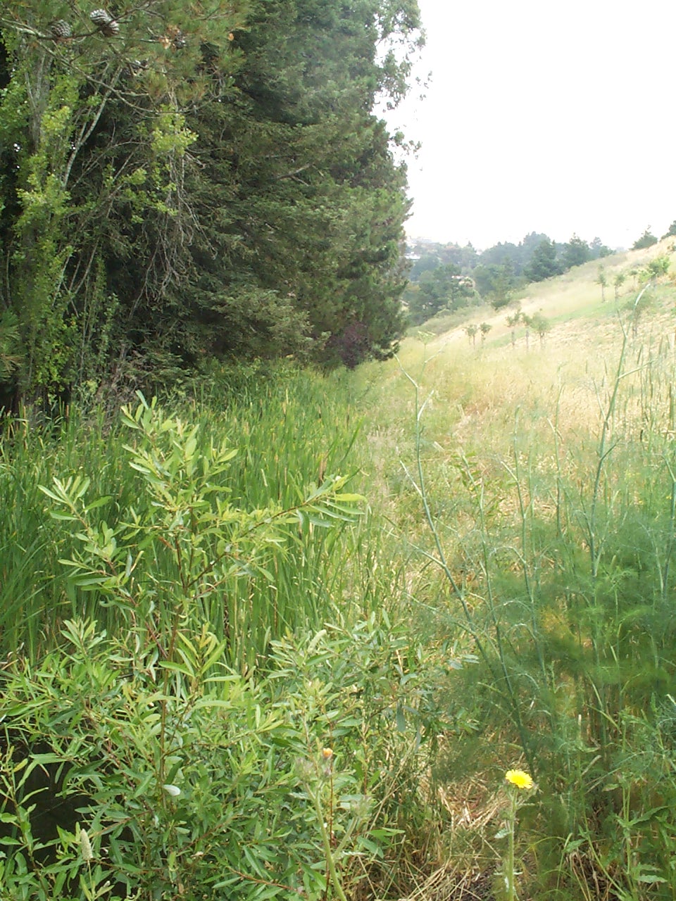
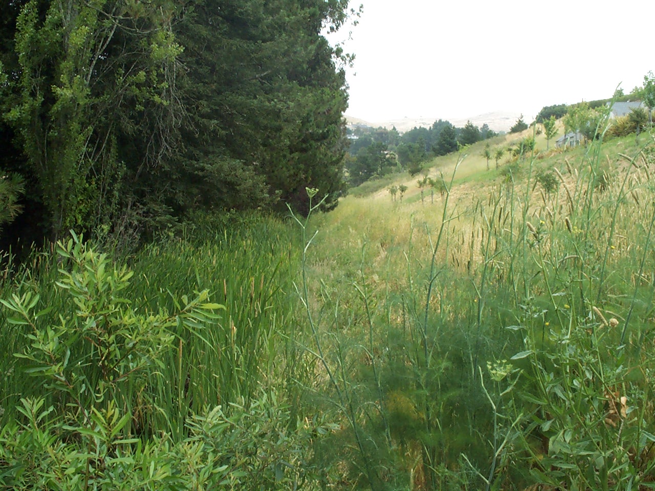
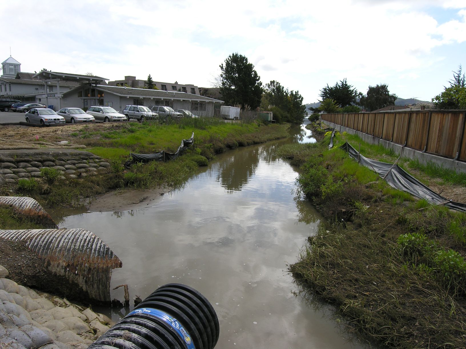
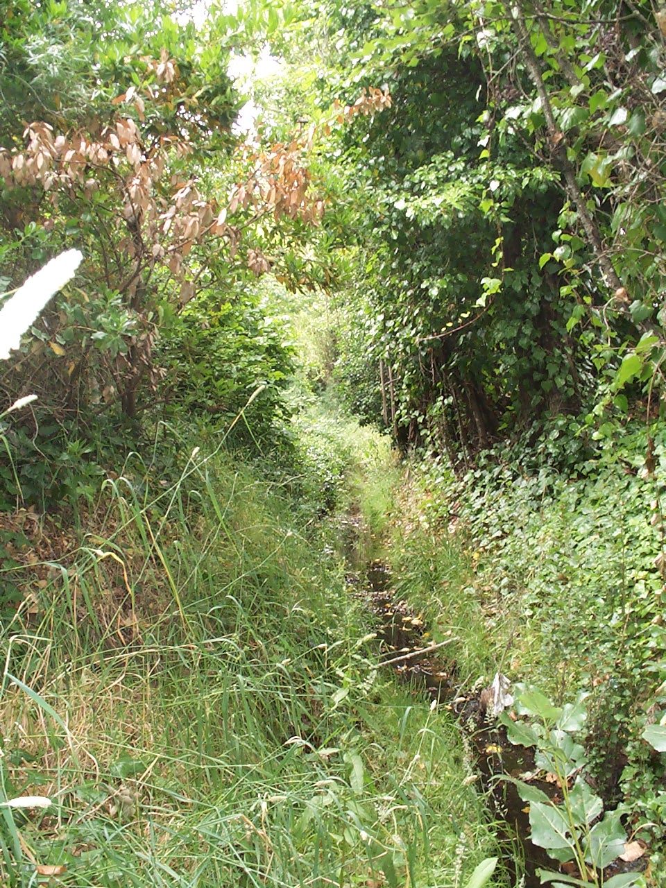
.jpg)
.jpg)
.jpg)
.jpg)
.jpg)
.2.jpg)
.2.jpg)
.jpg)
.jpg)
.jpg)
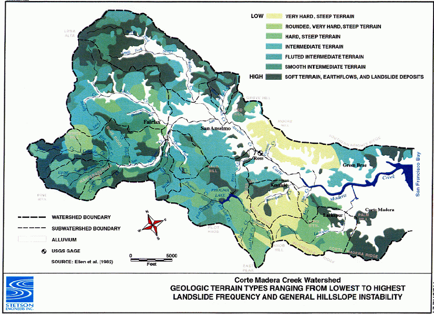
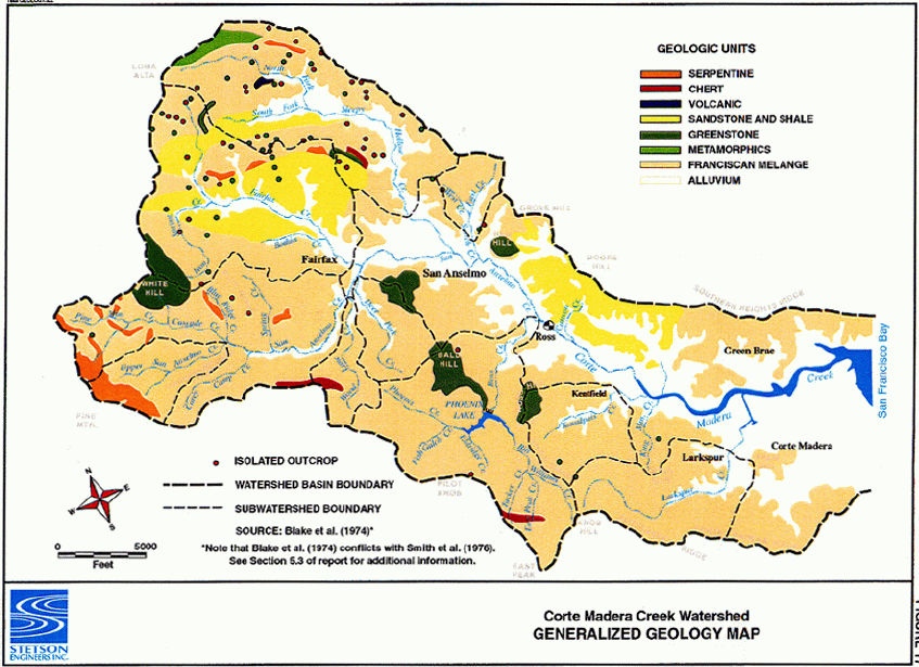
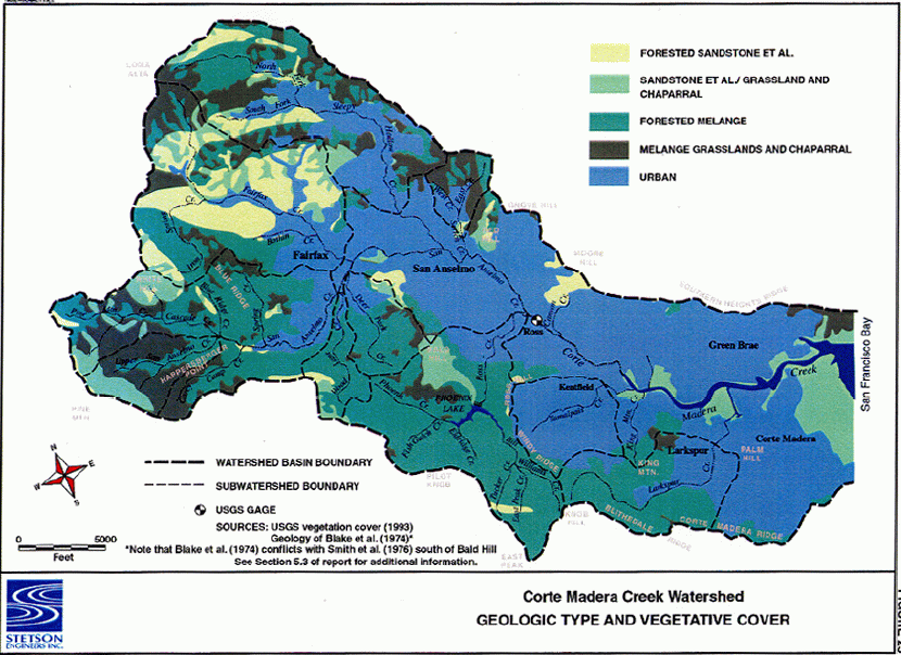
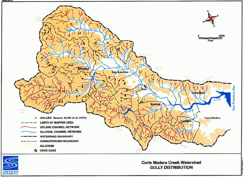
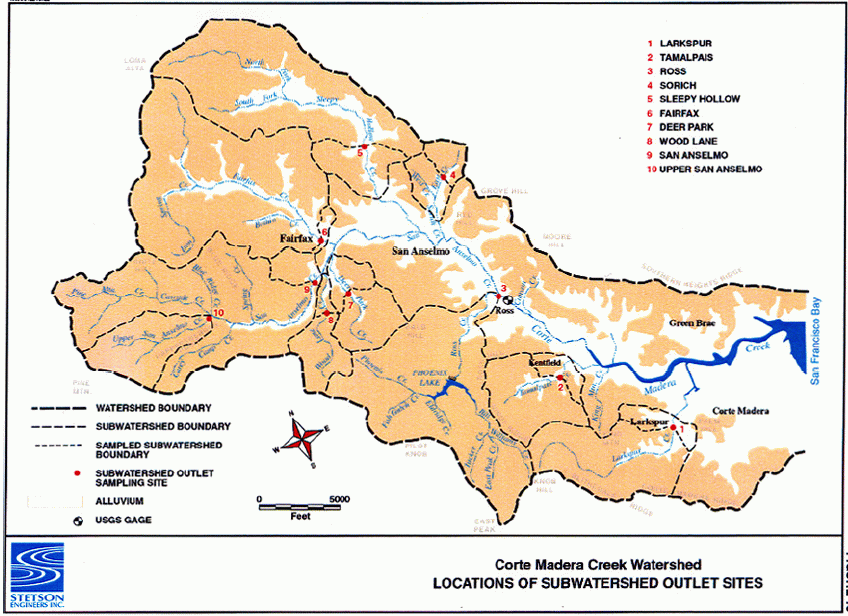
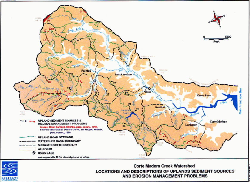
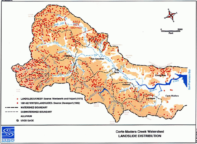
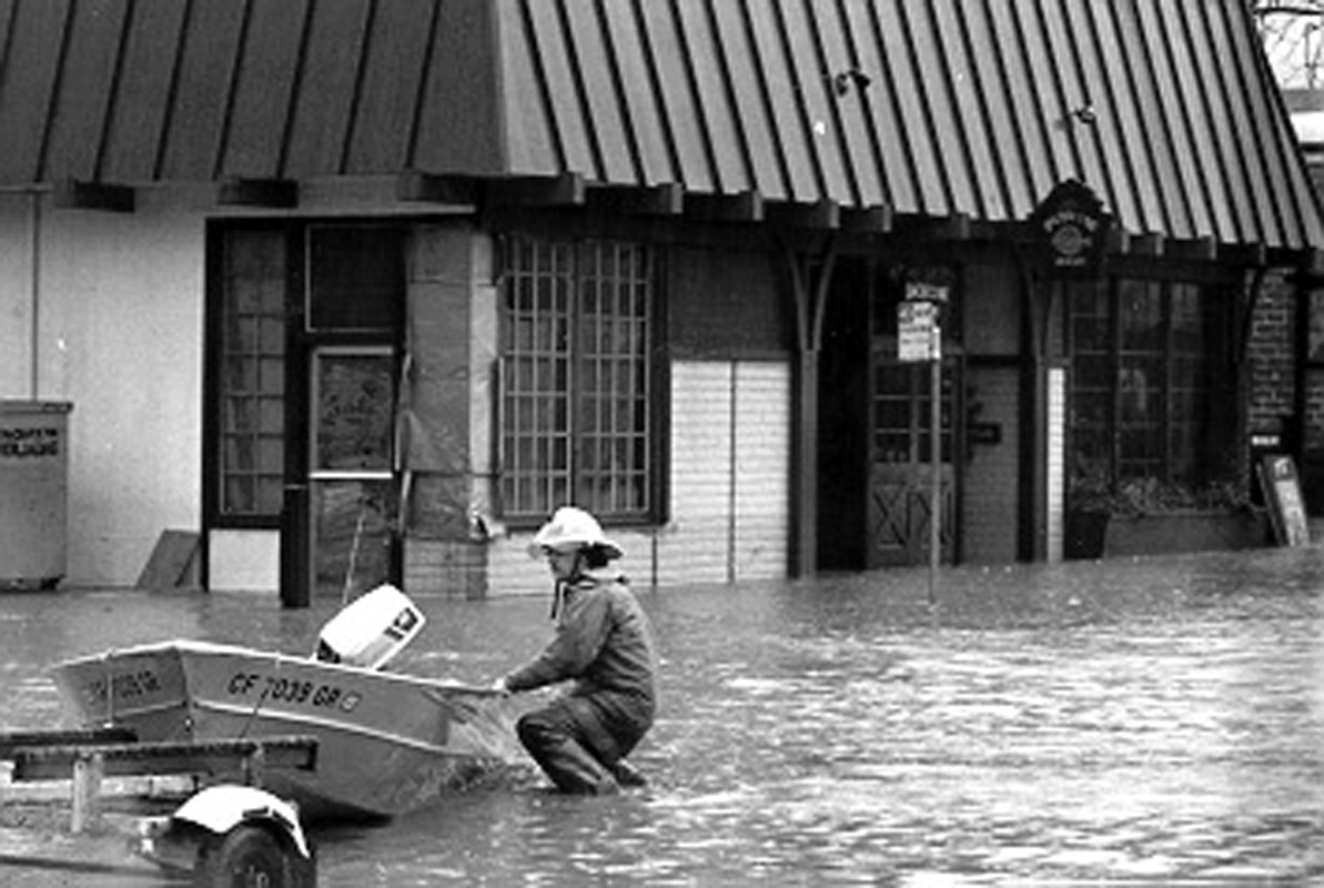
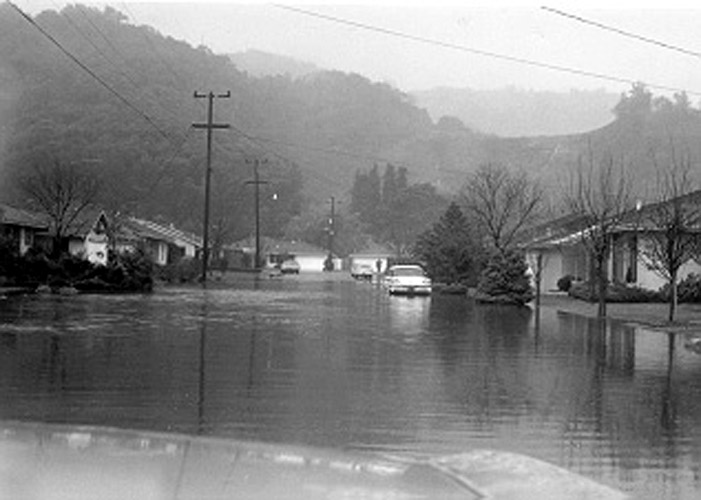
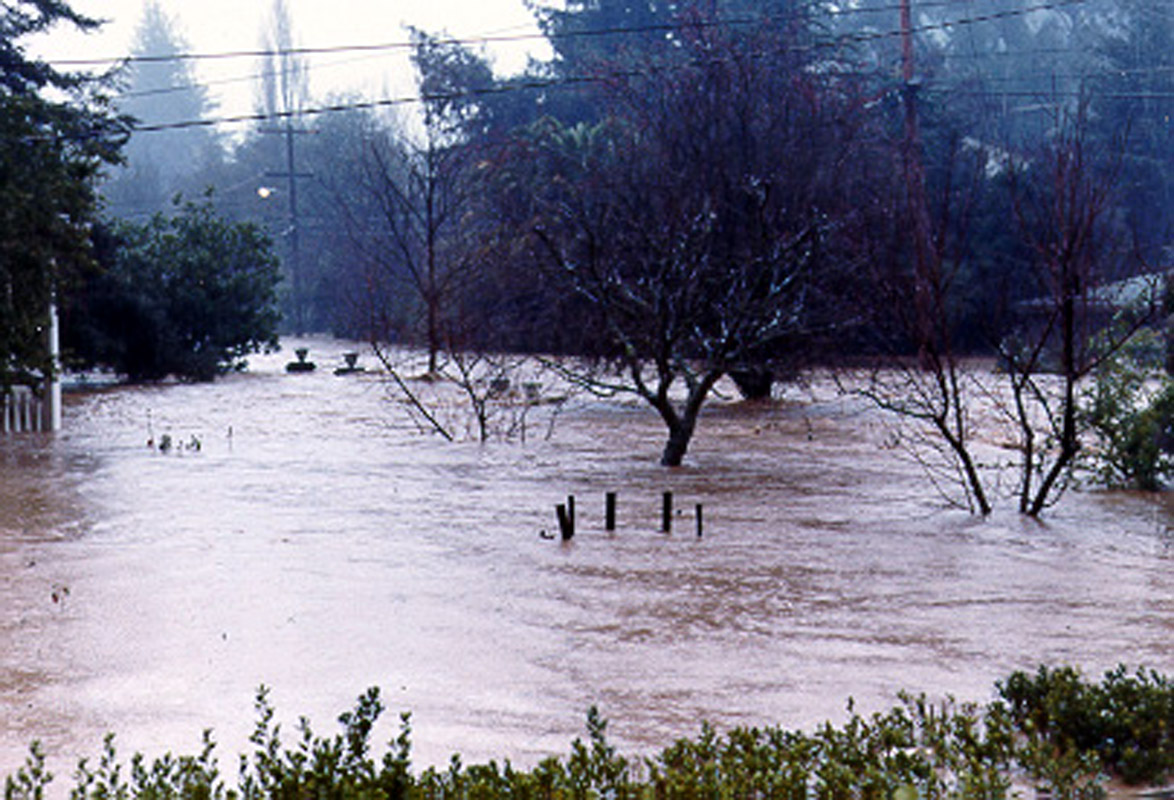
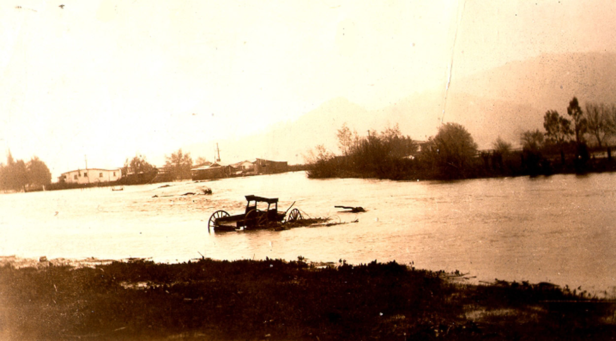
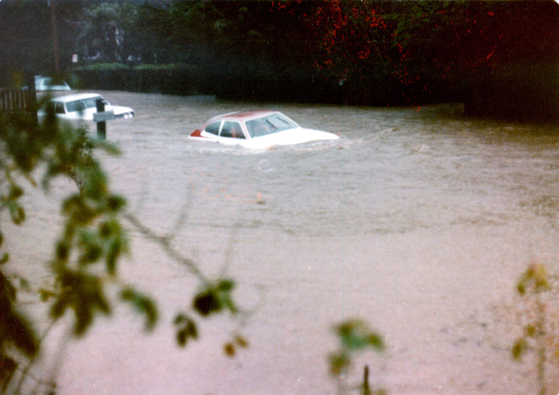
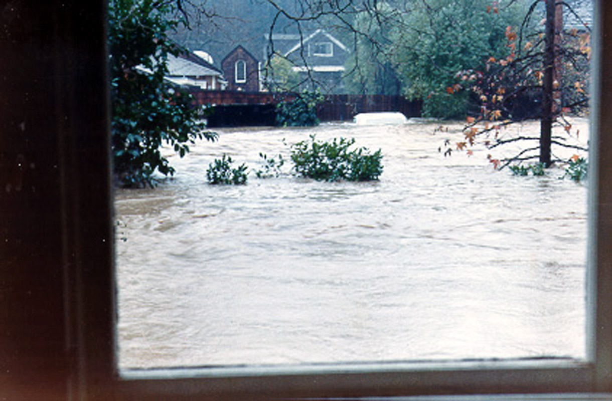
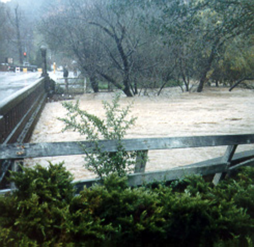
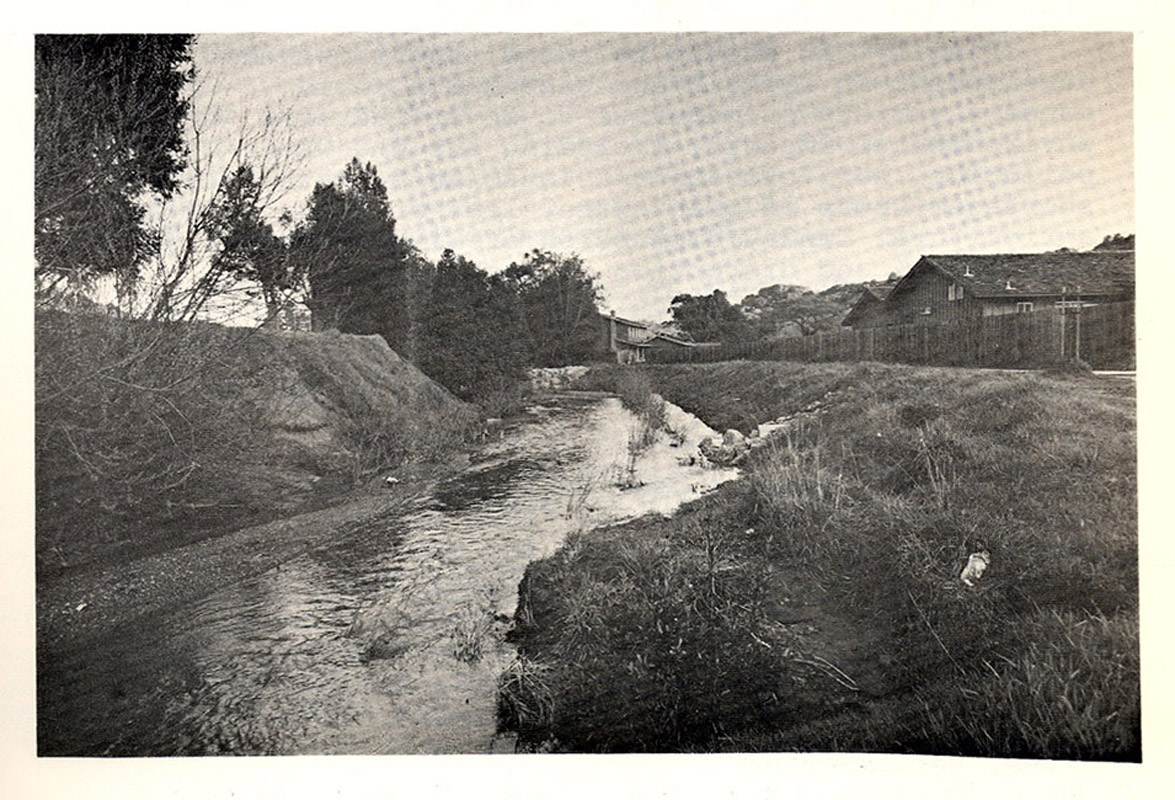
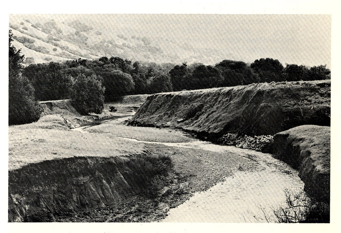
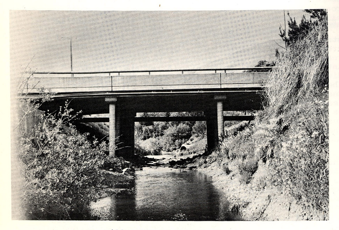
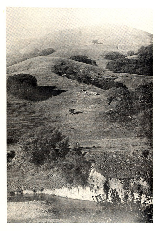
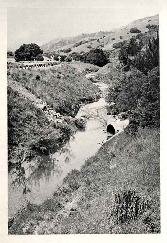
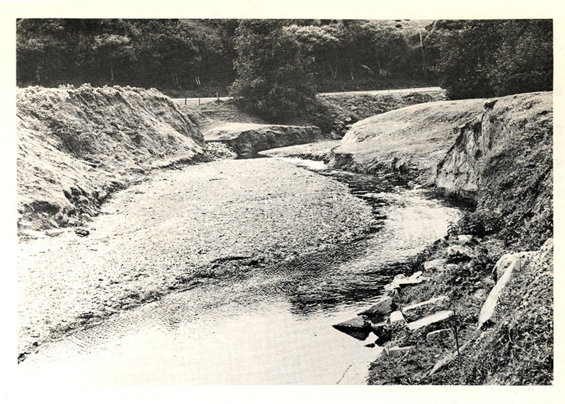
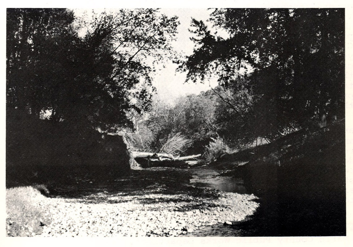
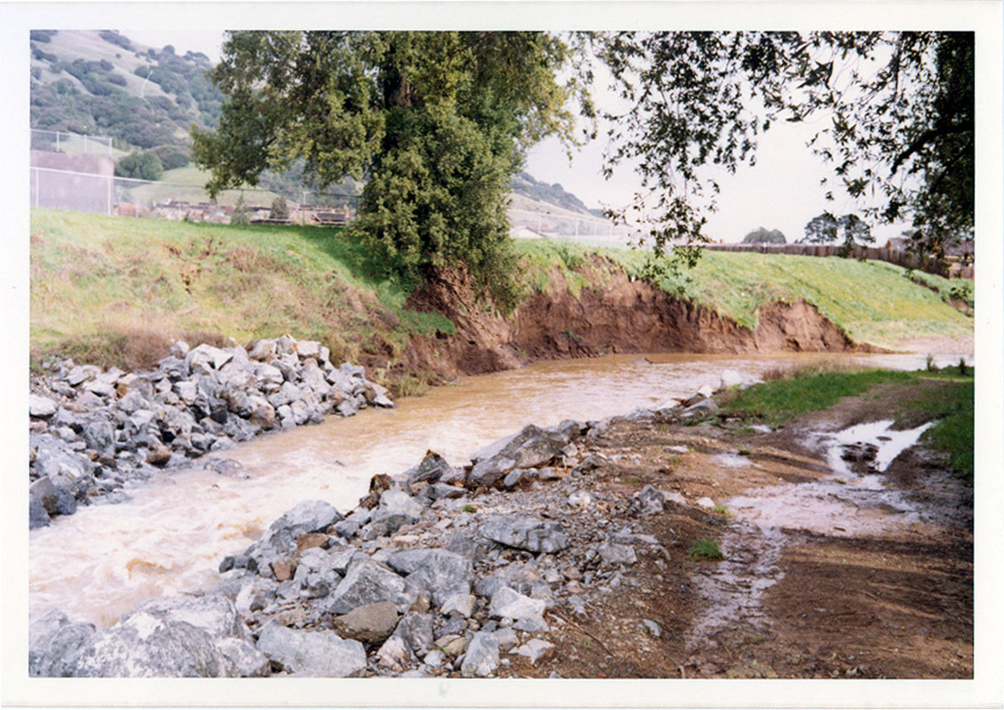
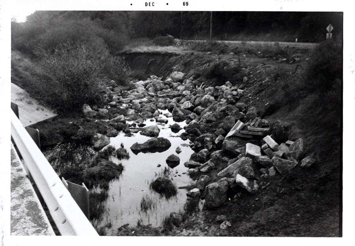
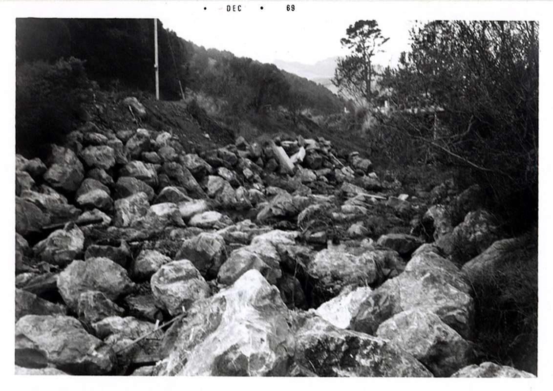
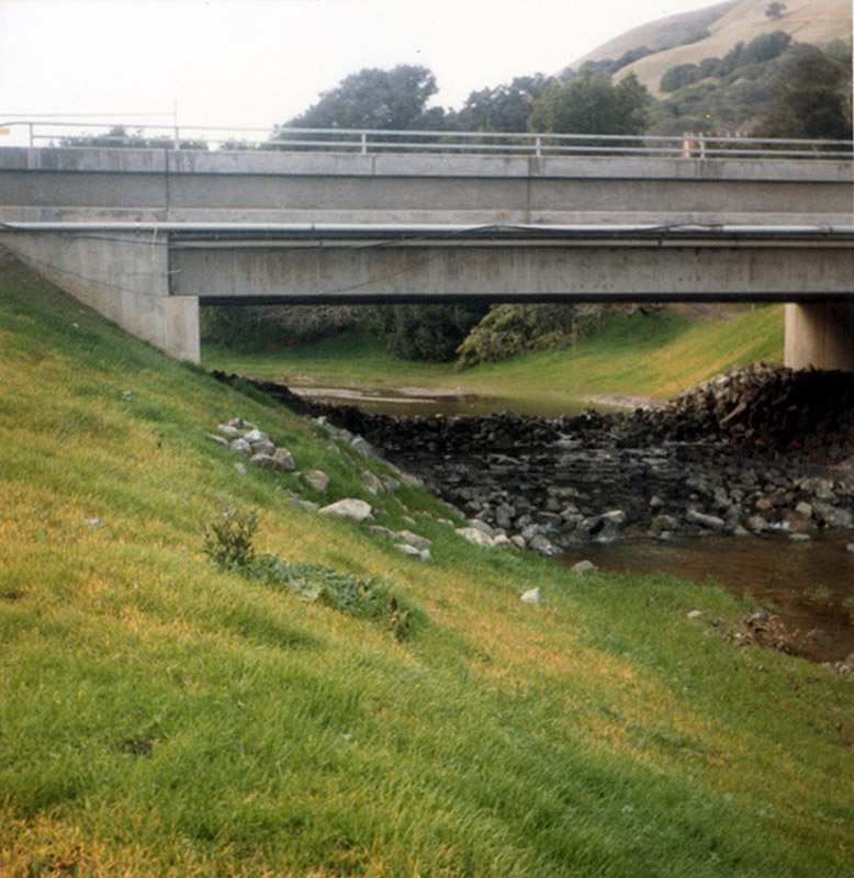
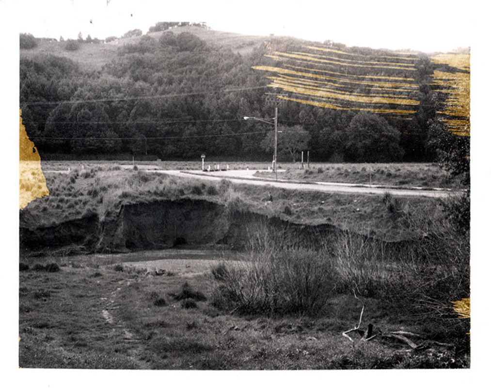
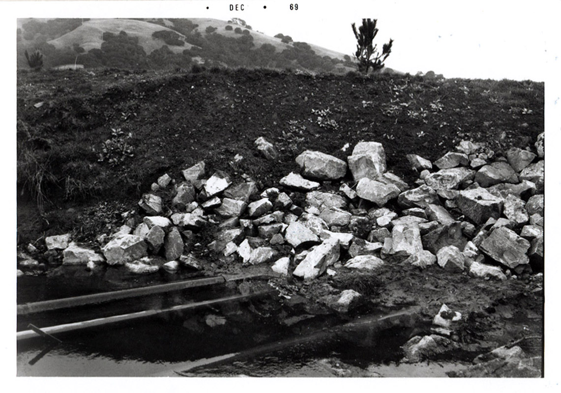
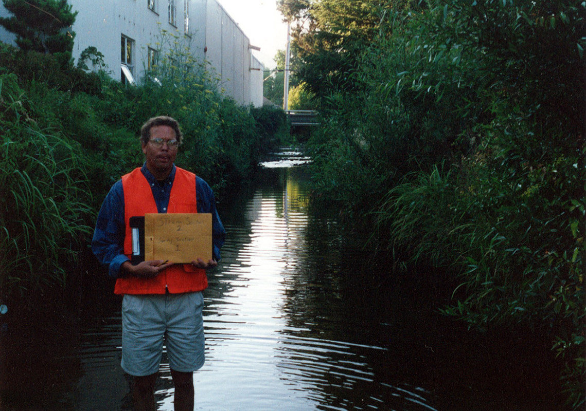
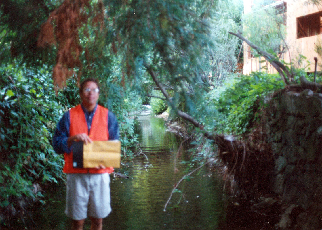
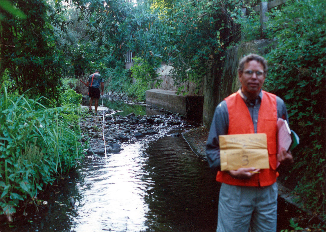
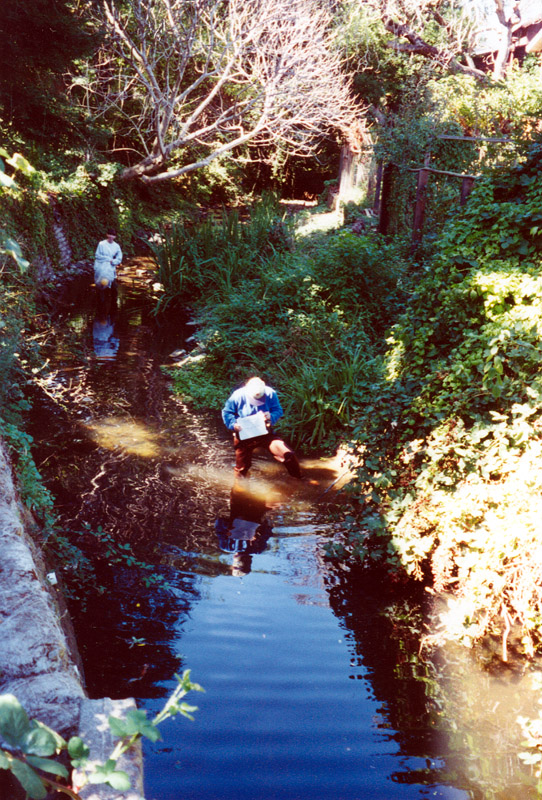
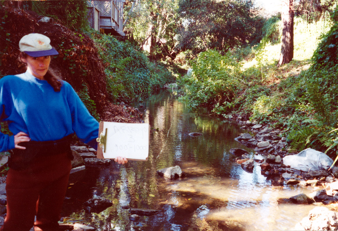
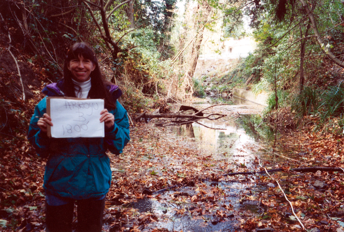
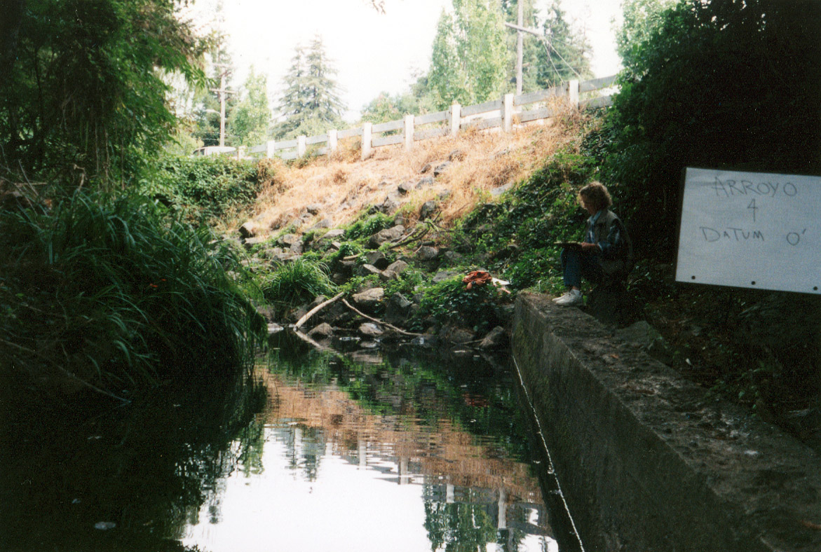
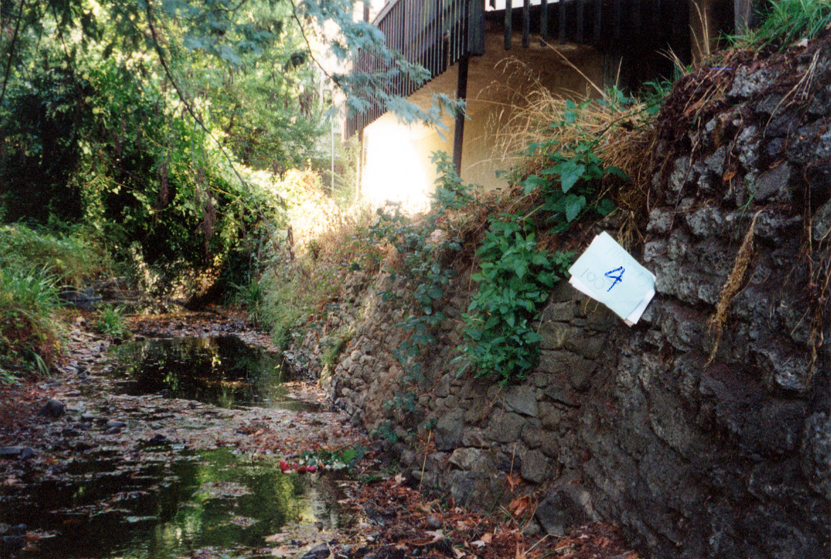
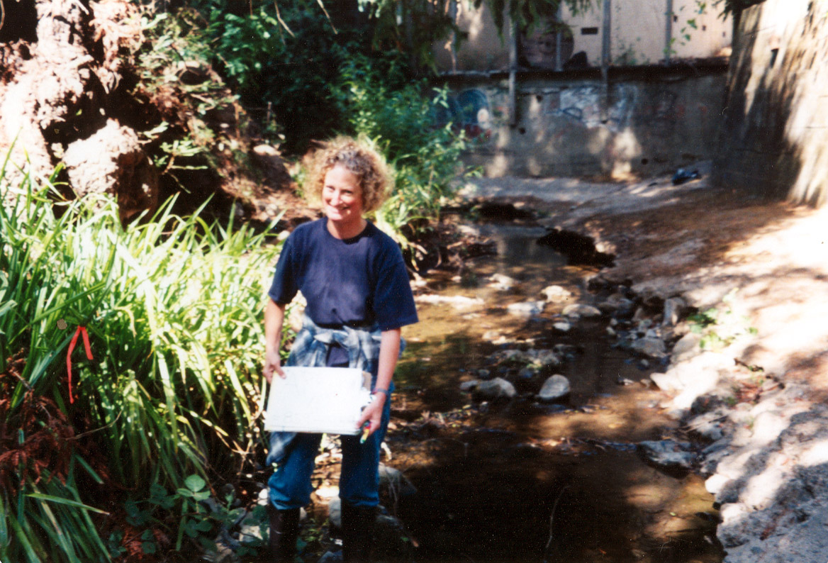
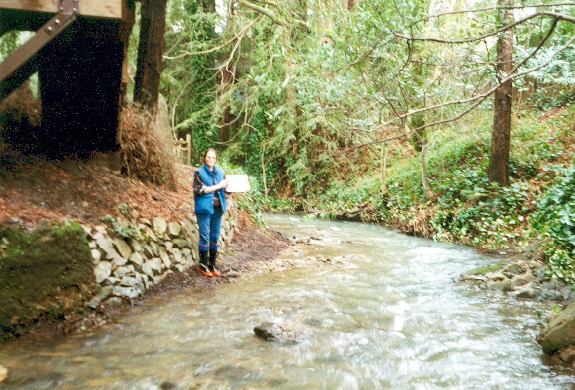
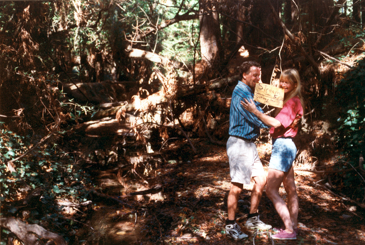
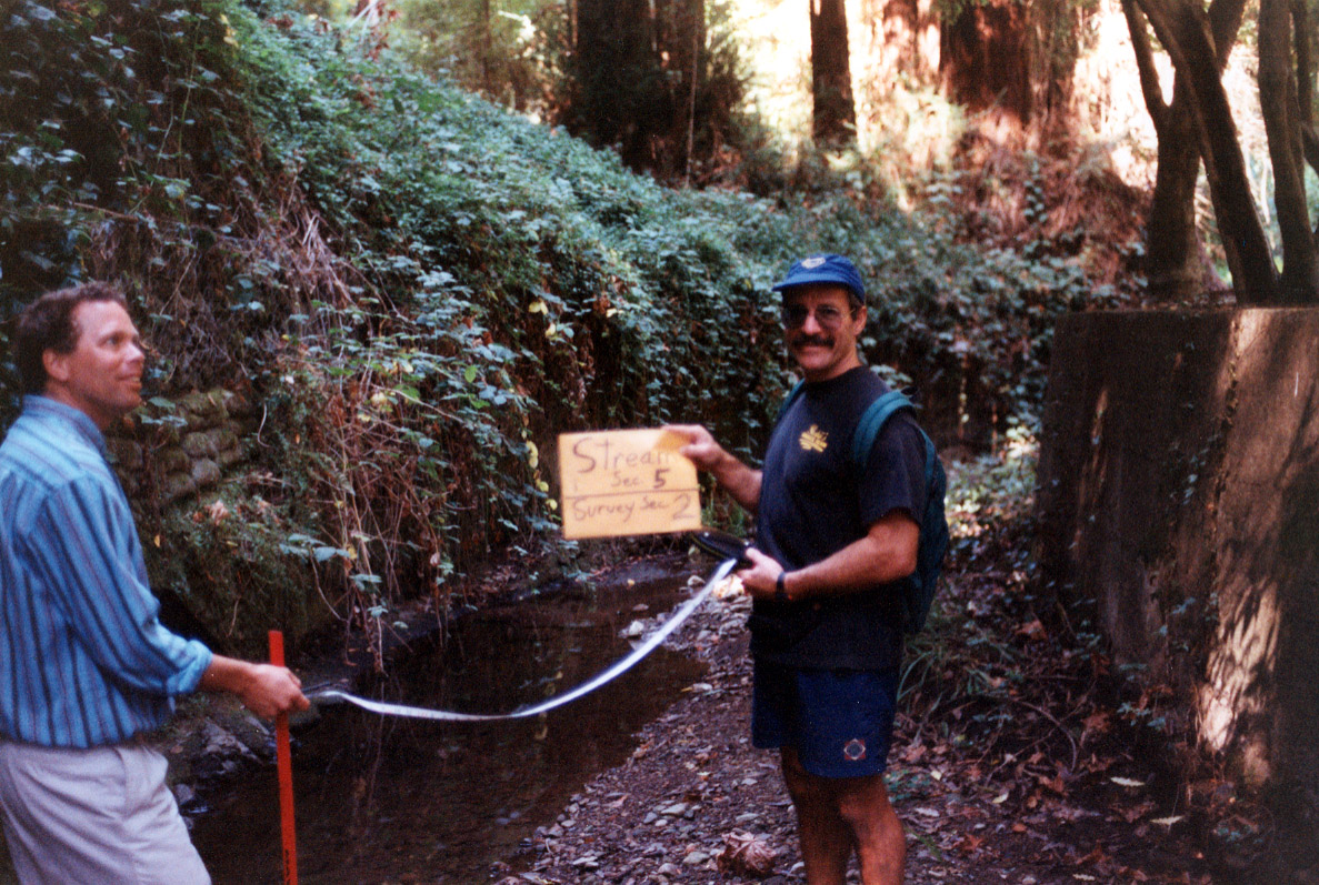
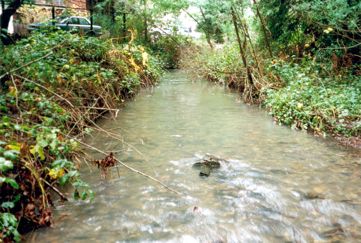
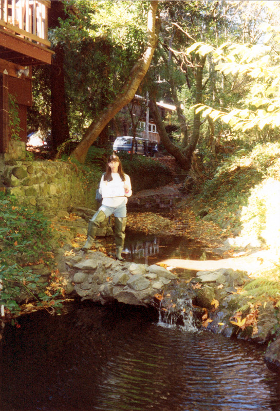
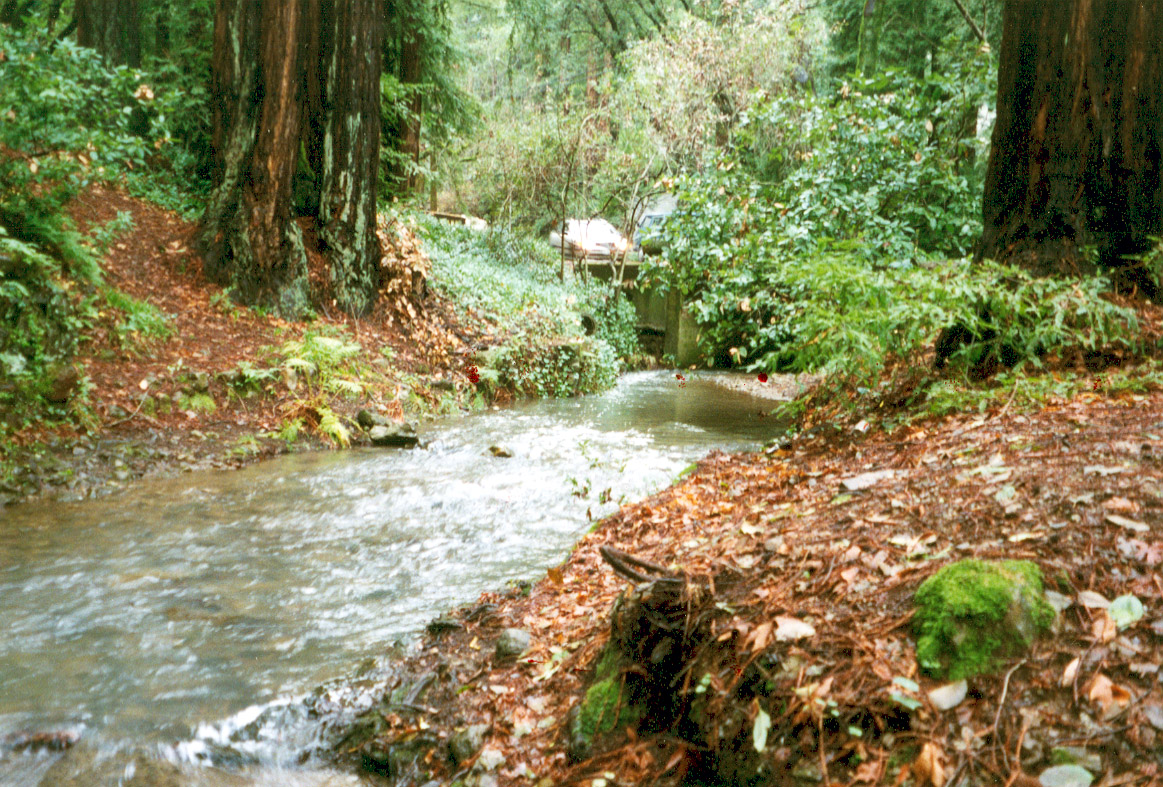
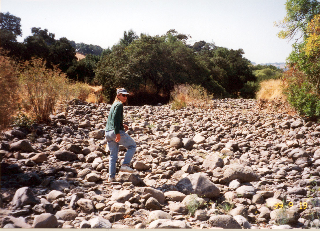
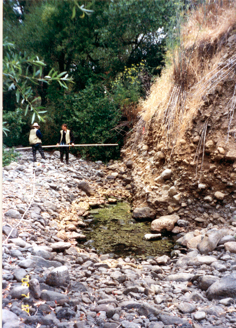
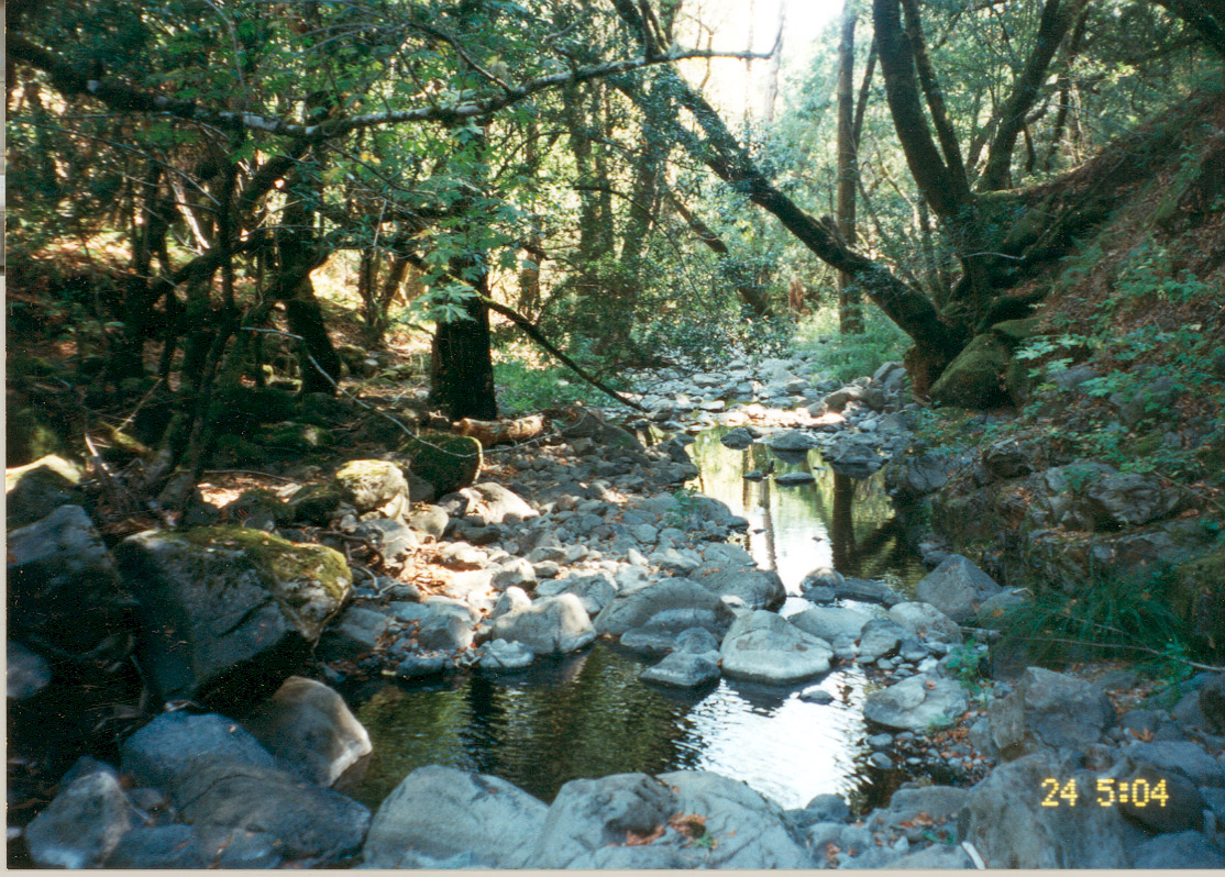
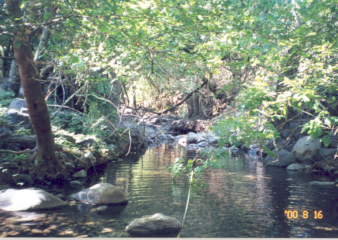
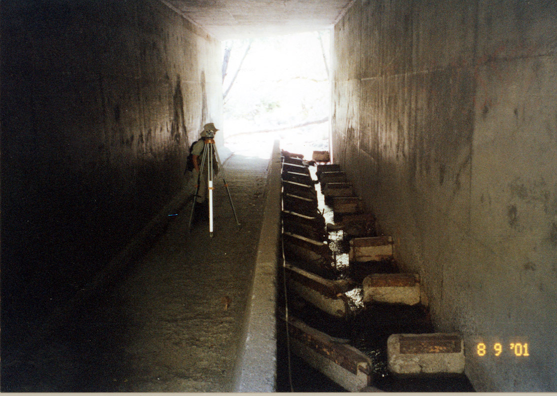
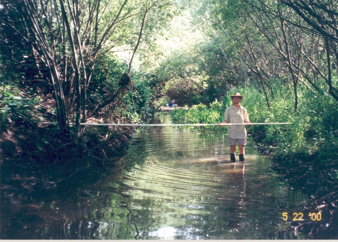
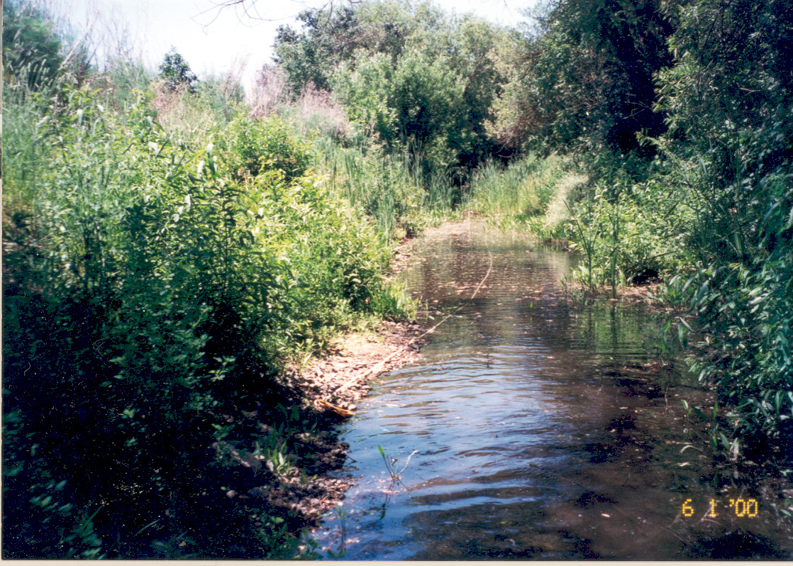
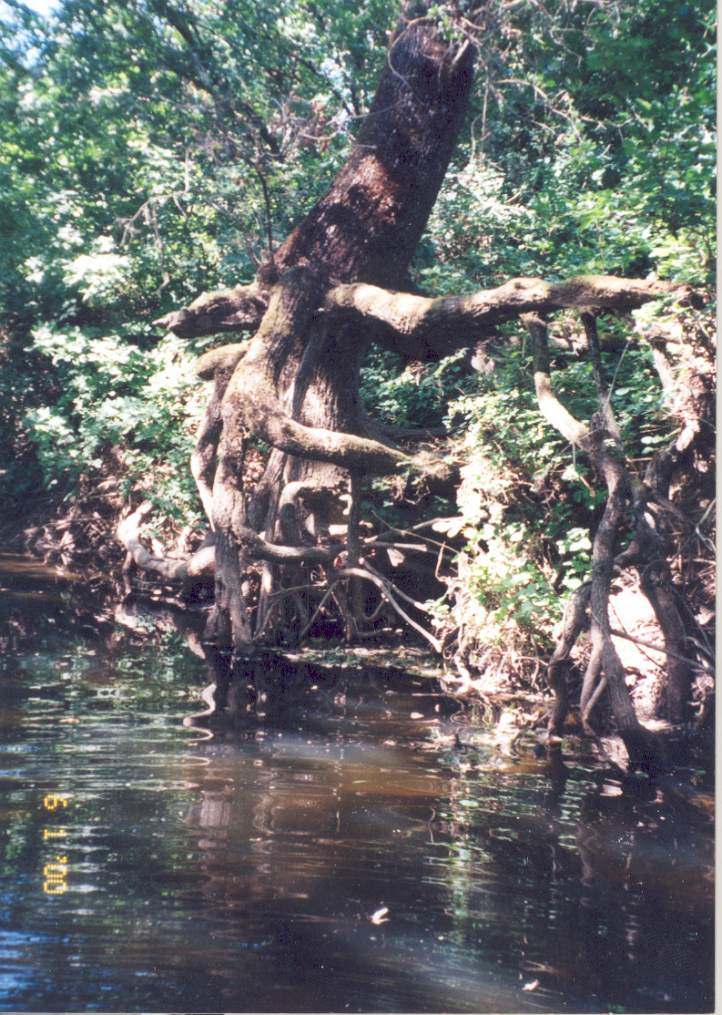
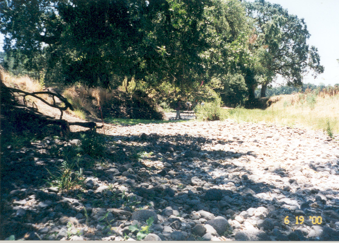
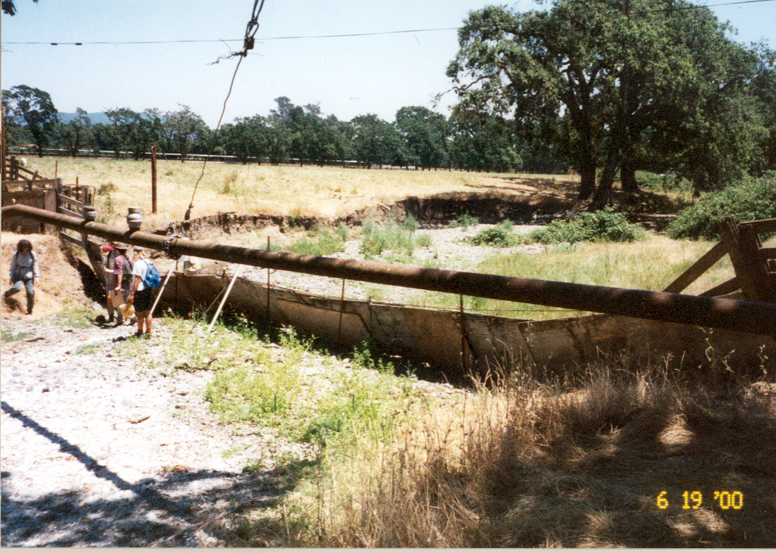
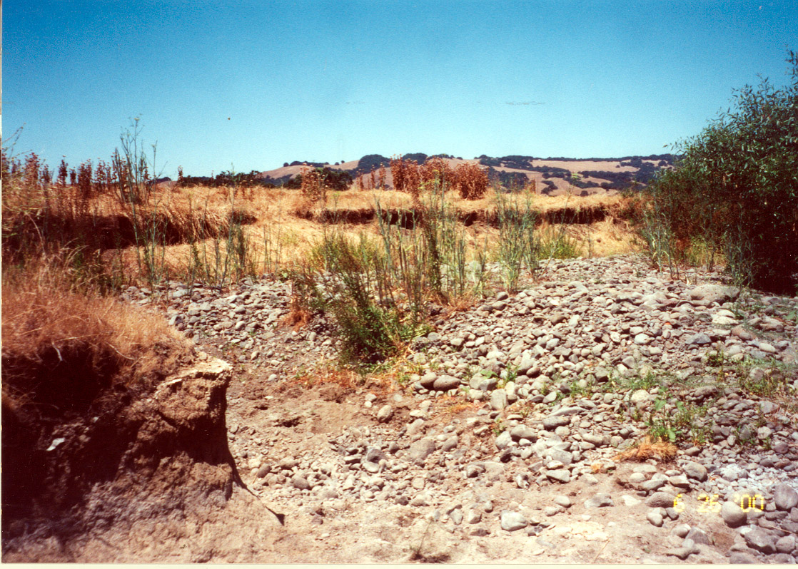
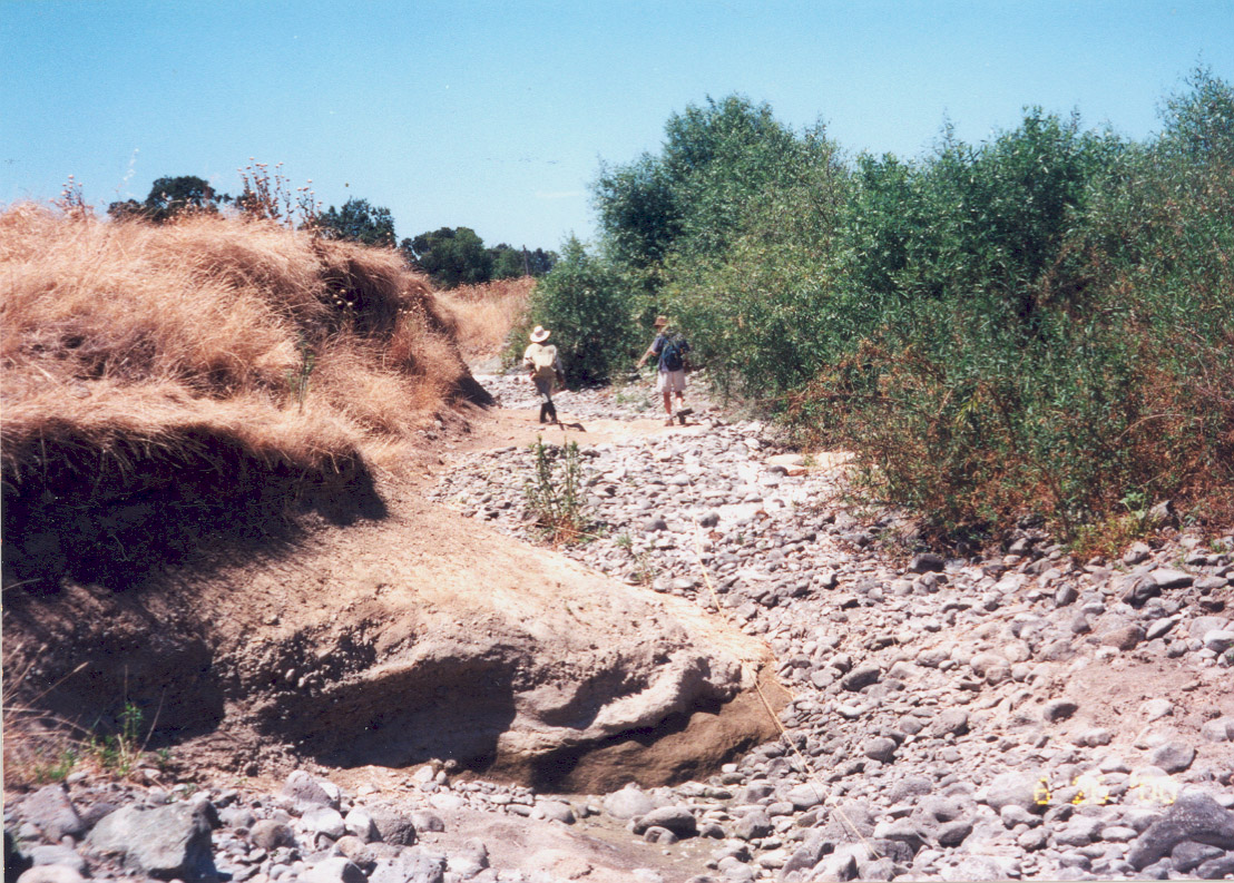
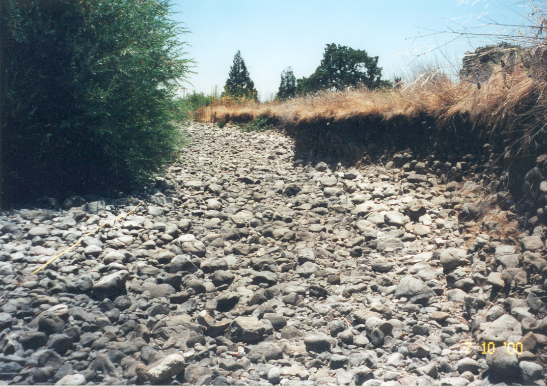
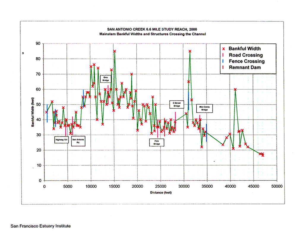
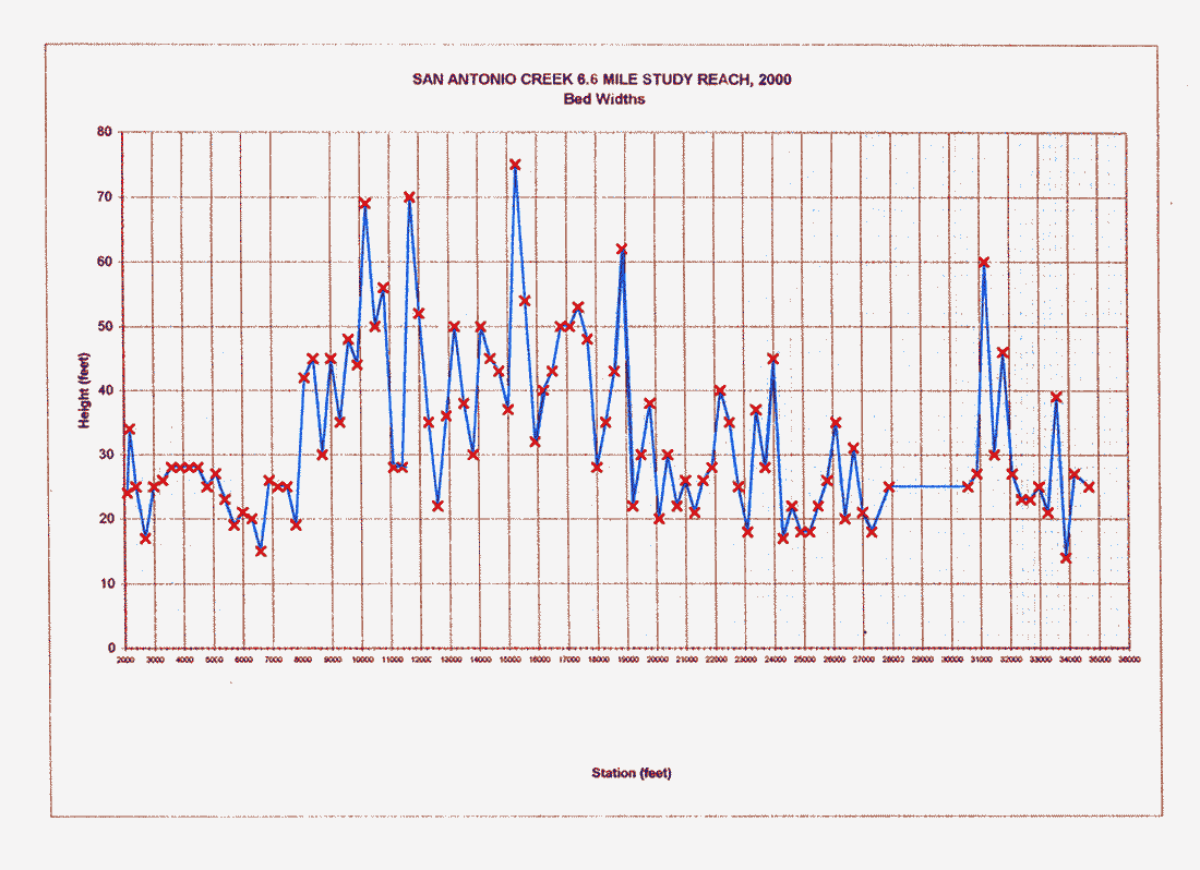
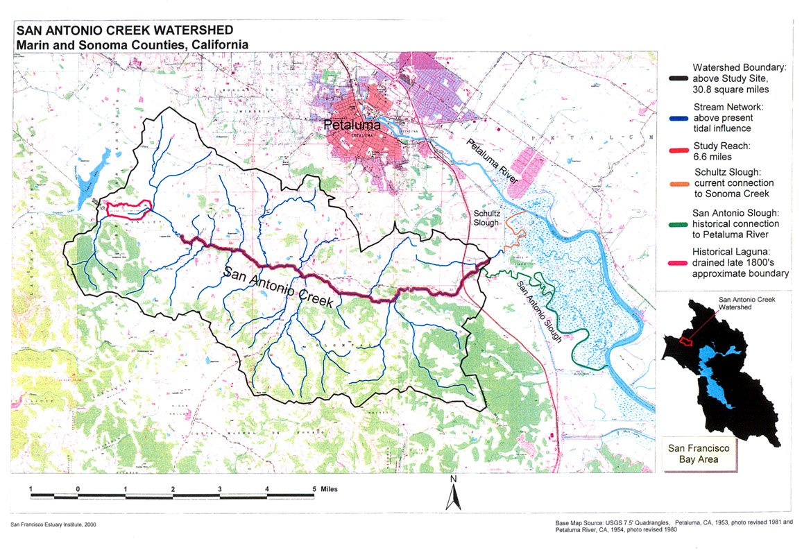
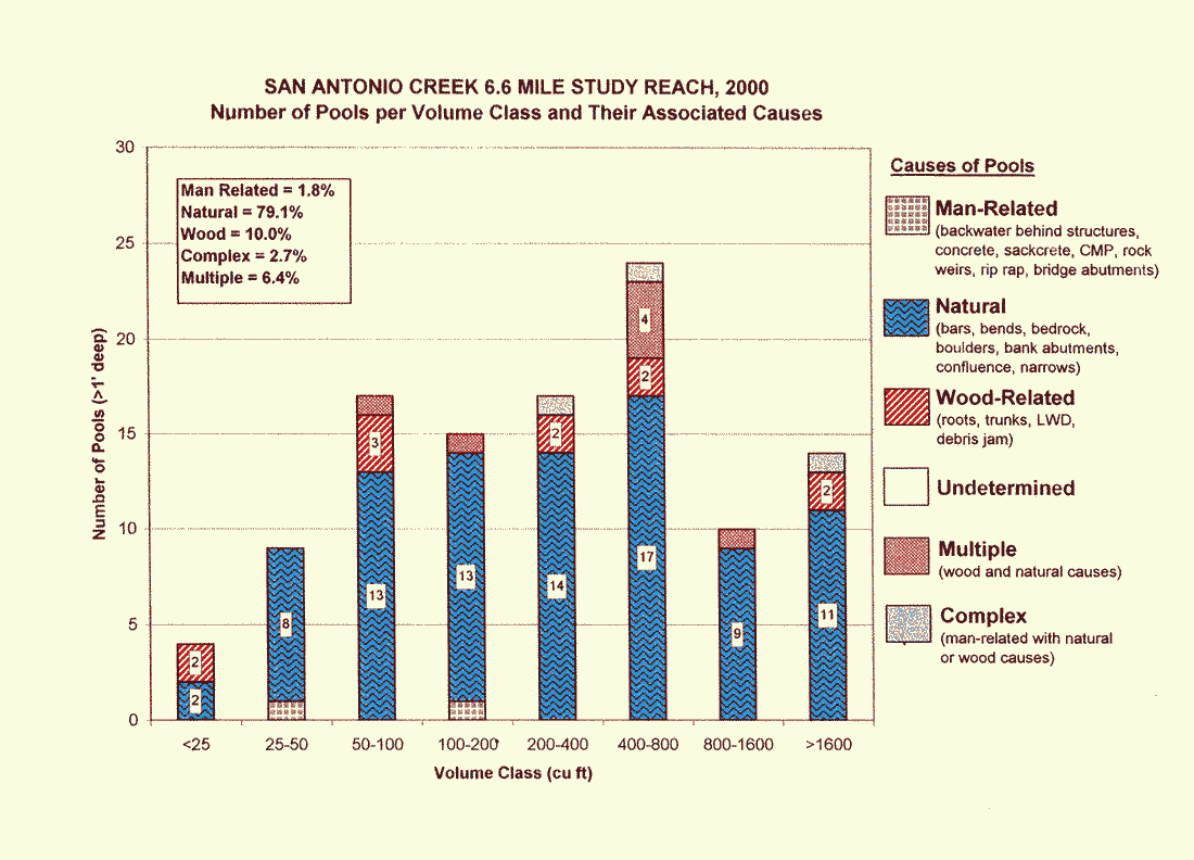
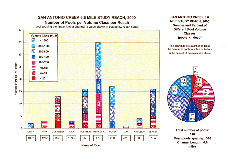
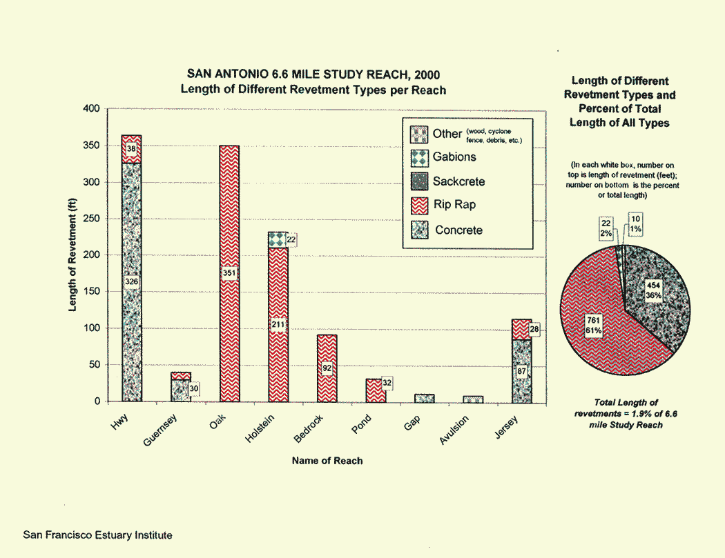
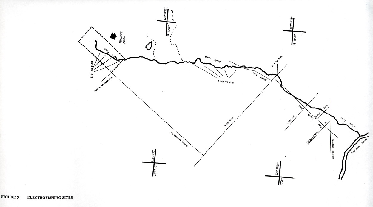
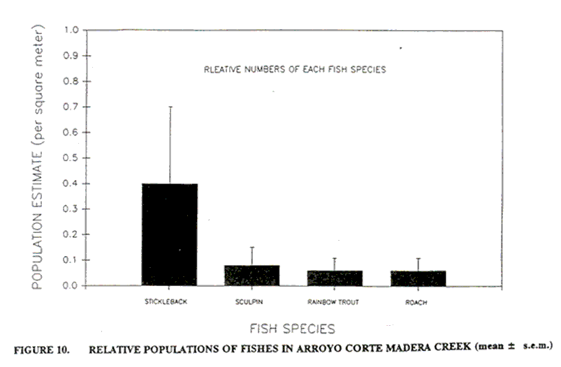
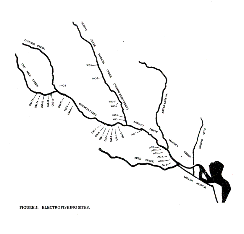
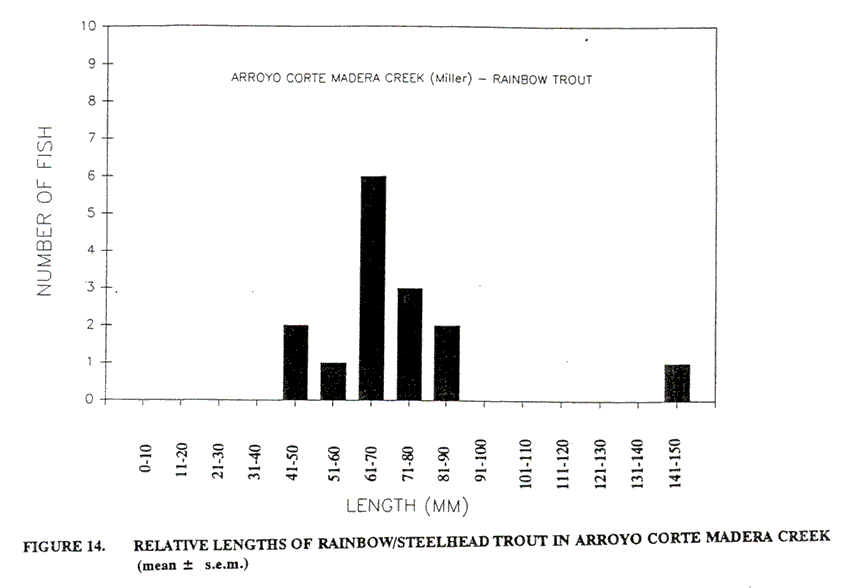
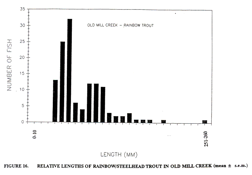
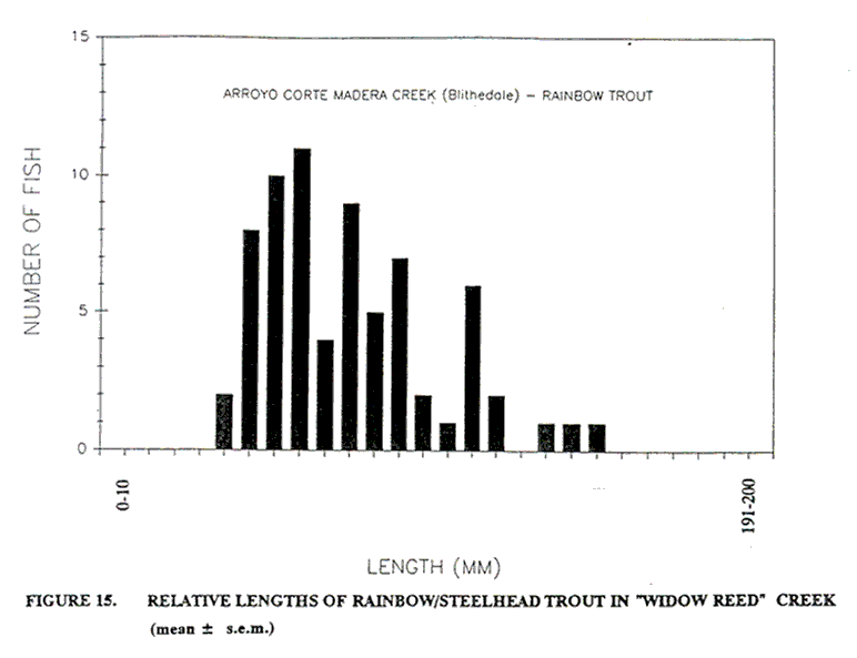
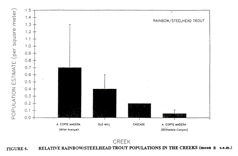
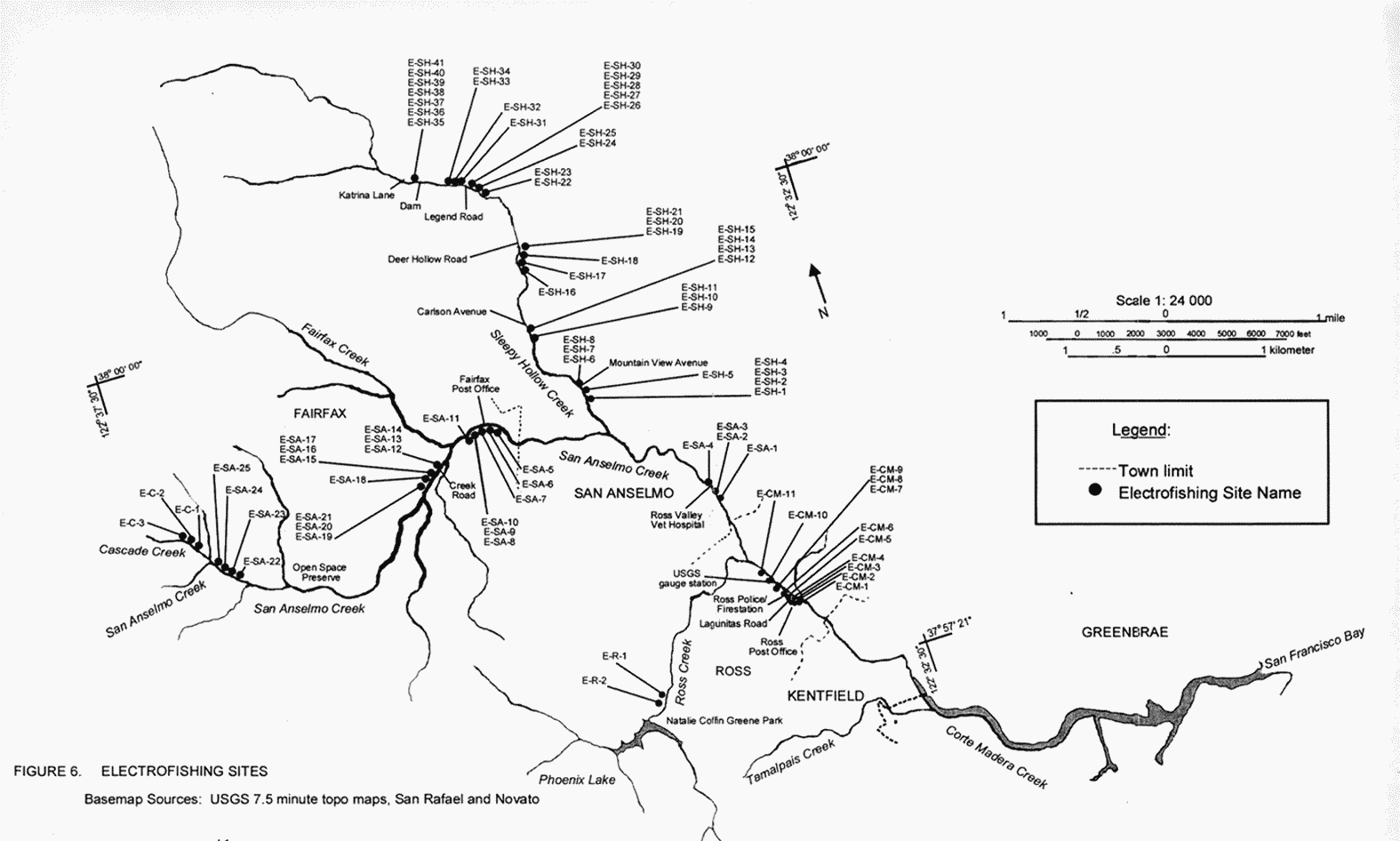
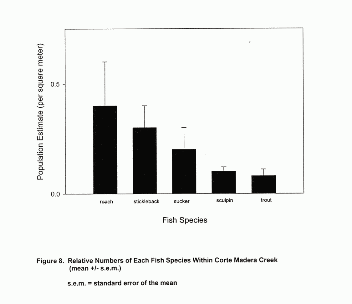
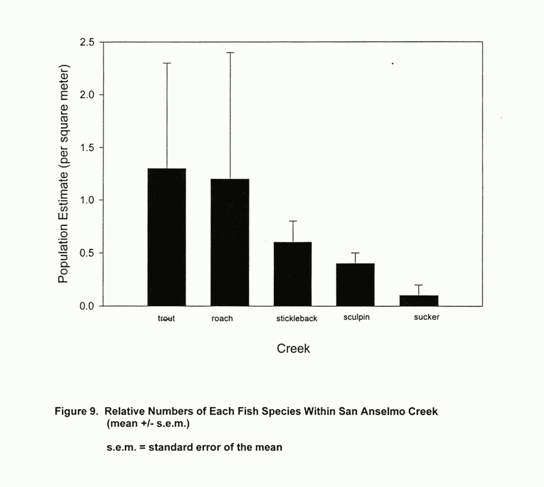
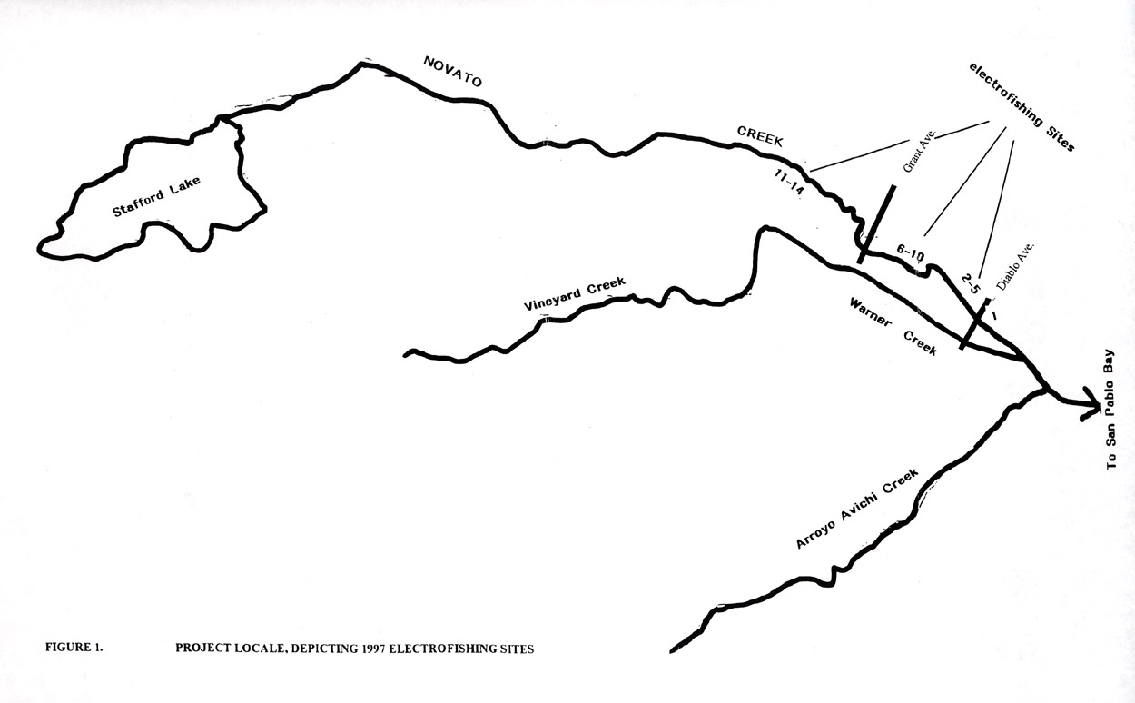
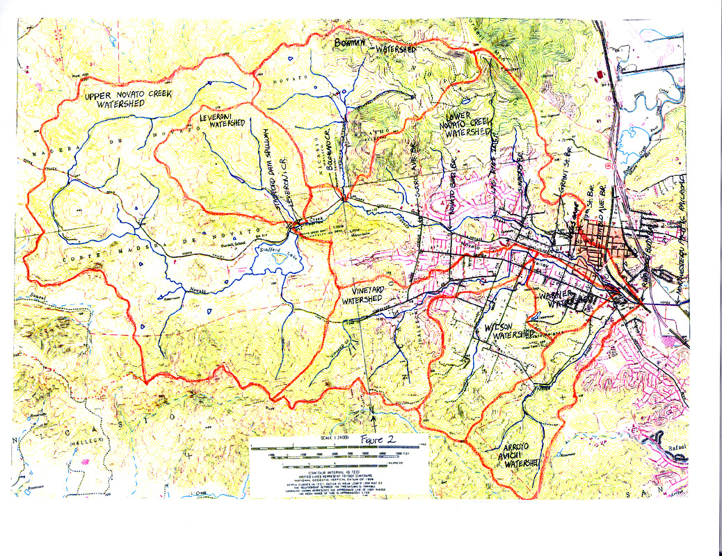
.jpg)
arc.jpg)
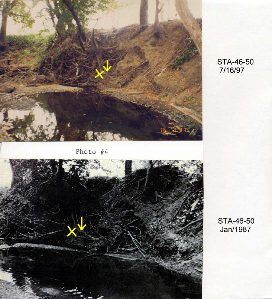
.jpg)
.jpg)
.jpg)
.jpg)
.jpg)
.jpg)
.jpg)
.jpg)
.jpg)
.jpg)
.jpg)
.jpg)
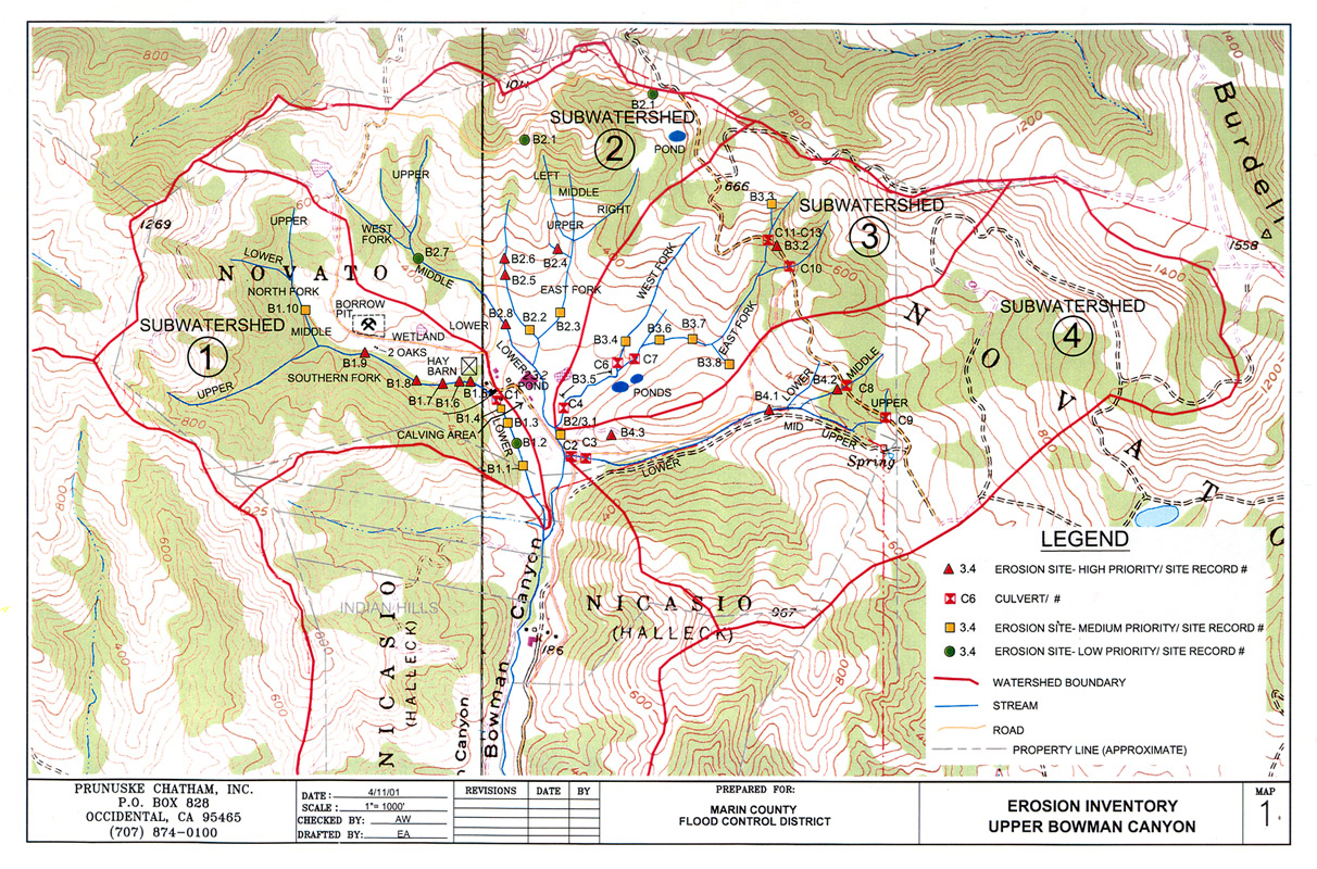
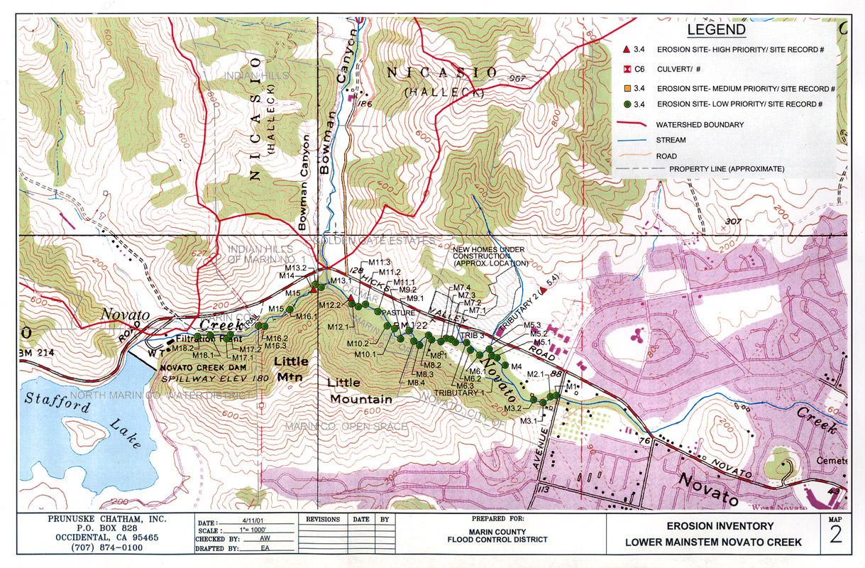
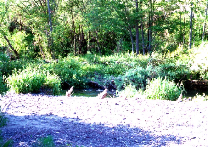
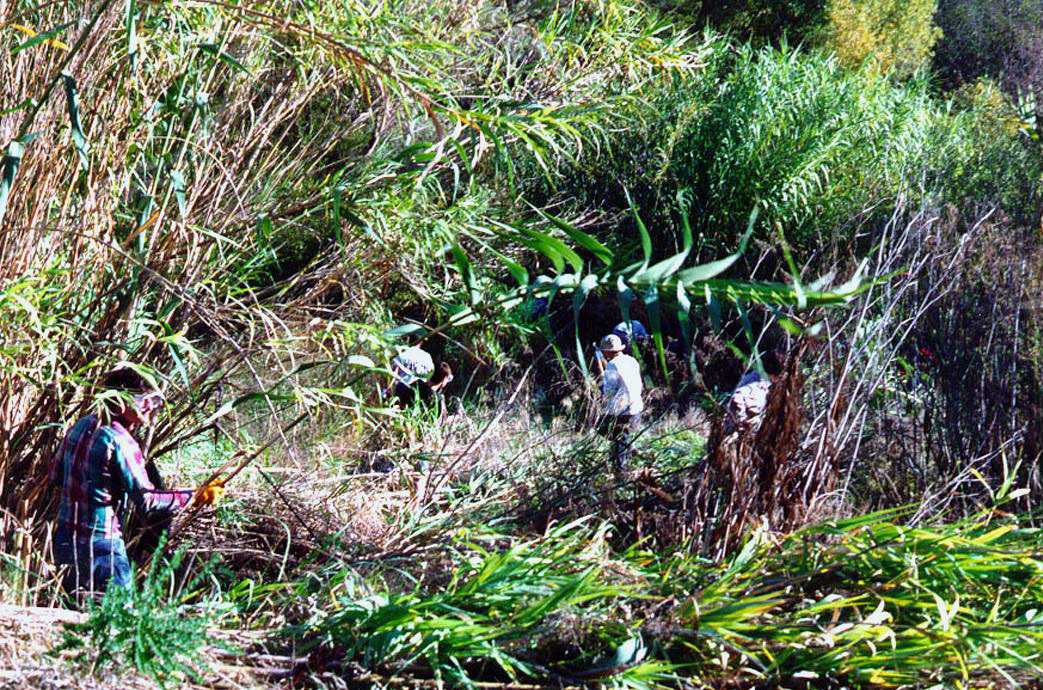
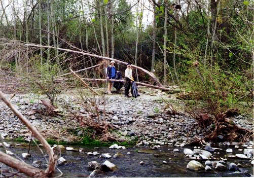
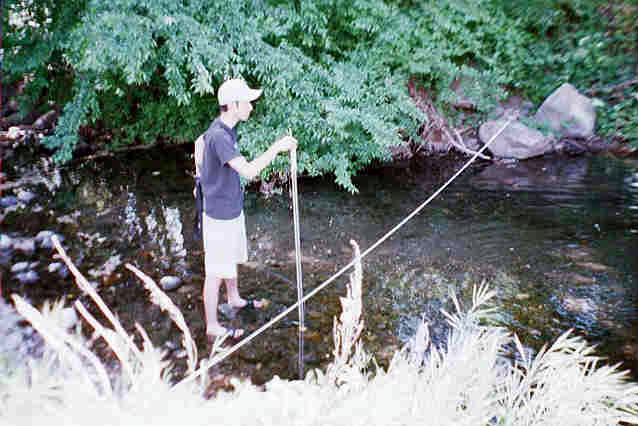
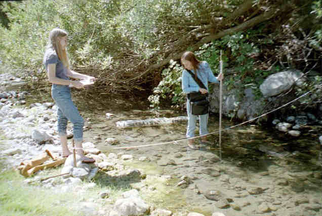
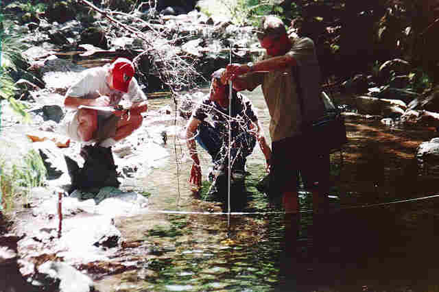
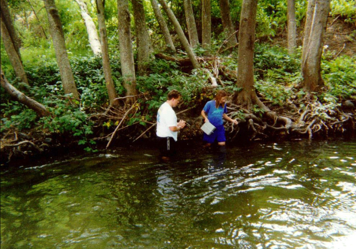
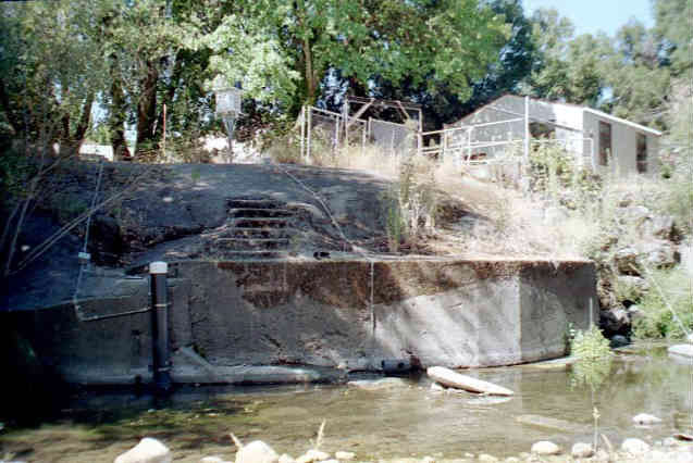
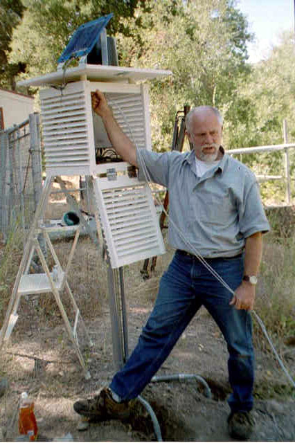
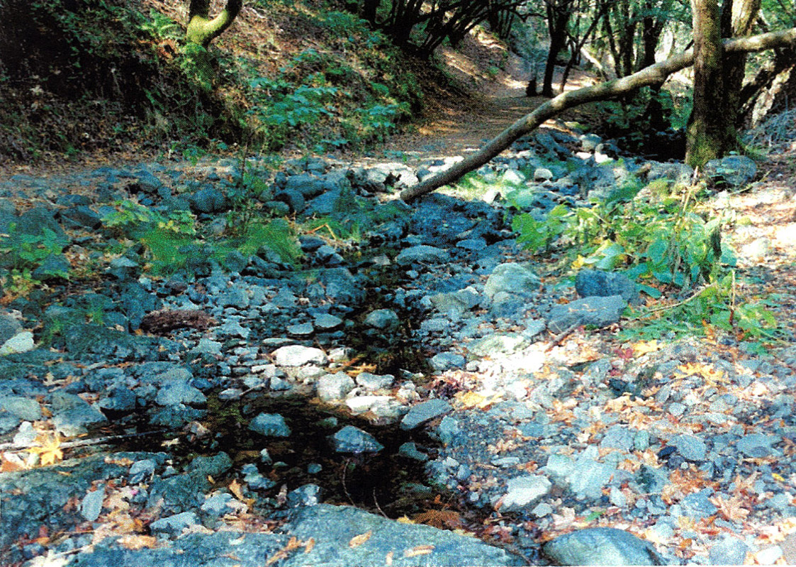
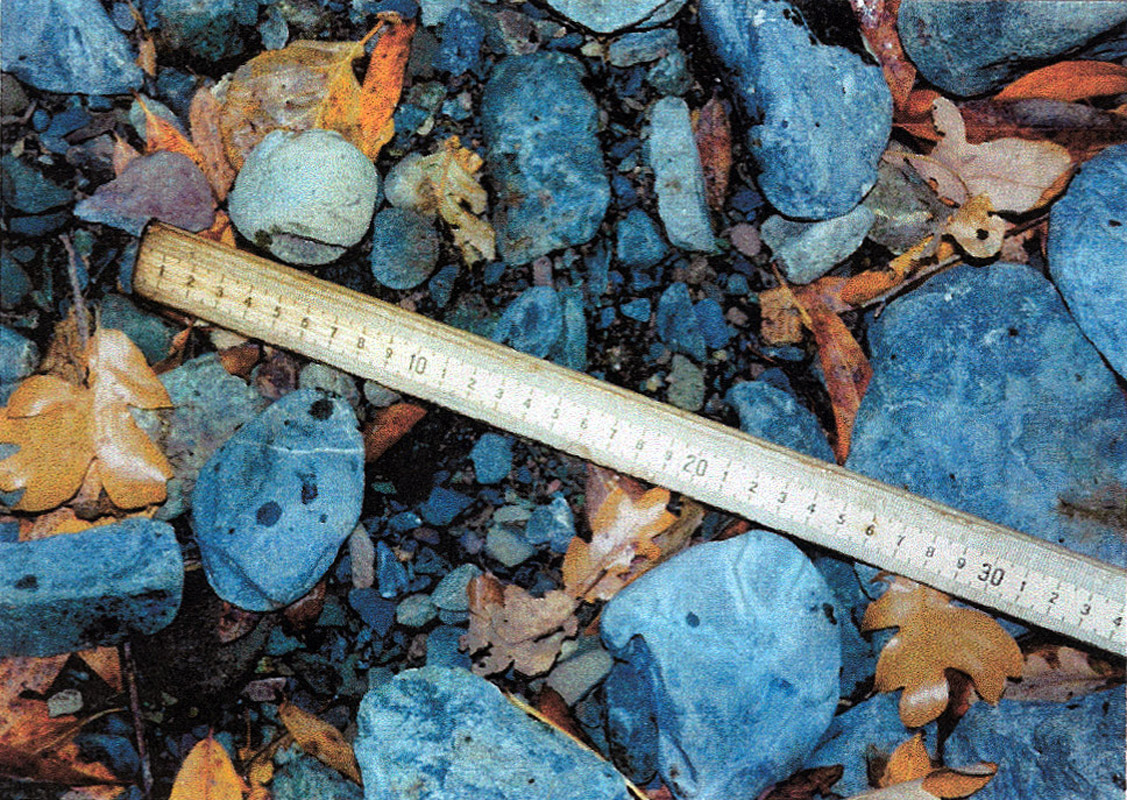
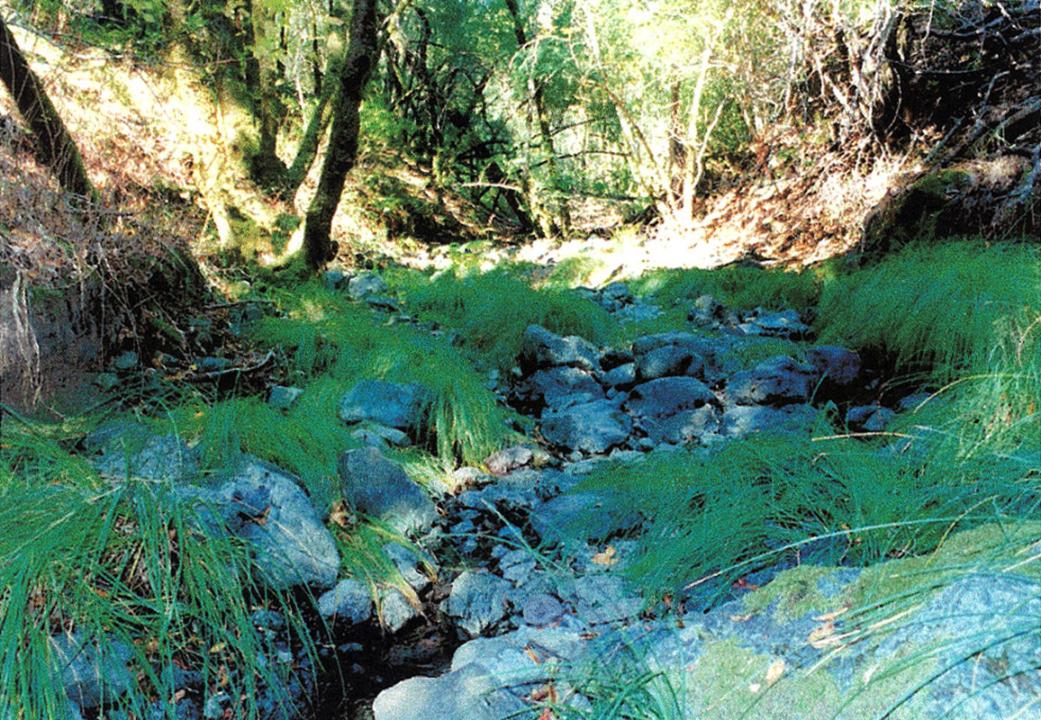
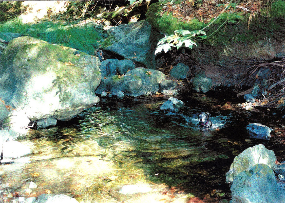
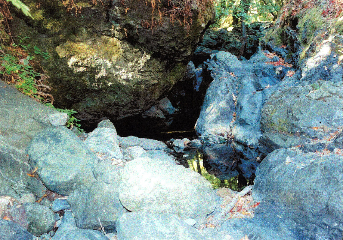
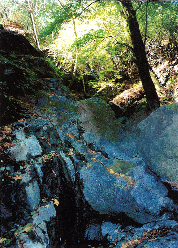
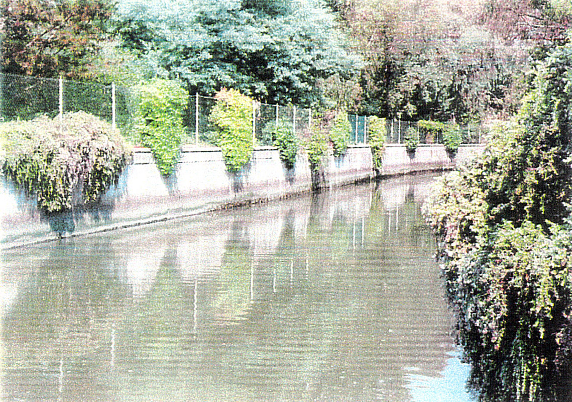
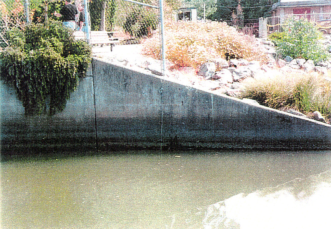
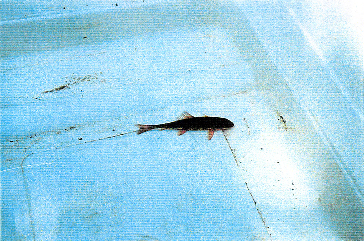
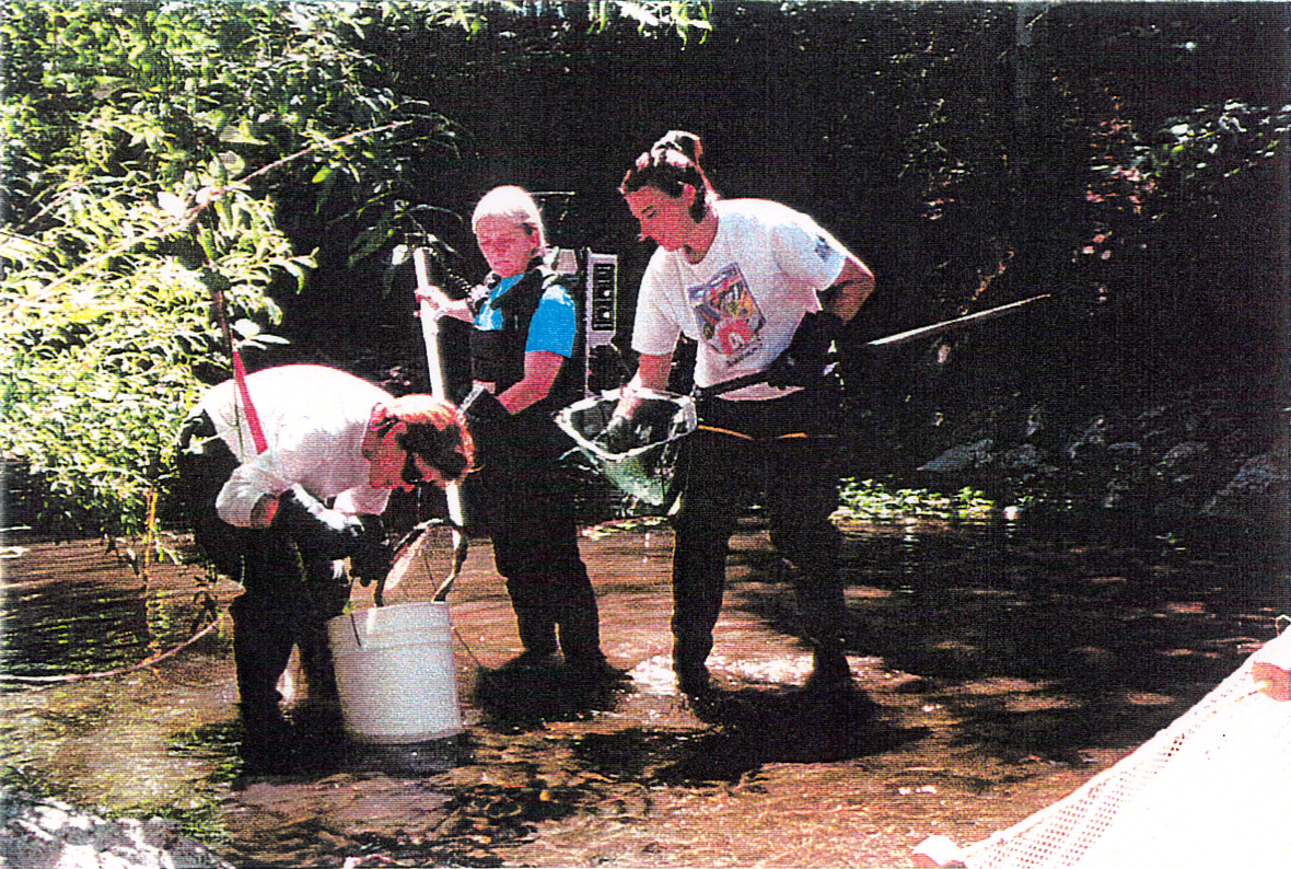
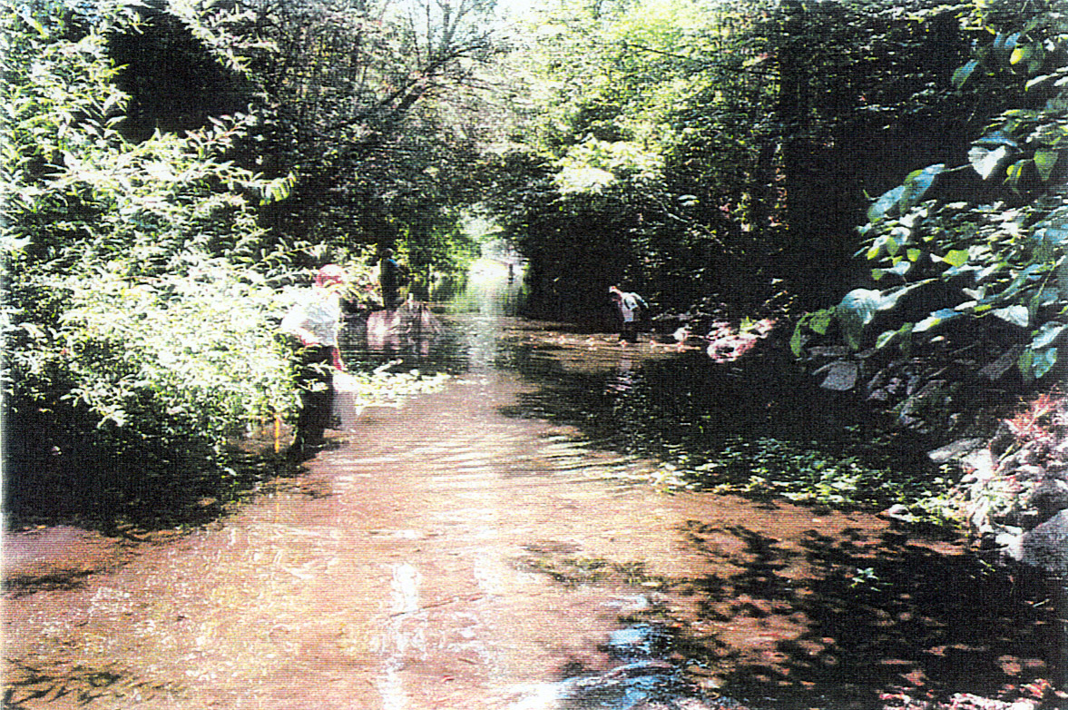
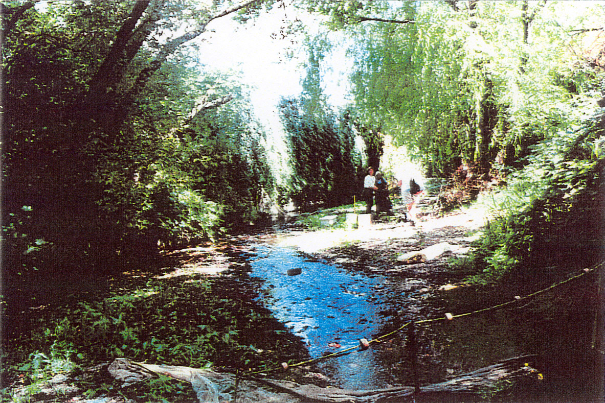
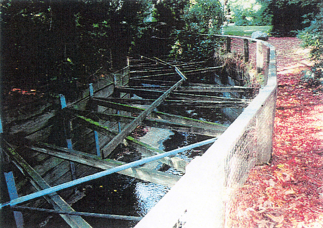
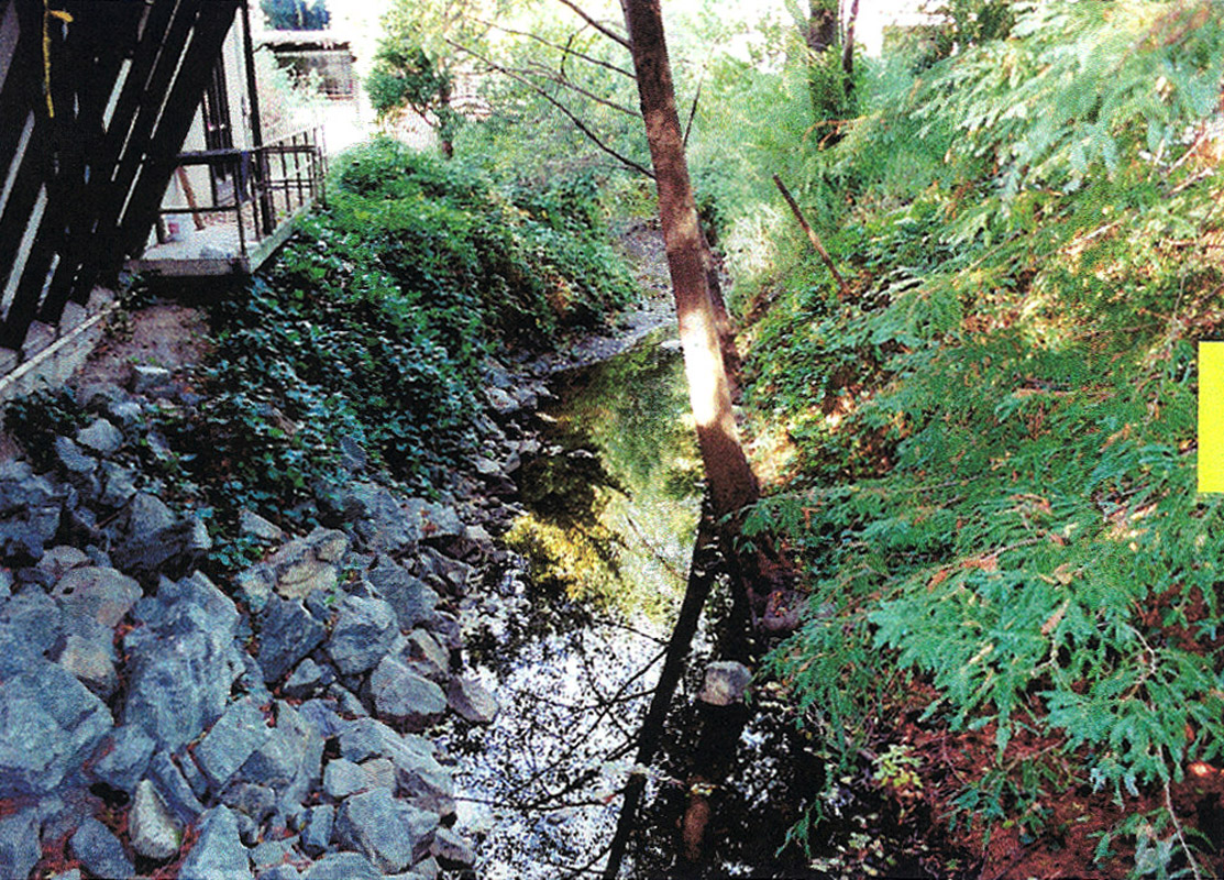
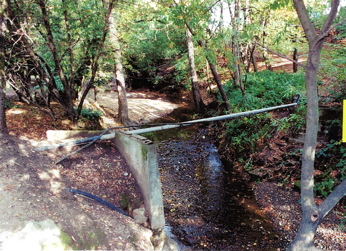
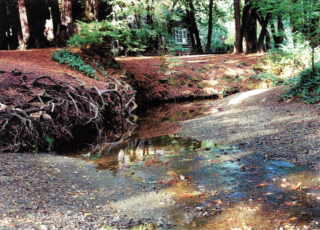
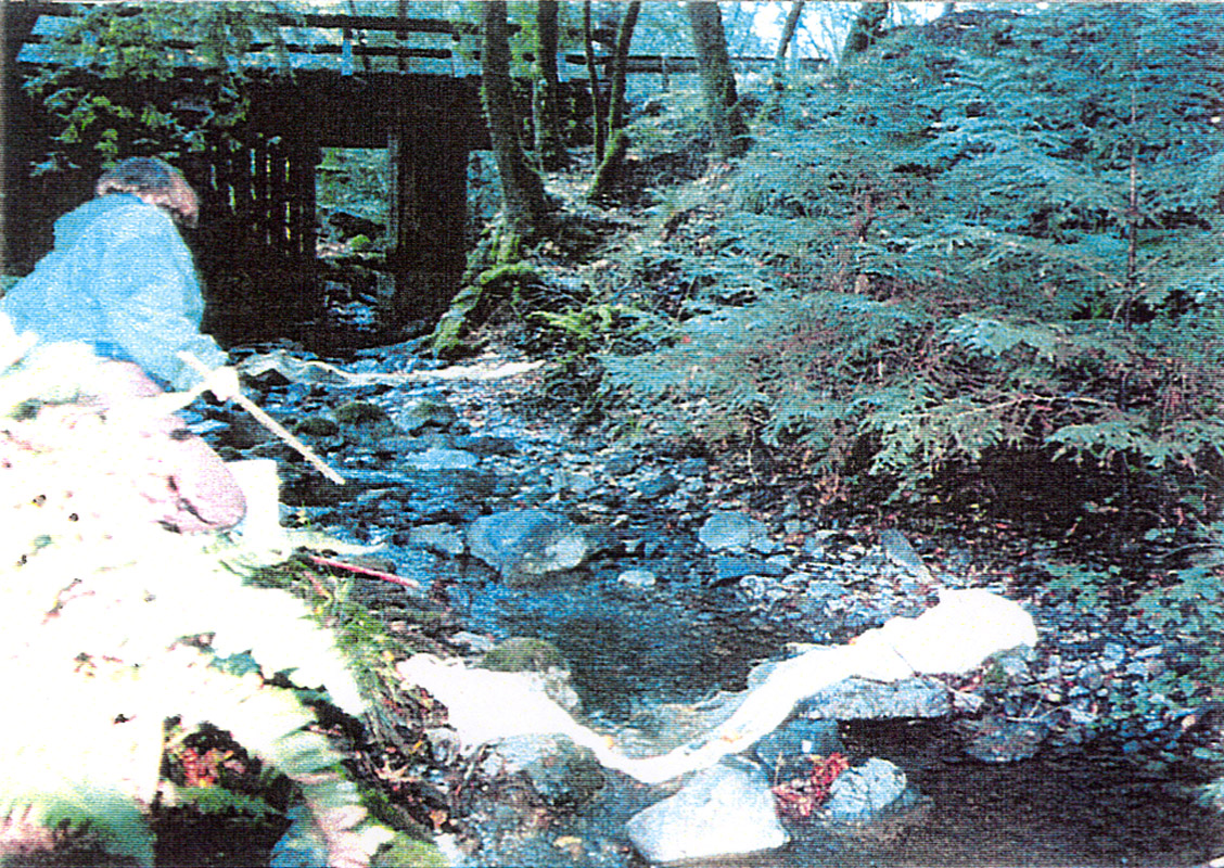
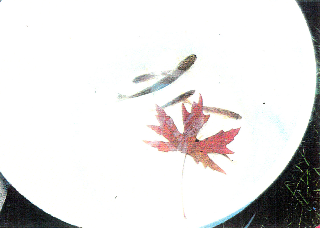
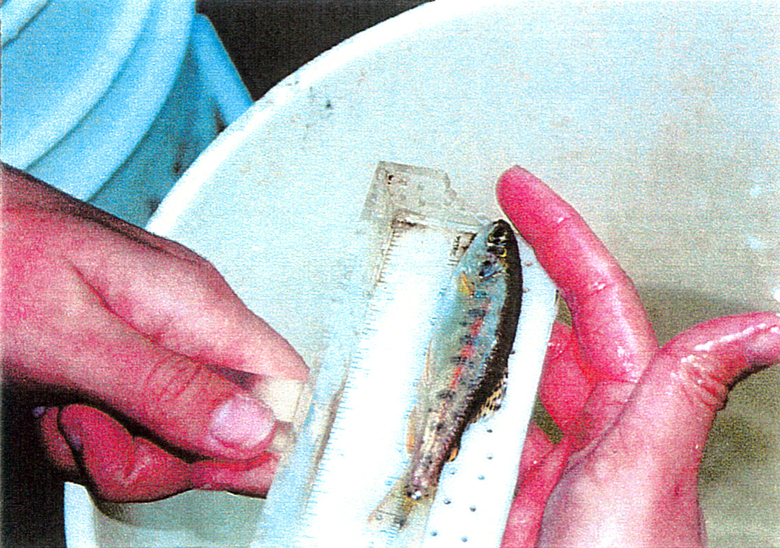
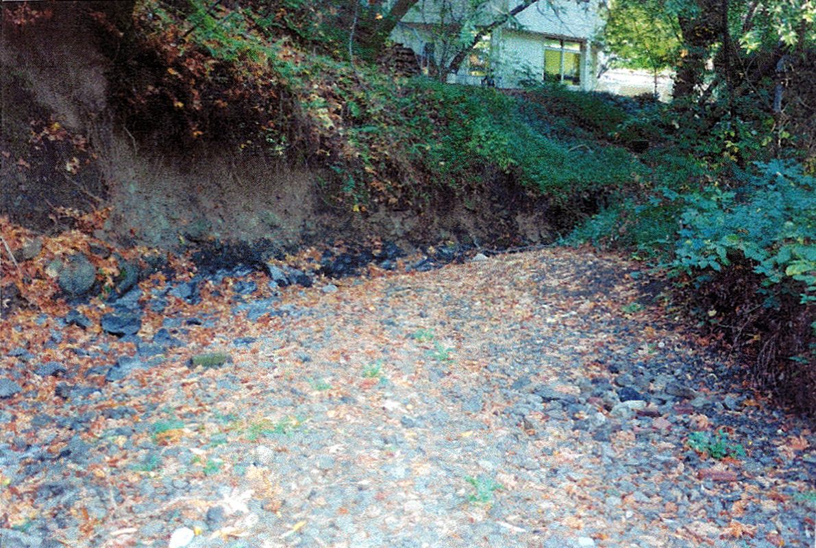
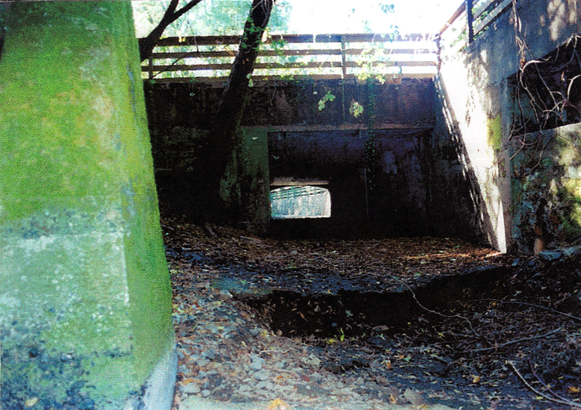
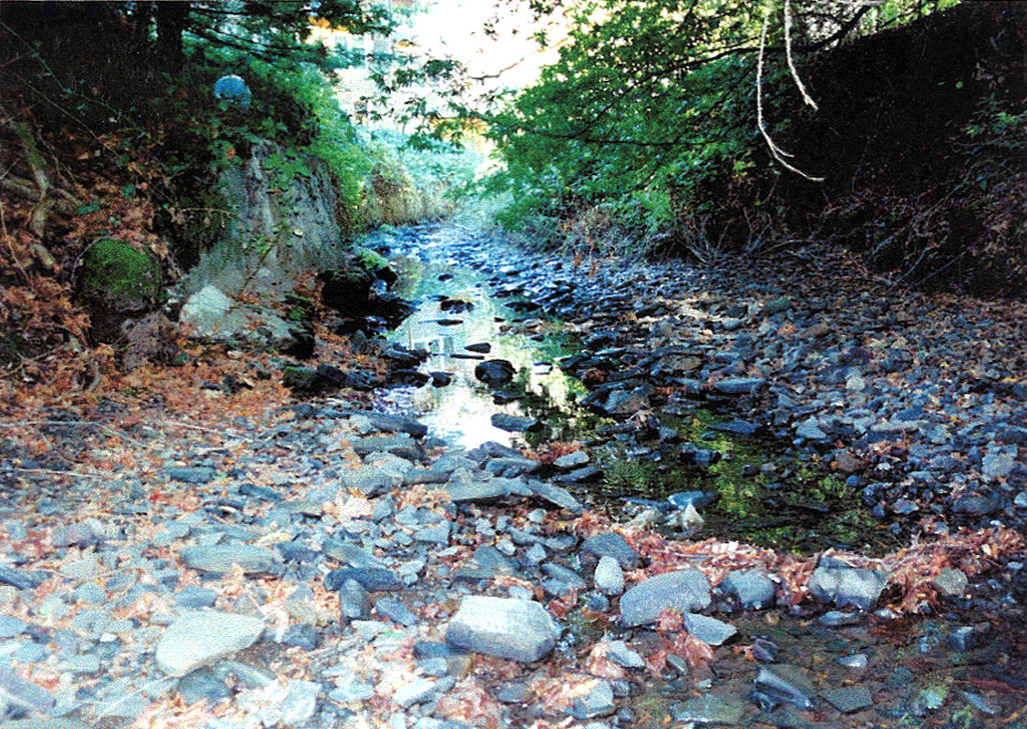
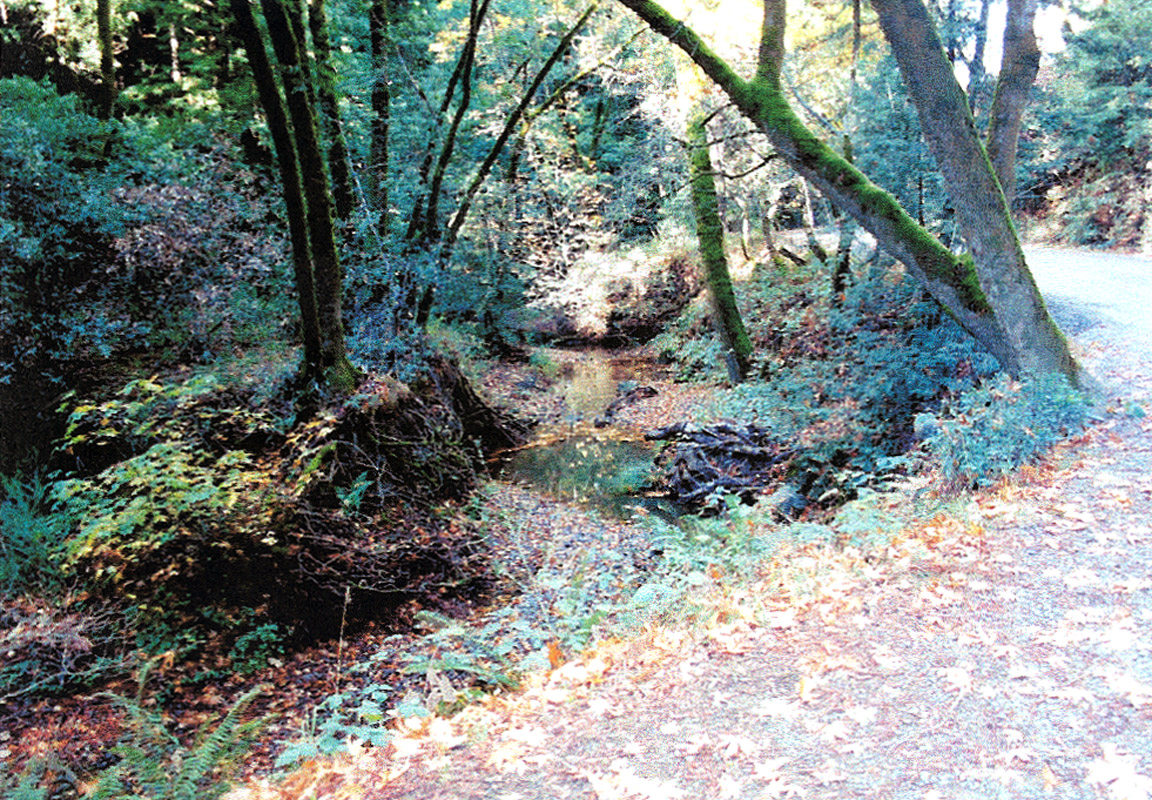
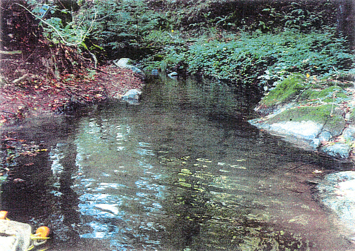
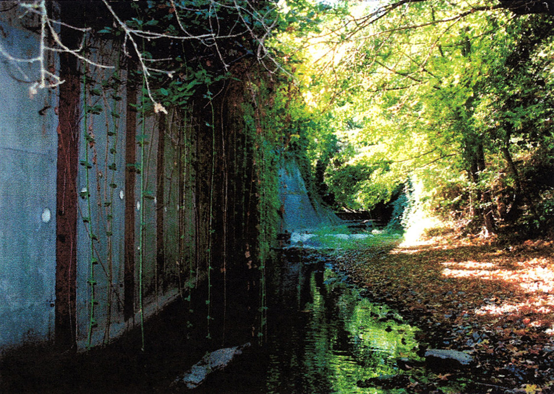
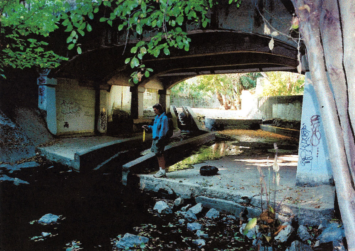
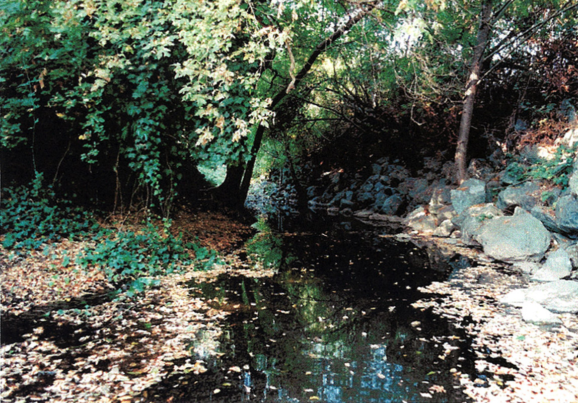
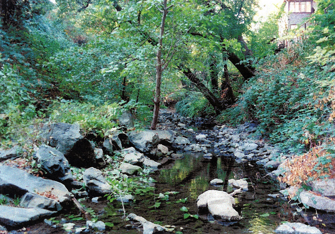
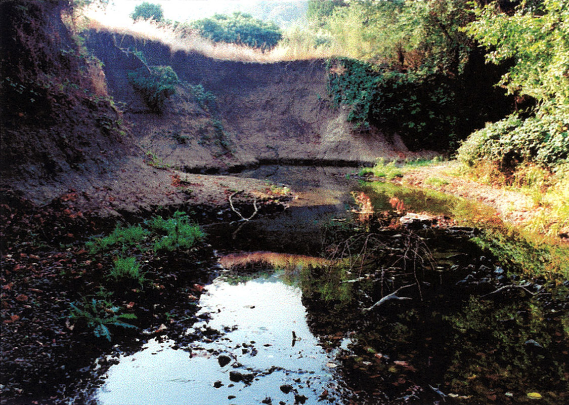
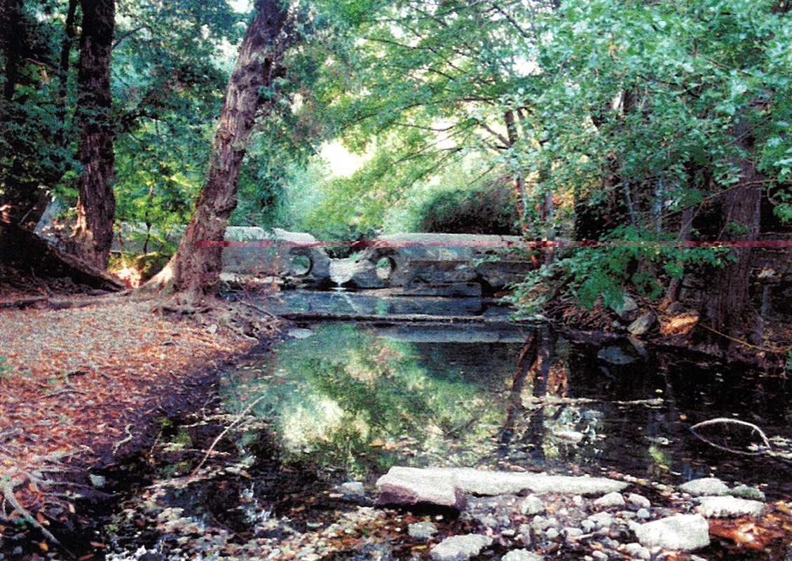
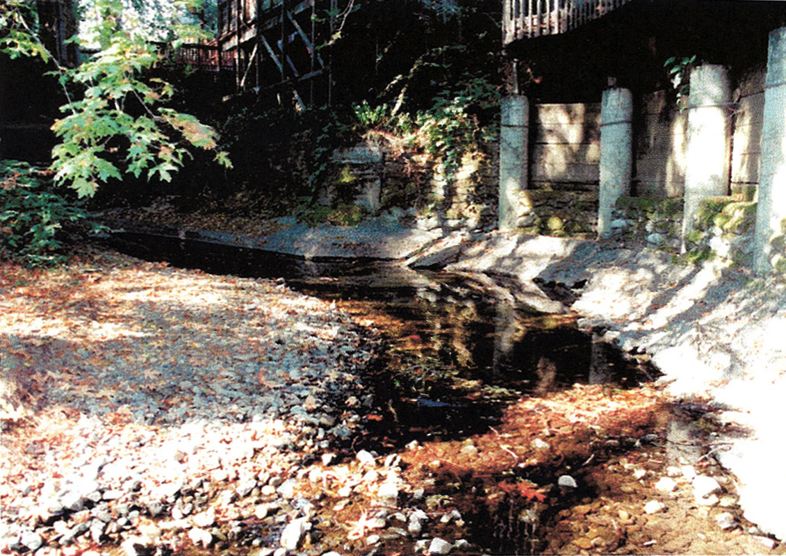
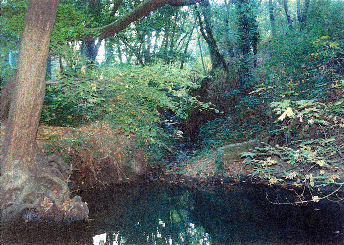
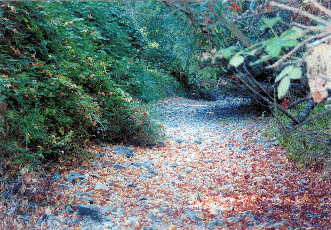
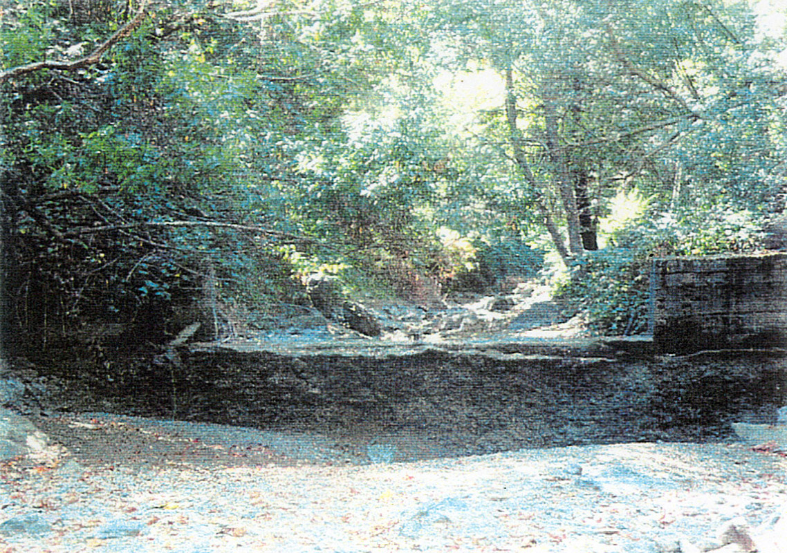
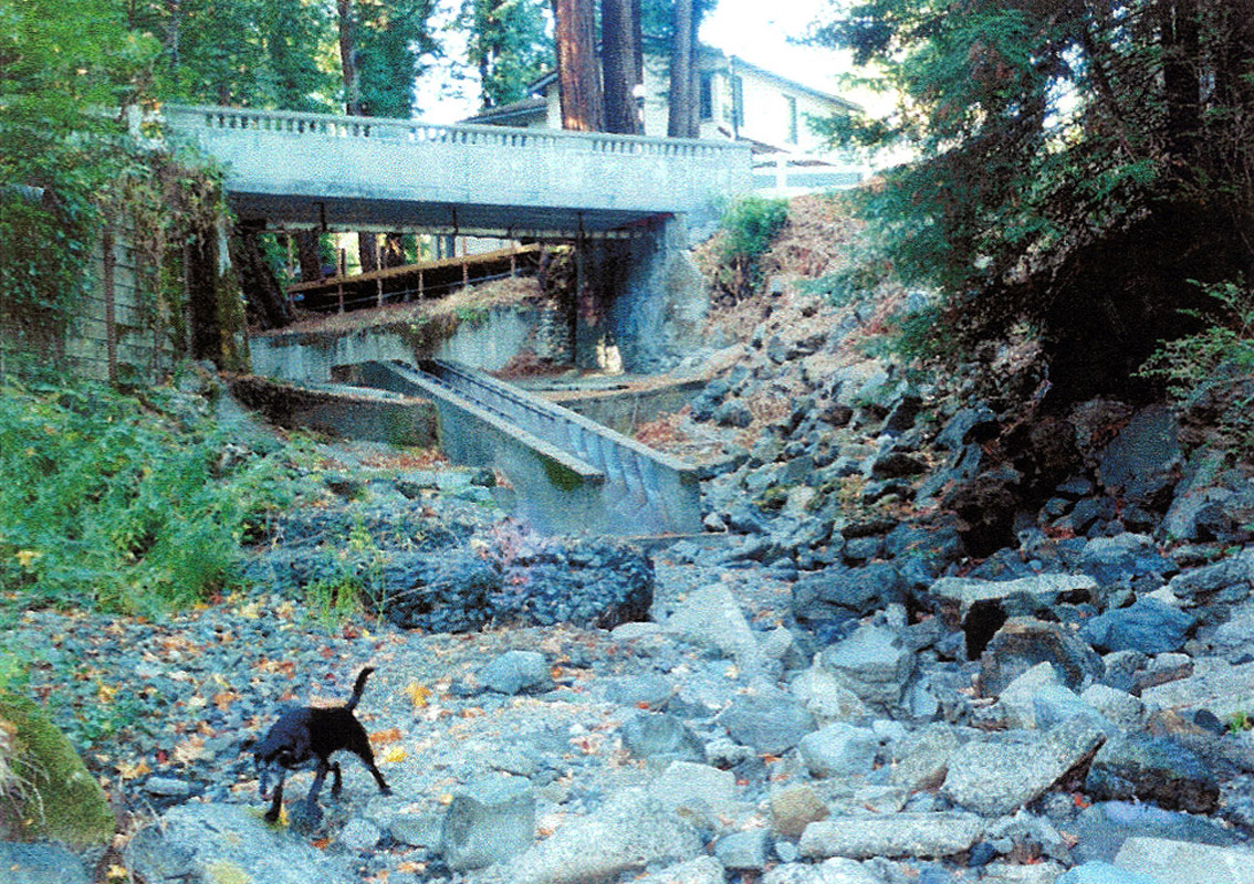
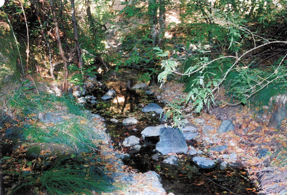
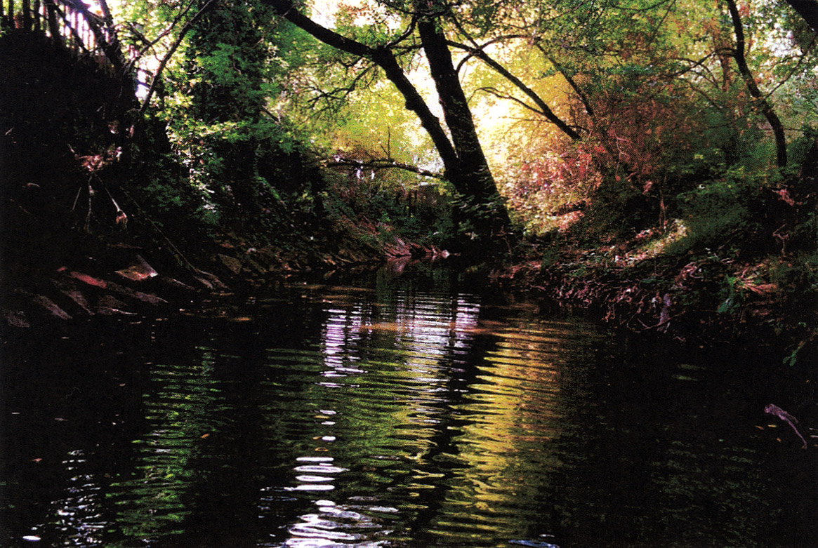
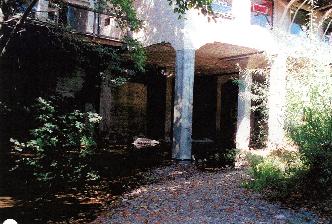
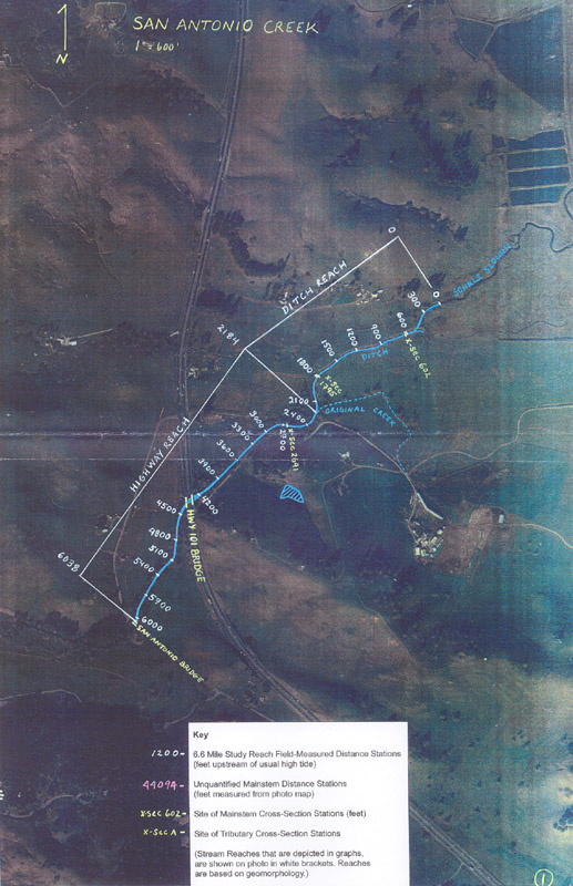
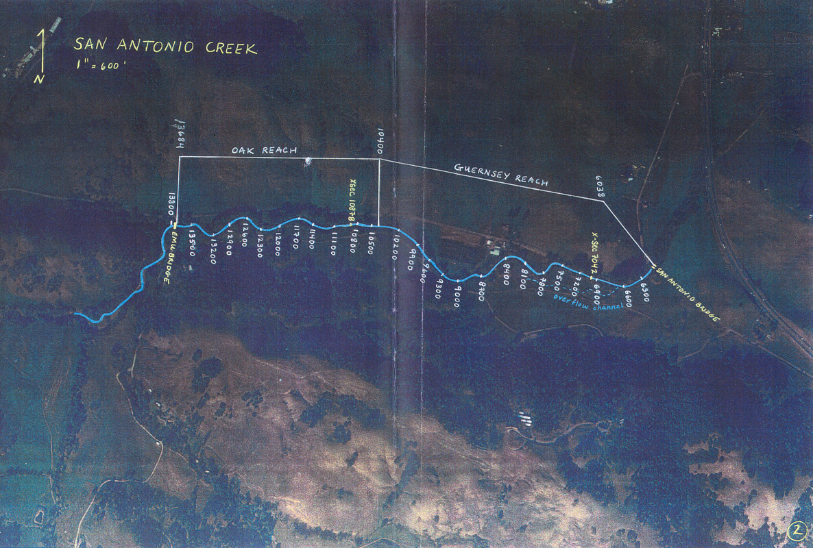
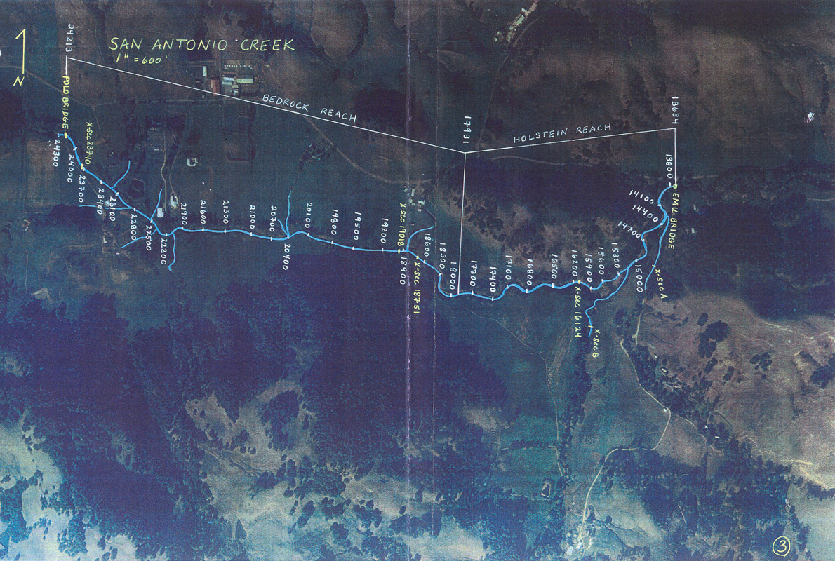
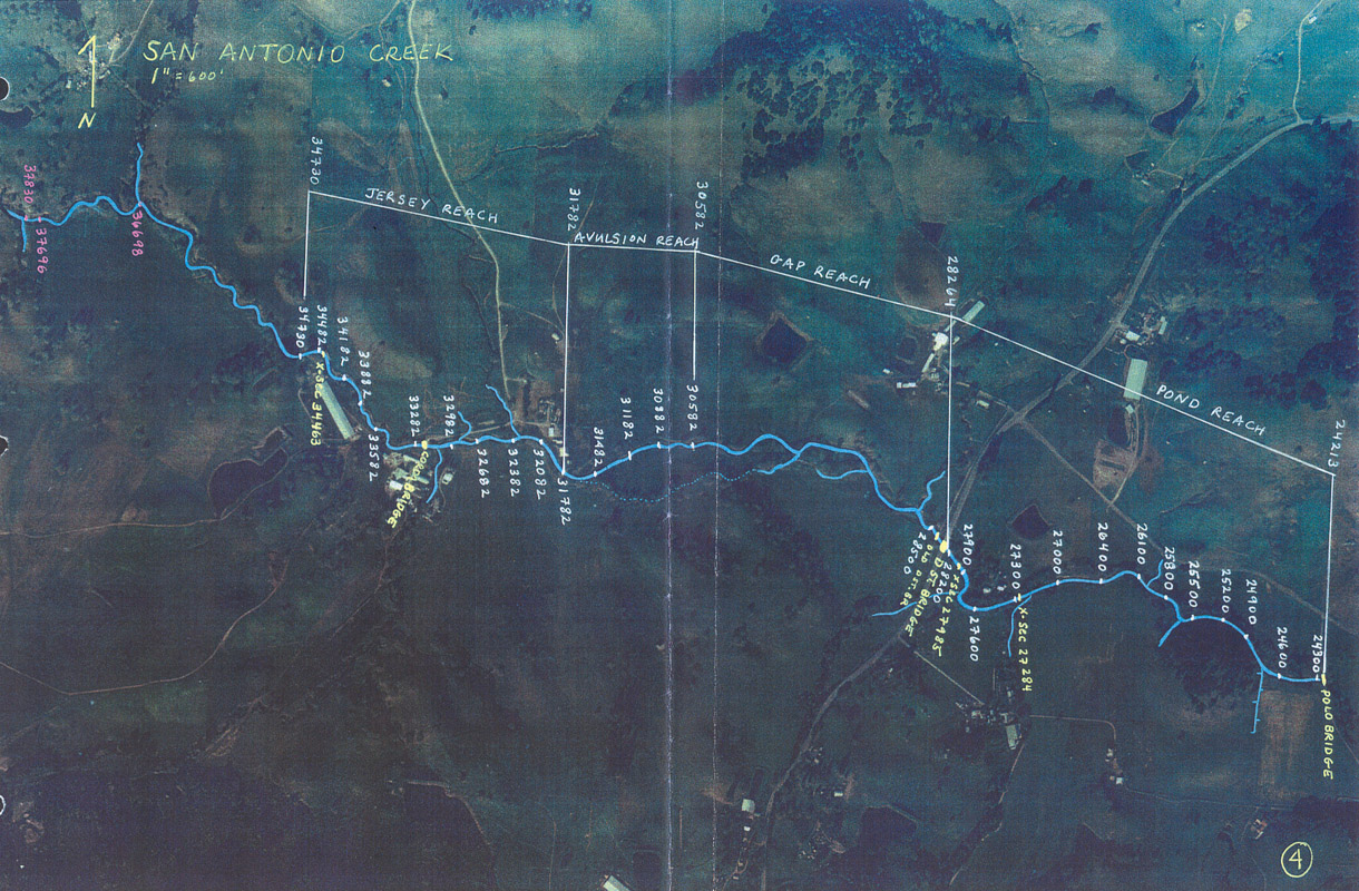
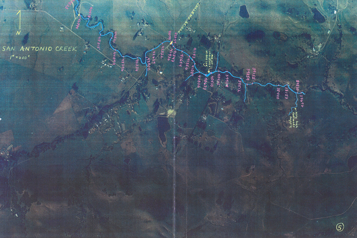
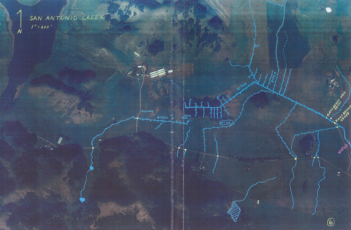
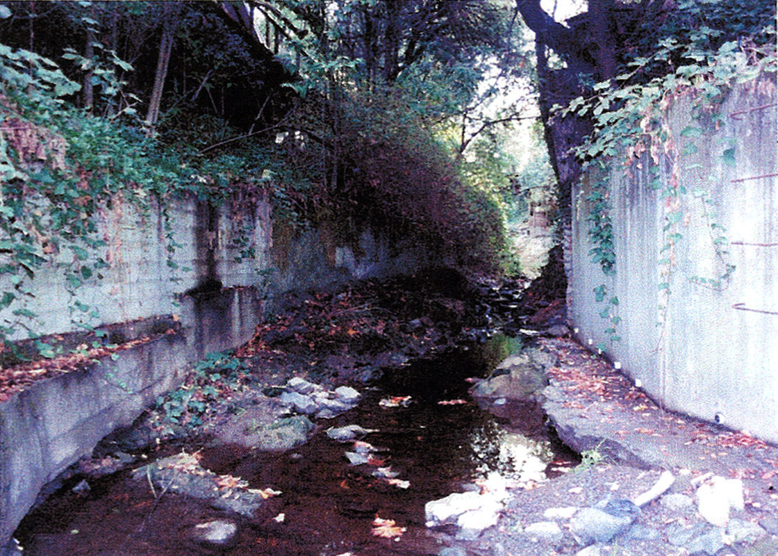
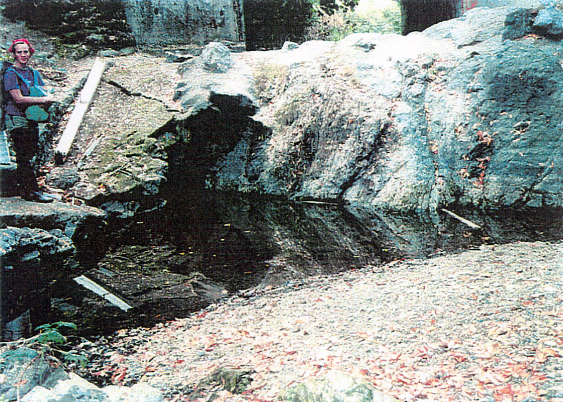
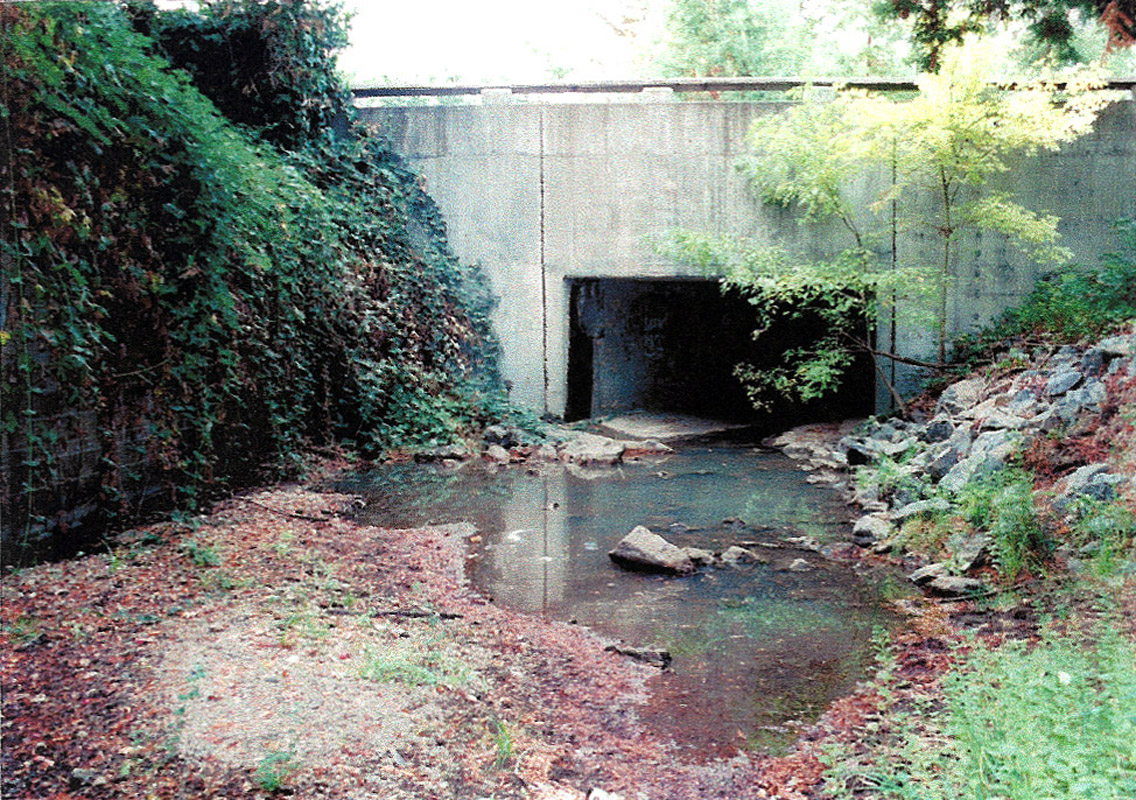
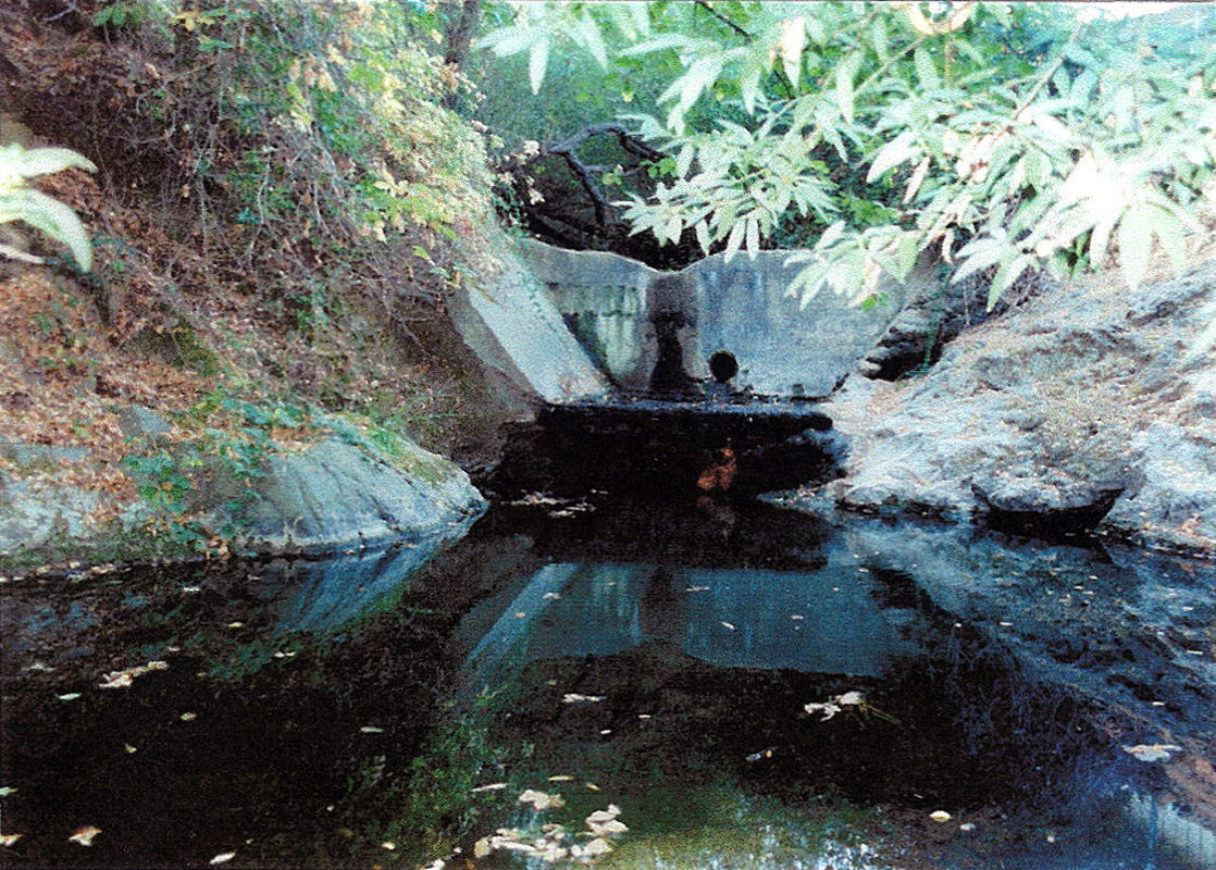
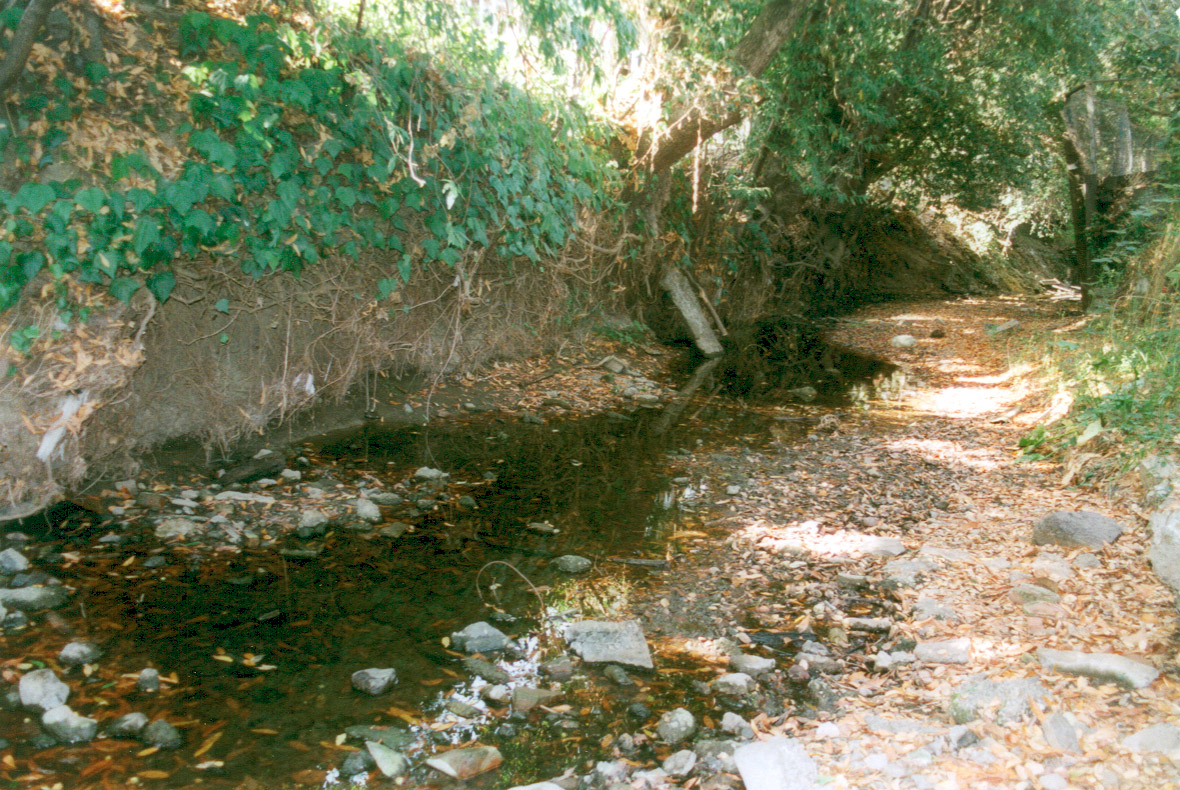
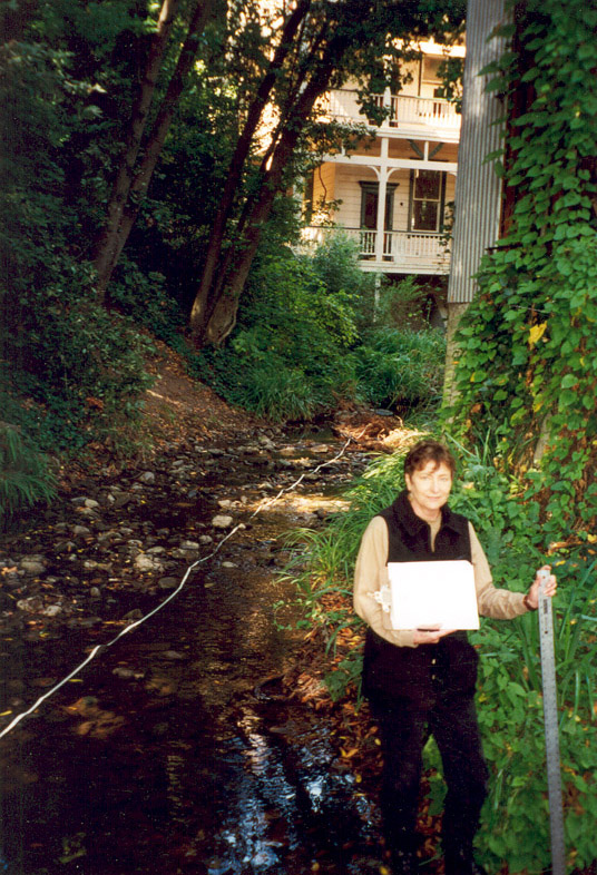
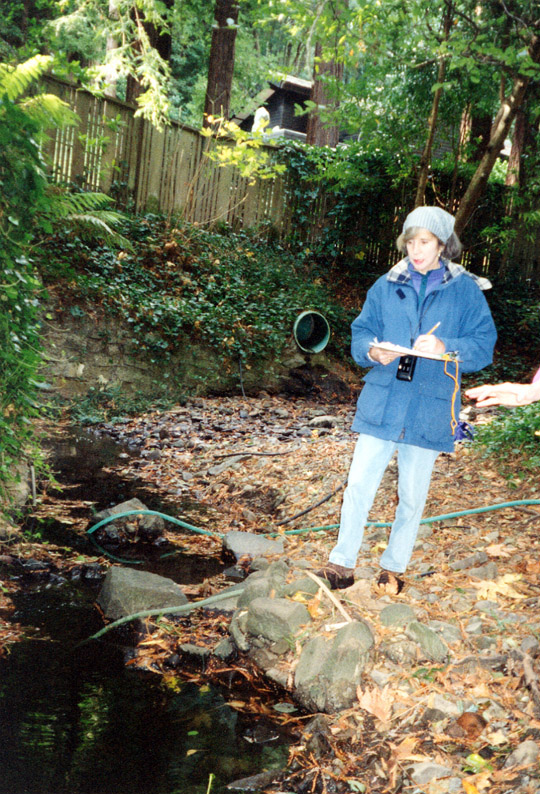
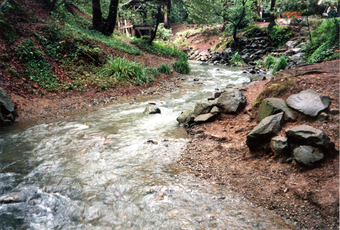
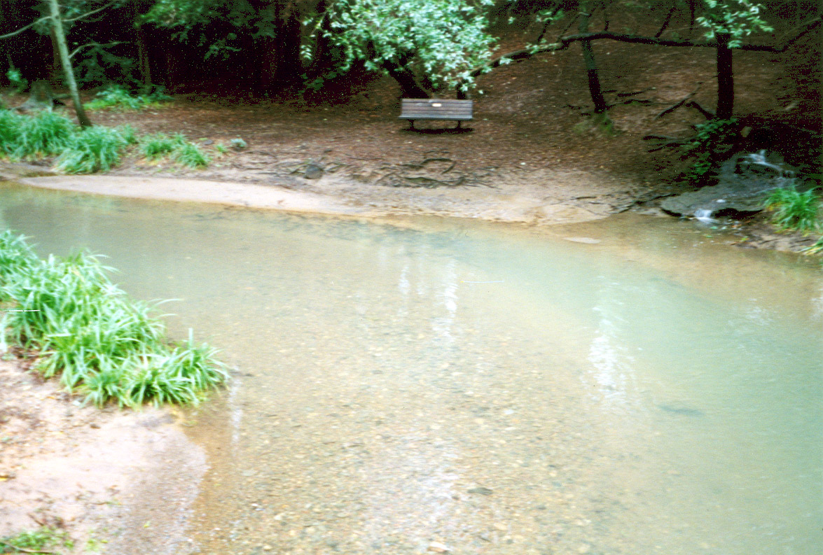
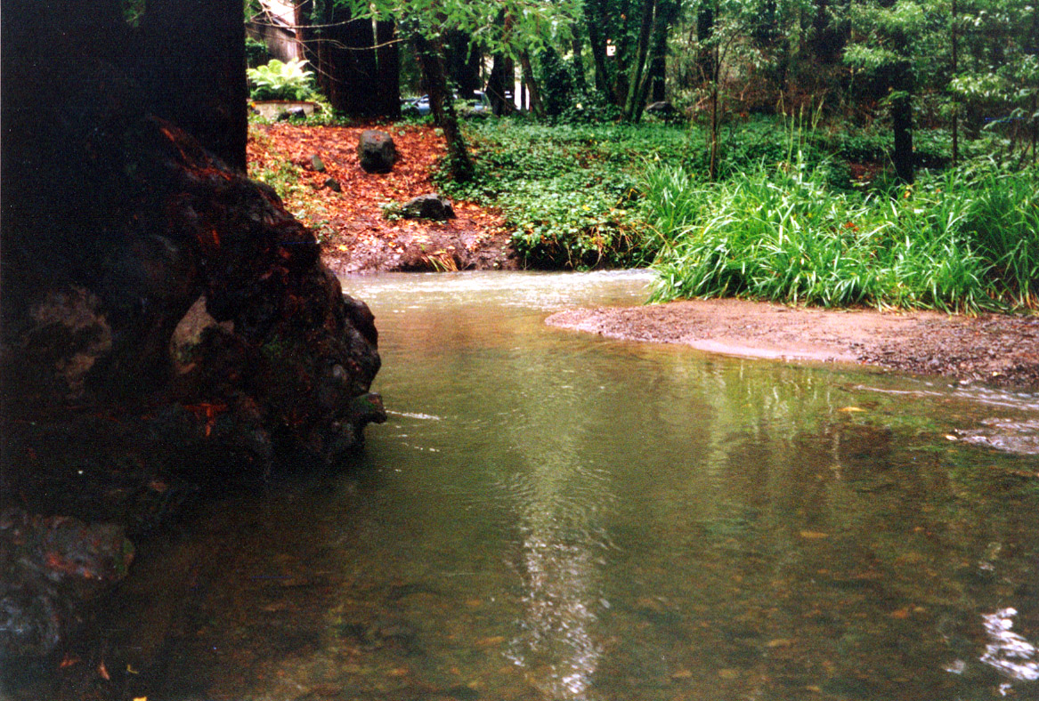
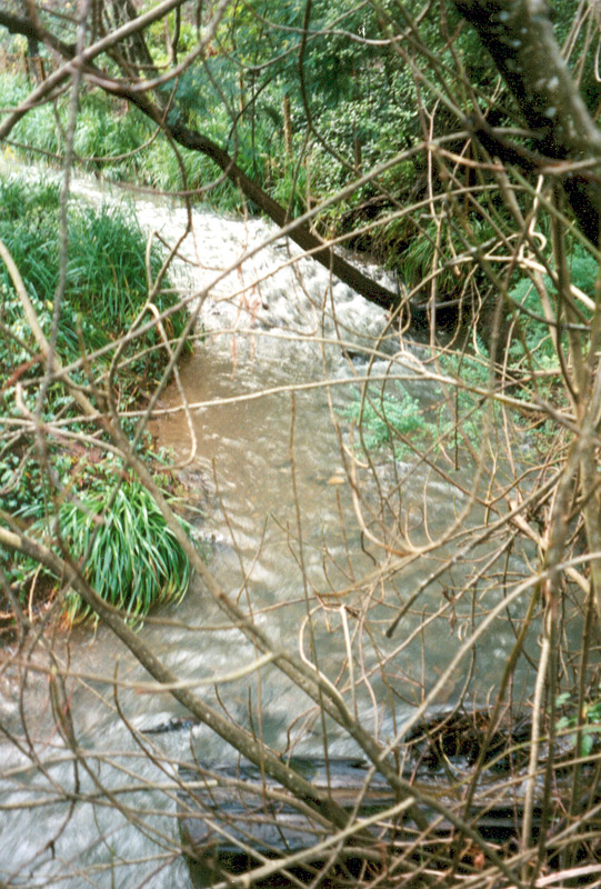
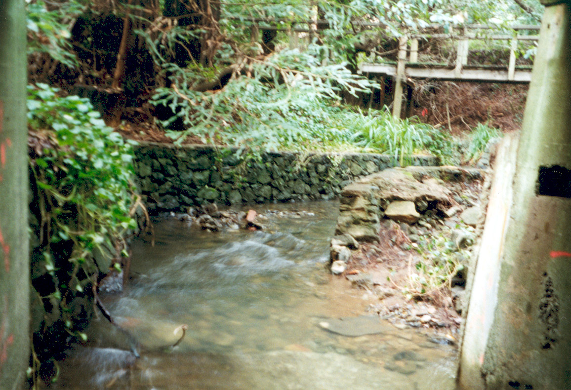
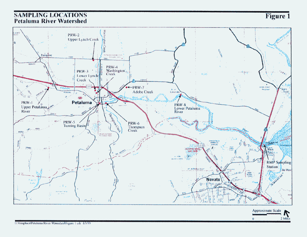
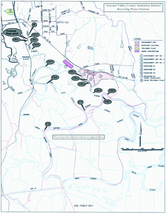
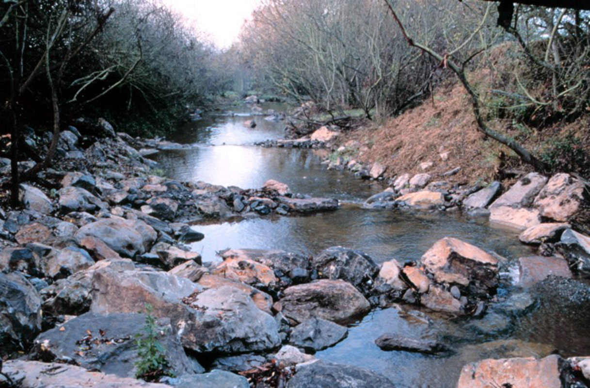
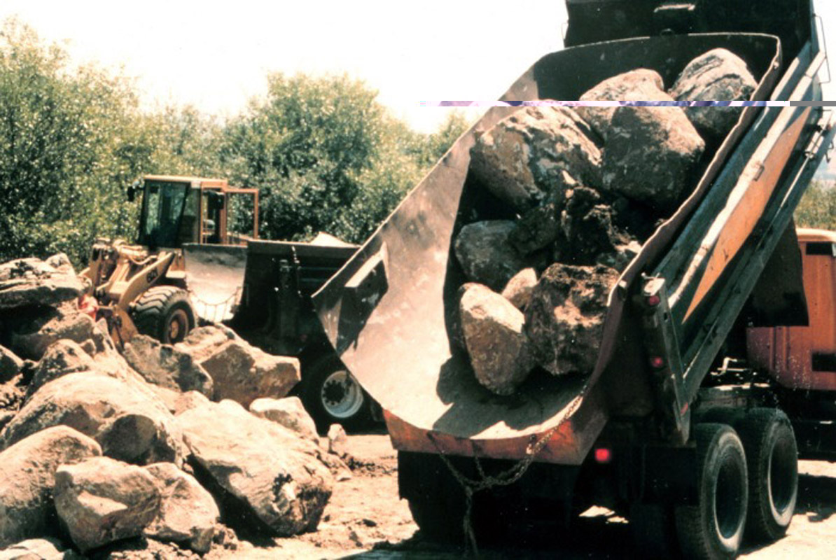
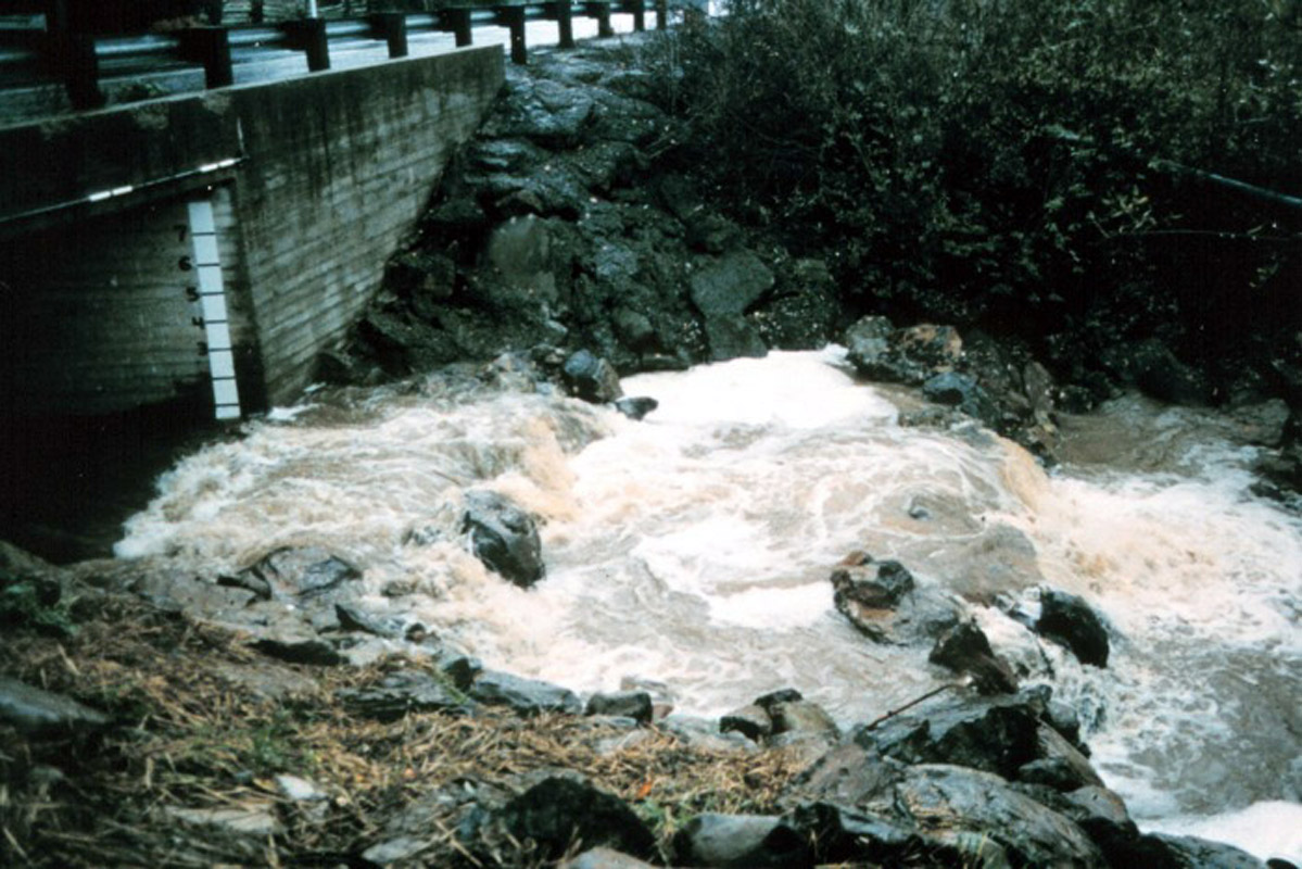
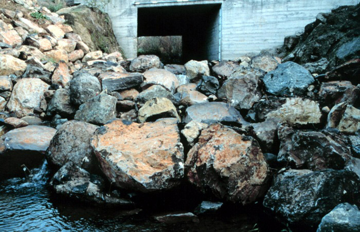
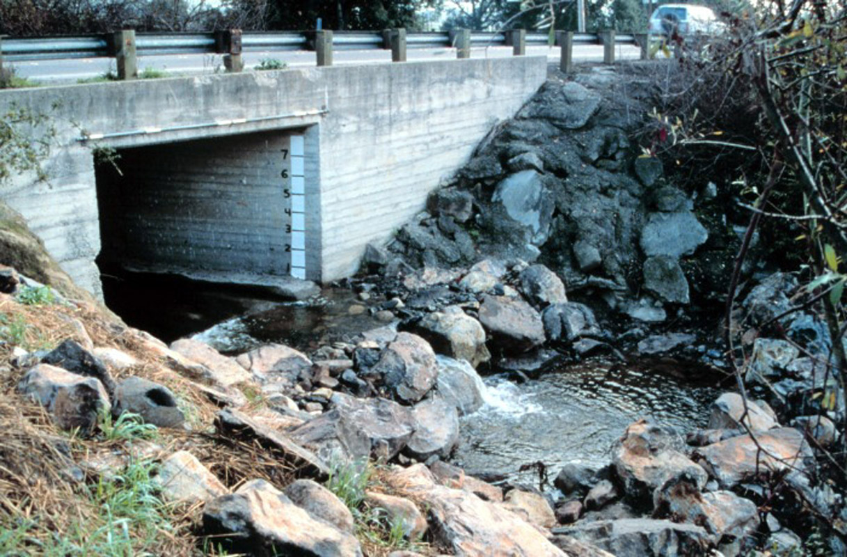
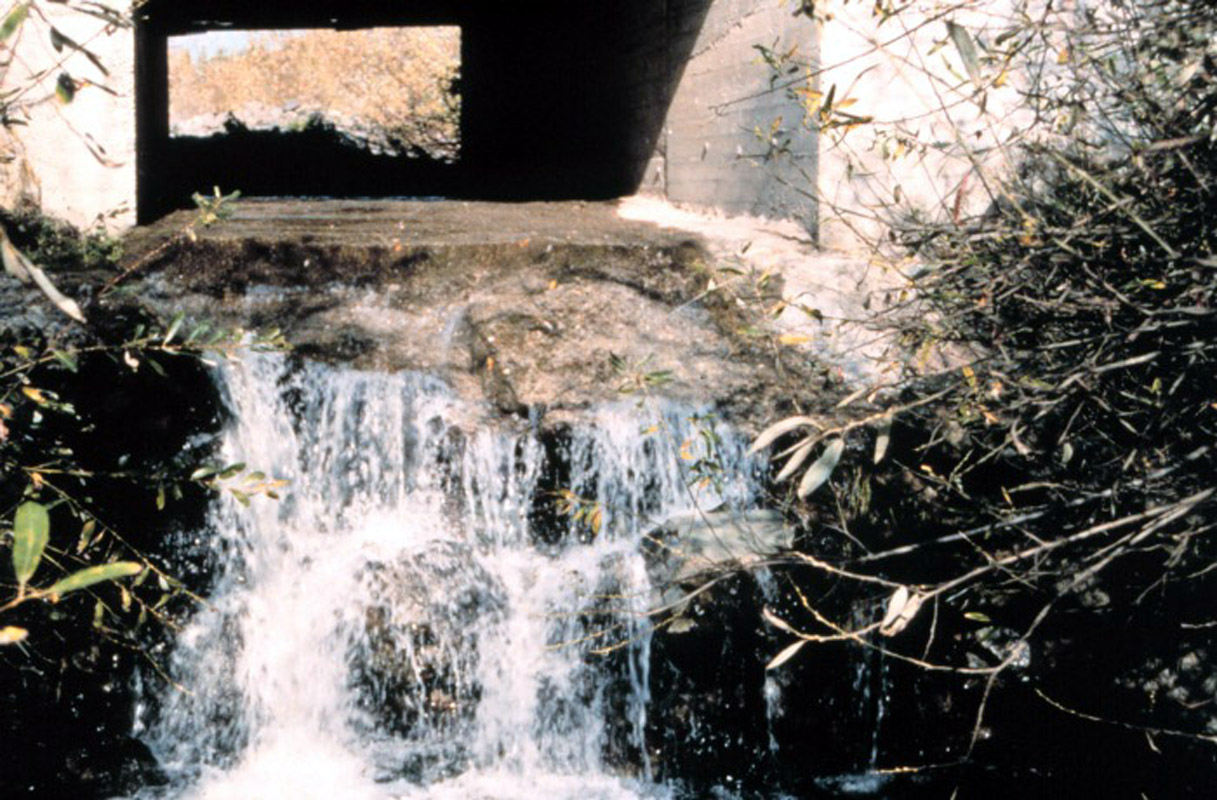
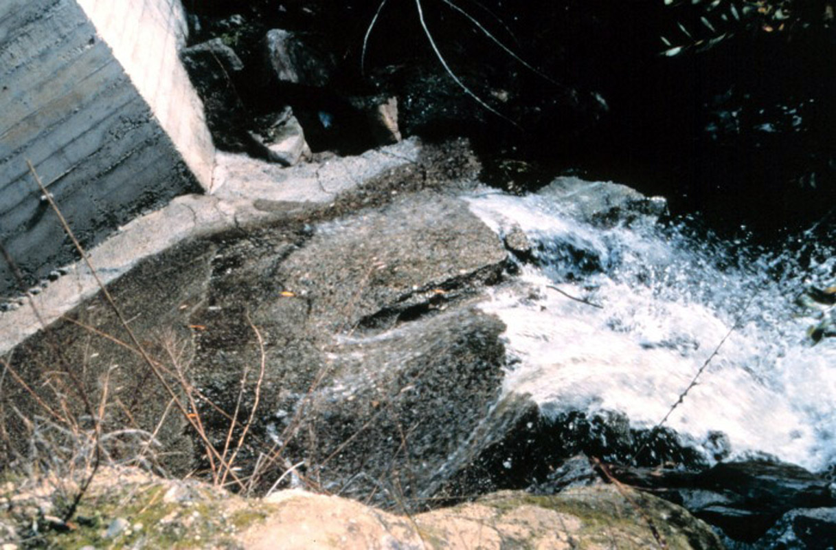
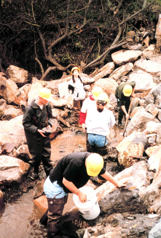
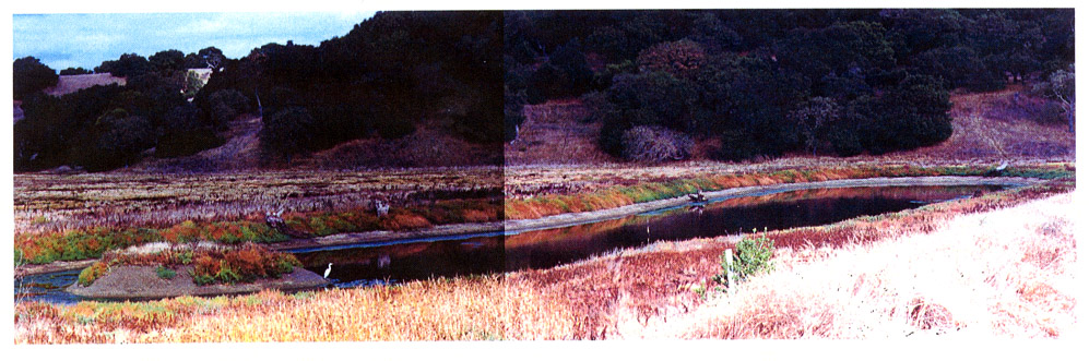
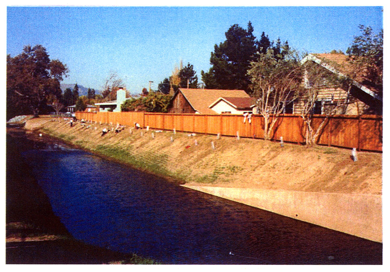
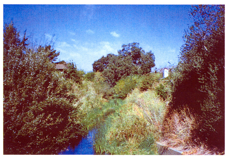
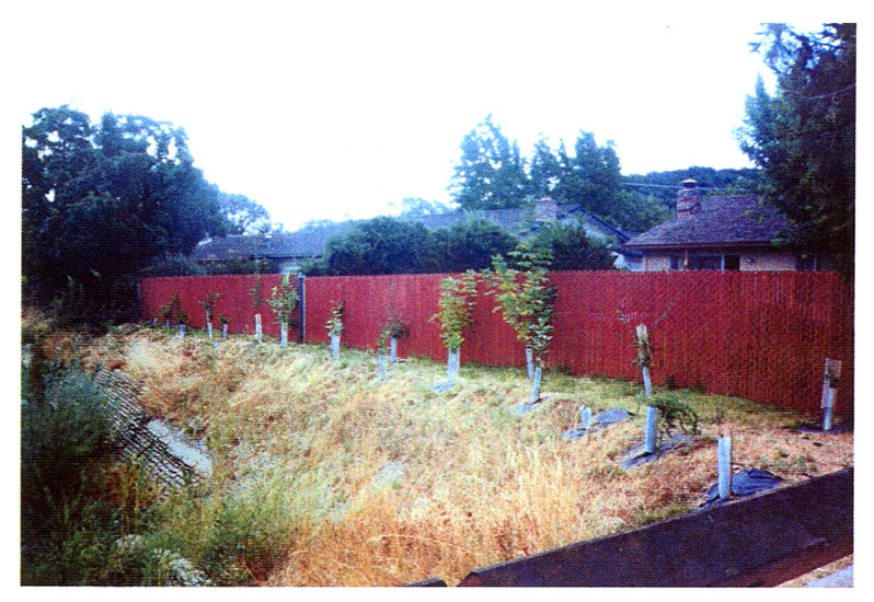
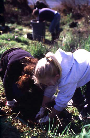
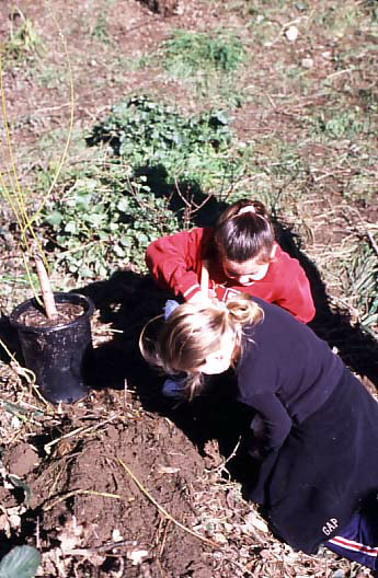
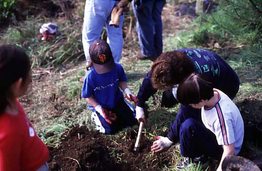
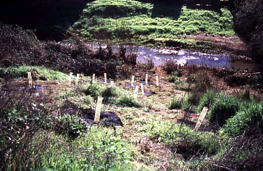
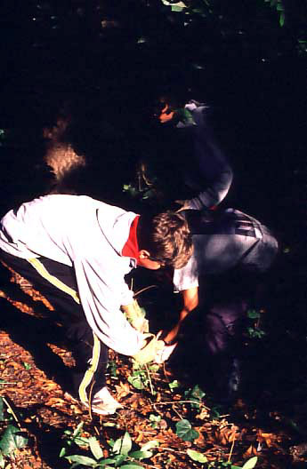
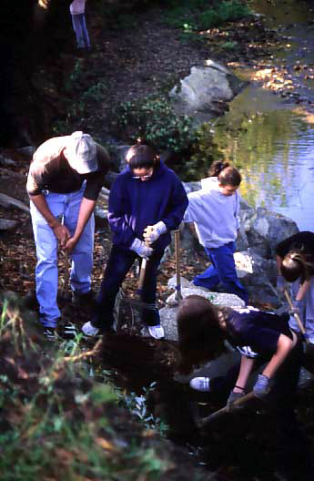
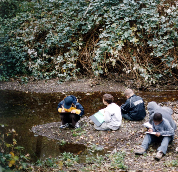
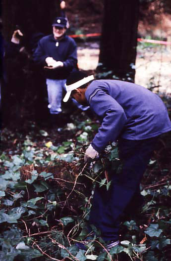
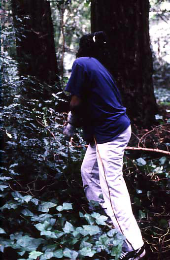
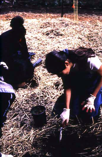
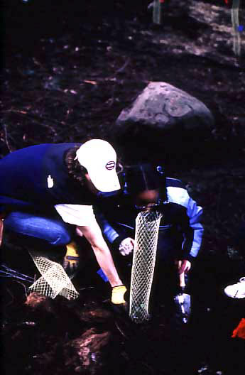
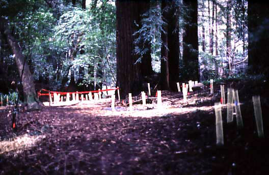
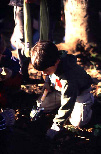
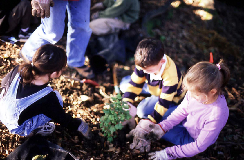
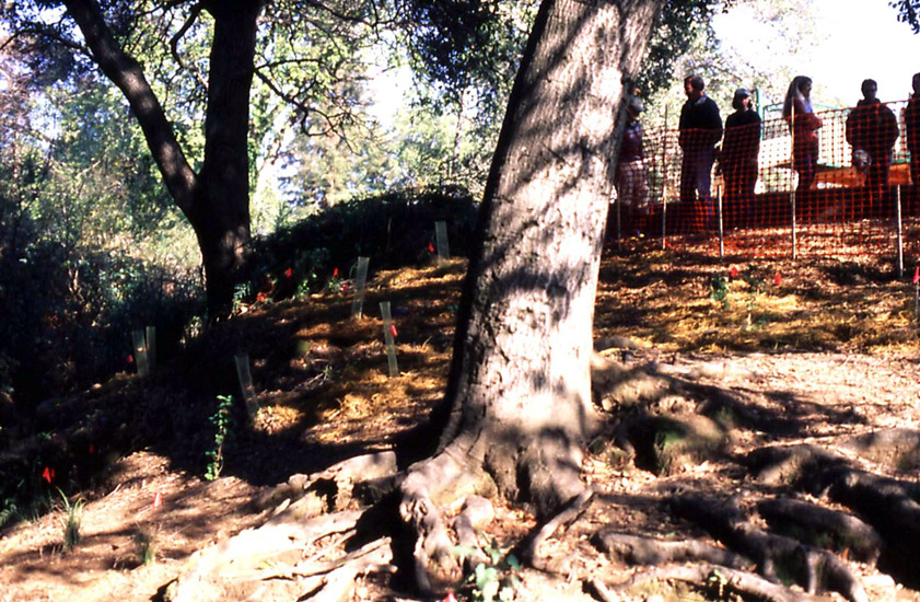
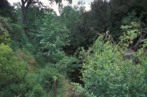
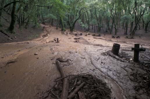
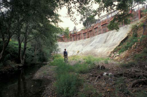
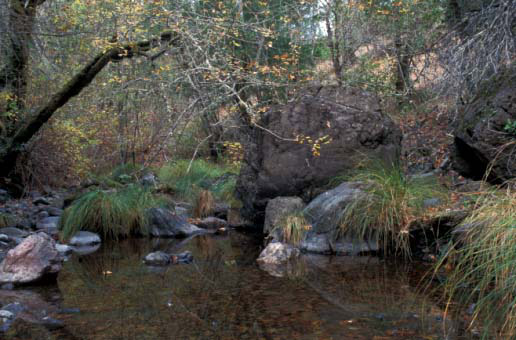
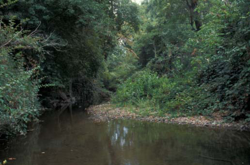
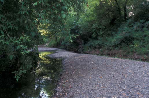
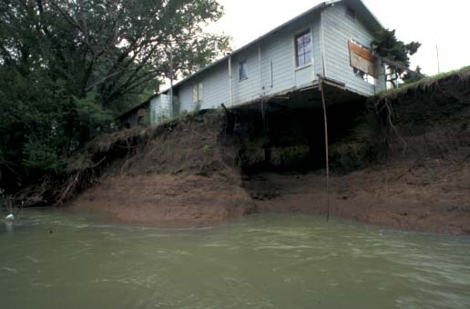
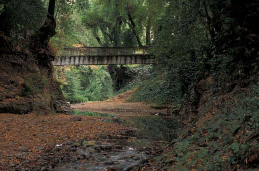
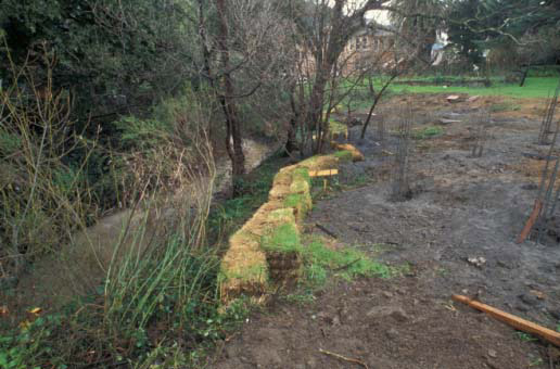
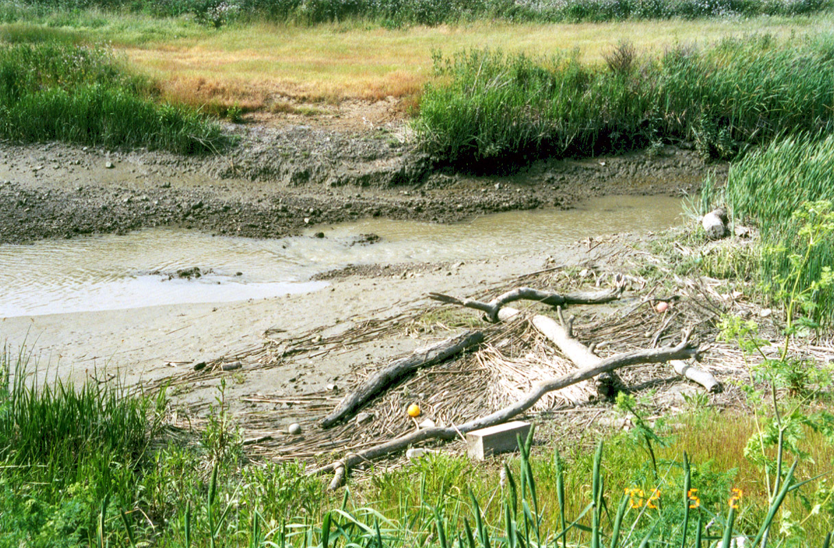
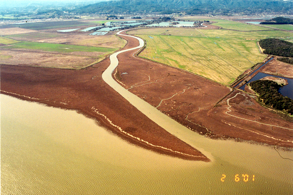
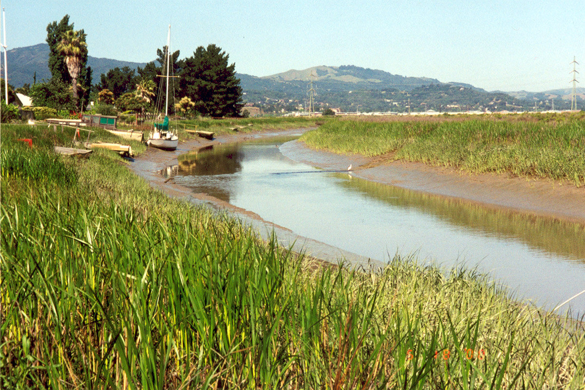
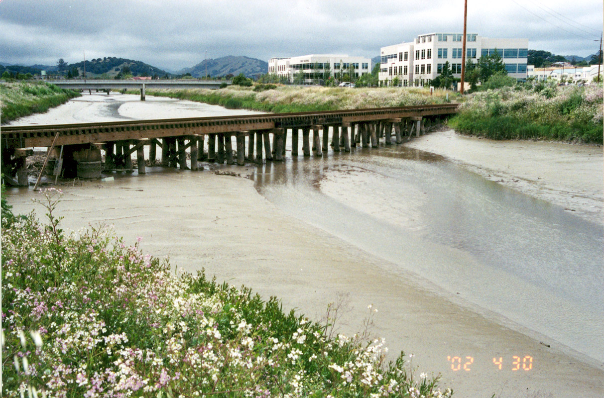
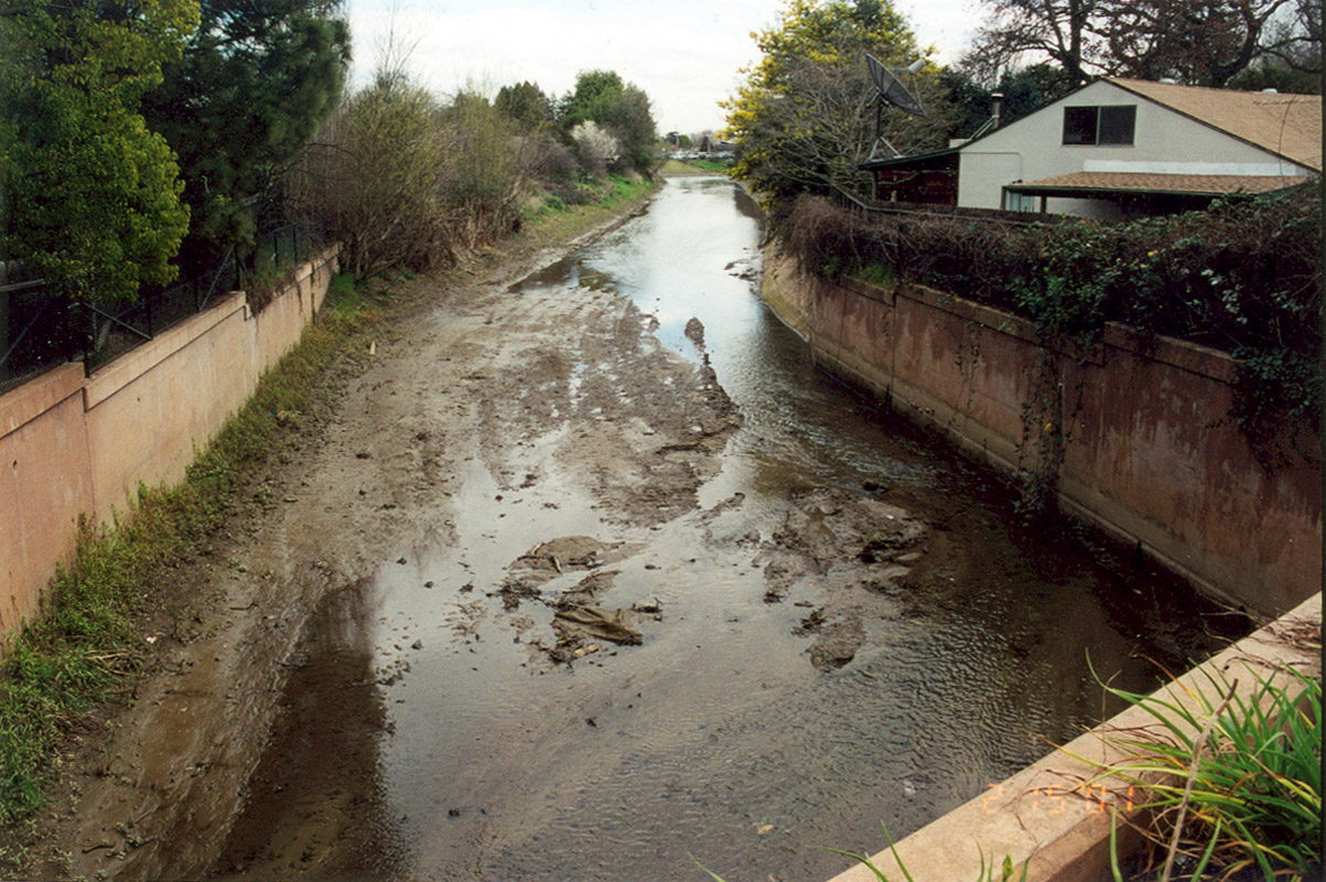
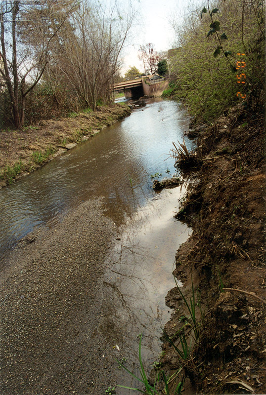
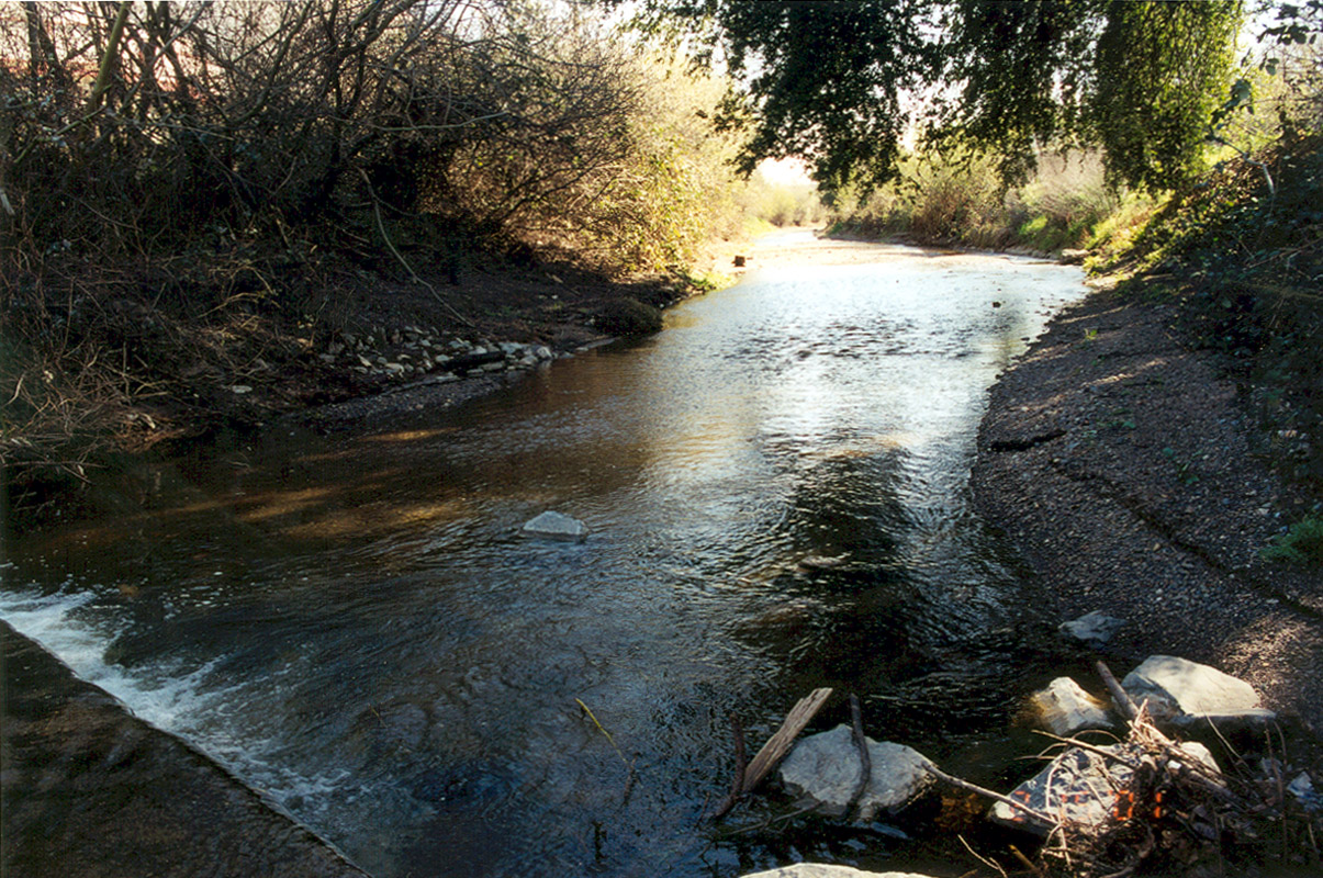
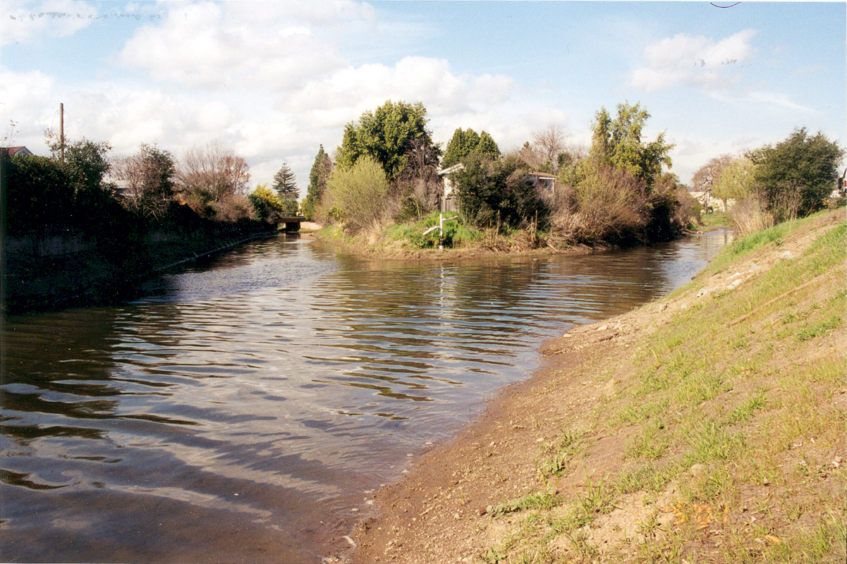
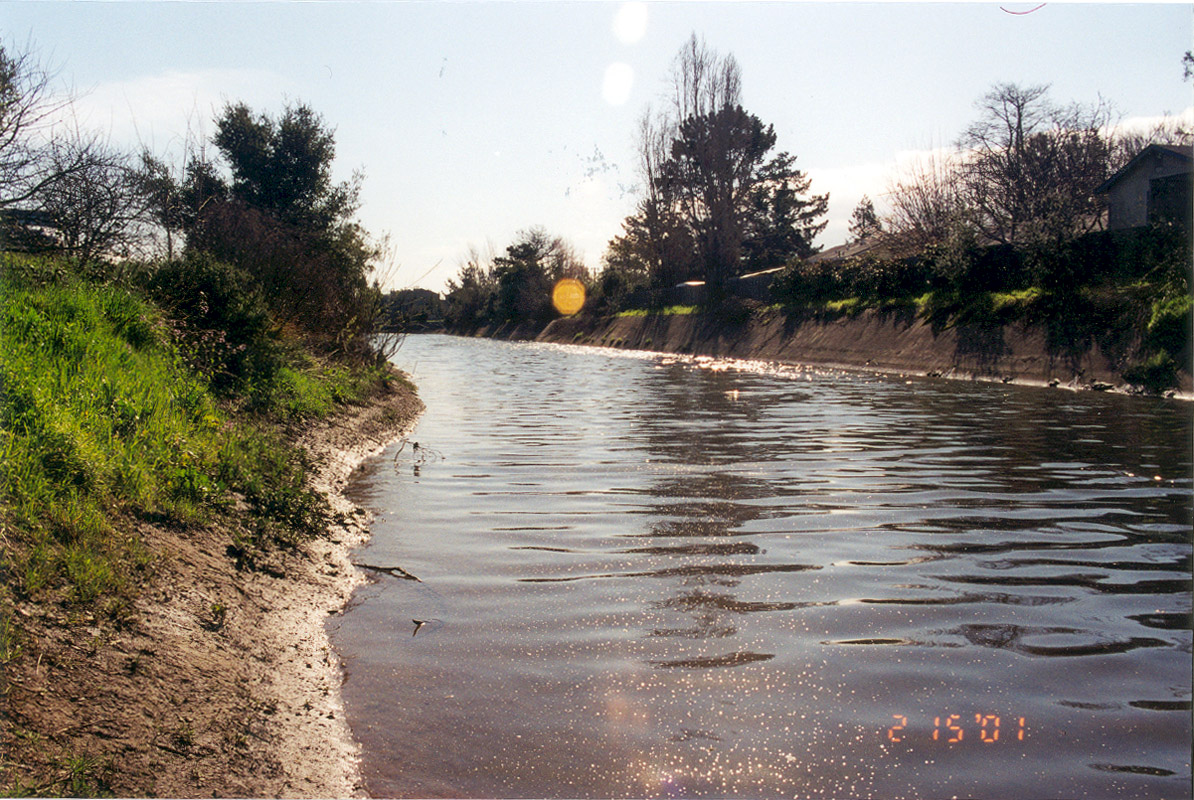
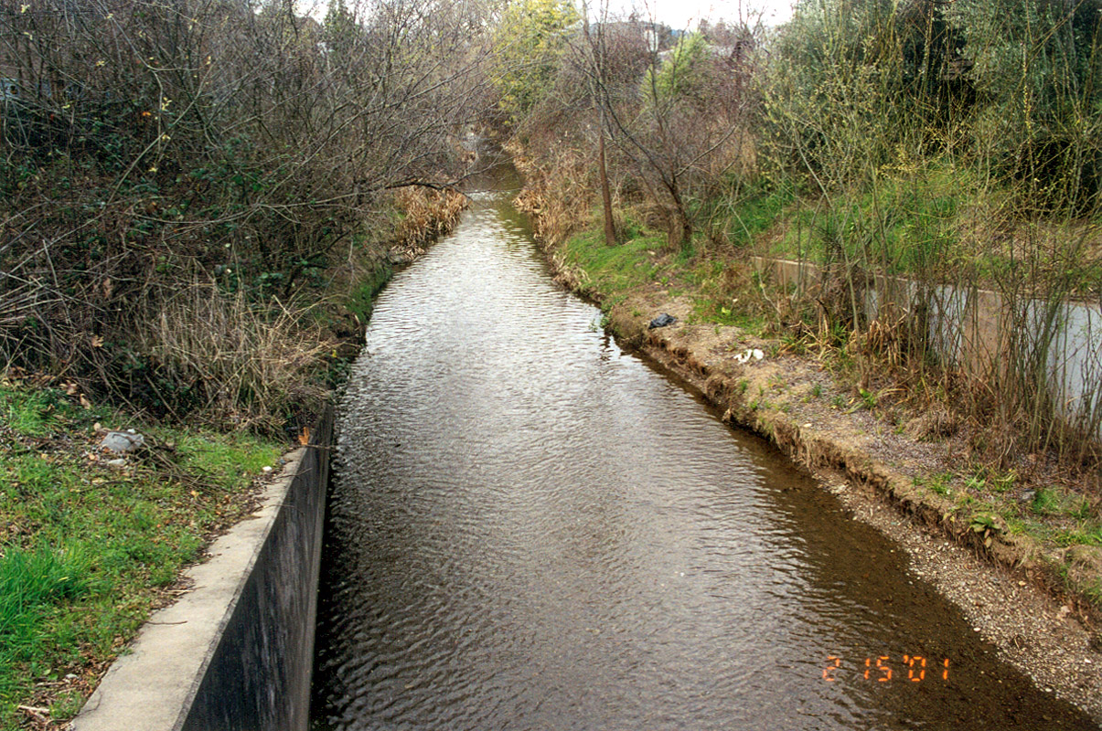
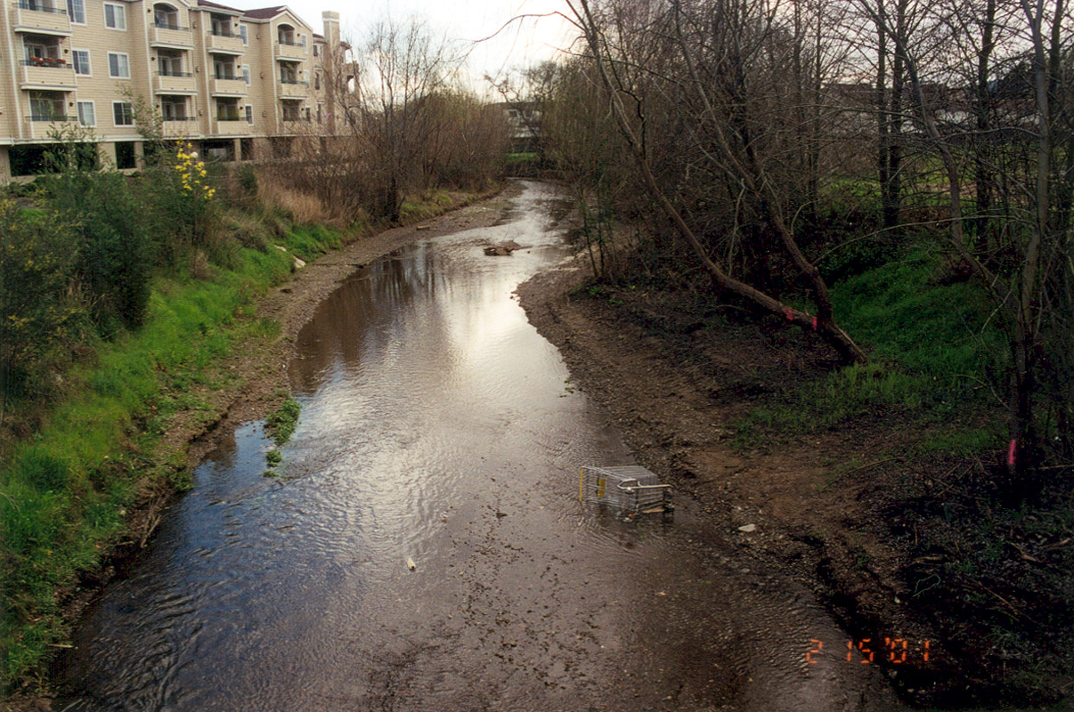
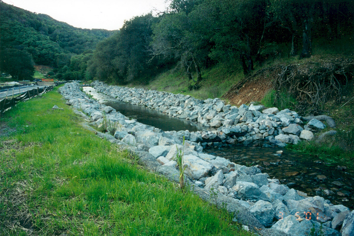
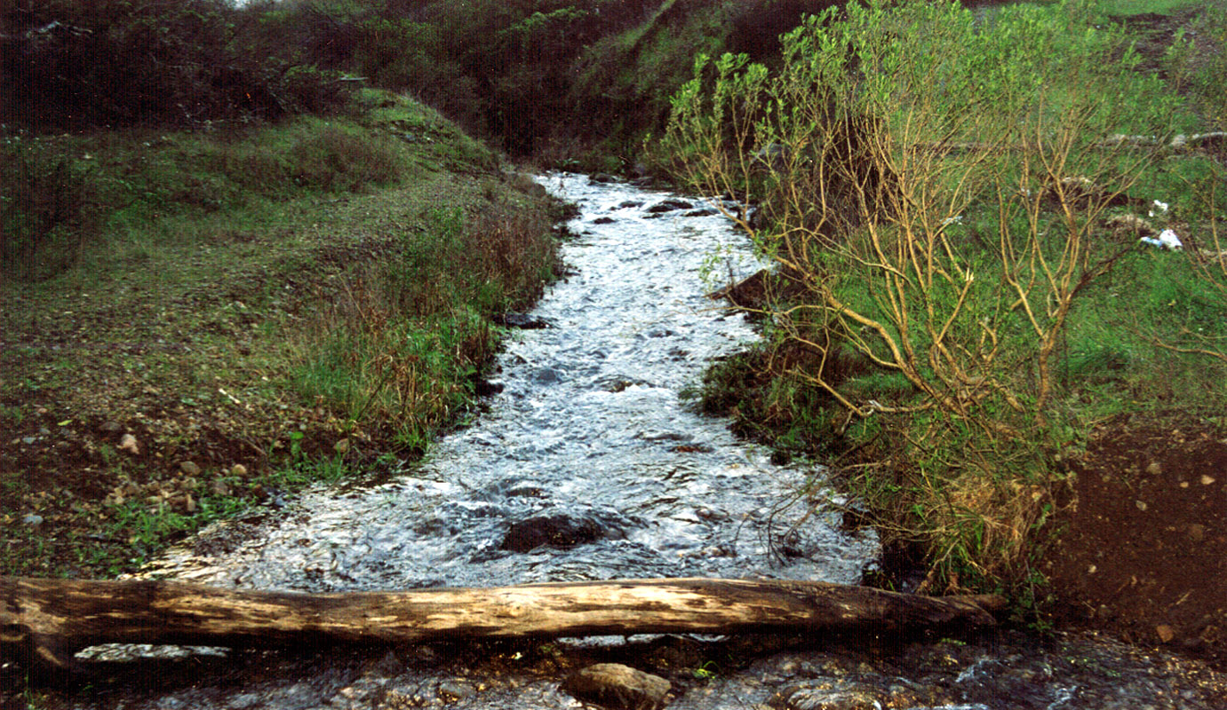
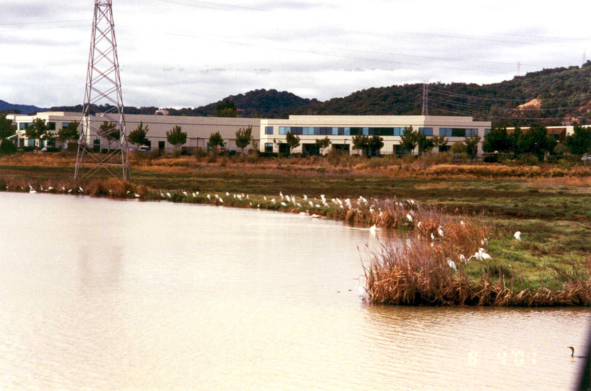
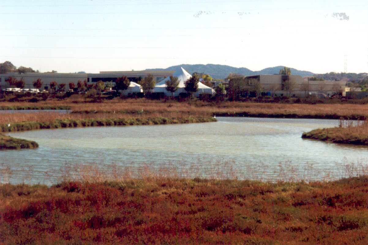
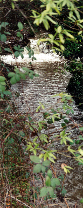
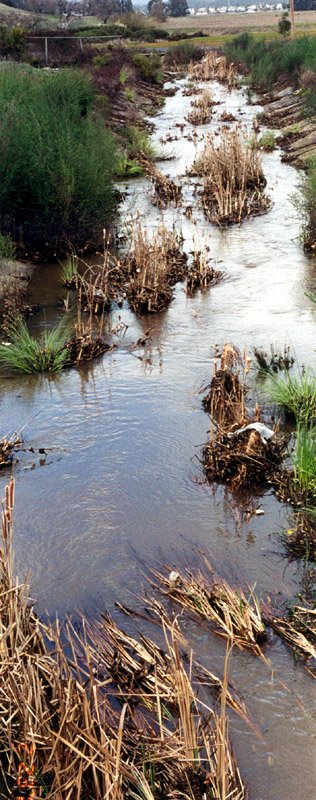
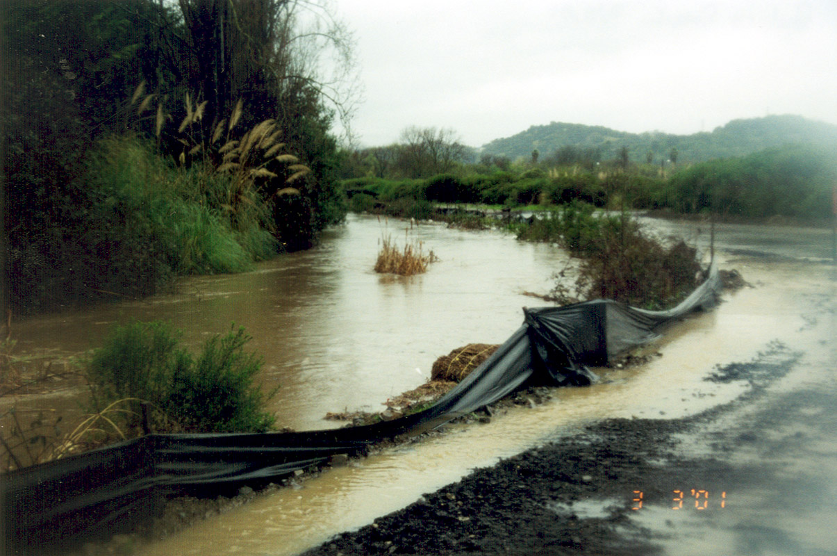