| Area |
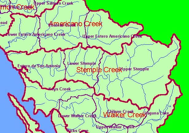
Stemple Creek |
| Topic |
Land Cover: EPA Land Use in Stemple Creek Sub-basin 1992 |
|
This is a map of the EPA Landcover/Landuse in the Stemple Creek sub-basin derived from a 1992 Landsat image. This theme
shows that much of the basin is in pasture and grasslands and other types of agricultural activity also occur in about 50% of the
watershed. Residential areas show up as hot pink and there is a large mine in the northeast corner of the basin. Data provided by
the U.S. Environmental Protection Agency.
|
|
|
 |
 |
To view metadata about a map layer, click on a link in the table below.
| Name of Layer in Map Legend | Metadata File Name |
|---|
| Calwater PWS (w/ labels) | calw22.shp.txt |
| Subbasins (w/ labels) | subbasins.shp.txt |
| Streams (1:100k scale)(no labels) | streams100.shp.txt |
| Frame Project Outline | Unavailable |
| EPA Landcover, Aggregated (1992)(TIFF) | lndcov2.tif.txt |
| EPA Landcover, Unaggregated (1992)(TIFF) | lndcov.tif.txt |
| Topo Map, North (1:24k scale) | Unavailable |
| Topo Map, South (1:24k scale) | Unavailable |
| Project Area Background | Unavailable |