| Area |
Basin-wide |
| Topic |
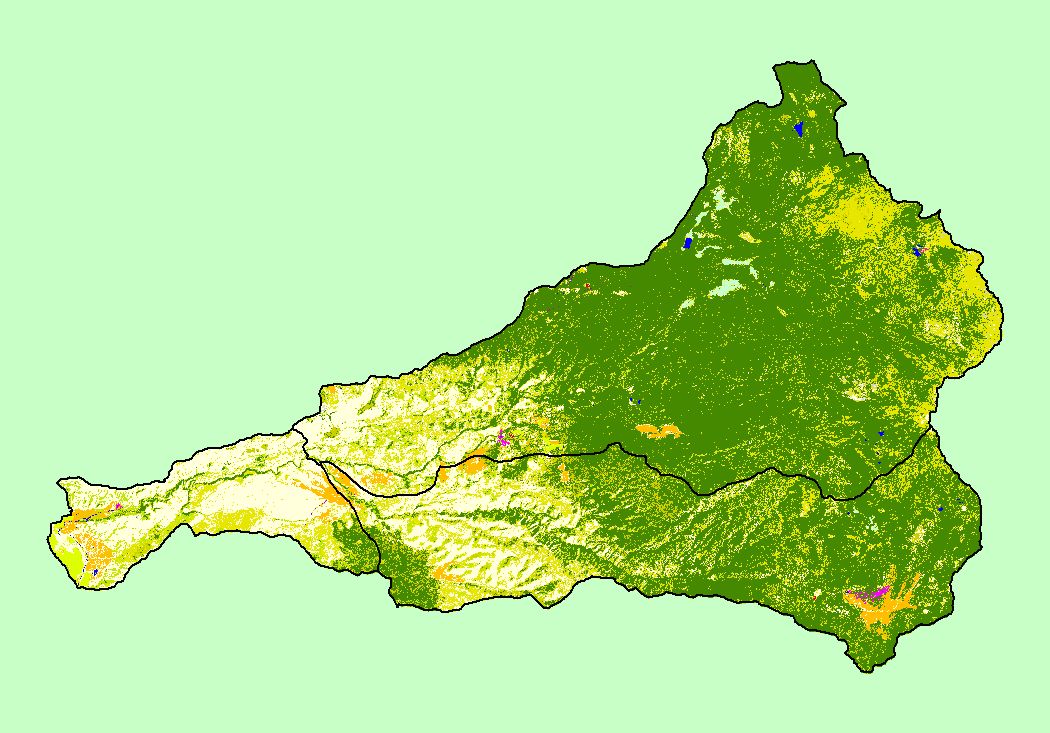
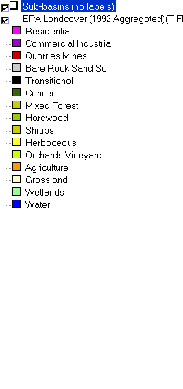
Map: 1I EPA Landcover/Landuse, Battle Creek Basin |
To view a more detailed version of this map click
here
|
This is a map of the 1992 Environmental Protection Agency Landcover/Landuse in the Battle Creek basin. These data are derived from a 1992 Landsat image.
Landcover shows clear trends related to elevation and topography. Many of the flat valleys along streams are covered in agriculture (pale orange), including meadows
used for grazing. The Mixed Forest at high elevation is the Montane Chaparral vegetation. Scale = 1:299,472 .
|
|
|
 |
 |
To view metadata about a map layer, click on a link in the table below.