| Area |
Basinwide/Regional |
| Topic |
WQ: pH at Various Sites, 2001 (SWAMP) |
 Click on image to enlarge (122K). Click here to display a larger version (224K).
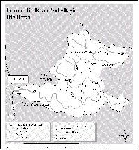
Map of the modified Lower Big River Sub-basin, which is comprised of the Mouth of Big River, Berry Gulch, and Laguna creek planning watersheds. Note location of SWAMP station BIGMWD (Big River at Mendocino Woodlands). See Source Table for sample data.
 Click on image to enlarge (120K). Click here to display a larger version (213K).
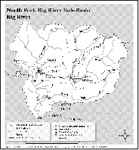
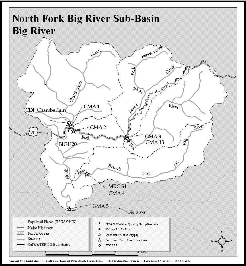
Map of the North Fork Big River Sub-basin, which is comprised of the Chamberlain Creek, James Creek, Lower North Fork Big River, Upper North Fork Big River, and East Branch North Fork Big River planning watersheds. Note location of SWAMP station BIGHW20 (North Fork Big River at Highway 20). See Source Table for sample data.
 Click on image to enlarge (120K). Click here to display a larger version (217K).
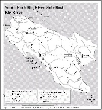
Map of the South Fork Big River Sub-basin, which is comprised of Mettick Creek, Dark Gulch, South Daugherty Creek, and Leonaro Lake planning watersheds. Note location of SWAMP station SFBIGD (South Fork Big River at Daugherty Creek). See Source Table for sample data.
To learn more about this topic click here

 Click on image to enlarge (122K). Click here to display a larger version (224K).
 Click on image to enlarge (120K). Click here to display a larger version (213K).
 Click on image to enlarge (120K). Click here to display a larger version (217K).