
| Area | Middle Big River |
| Topic | Sediment: Fines <0.85 mm for Two Log Creek (BIG 4), 1996-2001 |
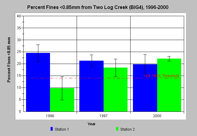
| Caption: The chart above displays percent fine sediment less than 0.85 mm from wet sieve McNeil bulk gravel samples in the Two Log Creek (BIG4). The bars represent the average of four McNeil samples at each station and the whiskers are one standard deviation from the mean. Generally, percent fines <0.85mm exceed the Big TMDL value of 14%, with the exception of year 1996 at Station 2. Data provided by Hawthorne Timber Company. See Info Links for more information. | |
 |
To learn more about this topic click here .
To view the table with the chart's data, click Chart Table web page.
To download the table with the chart's data, click htc_sed_lt085_big4.db (size 4,096 bytes) .
To see meta information about the data table used for this topic click here
To view the table with the chart's source data, click Source Table web page.
To download the table with the chart's source data, click htc_sed.dbf (size 7,490 bytes)
| www.krisweb.com |