
| Area | South Fork Big River |
| Topic | Maps of SF Big River Basin |
The image above shows the South Fork Big River KRIS sub-basin with the three CalWater planning units it contains. From the KRIS Big River Map project.
This image from the KRIS Big River Map project shows USFS vegetation and stand types for the SF Big River watershed derived from a 1994 Landsat (see USFS VegType Topics for more information). Non-Forest and Saplings in the eastern part of the basin are in part in response to Central Franciscan geology. In other areas of the sub-basin these patterns are mostly associated with recent timber harvest. Scale of accuracy for stands is one hectare.
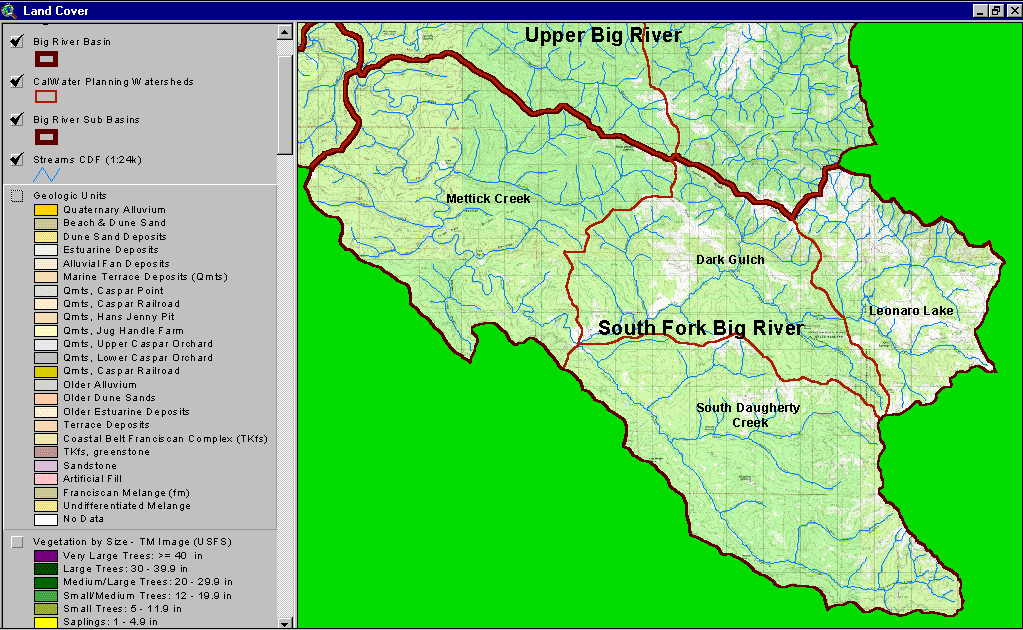
The image above is a map of the geological units mapped by California Department of Conservation, Division of Mines and Geology. The South Fork Big River is dominated by the Coastal Belt Franciscan Complex. Taken from the KRIS Big River Map project.
The image above is from the EPA Land Cover project, which is included in the KRIS Big River Map project. Patches of mixed forest and shrubland disbursed throughout South Daugherty Creek reflect early seral conditions after timber harvest.
The image above comes from the KRIS Big River Map project and shows timber harvests as mapped by the California Department of Forestry by year from 1986 to 1999. Over 50% of the basin was logged in this period.
The image above comes from the KRIS Big River Map project and shows changes in vegetation between 1994 and 1998 according to CDF FRAP change scene detection. Not much of the South Fork Big River watershed experienced appreciable loss of canopy except for the western Mettick Creek CalWater.
The map above shows the vegetation type and tree diameter for the riparian zone of the South Fork Big River and adjacent basins according to a 1994 Landsat image classified by the USFS Spatial Analysis Lab in Sacramento. See USFS Veg Type topics or Background pages for more information.
The map image above shows roads and particularly roads within 30 meters of the stream. Long reaches of road within the riparian zone occur along the South Fork Sub-basin. Streamside terraces have always made a handy location for logging roads and railroads before them, however, streamside roads may contribute substantial amounts of fine sediment to streams.
 Click on image to enlarge (170K).
 Click on image to enlarge (79K).
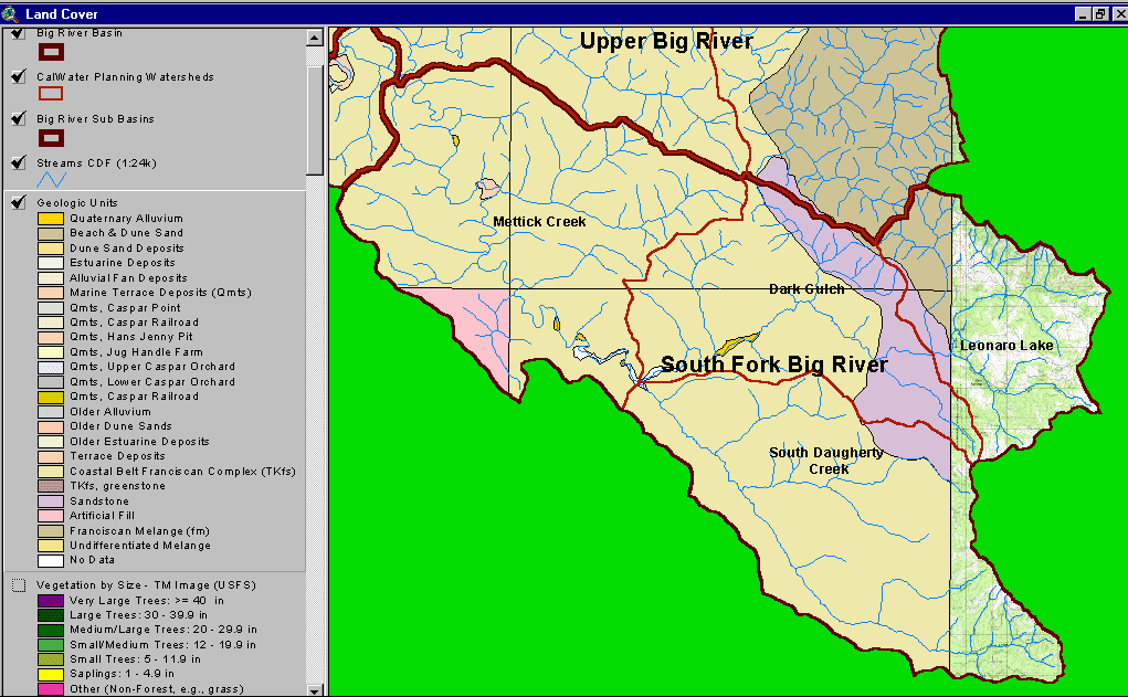 Click on image to enlarge (63K).
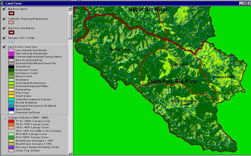 Click on image to enlarge (74K).
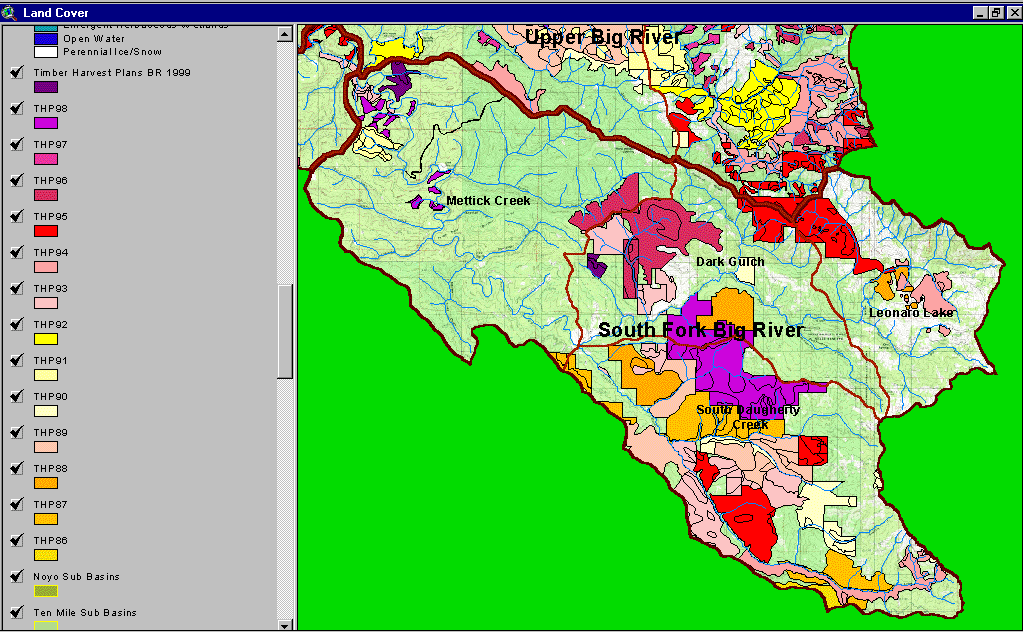 Click on image to enlarge (146K).
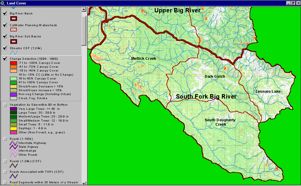 Click on image to enlarge (174K).
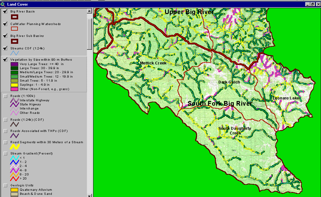 Click on image to enlarge (158K).
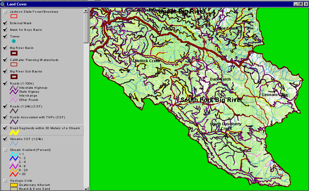 Click on image to enlarge (166K).
To learn more about this topic click here
| www.krisweb.com |