
| Area | Mainstem Trinity |
| Topic | Tour: Main Trinity Basin Map Tour |
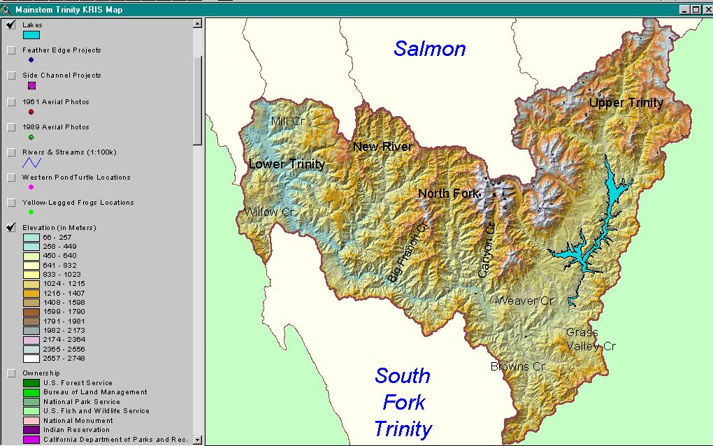
The map above shows elevation of the Trinity River watershed which rises to over 2750 meters (9000 feet) in elevation in the Trinity Alps. The only areas of low topography are in the Weaverville, Lewiston and Trinity Center areas. Snow pack from high elevation areas can prolong summer high flow periods and help moderate water temperatures to the benefit of salmonids. Image from Main Trinity KRIS Map ArcView project.
The ownership map of the Trinity River Basin shows vast expanses of public land which is largely Shasta Trinity National Forest, although Bureau of Land Management lands are prevalent around Weaverville, Lewiston and Grass Valley Creek. Six Rivers National Forest covers much of the Lower Trinity Basin, west of the New River. Private lands that extend along the eastern boundary of the basin from Browns Creek through the Upper Trinity are largely in private, industrial timber company ownership and are managed intensively.
This map shows the Trinity River Basin with vegetation types and timber size classes highlighted. These signatures were derived from 1994 Landsat imagery for use in KRIS. The bare rock and soil of alpine peaks shows in the central part of the image in the Trinity Alps Wilderness. Large tracks of mature forest are indicated at lower elevation in the Wilderness from Big French Creek, through the New River and into upper Horse Linto, Tish Tang and Mill Creeks. The signature of shrubs, shrubs and small trees and grasses in the Upper Trinity is in part owing to intensive logging and slow recovery of forests at high elevation. Map from the Main Trinity KRIS Map ArcView project.
The KRIS Trinity Map project has captured the locations of all Trinity River Restoration Program projects and provided a USGS Topo map as a backdrop for ease of use in restoration planning. This image shows side channel projects immediately below Lewiston Dam. The side channel location symbols are Hotlinked in ArcView so that they connect with a photo tour in the KRIS database. See the next Picture to see the same location with an orthophoto image as a backdrop.
This image shows locations of Side Channel projects implemented by the Trinity Restoration Program but against a 1994 orthophoto backdrop. The USGS quad-size photographic image allows restoration planners to see the location of projects relative to river meanders, location of projects relative to sediment sources and how they fare over time. Photo image provided by USGS and compressed using Mr Sid technology for use in KRIS.
Maps of the riparian zone of the Trinity River in 1962, prior to construction of dams, have been created by the U.S. Forest Service Redwood Sciences Lab from aerial photos. This coverage allows restoration planners to see how the riparian zone changed after dam construction and gives some clues as to changes in fish habitat. See the Picture #7 to see changes in 1989, 25 years after dam construction and low flow regimes began. The image is overlayed on a 1994 USGS orthophoto quad.
The map image above shows a much narrower riparian zone in 1989 than in 1962 (see previous Picture) with much less active gravel bar. Alders and willows have encroached closely on the channel and eliminated slow edge water areas needed by Chinook salmon for rearing. The riparian vegetation map was digitized from aerial photos and extensively ground-truthed by the USFS Redwood Sciences Lab who provided the ArcView data for use in the KRIS Trinity Map project.
The map image above is taken from the KRIS Trinity Map ArcView project and shows mining claims. Mining claims are most intensely clustered in the New River, North Fork Trinity, Canyon Creek and Upper Trinity areas. If all claims were activated in response to an increasing price of gold, there is a potential for adverse cumulative effects to fisheries and water quality. The 1872 Mining Act still allows claims to be filed anywhere on public lands so the number of claims could also expand substantially. Data from the U.S. Bureau of Mines.
 Click on image to enlarge (188K).
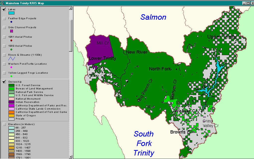 Click on image to enlarge (38K).
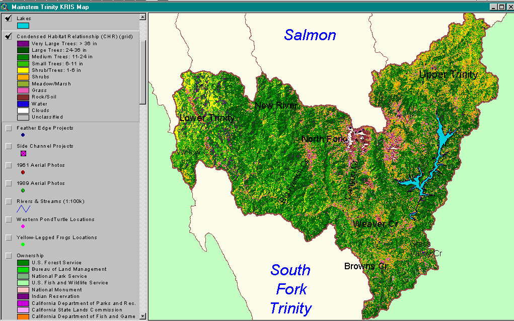 Click on image to enlarge (91K).
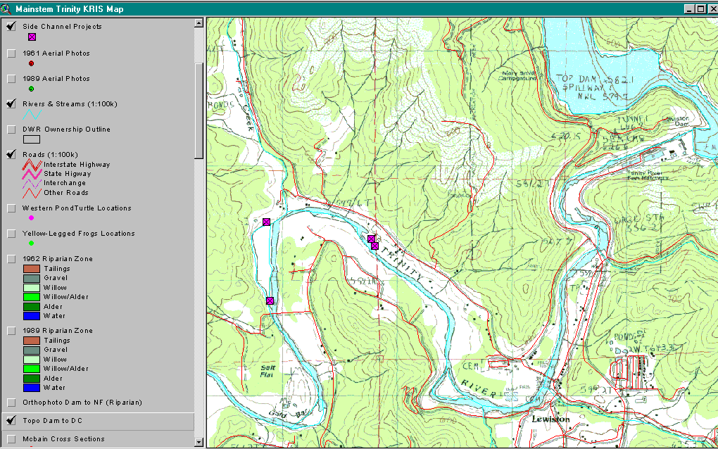 Click on image to enlarge (150K).
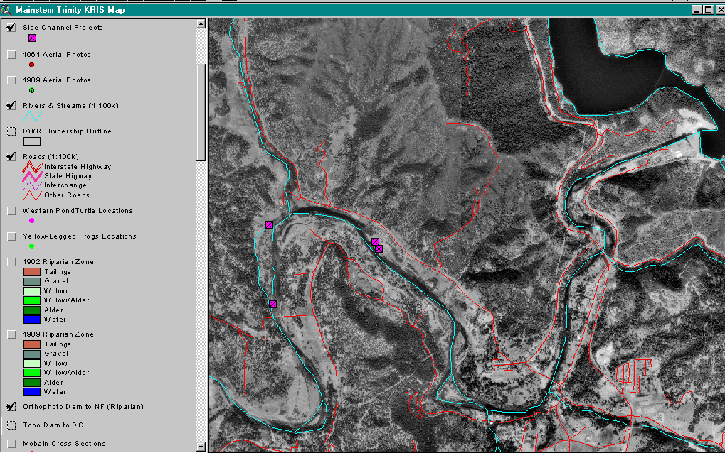 Click on image to enlarge (286K).
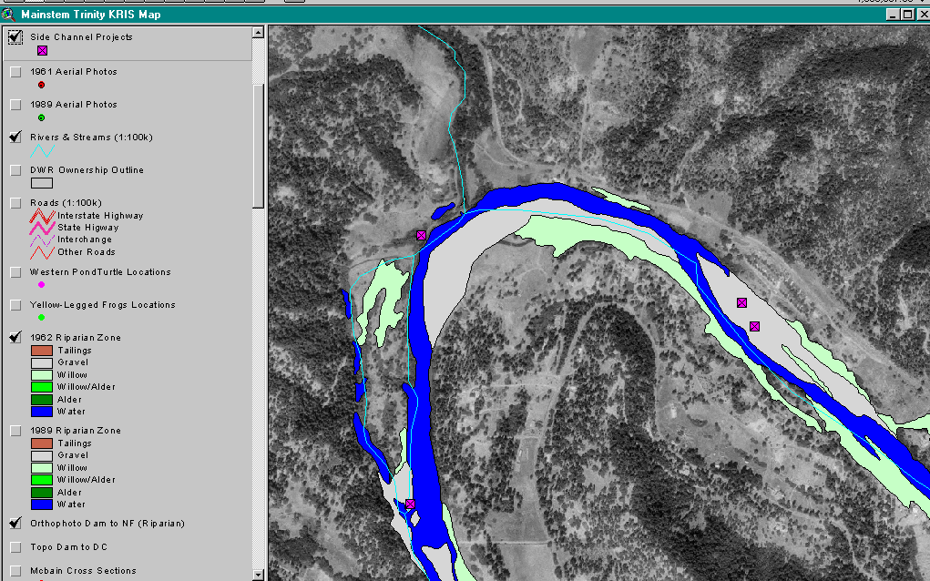 Click on image to enlarge (246K).
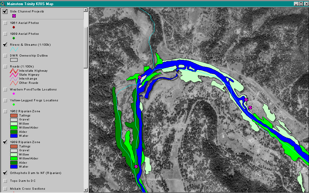 Click on image to enlarge (250K).
 Click on image to enlarge (61K).
To learn more about this topic click Info Links
| www.krisweb.com |