
| Area | Middle Trinity |
| Topic | Tour: Grass Valley Check Dams |
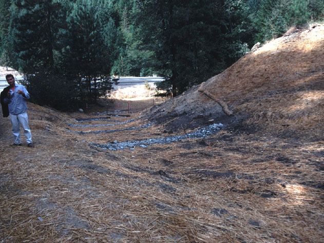
The rock structures installed in this draw within the Grass Valley Creek watershed were intended to catch sediment. However, the erosive force of flows during major rains caused erosion around them (see Picture #2). This is in sub-watershed 26B at site 101 with Highway 299 in the background. Photo courtesy of the Trinity RCD. October 1993.
This photo shows site 26B-101 in February 1995 during a significant storm. Scour at the base of the rock structures caused them to fail which resulted in increased erosion. Photo courtesy of the Trinity RCD.
This photo shows site 26B-101 in April 1995 showing failure of grade control structures.
Log check dams installed in a tributary of Grass Valley Creek were an attempt to decrease gully formation and stream downcutting. The ponds at the top of each structure were designed to catch sediment but actually ponded water during storm events that then cut around the structures (see Picture #5). Photo courtesy of the Trinity RCD. June 1993.
This is a typical log structure failure in Grass Valley Creek sub-watershed 25 along Lowden Road. As water spilled around this structure it caused bank erosion. Most structures for sediment retention are now constructed at very near the grade of the stream. Photo courtesy of the Trinity RCD. June 1995.
 Click on image to enlarge (118K).
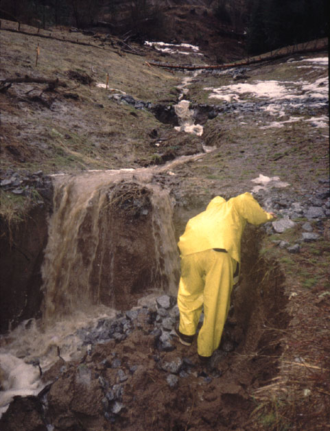 Click on image to enlarge (91K).
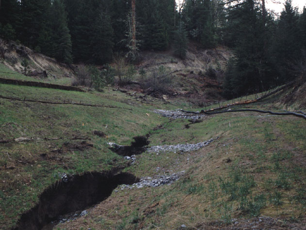 Click on image to enlarge (86K).
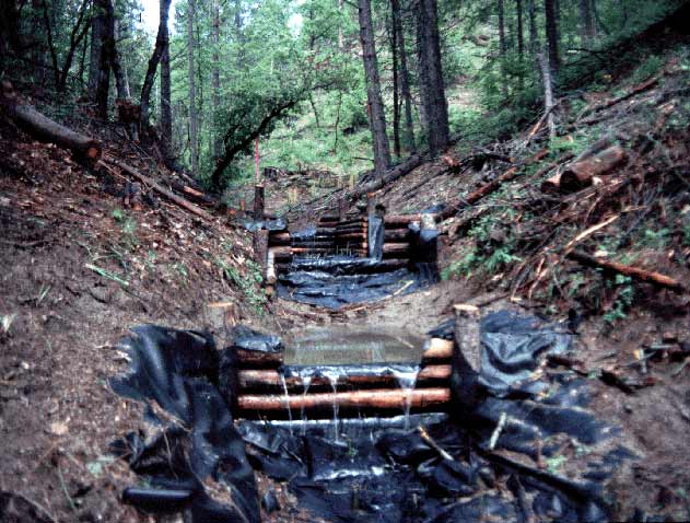 Click on image to enlarge (64K).
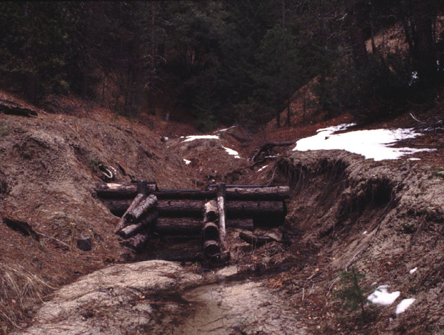 Click on image to enlarge (93K).
To learn more about this topic click Info Links
To view additional information (data source, aquisition date etc.) about this page, click Metadata
| www.krisweb.com |