
| Area | Salmon River |
| Topic | Map: Salmon River Geology |
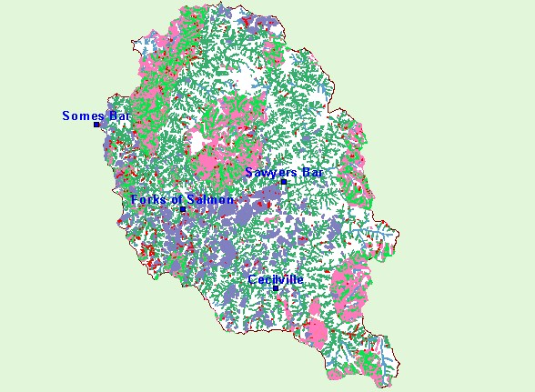
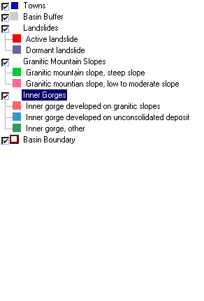
| This is a map of geologic features in the Salmon River Project Area. Active Landslides, Granitic Slopes and Inner gorge areas are are shown in the currently displayed layer. Identifying sensitive geomorphic areas is integral to resource management planning in the Salmon Basin. | |||
 |
 |
||
To view metadata about a map layer, click on a link in the table below.
| Name of Layer in Map Legend | Metadata File Name |
|---|---|
| Towns | towns.shp.txt |
| Basin Buffer | buffer_basinboundary.shp.txt |
| Landslides | geo13l.shp.txt |
| Granitic Mountain Slopes | geo13l.shp.txt |
| Inner Gorges | geo13l.shp.txt |
| Elevation (in Meters) | sr_elevation.tif.txt |
| Hillshade | srhillshade.tif.txt |
| Basin Boundary | basin_bnd.shp.txt |
| www.krisweb.com |