
| Area | Upper Trinity |
| Topic | Tour: Trinity Lake Construction: Ranch Lands |
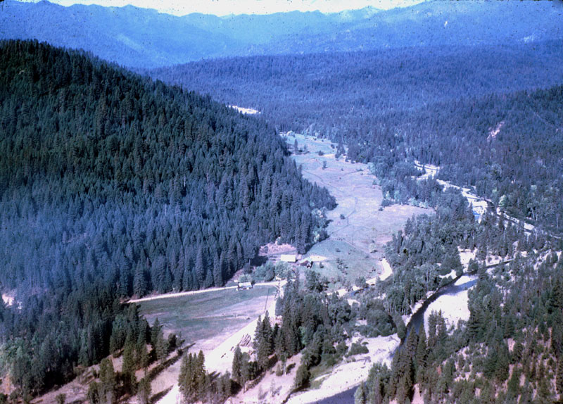
This photo is shot looking up Stuart Fork drainage. The Van Matre ranch and homestead are visible stretching up the valley floor. The confluence of the east fork of Stuart fork is just off camera on the left (where the sharp bend is visible in Stuart Fork). Photo courtesy Sue Corrigan and family.
This photo is shot looking up Stuart Fork drainage and was taken further west than the first shot (just past the confluence of the east fork of Stuart fork). The Rush creek bowl and the north face of Monument peak are now visible in the upper left of the photo. The Van Matre ranch lands are visible stretching up the valley floor. Photo courtesy Sue Corrigan and family.
Photo showing the west end of the Van Matre ranch land and valley floor. Photo courtesy Sue Corrigan and family.
Spliced photo showing panoramic view of the Van Matre ranchland after lake clearing and building demolition stages were complete. The homestead and buildings used to sit next to the road "s" turn and trees visible on the lower left of photo. Stuart Fork is visible in the foreground. The confluence of Buckeye creek with Stuart Fork would of off camera to the left. Stuart Fork drainage runs off to the right, the end of the ridgeline above former homestead is the west ridge of Buckeye drainage. Photo is shot from the end of Bowerman ridge. Photo courtesy Sue Corrigan and family.
Photo of the Van Matre ranch barn and out buildings looking east. The end of Fairview ridge is visible in the center of photo. The end of Bowerman ridge comes in from the left. Photo courtesy Sue Corrigan and family.
Photo looking west from the Van Matre ranch showing Granite peak in the background. Photo courtesy Sue Corrigan and family.
Photo showing the confluence of Buckeye Creek where it joins Stuart Fork. The Trinity river drainage is visible past the tip of Bowerman ridge towards the center of photo. Photo is shot looking north east from the tip of the western ridge of Buckeye drainage. Photo courtesy Sue Corrigan and family.
Photo is shot looking north up the Trinity river drainage from near the west side of the dam. Fairview marina now sits on the bald ridge closest on the left. Fairview ridge is visible coming in on the left with Bowerman ridge visible in the background. Stuart Fork joins the Trinity river as it curves around the tip of Fairview ridge and flows south. Earth works related to dam construction are visible in the foreground. Photo courtesy Sue Corrigan and family.
 Click on image to enlarge (155K).
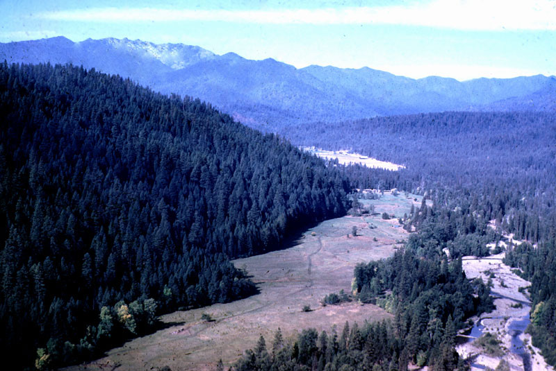 Click on image to enlarge (122K).
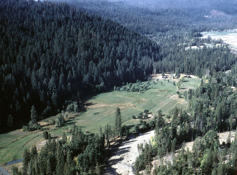 Click on image to enlarge (153K).
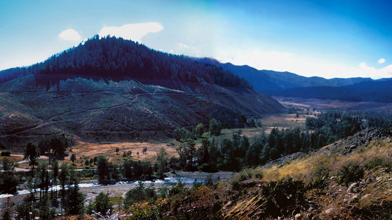 Click on image to enlarge (105K).
 Click on image to enlarge (101K).
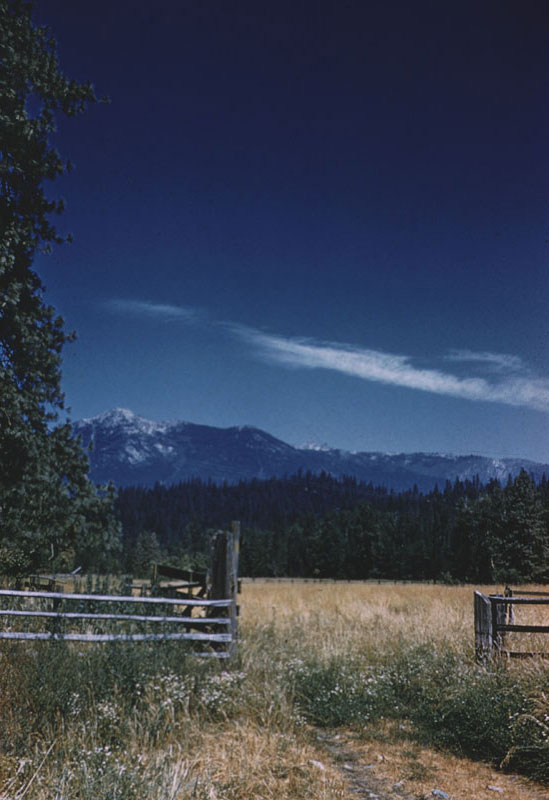 Click on image to enlarge (75K).
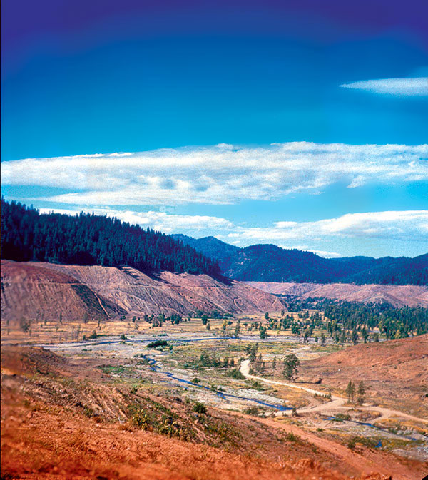 Click on image to enlarge (129K).
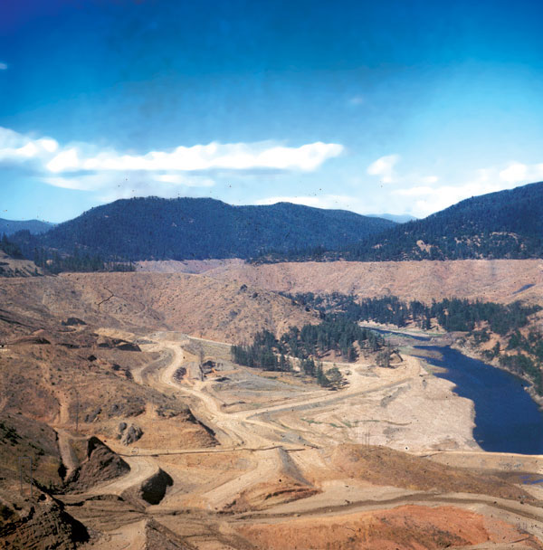 Click on image to enlarge (89K).
To learn more about this topic click Info Links
To view additional information (data source, aquisition date etc.) about this page, click Metadata
| www.krisweb.com |