
| Area | North Fork |
| Topic | Tour: Images of NF Noyo Riparian Maps (USFS Landsat) |
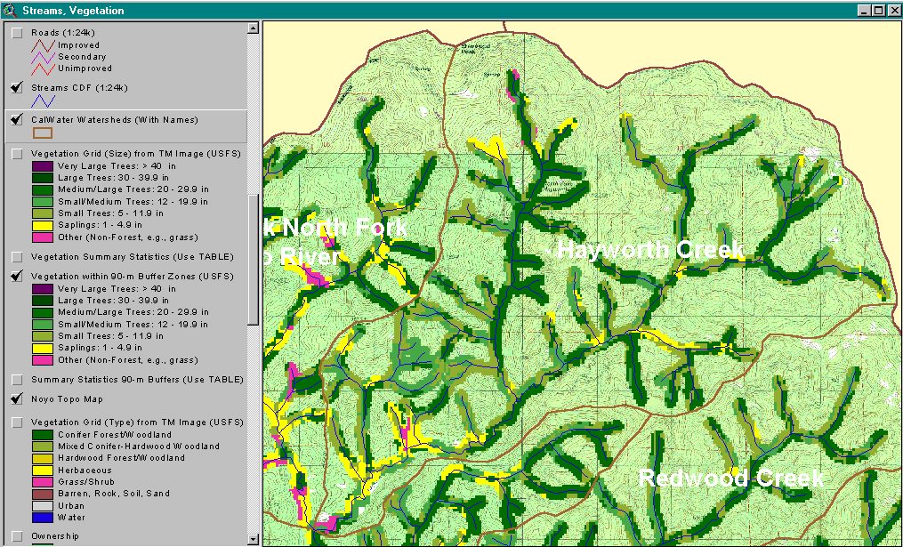
The riparian zone of Hayworth Creek CalWater is shown above as a 90 meter clip of USFS vegetation and stand type data derived from a 1994 Landsat image. This data is only accurate to the one hectare scale and should be used only as a reconnaissance tool for riparian conditions. Much of the North Fork Hayworth riparian area is dominated by medium-large trees (20-29.9" diameter) but saplings (<5" diameter) are indicated for headwater areas and along the lower mainstem Hayworth Creek. See InfoLinks for more information.
The riparian zone of the Middle Fork North Fork Noyo River CalWater is shown above as a 90 meter clip of USFS vegetation and stand type data derived from a 1994 Landsat image. Parts of the riparian zone in upper Dewarren Creek and the upper Middle Fork North Fork are dominated by medium-large trees (20-29.9" diameter) but saplings (<5" diameter) and non-forest are indicated for headwater areas and along the North Fork Noyo above Hayworth at the bottom-center of the image. See InfoLinks for more information. This data is only accurate to the one hectare scale and should be used only as a reconnaissance tool for riparian conditions.
The riparian zone of the North Fork Noyo River CalWater is shown above as a 90 meter clip of USFS vegetation and stand type data derived from a 1994 Landsat image. The mainstem Noyo downstream of Northspur is included in this CalWater and shows the largest area of medium-large trees (20-29.9" diameter). Saplings (<5" diameter) and non-forest predominate the headwaters of Marble Gulch and the mainstem North Fork Noyo. See InfoLinks for more information. This data is only accurate to the one hectare scale and should be used only as a reconnaissance tool for riparian conditions.
 Click on image to enlarge (152K).
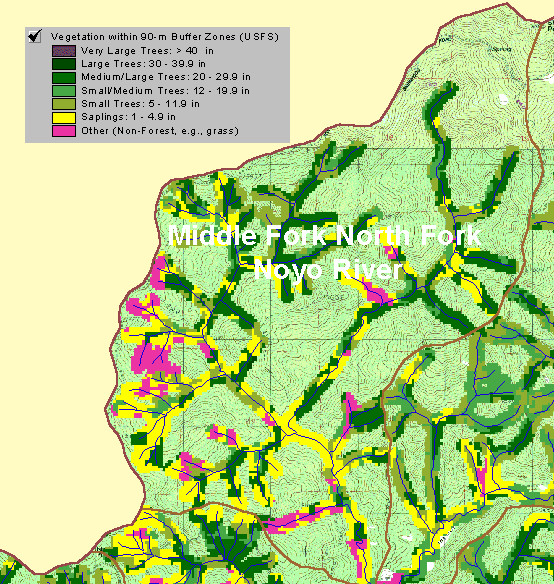 Click on image to enlarge (73K).
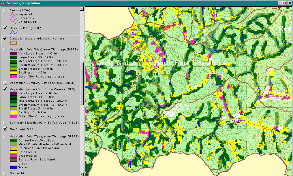 Click on image to enlarge (146K).
To learn more about this topic click here
| www.krisweb.com |