| Agency |
Environmental Science Associates |
| Basin |
East Marin-Sonoma |
| Caption |
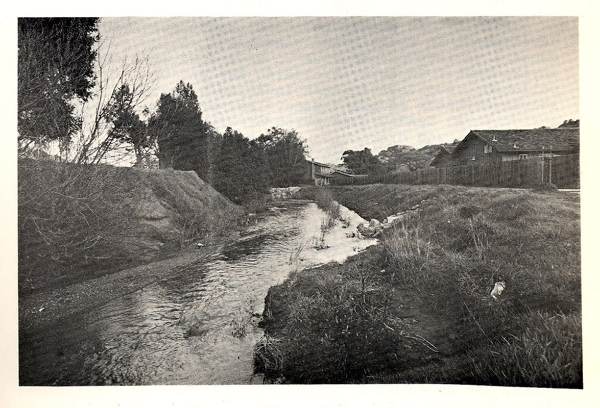
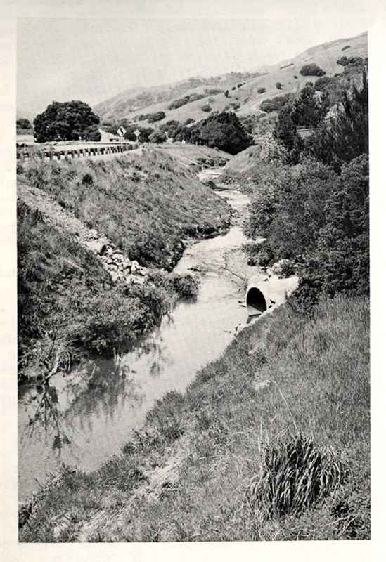
This is a picture of Miller Creek, flowing through areas of residential development. Photo taken from Environmental Science Associates, 1973.
|
| CaptionTemplate |
[Description] |
| Category |
Historical Photos |
| Description |
This is a picture of Miller Creek, flowing through areas of residential development. Photo taken from Environmental Science Associates, 1973.
|
| Filename |
mcdpw_miller_develop_1973.jpg |
| Filesize |
306500 |
| Meta_Id |
MCDPW_photos |
| Notefile |
emarins.htm#photos |
| Path |
topics/nm/mcdpw_miller_develop_1973.jpg |
| Photo Number |
7 |
| Restriction |
None |
| Series |
Historical Photos: Miller Creek 1973 |
| SubBasin |
Novato and Miller Creeks |
| UpdateDate |
8/26/2006 |
| UpdateName |
JEA |
| Agency |
Environmental Science Associates |
| Basin |
East Marin-Sonoma |
| Caption |
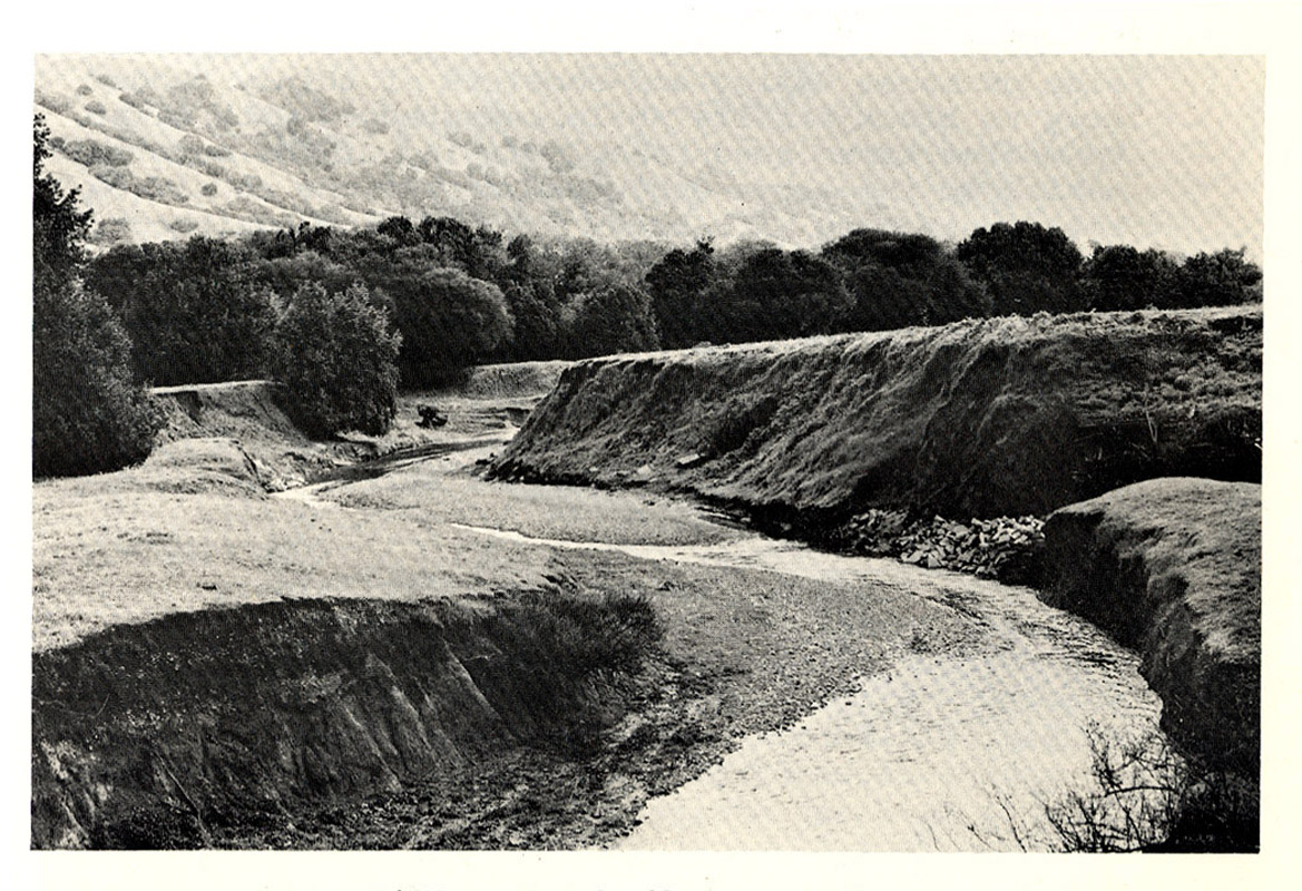
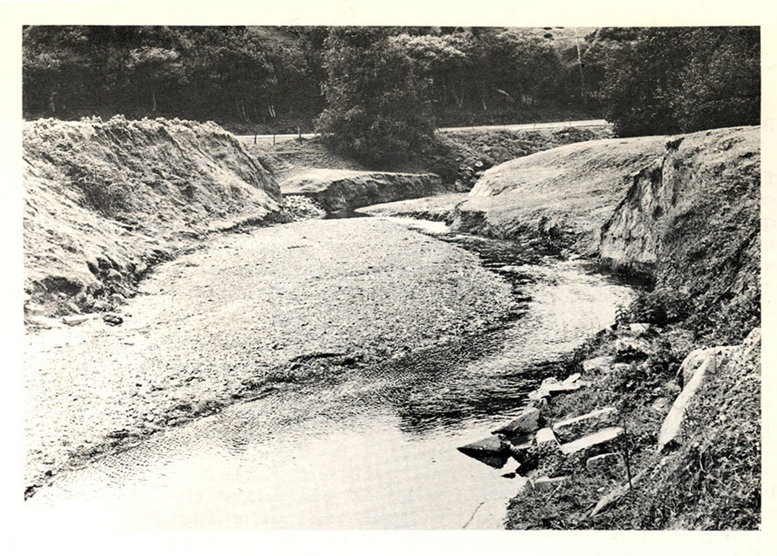
The picture shows the Miller Creek flats, upstream of the (former?) Luiz Ranch. Photo taken from Environmental Science Associates, 1973. |
| CaptionTemplate |
[Description] |
| Category |
Historical Photos |
| Description |
The picture shows the Miller Creek flats, upstream of the (former?) Luiz Ranch. Photo taken from Environmental Science Associates, 1973. |
| Filename |
mcdpw_miller_flats_1973.jpg |
| Filesize |
340475 |
| Meta_Id |
MCDPW_photos |
| Notefile |
emarins.htm#photos |
| Path |
topics/nm/mcdpw_miller_flats_1973.jpg |
| Photo Number |
1 |
| Restriction |
None |
| Series |
Historical Photos: Miller Creek 1973 |
| SubBasin |
Novato and Miller Creeks |
| UpdateDate |
8/26/2006 |
| UpdateName |
JEA |
| Agency |
Environmental Science Associates |
| Basin |
East Marin-Sonoma |
| Caption |
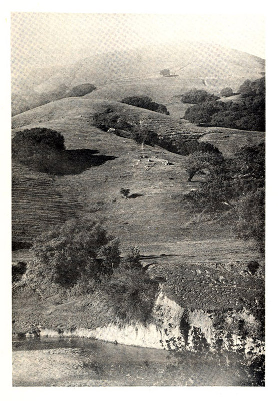
This is the north side of Lucas Valley, with Miller Creek in the foreground. Photo taken from Environmental Science Associates, 1973. |
| CaptionTemplate |
[Description] |
| Category |
Historical Photos |
| Description |
This is the north side of Lucas Valley, with Miller Creek in the foreground. Photo taken from Environmental Science Associates, 1973. |
| Filename |
mcdpw_miller_northvalley_1973.jpg |
| Filesize |
167458 |
| Meta_Id |
MCDPW_photos |
| Notefile |
emarins.htm#photos |
| Path |
topics/nm/mcdpw_miller_northvalley_1973.jpg |
| Photo Number |
6 |
| Restriction |
None |
| Series |
Historical Photos: Miller Creek 1973 |
| SubBasin |
Novato and Miller Creeks |
| UpdateDate |
8/26/2006 |
| UpdateName |
JEA |
| Agency |
Environmental Science Associates |
| Basin |
East Marin-Sonoma |
| Caption |
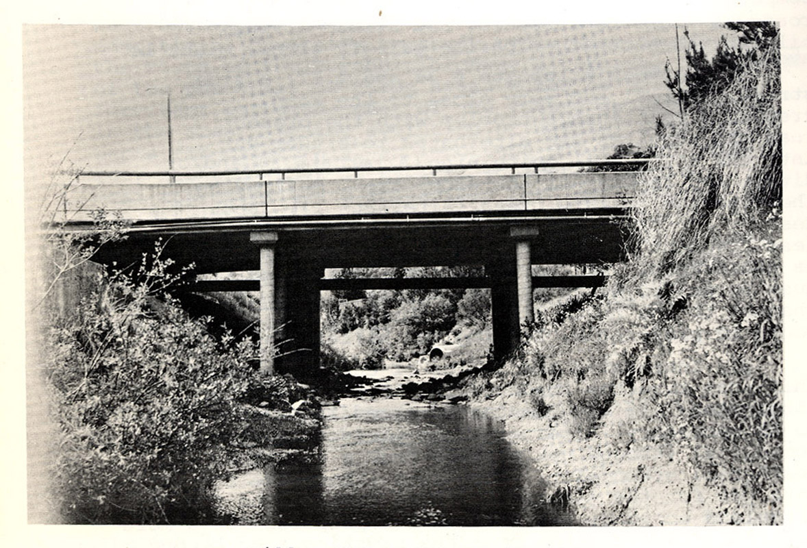
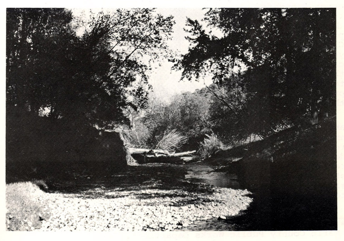
This is a another picture of Miller Creek, west of the (former?) Luiz Ranch. Photo taken from Environmental Science Associates, 1973. |
| CaptionTemplate |
[Description] |
| Category |
Historical Photos |
| Description |
This is a another picture of Miller Creek, west of the (former?) Luiz Ranch. Photo taken from Environmental Science Associates, 1973. |
| Filename |
mcdpw_miller_westluiz2_1973.jpg |
| Filesize |
292870 |
| Meta_Id |
MCDPW_photos |
| Notefile |
emarins.htm#photos |
| Path |
topics/nm/mcdpw_miller_westluiz2_1973.jpg |
| Photo Number |
4 |
| Restriction |
None |
| Series |
Historical Photos: Miller Creek 1973 |
| SubBasin |
Novato and Miller Creeks |
| UpdateDate |
8/26/2006 |
| UpdateName |
JEA |