| Area |
Regional |
| Topic |
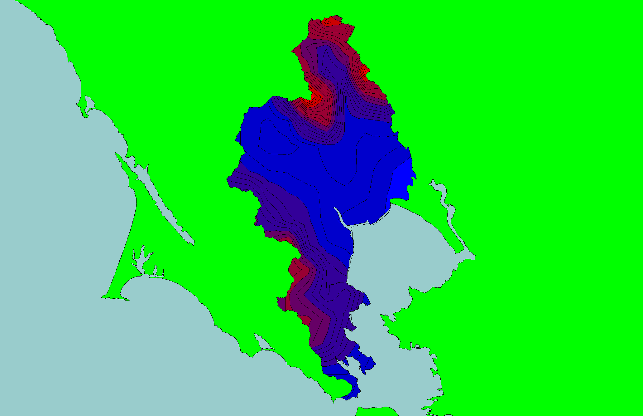
Map: 1E. Rainfall, East Marin-Sonoma |
|
This is a map of annual rainfall in the KRIS East Marin-Sonoma project area based on work by the Oregon Climate Service at Oregon State University. Their model
was based on 1961-1990 rainfall data. The highest rainfall occurred in areas of higher relief around mountaintops in the northern project area.
|
|
|
 |
 |
To view metadata about a map layer, click on a link in the table below.
| Name of Layer in Map Legend | Metadata File Name |
|---|
| Frame Project Outline | Unavailable |
| Annual Rainfall (inches) | rain61_90.shp.txt |
If you obtain KRIS on a CD and install it on your hard drive as a desktop program, you will have access to increased map capabilities such as zooming in/out, turning layers on/off, adding layers and changing legends.