| Area |
Regional |
| Topic |
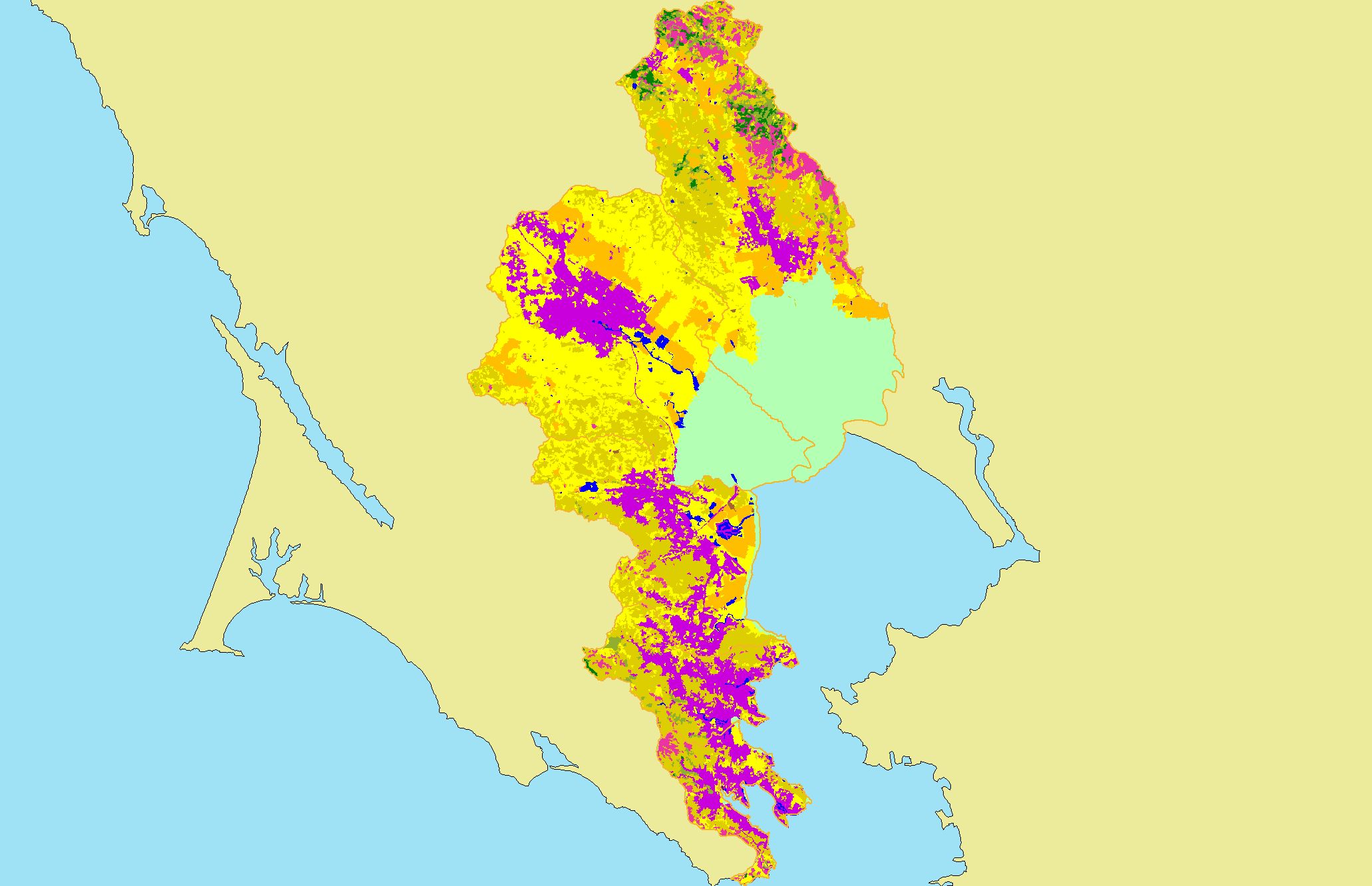
Map: 1I. USFS Vegetation Type, East Marin-Sonoma |
|
This is a map of 1999 USFS Landsat vegetation type data in the KRIS East Marin-Sonoma project area. Unlike the tree size coverage in the previous Topic, this map
differentiates between hardwoods and conifers.
|
|
|
 |
 |
To view metadata about a map layer, click on a link in the table below.
| Name of Layer in Map Legend | Metadata File Name |
|---|
| Subbasins (no labels) | subbasins.shp.txt |
| Frame Project Outline | Unavailable |
| USFS Vegetation Type (1999) | vegtype99.tif.txt |
| Project Area | Unavailable |
If you obtain KRIS on a CD and install it on your hard drive as a desktop program, you will have access to increased map capabilities such as zooming in/out, turning layers on/off, adding layers and changing legends.