| Area |
Rockpile Creek |
| Topic |
Tour: Aerial Photos of Timber Harvest Rockpile Creek |
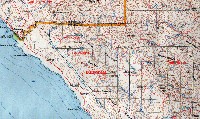 Click on image to enlarge (77K). Click here to display a larger version (610K).
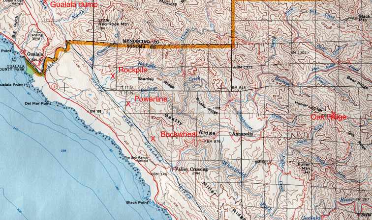
Map of lower SF Gualala and Wheatfield Fork with timber harvest areas by name. Photos in this sequence are for the "Rockpile" THPs. Photo provided courtesy of Russian River Residents Against Unsafe Logging.
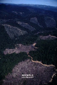 Click on image to enlarge (92K). Click here to display a larger version (290K).
This aerial photo shows the lower Rockpile Creek watershed above its convergence with the lower South Fork Gualala. Clear cuts with cable yarding appear to have taken place on steeper slopes with tractor logging and associated dense skid trails noticeable on flatter terrain. Photo courtesy of Russian River Residents Against Unsafe Logging.
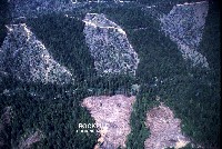 Click on image to enlarge (47K). Click here to display a larger version (192K).
Close up of clear cuts in lower Rockpile Creek in steep areas of the inner gorge. Russian River Residents Against Unsafe Logging
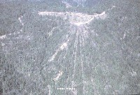
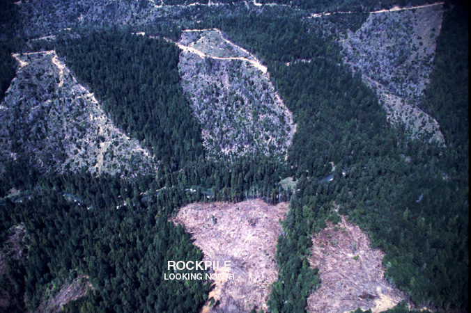
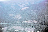 Click on image to enlarge (66K).
Panorama of lower Rockpile Creek looking east from the South Fork Gualala River. Notice also clear cuts on east side of the South Fork at the bottom of the photo. Photos in this sequence are for the "Rockpile" THPs. Photo provided courtesy of the Russian River Residents Against Unsafe Logging.
 Click on image to enlarge (55K).
Close up of timber harvest where cable yarding tracks are evident. Photos in this sequence are for the "Rockpile" THPs. Photo provided courtesy of the Russian River Residents Against Unsafe Logging.

 Click on image to enlarge (77K). Click here to display a larger version (610K).
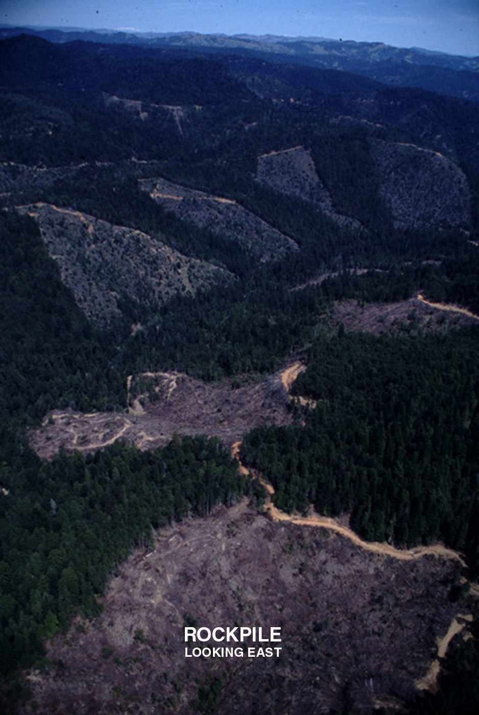 Click on image to enlarge (92K). Click here to display a larger version (290K).
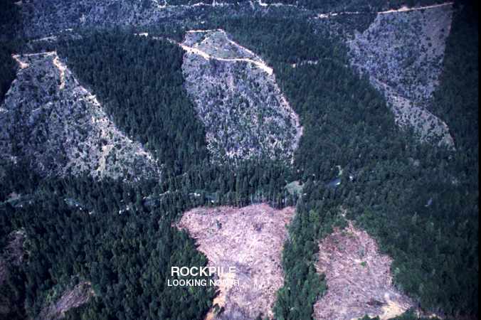 Click on image to enlarge (47K). Click here to display a larger version (192K).
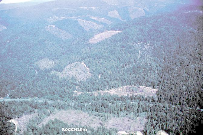 Click on image to enlarge (66K).
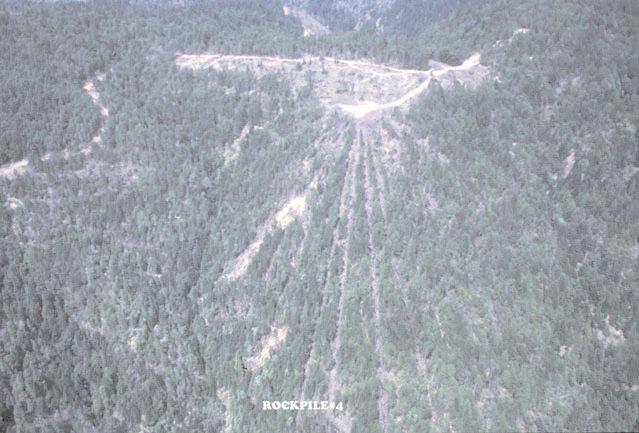 Click on image to enlarge (55K).
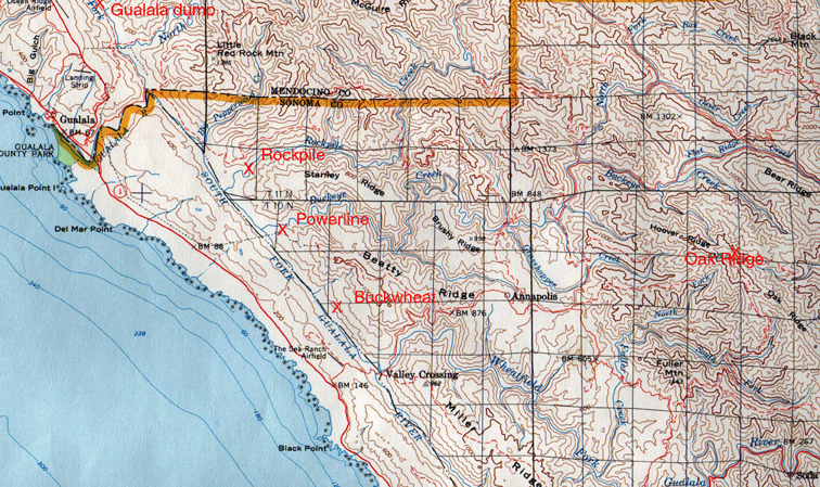