Bibliography Background About KRIS
The Noyo River Basin: A Brief Overview
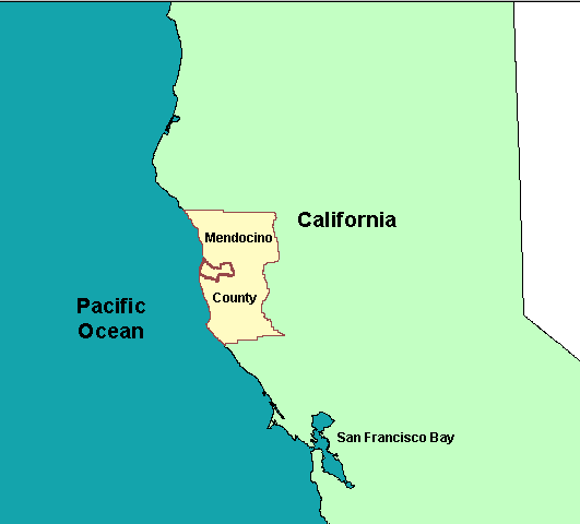
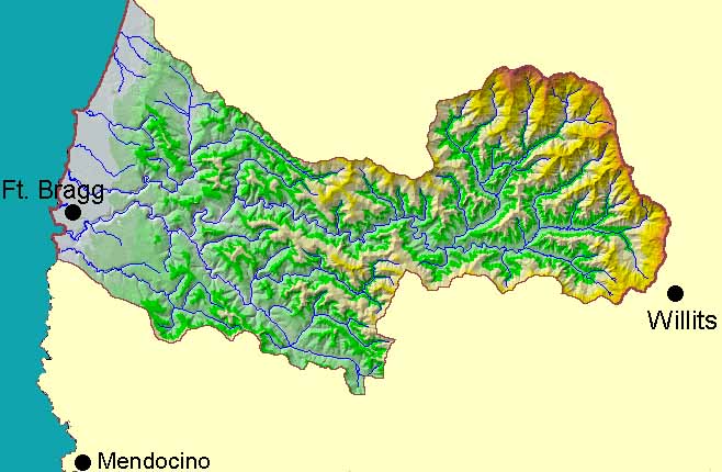 The the Noyo River is located in Mendocino County in northwestern California. These two images, from the KRIS Noyo Map project, show the location within the state, and the Noyo River watershed.
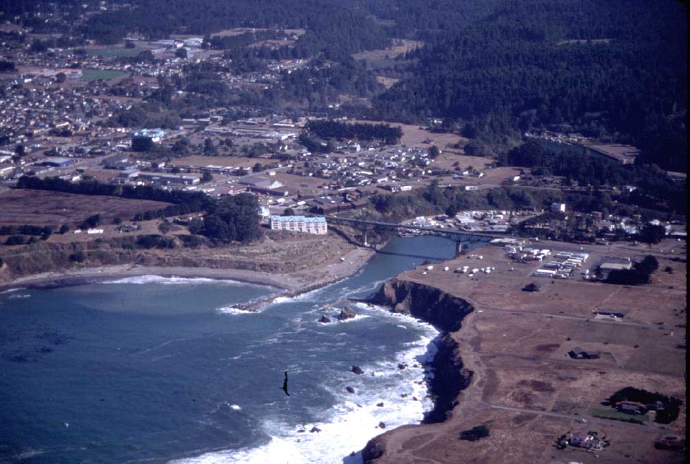
The Noyo River and its tributaries flow from a 113 square mile watershed located west of Willits and east of Fort Bragg, California. The Coast Range rises in the eastern side of the basin, where Sherwood Peak reaches 3207 feet. The western portion of the Noyo basin is made of old marine terraces and is relatively flat, with elevations sloping down to sea level.. The City of Fort Bragg was originally built on the river's north side, but now it encompasses both sides of the river (image #1).
The Noyo River supplies domestic water to the city and the Noyo River watershed has provided rich timber resources for mills since the 1850s. The Pomo Indians were the dominant tribe in the vicinity of the Noyo River basin prior to European colonization.
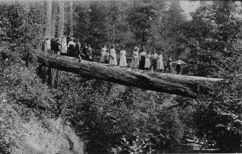
Fort Bragg was originally settled in 1857 by the U.S. Army, whose mission was to oversee a locally established Indian Reservation. Small scale logging began in the Noyo River basin shortly thereafter. Original logging was conducted with oxen or horses, which dragged logs to water courses so they could be floated downstream (image #2). In 1885, a railroad line was built 20 miles into the Noyo River watershed to haul out the huge redwood, and mechanized logging got into full swing. A large mill was established at the site of the old fort and a log loading facility was established at Noyo Harbor. The City of Fort Bragg was incorporated in 1889 and C. W. Johnson, founder of the Union Lumber Mill, was elected mayor.
 |
 |
 |
| Horse logging in the early days (circa
1860). Courtesy Heald Poage Museum. 78 KB |
Ladies and gentlemen enjoy the Noyo River. Courtesy Heald Poage Museum. 58 KB |
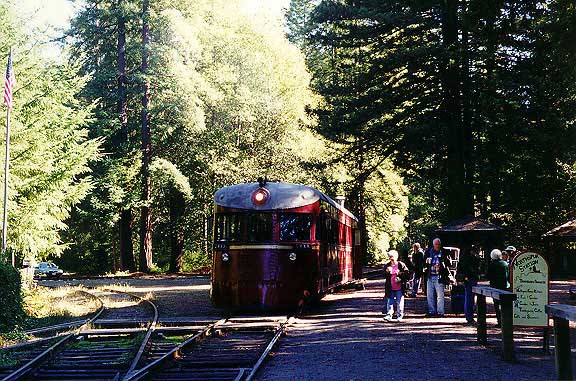
The Skunk Train at Northspur in November
1999. 100 KB |
In 1905, the rail line from Fort Bragg began expanding eastward, toward the town of Willits, to link with the railroad line there. The 1906 earthquake set back progress on the railroad extension and was disastrous for Fort Bragg. It wasn't until 1911 that the rail line was extended and passenger service was initiated. Dozens of trestles and bridges were needed, as well as several tunnels, to complete the project. The passenger service was an immediate success, with families from Willits and Fort Bragg enjoying the scenic beauty of the Noyo River along the route (image #3). This railroad line remains in use today as the Skunk Railroad, a popular tourist attraction in Mendocino County (image #4).
 |
 |
 |
| The town of Ft. Bragg and Noyo Harbor. Photo by Rixanne Wehren. 93 KB |
Commercial salmon catch being processed at Ft.
Bragg (1920s). Courtesy Heald Poage Museum. 51 KB |
The Noyo River harbor. Photo by Rixanne Wehren. 74 KB |
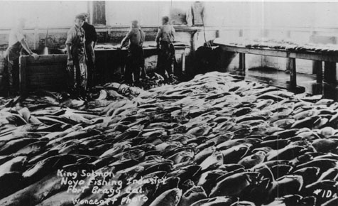
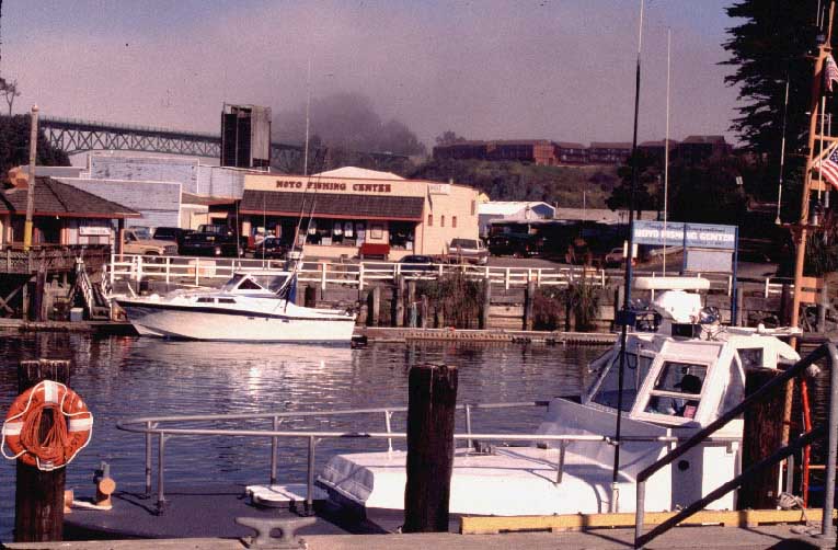
The Noyo River has provided fish for local residents since people have inhabited the area. For Europeans who settled the area, the natural harbor provided by the Noyo River estuary allowed access to an even greater bounty of salmon in the ocean. Motorized salmon trolling vessels came into use in the 1920s and millions of pounds of salmon were caught and brought to market in Fort Bragg (image #5). Today the Noyo Harbor remains an important commercial and sport fishing center but access to ocean salmon for commercial fishing has diminished due to closures related to conservation.
Logging of second growth trees in the Noyo River basin began in the 1960s and continues today. In recent years, the Noyo River has been recognized as an impaired water body because of its high sediment loads. The U.S. Environmental Protection Agency and the North Coast Regional Water Quality Control Board have finished an assessment of the river's sediment budget and have set water quality targets aimed at reversing pollution problems (NCRWQCB, 1999). The Noyo River is also the pilot area for the California Resources Agency watersheds assessment, which is why this KRIS project was funded.
 The are area encompassed by the KRIS Noyo project includes the Noyo River sub-basins and Pudding Creek. 10 KB