
| Area | Below Head Tide |
| Topic | Tour: Alna Area Historical Topographic Map Series |
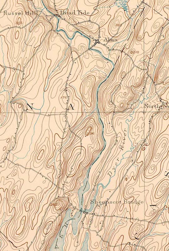
1893 topographic map of the Alna area of the Sheepscot River. From the Wiscasset SE 1893 quad downloaded from http://docs.unh.edu/nhtopos/nhtopos.htm.
1944 topographic map of the Alna area of the Sheepscot River. From the Wiscasset SE 1944 quad downloaded from http://docs.unh.edu/nhtopos/nhtopos.htm.
1957 topographic map of the Alna area of the Sheepscot River. From the Wiscasset SE 1957 quad downloaded from http://docs.unh.edu/nhtopos/nhtopos.htm.
 Click on image to enlarge (170K).
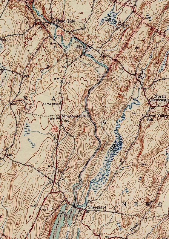 Click on image to enlarge (238K).
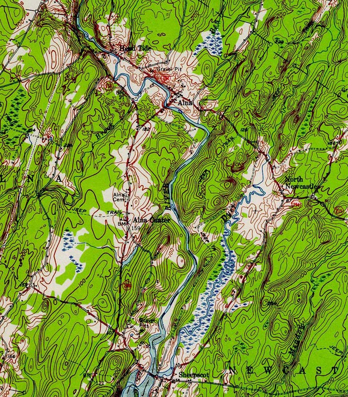 Click on image to enlarge (301K).
To learn more about this topic click Info Links
To view additional information (data source, aquisition date etc.) about this page, click Metadata
| www.krisweb.com |